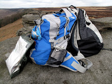
Stanage

Tuesday, 13 November 2012

IN SEARCH OF AUTUMN COLOUR

AN UNSEASONAL VISIT TO CHATSWORTH


We're well into autumn now, not our usual time of year for visiting the grounds of Derbyshire's most prominent stately home since we tend to reserve its easily accessible parking for more unpredictable weather, but we were wanting to try to catch some autumn colour. We've missed some walking again - holidays and viruses - so we have fingers firmly crossed that the trees  have held out just enough for some good photos.

We park in the Calton Lees car park, pleased that the little man isn't collecting money on this bitterly cold morning, and attempting to avoid the massed ranks of an organised walk. We hope they aren't going our way.

By the time we have donned our many layers the group has disappeared and we meander down to the garden centre loos before setting off. We have Mollie with us today, and she's raring to go.

We drop down to the road bridge over the River Derwent as two dogs at the adjacent cottage bark frantically at us and chase us along the fence line. The Alsatian looks as though it means it, but we can't really take the giant poodle seriously! Mollie ignores them both.

At the far side of the bridge we walk up the road and turn left at the side of Beeley Lodge and take the lane that rise up to Beeley Hilltop. We're able to see some good colour in the trees when we turn to look back, but it isn't as spectacular as we had hoped.


We continue upwards past the farm and onto the rough, rutted "other route with public access" - which tends to mean vehicular access. Fortunately we see no 4x4s today and we pause half way up to admire the view towards Matlock with the sun illuminating the hills.

At the top of the lane we clamber over the extremely high stile onto the path through Rabbit Warren. 


We're very exposed here and we feel the intense chill of the wind. And rain clouds are gathering too.


When we reach the end of the path we climb another high stile to enter the woods at the top of the Chatsworth estate. 


Here we are in a beech grove and these trees do not disappoint with their burnished brassy leaves.


We decide to walk along the top path towards the ponds, something we have never done at this time of year, and we're surprised at how soon we come to Swiss Lake. There are some ducks bobbing about on the water but there is nowhere for us to sit so we press on until we come to the Emperor Lake, which ultimately feeds the Emperor fountain in the grounds of the House.

There is a bench here, so we sit down as Mollie investigates the water and keeps the ever-hopeful ducks away. Coffee first, to warm us up, then our sandwiches before the buns. This week PC had only a limited choice, so it's chocolate and vanilla cupcakes. They look very good, but sadly don't quite live up to their promised delights, although they redeem themselves slightly by having gooey chocolate in the centre of the vanilla bun. We finish off with more coffee then set off again. It's very cold sat here and we're both feeling the chill.

The path takes us past the hunting tower, now (we believe) used as a holiday cottage, and continue on until we reach a left hand track which drops down to a wall beyond which is the parkland.


Once in the park the sun comes out and it feels surprisingly warm after the chill of the woods. Sadly it doesn't last very long and by the time we reach the house the sun has disappeared.

The car park to the house is full and we wonder if it is time for the Christmas decorations to be up yet. We drop down to the bridge, cross over then set off across the park.


The house is on our left on the opposite side of the river, and we see the gilded window frames glistening in the weak sunlight. We're not sure if the expensive gold leaf suits the house, or just looks trashy. It certainly makes a statement!

We take the straight route above the river and soon find ourselves on the road a few yards away from the cattle grid next to the Calton Lees car park and only a short stretch from the cars.


We've done quite well with our aim of finding some colour, though the trees are by no means as spectacular as they have been in previous years. Maybe we've just mis-timed it, though we tend to think that it isn't a particularly good year for colour.

Next week we hope to go exploring somewhere new again!

Sunday, 21 October 2012

FOLLOWING THE RIVER BRADFORD


FROM ALPORT TO BRADFORD DALE

We've missed a week again - PCs fault, or rather the boat's fault (long story) - and we seem to have missed the best of the weather. Last week it was glorious, this week considerably less so.

Undaunted by the heavy overnight rain, plummeting temperatures and brisk wind we nevertheless continue as planned and meet at Alport. Sadly we don't have Mollie with us this week as PC couldn't get Mollie's house door open (dodgy key), something that will have to be rectified.

There's ample room for us in the tiny car park and we spend a little time layering up. It really is that cold, so out come hats and gloves too. We also have a quick nip from one of the secret flasks (Ramblers Restorative - mmm). Once we're ready we head down the road to have a look at the river running under the road bridge. On our last visit the river was so high that the arch of the bridge was barely visible and the water had risen up the stonework, but now it is running smooth and clear, the water flowing freely under the arch and the stones of the riverbed stand out as though they are under glass.

We cross over to the other side and set off down the path at the side of the telephone box. Looking back we have a perfect view of the bridge from this side, so PC fetches out her camera. A few paces further along and we are greeted by some brown fleeced sheep in the adjacent field, either very friendly or curious, so again it is time for a photo-stop. (I've tried really hard to find the breed - but do you know how many different breeds of sheep there are in the UK? And there doesn't seem to be a way of searching for a 'small brown sheep', so many apologies for lack of information, but if I manage to identify them at a later date, I'll add it.)(It could be a Balwen Welsh Mountain, or a Zwartbles.)

This path is wide and easy to walk. It follows the small river through fields which are, fortunately, free of livestock (cows). We pass the occasional dog walker then come to a very picturesque

stone bridge next to a high, overhanging wall of limestone rock, just below the village of Bradford. Beneath the rock is a conveniently placed bench, a perfect spot for anyone needing a rest of just wanting to sit and enjoy the view. But we press on, following the river towards Youlgreave.


The path bends and brings us to a stile - bit of a squeeze with the added obstacle of a small gate too - next to a bridge. We're then out onto the road (it may be Mawstone Lane, or Hopping Lane, or something different!) to admire the bridge before crossing over and following the Limestone Way along the side of the River Bradford.

This is an extremely lovely spot; there's a small clapper bridge over the river leading to a bench should anyone want to take advantage of it, but we go through the gate and follow the river.


We're in a wide expanse of a field which slopes steeply up to the village on our right with the clear river on our left. And the sun is starting to shine! We amble along until we come to a small weir just as the sun strikes it, so out comes the camera again to catch the sunlight sparkling on the water. And to our surprise, at the top side of the weir is a pool for swimming! It must be wonderful to take a dip here in the summer, luxuriating in the cool, fresh water although we suspect it may become rather crowded.

We continue, pause to admire the hefty sheep (these are far from cute and look as though they would be capable of inflicting some damage if they took a dislike to you) then pass through another gate before consulting the map. A local gentleman walking his dog stops for a few minutes to chat and confirms that we're on the right route. We let him go on ahead as we're enjoying a steady pace.


The River Bradford is on our right now with a wooded hillside on our left. The river appears to be running slower here, and is wider, but is still crystal clear. The river weed is a lush, vivid green and there are ducks and moorhens dabbling in the water.


Upstream there are a number of weirs and wide ponds, presumably for fishing, but today there are only birds fishing.

Because of the flat terrain we are able to walk a long way in a short time, and we soon reach another bridge crossing the river. Again we study the map, and although the path across is one of our options we decide that, for now, we'll carry on and hunt out somewhere for lunch. Naturally all the benches, of which there are so many downstream, have gone.

We reach a wide river crossing with an intriguing stone enclosure on the left. Naturally we explore but despite looking around we can't quite work out what it is supposed to be. There appears to be a number of 'rooms' or 'pens' and at the far side a stream of water runs into the enclosure then underneath it. We wonder if it is an old sheep-wash, or possibly the remains of an old mill (a mill for Middleton was mentioned in the Doomsday Book), but non the wiser we continue on our way. (Sorry, but again my research hasn't managed to come up with anything conclusive.)

At the far side of the river crossing we have an option; straight up along a very wide but gloomy path which we assumes climbs to Middleton village, or a narrower path running along the side of the water again. We choose the latter, and the path proves worthwhile. The river, narrower and less obvious, runs in a reed and weed bed which appears to be wide and marshy. A spring gurgles out from the rocks to our right and we soon reach a very rickety bridge over the small river.


Bravely PC goes first, and I follow. We push our way along a narrow path with overgrown vegetation on either side of us, then ascend some metal steps and turn right at the top. A short walk takes us into Rowlow Dale (not named on the OS map) and we find a perfect limestone rock on which to sit and have lunch. The sun is out and we have a lovely view of the very narrow river (or is it just a stream now?) and its extremely old clapper bridge.

We start off with a sample from PC's secret flask (cointreau) before settling down to our coffee, sandwiches and bun. The bun is PC's choice today and a concession to healthy eating; apple tarts with custard and fresh cream. Admittedly, there isn't a great deal of apple, but the custard and cream are suitably calorific.

Whilst enjoying our second coffee a damsel fly (or is it a dragon fly) hovers around then lands on PC's leg. Luckily it stays still for long enough to have its photograph taken before scooting off again.

We pack up ready to set off back, but first amble down to the small bridge to have a look. Carved into it are words from a poem, and we puzzle over it for a while, struggling to make much sense of it. However, a bit of research has led me to this website: www.sitesofmeaning.org.uk which catalogues a number of boundary and marker stones erected as a Millennium Project throughout the Middleton and Smerrill area, detailing the inscriptions and giving some detail. This small bridge is 06: Clapper Bridge on the site's menu, and the whole site is worth looking at.

We retrace our steps and head back the way we came, negotiating the metal steps (spotting some fossils in the rock as we descend) and the rickety, narrow bridge. Eventually we reach the larger stone bridge over the river and discover another inscription, this time by Wordsworth. Again, have a look at the above site which gives details. The bridge is 03: Bradford Bridge. (Note how low the river is in the photographs.)

Crossing the bridge we climb upwards a little way then take a fork in the path, turning right so that we are once again walking along the side of the river. This bank is clearly not so frequently used but it provides a good contrast to our outward walk.

There is a small clearing where a large tree has come down, only an upended stump and a few wayward branches remain, but the stump is cloaked in a massive growth of fungi. We clamber up the slope for a closer look and for PC to photograph it. There is more fungi growing nearby, it looks like a strange white goo but on closer inspection it resembles the curds of a cauliflower. Odd!

We continue and soon the path begins to ascend the slope towards Youlgreave. We've never been to this village before and as we emerge from the woods into the sunshine it looks at its most attractive. Even the allotments are neat and tidy.


We walk down the village street, then debate on whether to continue towards the church where we will turn right towards the river, or turn right immediately (King Street) which we think leads to a footpath. After meandering down the narrow lane (barely wide enough for a bicycle and reminiscent of Robin Hoods Bay) we push our way onto a path through some seriously overgrown weeds. Squeezing through a narrow gate we come to the footpath on a steep downwards slope.

This is a seriously bad idea, but we have reached the point of no return. Clearly this path is rarely used, despite the waymarkers, and we soon discover why. It is slippery, steep and loose underfoot. Negotiating it is hazardous, as PC finds out when she sits down involuntarily!

Eventually, though, we manage to zig-zag our way to the bottom and vow never to return even if the path at the riverside is flooded and we have to wade! Fortunately, that isn't put to the test, the path is not underwater but it is virtually non-existant and we push our way along until we reach safe ground again.

We're back on track now, retracing our outward journey along the first part of dale beneath Youlgreave where the hefty sheep are eyeing us suspiciously. At the end we cross the tarmac road, go through the narrow stile with the gate and take the path to the bridge next to the limestone rock and bench.

Here we cross the river and walk up the narrow, grassy lane. At the top we turn right onto a footpath which crosses some fields high above the river. We have some lovely views of the dale beneath us and the trees, some of which are just starting to take on their bright autumn colouring.

The last field we cross has three disinterested horses dozing in it then we're out onto the main road. It's only a short walk here down to the cars where we sit, minus hats and gloves, in the afternoon sunshine.


It has been a lovely walk, and a treat to visit somewhere different. It hasn't been too challenging, and PC's foot seems to be on the mend. In the end the weather wasn't too bad, a couple of very brief showers of rain soon cleared and we've been left with a superb autumn afternoon.

We keep our fingers crossed as we plan to see some more autumn colour on our next walk.


Thursday, 4 October 2012

ALONG THE RIVER LATHKILL

We can't believe it. We've missed a couple of weeks during which the whole area has been experiencing rain of biblical proportions, and we've chosen to walk on a gloriously sunny day without a rain cloud in sight! 
We'd already altered our plans to avoid slogging through quagmires so we meet up in the Over Haddon car park (Pay and Display but it has toilets open until October) slightly dismayed to discover numerous other cars parked here and a group hike being organised. We hang back and let the hoards leave whilst PC fills her secret flask with cointreau and Mollie sets herself up with a couple of biscuits. We're already catching up on news and gossip as we pay our parking fee, shoulder our rucksacks and set off down the steep road towards Lathkill Dale.
PC's foot is a little better, and we're hoping it continues to improve, so we take it steady down the tarmac road. A couple of walkers with a pair of collie dogs pass us and reach the bottom before we do.

For the first time in ages we can see the River Lathkill in full flow. Sparklingly clear water is gushing down the frequently dry riverbed and the shallow ford isn't quite so shallow at the moment. We've already made our mind up that we won't go right through the nature reserve and Lathkill Dale, nor cross the footbridge which leads to Meadow Place Grange, rather we're going to follow the river downstream towards Conksbury.


The path is narrow here beside the river, and the river itself is squeezed tight, making it rush and boil ferociously. Fortunately Mollie shows no inclination to dip her paws as there would be a serious risk of her being washed away. We go through a gate where the path moves away from the river, then upwards on a slippery limestone path, always worse in the wet. At least there are some fence rails to help.

By now we're in an elevated position and through the trees we can see how the river has widened as it approaches a series of weirs with a backdrop of limestone cliffs. The water is crystal clear but the prolific underwater weed lends it a beautiful green hue which is enhanced by sunlight.

The path dips down through meadows then runs alongside the river and its weirs again. A solitary swan is cruising along the water at a stately pace oblivious to people a few feet away.
It isn't long before we reach Conksbury Bridge, a Grade II Listed 18th century road bridge, but with medieval origins. It is a lovely bridge and since it carries the road from Bakewell to Hartington there is a fair amount of traffic for such an out of the way place, and a lot of drivers stop off just to have a look at the view. Who can blame them?
We find a series of 3 benches nestling under the trees at the side of the bridge so decide to stop for a quick drink. Out comes the secret flask (perfect) followed by some coffee. We can afford to linger, our planned walk isn't too far and we don't really want to rush back towards 'real life'! However, Mollie doesn't like being so close to the road and is very nervy whenever a car passes, so we pack up our things and press on across the bridge (pausing to admire the river up and downstream) and up the hill towards Conksbury.

We're only just level with the site of Conksbury Medieval Village when we decide to check the map, and cross the road to a footpath sign where we can stand in a wood so that Mollie feels safe. After checking the map we abandon our original plan (a walk we've done previously but in reverse) to follow the path we have now found. Never been on it before, so it appeals to our sense of adventure.
The path takes us through some woods and to open fields which dip down towards the river again. We haven't walked far before we come to a narrow lane, which we cross. To our left the lane goes over a pretty bridge over the river, to our right is a beautiful stone house called Reaper Lodge.
We follow the path along the edge of fields with the winding river away to our left. The fields closer to the river are waterlogged, and one has a sizable lake in the middle of it.

It isn't long before we discover how wet this part of the walk can be. We pass through a crush-stile onto a narrow, fenced path only to see the path ahead totally submerged. A walker is making his way carefully towards us wearing wellies, so we decide to wait to hear his verdict. When he reaches us he admits that he thought his wellies were going to be swamped at one point, so we don't have much chance in our hiking boots. However, the rest of his walking group are apparently making their way through the adjacent field so we decide to do the same. We pass the group and are warned that we have to climb a gate or fence at the other end. No problem!

Of course, we hadn't taken account of Mollie deciding to be extremely dim-witted when we reach the gate. I go over the fence first, but Mollie won't follow. We try to encourage her to go under, over or through, but she appears to have brain block. In the end PC picks her up (no mean feat) and hands her over the gate to me before climbing over herself. Mission accomplished.

 
We're now in Alport, a village we have never visited before, and are immediately taken with how pretty it is. The name of the village apparently derives from 'Portway' (or Port-weg as the Anglo-saxons called it), an ancient, pre-roman trackway running from SE to NW and still used by pack horse teams up until the end of the 18th century.
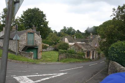


The River Lathkill runs under the bridge and we spend a few minutes watching a dipper as it ducks and dives under the deep, fast flowing water before crossing over to the other side of the road. There's a red telephone box here - a fast disappeared British monument - and the start of walks along Bradford Dale. The bridge wall curves around and we notice that, set into it, is a stone pillar. It looks like the bottom part of an old cross and although there is a photo of on: http://www.derbsyshireheritage.co.uk I can't find any information about its date nor any other details.

We decide that we'll return to Alport at another time to explore further, but for now we must be on our way. We walk north out of the village then turn left onto the appropriately named Dark Lane which rises steeply from the road and is shrouded by trees. We're surprised at how quickly we climb and we soon have excellent views all around.

The top of Dark Lane - which is only a track but is open to traffic (beware the dreaded 4x4 brigade) - levels out and approaches a cattle barn. Here our plans change again. We had intended to plough straight on across the fields, following the straight line of the lane until we came to Noton Barn Farm close to Over Haddon. But there are cows in the fields. Lots of them. And right across the path. My aversion to cows kicks-in big time so instead we go through a gate (just into the cow field, but they are some distance away so we're safe) then turn sharp left to go through another gate into a field of sheep - much safer. From here the path takes us diagonally across a couple of fields to the Conksbury road.
When we reach the road we have the option of going straight on, and so directly to Over Haddon, or down the road to the bridge and back along the side of the river. Since the path across the road has been ploughed up and looks as though it will be very heavy going, we choose the second option and walk down the road instead.

We still haven't had lunch so we decide to sit on the single bench at the side of the river for a while. Except that the bench is already occupied! We carry on towards the weirs and find, instead, a fallen tree up on the hillside. Perfect.

We settle down on the natural seat and fetch out lunch; sandwiches, coffee and buns. Today the buns are a little on the large side - fresh cream apple turnovers with lots of apple and lashings of cream. A hopeful duck waddles up from the water, ignoring Mollie as it focuses on the buns. No chance! Not even Mollie will get a lick of cream.
It is extremely pleasant sitting here, and warm too. We can look down at the river and the path which has more walkers out now that the weather is holding good. And we have time to linger, to chat, to look at photos. Filled to the brim with buns and coffee there is very little incentive to move on!


But move on we must, eventually. We descend to the path then retrace our steps along the side of the river. When we reach the footbridge we stand in the middle to watch the water rushing beneath our feet, but Mollie isn't too keen. Then all we have to do is make the steep but steady climb back up the road to Over Haddon and the cars.
It has been a wonderful day in glorious weather, made better by us being able to cover ground we haven't been on before. And we've manged to find the start for our next walk too.


Monday, 10 September 2012

STEADILY AROUND EYAM MOOR

We're back. The prolonged (wet) summer break is over and we have emerged at the other end of it blinking mole-like in the unaccustomed sunshine.

Before we start the blog, though, a quick CONGRATULATIONS to our daughters. This exam season saw PC's youngest taking her A levels and mine taking her GCSEs. After all the stress, tension and angst (and that was just us) their hard work has paid off with both girls getting the results they needed. PC's daughter is off to her top-choice university to follow her chosen course, and mine has secured her place at a first rate 6th form to study for A levels. Well done girls - and maybe we can relax a bit now!

Back to the walk. Our enthusiasm to return is high, but we're a bit stumped as PC is still having trouble with her foot. Turns out it is tendinitis (painful) so we need to tailor our walk towards softer ground (shouldn't be too problematical given the amount of rain we've had) and something relatively short. She hasn't been walking at all over the summer whereas I did a little hiking in Scotland earlier on, but nothing more recent. So, after some careful thought we decided on a circuit of Eyam Moor.

We meet up on Sir William Hill Road where the tarmac gives way to rubble. It's a steep drive up from Grindleford but the views are worth it, and I have plenty of time to enjoy the views as PC is uncharacteristically late. She's had trouble locking the door at Mollie's house so ends up having to leave Mollie at home on guard after taking her for a brief consolation walk. Which means that today we're dogless.

Naturally we spend a while catching up with news and gossip as we put on our walking boots and shoulder our rucksacks. Mine's new. Or rather, it was new over a year ago but I have only just got around to swapping all the stuff from my old rucksack to this one. It's a little larger so there's more room for all my 'essentials', but unfortunately it has fewer pockets. Not sure if it will be an entirely suitable replacement, time will tell (but I haven't thrown away the old one, just in case).

The first obstacle is the stone stile over the wall (signed for Abney and Stoke Ford). It needs longer legs than ours, and an agility that we seem to have misplaced, but fortunately there's no audience so we can huff, puff and grunt as we hoist ourselves over. The next part of the route is steady, level and grassy underfoot. PC isn't having any problems so far, which is encouraging.

There's plenty of evidence of the wet summer, even up here. Boggy areas cross the track and new ways around them have been trodden down by earlier walkers. No doubt these will soon become favoured way.

The sunshine is glorious even though there is a brisk breeze, and we're spending so much time talking that PC almost forgets to take photos of the wide ranging views.


To our left is the more prominent point of the moor (marked only on the map as Rock Basin) where there are large boulders of grit stone, so we detour along a narrow track at the side of what appears to be a small quarry and push through the heather to the  boulders. We find a suitable flattish rock and remove the rucksacks. No, we haven't walked far yet but we have plenty of time, PCs foot to consider and we haven't exactly got miles to travel. I have a quick look higher up on the moor as PC makes herself comfortable, but the lure of elevenses is too much so I return at a jog.


As I pour out the coffee PC brings out a couple of chocolate chip cookies. Wow! They are huge, the chocolate chips are more like chunks and the cookie dough is obviously only there to hold as many chunks together as possible. Needless to say, they are wonderful and go down extremely well.

We linger rather a long time before repacking our belongings and retracing our steps to the small quarry where we rejoin the path. We're going downhill now and the path is heavily eroded in places, we can imagine a small river running down here during heavy rainfall. Eventually, though, it swings left, levels off and becomes easy underfoot again.

At the stile ahead there are a multitude of paths to choose from, but we have our route planned and turn left, slightly uphill and skirting the wall. The sun is hot now and we have some shelter from the breeze, and soon we are walking on the cushioned ground beneath the canopy of trees that make up Gotherage Plantation.

The path keeps to the edge of the trees then dog-legs through Big Moor Plantation to come out (over yet another stile) on the track beneath Stanage House. The sheep in the field are blissfully unaware of us as we meander up the middle of the track (softer underfoot for PC) and continue to yet another stile which, this time, brings us onto a very rough crossroads. Here we turn left with PC having to walk on the verge as the track is rubbly and uneven.

It isn't long before we reach the Bretton-Eyam road and within a few paces were on the western end of the Sir William Hill drovers road again - and we haven't even stopped for lunch (although we haven't walked off the cookies yet).

The track is very rough and the verges aren't exactly even, so we take it steady. We can see the huge phone mast ahead on our right (excellent mobile coverage should we need it) and as we reach the summit of the track we can pinpoint the trig point on our right. The verges are covered in late summer flowers (scabious and harebells) which are proving to be a magnet for the bees.


Down the track and we turn left to go over the wall (yes, another stile) and back onto the moor where we eventually find some comfortable tussocky grass to sit on. We're aren't particularly hungry (did I mention that they were HUGE cookies?) but undaunted we eat our sandwiches after a fortifying nip from PC's secret flask of cointreau - mine having gone AWOL sometime during the holidays. Then out come the buns - extra chocolaty chocolate chip muffins - and we finish off with coffee. Certainly a Death By Chocolate day today.

It would be good to sit here for longer but we have a timetable to stick to, so we set off back just as another couple of walker, plus dogs, pass us on the path. We hang back to let them get over the stile first (no point us humiliating ourselves in front of strangers, much better to let them provide us with the amusement) then we amble down Sir William Hill road towards the cars.

Our timing is perfect. We have just enough time to plan our next walk (another 2 week break first, though) before we have to leave. PC declares that her foot is feeling fine so we are keeping our fingers crossed that she may be on the mend.

We've been really lucky with the weather today; is it too much to hope that our next walk will be equally bright?


Wednesday, 22 August 2012

A GENTLE WALK AROUND CHATSWORTH


Well, we've done it. We've achieved the near impossible - we've actually chosen the one fine day this summer. No rain, hardly any clouds and the slightest possibility of a sun tan (OK, not much chance there but we are forever hopeful). The only downside to the day is that PC has injured her foot so we're keeping the walk steady (hence the choice being Chatsworth) and away from hard ground. At least that isn't too difficult given the amount of rain we've had recently.

We meet up in Calton Lees car park and duly pay the nice man in the kiosk who informs us cheerily that the rain is due back tomorrow and that we need to make the most of today. We don't need telling twice.

Mollie is back from her holidays and happy to be out of the car with the prospect of a good walk in front of her. We load our rucksacks with gear (coffee, buns and a waterproof coat - you never know when it might be needed) then debate on a route. We choose to leave the car park in the direction of the House but once we're through the gate at the side of the cattle grid we head uphill on the grass rather than crossing the road then walking down to the river.

We're so busy catching up on gossip that we hardly notice how steep the hill is. The narrow track is easy to follow though, as it is well worn by sheep. In parts it's quite boggy despite being on a sharp slope so we manage muddy boots, but at least PC is getting the soft ground she needs.


This is such easy strolling that we have loads of time to pause and admire the (sunny) scenery but even with plenty of looking around we're going too fast. What we need is somewhere to sit a while, and as we come up to the turn in the path which leads through the woods there are three benches lined up with their backs to the wall, facing the view. We head for the far one, it has a back rest, but it also has a huge puddle at its foot so we choose the second one instead and settle down with the secret flask. Raspberry Gin again today, a genuine taste of summer on a genuine summers day. It couldn't be better.

It would be easy to linger here for most of the day but we decide we ought to press on so we go through the gate and onto the wooded track leading gently uphill. 

 Mollie can run off the lead for a short distance, and she immediately finds a rock to play with before darting off to greet some other walkers. This can be a bit of a problem with Mollie. She's a beautiful, friendly dog who, unfortunately, treats obedience as optional and since she doesn't belong to us she doesn't seem to sense any permanence in our relationship. Hence, if she sees someone interesting she's off to investigate, possibly in the misplaced hope that it could be her owners or someone she is more attached to than us. After a quick greeting she's happy enough to return, but not until she's satisfied her curiosity, which is why she's usually kept on the lead. At least today's people were doggy-folk who, coincidentally, do the same as us and take someone else's dog for walks and thought Mollie delightful.

After that it's back on the lead for Mollie as we reach the top of the woods and go through the gate into the field beyond. There are lovely views here as we cross large field on the grassy track, dipping down to the gate near to Calton Houses and the rough track that takes us past them.

At the bottom we go through yet another gate where two small dogs yap ferociously as their owners sit in the sun, and we take a small spur of a track to a bench where we can sit out of yapping distance and eat lunch.

The sun is quite bright now as we have the first cup of coffee followed by sandwiches. Then come out the buns. PC's choice today, and she calls them her end-of-summer Wimbledon buns. Strawberry shortcakes: sweet shortcrust pastry, creme anglaise, juicy strawberries and fresh cream. They are eaten in complete, reverential silence. A second coffee finishes off lunch in a very civilised manner.

Once we've lingered we set off down the slope only to be approached by a couple who need some directions. They have a small card with a route on it, and an unopened OS map, but are wondering if they are on the right track. They aren't. By quite a considerable distance. They thought they were near the Emperor Lake above and behind the House, and were quite surprised that they weren't even on the right side of the river. After a discussion they decide to forgo the visit to the Lake and instead follow the path we've just walked then extend it down to either Edensor or the House. They asked if it was possible to get lost again, and we said no, use the House as a landmark. Easy. But we did wonder.....

We continued on our way down the sloping rough track with PC trying to walk on the grassy verge. There are plenty of people walking up the hill, not surprising given this one, fine day, and we can hear buzzards over to our left even though we can't see them. The stream is full and fast flowing, hardly surprising, and Mollie refuses to have a drink from the stone water trough, choosing to drink out of puddles instead. Typical dog.

At the bottom of the track we come out onto road at Calton Lees village, admire the gardens then pause to study one of the trees at the back of the garden centre which has heavy clusters of palest green papery flowers along its branches. It seems that it is probably the Hop Hornbeam (Ostrya carpinifolia), but whatever it is it has been well worth seeing.

We're back at the car park far too early, so we dump some of our gear into the car and amble down to the river where we sit for a while enjoying the last of the day and watching ducks bobbing about on the fast flowing water.

We don't seem to have had much of a season this year with all kinds things conspiring to erode our walking time, and it's over all too quickly. The summer holidays are upon us but although we'll not be out on the hills together we will try to get some walking in with our families. By the time we meet up again (early September!) the long, stressful wait for exam results for our daughters will be over, and the next few years mapped out for them depending on those results. We're keeping our fingers crossed for them both but feel sure that their hard work will have paid off.

Until we return in September we hope that everyone has a lovely summer.

Thursday, 5 July 2012

STORMY WEATHER - THE MONSAL TRAIL AND TUNNELS


Our usual excellent forward planning had deserted us so this walk was planned very hastily last night after we'd heard the rather grim weather forecast. Thunderstorms and heavy rain! Fortunately, PC came up with a suitable plan - visit the newly opened tunnels (see previous Monsal blog) on the Monsal Trail.

The decision to park in the laybay just past the bridge on the Great Longstone road (Longreave Lane?) is a good one, saving us driving through Great and Little Longstone as well as allowing us to follow the walk for a greater distance. However, given PC's legendary navigational skills I consider it prudent to be there before her so she doesn't miss the spot! Whilst waiting (yes, I make it first, an uncommon occurrence) the cloudy but dry day turns damp, then proceeds to become progressively wetter and wetter. By the time PC arrives we have to haul on all the waterproofs. Then I discover, to my dismay and PC's horror, that I've forgotten the umbrella. It would have been perfect on this steady, level walk.


Still, nothing we can do about it so we set off up the slight slope that leads us onto the bridge and the Monsal Trail just as we see a bright flash of lightening dropping onto Bakewell and hear the accompanying, ominously loud rumble of thunder.

The thunder rumbles around us as we walk along, and the rain hammers down. I'm seriously regretting forgetting the brolly as I'm sure my waterproof coat leaks but at least it is summer (supposedly) and warmish so I doubt I'll suffer too much.


The track sides of the trail are a mass of colour at this time of year (yes, rain-washed colour) with brilliant blue meadow cranesbill (geranium pratense) and bushes of climbing roses in whites and all shades of pink. The meadowsweet isn't out yet but later on we'll find spikes of lilac orchids - a rare treat.

We pass the village of Great Longstone over on our right, partly obscured by the rain, then under the bridge and past the old station. We walk on and pass the stile leading to Little Longstone which we'd always had to cross in the past as from this point the trail was closed. Not any more.

As we continue the rain eases a little and we pause to watch the tractors in one of Little Longstone's fields, then are quite surprised to see them going over a bridge that we're about to go under. A little way further on and we get our first glimpse of the Headstone Tunnel with its arched, protective cage to shield it (and those entering) from rock falls.

It's quite eerie walking up to the dark, bleak tunnel. There are lights along the roof but the far end cannot be seen as it curves away along its length. Along the approach the high walls of rock have insets of masonry making it look like something out of Lord of the Rings.! Very atmospheric.

OK, I'll admit it, I find it spooky but PC is in her element, snapping away with the camera while I try to get over the creepy, cold-fingers-down-the-spine feeling whilst trying to appreciate being out of the wet. Not that it's a lot drier under the tunnel as water is drip-dripping from the ceiling and running down the walls. It's quite a lot colder here too, though it's hardly a blisteringly hot summer's day outside, and we ponder on the suitability of using the tunnel for a wine cellar.

Sound carries very well and we can hear others entering from the far end long before we see them, and no doubt they can hear us and our rambling discussions too. We stop at the mid-point where we can just about see light at both ends of the tunnel, and PC attempts to take a series of panoramic shots.

We emerge from the tunnel at the iconic Monsal Head viaduct and peer through the high railings to watch the misty haze rising from the River Wye down in the dale. It isn't raining quite so much, but we hear another rumble of thunder which heralds a heavier downpour to come so we stride out along this familiar stretch of path to seek shelter in the last remaining building standing at the old Monsal Station. Just before we reach it - and with the promised rain keeping off for now, we discover a veritable field of toadstools emerging from some very damp wood chippings. Again, PC is in her element trying for a good photo.

The windowless, doorless station shelter provides a good place in which to enjoy a nip from the secret flask. Bit of a change today (in a rush to leave this morning so it was filled with the first bottle I put my hands on) so we treat ourselves to some homemade 'Red Arrow' (my name for raspberry gin). It's a while since I've had some and I'd forgotten how good it tastes. PC and I decide to savour a few sips to help to banish the gloom.

Maybe the gin hasn't helped the rain to stop but we feel a bit brighter and more summery for it and before long we reach the second opened tunnel, the Cressbrook Tunnel. It doesn't feel as long nor as gloomy as the Headstone, and there are a few more people about even though the rain is bucketing down again. Emerging at the far side we are high up above Water-cum-Jolly Dale and enjoying a view that we've never experienced before. It's quite magical - especially so when this is where we see the orchids.

Despite the continuing rainfall it's very pleasant walking along a brand new track (to us) but we haven't gone very far before we reach Litton Tunnel which we enter like old hands. We're beginning to feel hungry and do consider stopping in the tunnel for lunch, but it isn't terribly inviting so we decide to wait. Luckily, by the time we emerge the rain has slowed down considerably and looks ready to stop. By the time we reach our usual path down to Litton Mill (which we're not following today) the rain has actually stopped so we commandeer the bench at the side of the path and prepare for lunch.

We pass on another nip from the secret flask - it is possible to have too much of a good thing - and start off with a warming coffee. It's a good one this week, made by PC and far better that my dismal mix from the week before. Then it's lunch - a rapidly consumed sandwich for PC and a heavy salad for me (old joke) - followed by the buns. I'd been spoiled for choice on the bun-run this morning and eventually settled for individual banoffee pies - shortcrust pastry, bananas, caramel and fresh cream. I'd even brought forks to eat them with, but they weren't needed, the pies went down very quickly and very well.

A slight panic mid-lunch (another ominous rumble of thunder) made PC fetch out a small, flimsy brolly with a broken handle to cover us (and our buns) while we ate. It managed to do the job, saving us from soggy pies and diluted coffee.

The rain, though heavy, doesn't last long and by the time we've finished eating and drinking it has stopped and we're free to pour the rainwater from food containers and refill the rucksacks.

We've never walked this far along the trail before so, again, we have the benefit of newness. And as we walk we look up to see a glimmer of blue sky. Does this mean that the day is actually going to turn out nice after all?

The clouds gradually shift away and the grey murk starts to lift. We pause to admire the views at Ravenstor and a couple pass us in shirt sleeves and shorts - a sure sign that the weather is improving. Further along we see a metal speaker on a stand which turns out to have information on it 'Monsal Memories' - a series of six ten minute podcasts about the Monsal Line. It's a shame we don't have time to listen to them.


A little further on we decide it's time to turn around. It would be good to travel further, the sun is shining after all, but we have the same distance to travel back and we really can't be out too late. So we retrace our steps and see, a short way back, some wild strawberries. Tiny and sweet they are too good to miss so I    scramble up a slope and pick them. A real taste of summer. Further along  we see a huge swathe of them and temptation is too great. We have to stop and pick. It takes no time at all to gather a large handful - still plenty behind (oh, for more time) - and it really feels good to be eating them as we walk along. How come we missed them on the way out? And how come more people haven't seen them and devoured them? It's a very short season for the wild strawberries, so we're just grateful to have been lucky enough to find them. 


We're making good time, and enjoying the returning views though    PC's camera isn't too happy about getting soggy and will probably need some drying out when she gets it home. As we approach Cressbrook Tunnel we're greeted by swirling mist rising from the entrance and PC jokes that maybe the trains are still running. It certainly looks as though a ghostly train is on its way, but it's merely the effects of the warm moist air meeting the colder air of the tunnel. We can feel a distinct chill as we approach and the swirling fog extends some way inside before dissipating. Eerie.


We're on a bit of a march now so although we're enjoying the sights and the sun we don't have time to loiter. There are plenty of cyclists and walkers out, an indication of the popularity and accessibility of this trail. We pass a straggling group of primary school children who look as tired as their teachers, then we heading down the slope off the trail towards our cars. It's good to be able to take off soggy coats and boots although it doesn't look as though the rain has done with the day. A few more spots fall as we drive away.