Stanage

Friday 12 November 2010

LADYBOWER, CROOK HILL


Not an auspicious start to the day with high winds and driving rain on the agenda, but by the time we meet at the car park at the side of Ladybower the sky has cleared and we are hopeful. Hopeful, not stupid. We pull on all our waterproof gear, just in case!


The last time we walked this way PC had forgotten her camera. This time, though, she'd remembered it - but the battery wasn't working. Grovelling apologies ensued, but it was the proffered bottle of Old Tom (with chocolate - can't wait to try it) that clinched it. For that particular ale I'd forgive anything. Anyway, she has a mobile phone that takes pictures, so that would have to suffice for today.


We set off up the steep bridleway up Hag Side. Behind us, across the water, is the dramatic Derwent Edge which we had walked a few weeks ago, and the massive Wheelstones are prominent. We climb quickly and can soon see up the valley towards the dam which has water gushing over the top in a white, foaming cascade. We can even hear the pounding torrent from here. The light is perfect and PC takes a photo - just hope that the phone camera is able to do it justice.

This is a steep uphill climb which takes us beneath the trees where we startle some sheep who leap athletically over a fence to avoid us. A heavy shower of rain suddenly bursts down on us but no sooner do we pull up our hoods than it stops. It's going to be one of those days.


We both agree that the uphill slog isn't so bad. certainly not as bad as we remember it. Are our memories playing tricks? Or are we really getting better at this sort of thing?


Within no time we reach the top and as we go through the gate we are suddenly exposed to the howling wind, and another sudden torrent of rain. We turn our backs to the weather but this is more than a quick, passing squall so we retrace our steps back onto the bridleway where we gain some shelter from the rise of the hill and the trees. Sure enough, a few minutes patience is rewarded and the rain stops enabling us to strike out again.


We turn left on the path which is awash with rainwater. The trees to our left provide no shelter as the wind is coming across the moors from the right. It's hard to make ourselves heard, quite an achievement. The views are opening up as we trudge soggily up the gentle grassy incline: Bleaklow, Kinder, Mam Tor are all in our sights as we look around. Closest is the Vale of Edale to our right with Rushup Edge clearly defined. To think, we were only up there last week.


A couple of waterproof-clad walkers approach from the gate in the wall ahead of us. So we're not the only mad people out on the hills today. We pause a moment to exchange pleasantries, and we all remark upon our collective lunacy. At least if we're carted off to the loony bin we won't be alone. They head down the path as we push on up. The rain has abated but the wind is blowing hard.


Through the gate at Bridge-end Pasture (what bridge?) we're faced with an extremely waterlogged field and we become bog-hoppers as we try to avoid getting sucked into the mire. It's pretty much impossible.


At the crest of the field, though, we have a wonderful view of the twin peaks of Crook Hill. Again, the sun is shining and it is a perfect picture, so the lack of camera is cursed again. We drop down quite quickly across fields that don't seem to be the slightest bit boggy and go through a gate next to the high stone wall which takes us into the open access area around Crook Hill.


There's a distinct track leading around the base of the first hill and we follow it easily then veer off on a far less distinct path (Ok, so maybe it wasn't a path at all) up the side of the hill. Our aim is to reach the top but we come across a sheltered nook away from the wind and with glorious views over the valley to Derwent Edge. It's too good a place to pass so we sit down and have a drink from the (not so) secret flask and a coffee to wash it down. The sun is shining, the colours are magical and we aren't being buffeted by the wind.


We plan to hike to the next hill for lunch, but we're past noon now and the picnic police won't get us so we stay where we are and break out the sandwiches. Before the buns are brought out we see the rain clouds hurtling towards us again so we pour the coffee and keep our heads low. When the rain comes it splashes into our coffee cups and threatens to swamp us. We sit it out as the rain sheets across the landscape, then five minutes later the sky is clear and we are rewarded with a rainbow.


Postponing the bun fest we lever ourselves up from our comfortable spot and set off to have a look on the other side of the hill. We can see along the length of Ladybower stretching at the side of the A57, and the long ridge leading up to Win Hill. We drop sharply down then climb up again to reach the top of the higher of the twin hills. It's worth the effort. The 360 degree view makes up for the climb. For now the sky is perfectly clear and we spend ages admiring the views and trying to commit them to memory. We wave to someone on the top of Win Hill, but they don't wave back. Maybe it's not a person, but a trig point.


We trudge down the hill trying to pretend that there aren't cattle prints scored deep into the ground, and soon reach the broad track that goes through Crook Hill Farm yard. Instead we take a slight marked detour through a field, startling some sheep, and arriving at the end of the farm track where we only have to cross over. PC becomes slightly disorientated and tries to set off in the wrong direction. Like horses, she needs steering!


The cattle are in the large byre next to the path, and are making a heck of a racket. Thank goodness they aren't out in the open. However, a long, low, loud rumble of thunder rolls along the A57 valley and we know what will follow. We're in the open and can see the rain racing along the valley. Just enough time for us to pull up our hoods before the rain hits us.


There's something primitive and elemental about being out in this kind of weather. You can't do anything about it, you just have to accept it, the same as man has had to do for thousands of years. It's an enriching feeling, if a bit uncomfortable.


We're pretty certain that the rain has set in for the rest of our walk; visibility is negligible and even the sheep are squelching. Out come extra jumpers (PC) and the rucksack cover (me). Naturally, by the time we reach the bottom of the hill (the oddly named Toadhole Cote), the rain has stopped and the sun is shining again bathing everything in rainwashed light.


We cross the road, pause to admire some very neat hedge laying, then take the path running at the side of the reservoir. Some sheep, looking very clean, wander towards us before veering off, and we disturb a jay which flies overhead for a while before disappearing.


Soon we enter Fearfall Wood and are keeping our eyes open for somewhere suitable to stop. The uneaten buns are calling to us. The last time we were here it was bluebell time when it was considerably drier and sheepless. There are a lot of sheep about today.


We do the ugly up and down between the huge water pipes then we're on a long straight stretch in Lee Wood where we finally find a bench to sit and unpack the buns. Raspberry Rapture it says on the packet - very appropriate we agree as we hungrily devour the delicious raspberry cheesecakes. There's even another cup of coffee left in the flask and we drink it, enjoying the view and feeling very mellow.


It isn't far back to the cars now and soon we're crossing the road and stripping off our soggy gear. The changeable weather hasn't stopped us or hindered us, and we both agree that it's been a great day out.


Sadly this will be our last walk for a while. PC is going into hospital to be transformed into BW (Bionic Woman) complete with new hip. It will take a while for her to be fit enough to venture onto the hills so in the meantime we'll resort to going for drives before progressing to short strolls. Naturally, we'll have to keep occupied by visiting cafes on our trips, but we'll take up the challenge of sampling coffee and buns with stoicism and determination! And we'll keep a record too.

Wednesday 10 November 2010

EDALE, RUSHUP EDGE, CHAPEL GATE, BARBER BOOTH, EDALE


We knew this was going to be a big one, so plans were afoot to meet early. And you all know what happens to the best laid plans ...


Mild for the time of year, and with the sun attempting to shine, made today's start promising, until entering the Vale of Edale where the clouds pressed in smothering the hilltops in mist and threatening rain. Undeterred we met up at Edale's large car park, fed the meter with coins and after pulling on every item of clothing we possessed, set off looking like Bessie and Billie Bunter.


A short stroll down the road brings us to the bridleway that runs up past Hardenclough Farm. The footpath takes us over the young River Noe - its source is only a short distance, but steep climb, away on Kinder - and already the water is running fast and deep.


This first part of the walk is easy, a tarmac track with a gentle incline. Just enough to get us warmed up. Once we leave the farm behind us, though, the track deteriorates and branches: right up and over a stile to go across the fields to Barber Booth, left on the bridleway towards Greenlands or straight ahead on a barely noticeable footpath although there is, hammered into a tree trunk, a yellow arrow. Not very clear but we know from a previous walk that this is the path we want.

The path skirts the wall and remains under the cover of trees, but it soon emerges from cover and deteriorates. It is seriously muddy and is getting steep. We pause to admire the view (or to remove a layer) before slogging on. And it is a slog. Too late we recall how hard this initial climb had been last time. It's straight uphill across the contour lines. We have to keep stopping to catch our breath and cool down, as well as to admire the ever-expanding view. It's glorious in this late autumn light despite the clouds. Edale is snuggled cosily beneath the protective arms of the hills, the last glowing colours of golden trees standing out against the still-lush greens and mellow browns.


Then we glance up the valley and see, well, nothing. A huge sheet of rain is speeding towards us like a heavy grey curtain. We quickly don waterproofs again and prepare for the worst. Heads bowed we continue upwards, but the promised downpour is nothing more than a sprinkling as the wind whips it away before we really feel it.
We're at the stage of taking a few steps and stopping. This really is a tremendous slog.The only consolation is that it's early on in the walk where we, supposedly, have enough energy reserves to cope with it. But will we have enough energy left to last the course. Hope so, as neither of us is fit to carry the other!


We reach the road - three cheers - and pause to look at Mam Tor. It's impressive ancient ramparts are clearly visible here, and we wonder how on earth anyone could even think of attacking such a well defended site. They'd be knackered before they ever reached the top!


We walk up to the next stile where we cut off a bend in the road and reach the bottom of Rushup Edge. As we clear the dip between Mam Tor and Rushup Edge we are treated to the glorious views that, if you're really careful and crouch down, don't include the cement works. The sun is shining, but not on us (typical) although we can enjoy it at a distance.


The wind up here is extremely strong and we debate which of the two paths we should take. There's a bridleway and a footpath running parallel but either side of a stone wall. The footpath is on the Edale side, the bridleway on the Castleton side. Because of the wind, and the direction it is blowing, we decide on the bridleway for safety. We don't want to be blown off the edge.


My major concern is that there are cows ahead. PC looks at the hoofprints in the mud and declares them to be horses. The girl needs her eyesight checking. They are cow prints, lots of them!


The ridge is still climbing but it isn't too steep and there are plenty of ups and downs. For the most part the cows are out of sight then, cresting a hump, there they are. In full view. On the path. Loads of them. With young. I only dither for a moment before leaving the path, crossing a ditch and striding onward next to the wall. The cows watch me. PC is behind me saying something probably not very helpful - I can't hear because of the wind -and I don't pause to look back until I'm past the glowering herd. PC is stood next to them, TAKING A PHOTO. Doesn't she know the danger she's in? Admittedly the cows don't even blink, but they might have. I sprint on, leaving her to her foolish foibles, and find safely behind a gate. When PC catches up, blithely unconcerned, we have an essential pick-me-up from the secret flask. Ah, that's better.

It would be good to stop for a while but it's far too cold, the wind is blowing straight at us and we must press on. The path becomes wider but less distinct as we reach the high point of the ridge at 540m. The views to our left are excellent with the sun shining benignly on a patchwork of fields, but to our right the towering Kinder massive is covered in cloud.


We debate crossing the wall to find somewhere to eat, but behind the wall is a sturdy post and wire fence that makes us decide to keep on our side. It's easy walking and we're really covering the ground now, but we're hungry so our talk turns, naturally, to food: bruschetta, lasagne, chilli, pizza. Mmm.


At a metal gate the bridleway and footpath merge, and we have to cross a fast flowing stream to swap onto the northern side of the wall. The path here is almost sandy where the gritstone has eroded.


The path dips slightly then, with a fork to the left which leads down to the Chapel-en-le-Frith road, we turn sharp right across the moor. Here we see the only other person out walking today, a man sat huddled in a protected hollow of ground eating his picnic. Pity we can't oust him, he's in the perfect spot!


We press on speedily now, our stomachs rumbling. The wide track is waterlogged in places and we have to detour across the springy peat. It must be pretty grim up on Kinder. A couple of narrow tracks lead off towards the Kinder Plateau, and it may be good to follow them someday, but it would take more time than we usually have available.


We're on Chapel Gate, a track that was the old packhorse trail from Edale. As we start to descend we find a hollow to our right which looks promising. Yes, just right for lunch and providing a fantastic view down the Vale of Edale.


Out come the sandwiches, coffee and - joy of joys - fresh cream scones. How come everything tastes so much better out in the open? We devour everything with unseemly haste but maximum satisfaction. We can't linger, though, as this walk is taking longer than we'd intended, so we haul ourselves to our feet and continue our descent.


The wind is behind us now, helping us on our way, something we could do without given the state of Chapel Gate. It is seriously eroded, presumably due to the huge amount of water run off which, today, is a fast-flowing wide stream, but the track is also used by mountain bikers and motorcyclists.. I believe that the 4x4 brigade see it as one of their 'rights of way' too, but hopefully they will have enough sense to avoid it given the state it's in - but perhaps that is hoping too much. At least we see none of them today.

Surprisingly we descend fairly rapidly, our energy levels are obviously replenished, and at the bottom we debate whether to cross the fields towards Manor House Farm, or stay on the track. We decided to keep on the track, which may not have been the wisest choice. At one point the path is completely flooded and we have to scramble up onto a slippery bank to negotiate a way around the water. Yet again our supreme agility is put to good use!


A few spots of rain are starting to fall, and looking back we can see more clouds gathering with intent. We have no intention of pausing - we've already overrun our time on the parking meter - and as soon as we reach the road we're able to stride out. It's heads down and pushing the pace now as we stomp along the road between Barber Booth and Edale, but it doesn't take us long.


At last we stagger into the car park and as we are removing our muddy gear the rain that has managed to hold off all day finally decides it can wait no longer. The heavens open.


Our timing has been perfect (unless you count the overdue parking) and we're dry as we drive home through the torrent. It's been an excellent walk, but we are both seriously tired. We'll pick something a bit less challenging for next week.


Friday 22 October 2010

STRINES, FOULSTONE ROAD, BACK TOR, LOST LAD, DERWENT EDGE, WHINSTONE LEE TOR, CUTTHROAT BRIDGE


Despite predictions to the contrary yesterday's snow never materialised so it's all systems go for our much anticipated walk along Derwent Edge. Since this is to be our second attempt (see last week's blog) and aware of the distance we'll be travelling, we both manage to arrive at our meeting place early, pile everything into one car and set off for a small lay-by on the Strines Road facing Boot's Folly. It's snow free but not cold free and the arctic winds are making themselves felt. Undeterred we wrap ourselves up in as many layers as we possess and set off down the road to Strines. We're walking earlier than we usually actually meet up, so it's ten brownie points and a gold star each.

We trudge along the road wondering if we'd overdone the layers, and soon we're in the sleepy hamlet of Strines and wonder, is it actually big enough to be called a hamlet?

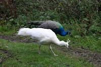
Barely past the few houses we almost walk into two male peacocks, their iridescent blue feathers glorious the early morning light. Naturally, by the time PC has her camera ready the birds had run for cover in a corn field. We wait. Patience pays off as a peahen and her chick emerge,which entices the males from cover. Then even more arrive, including a white one. Now we have plenty of photos and as we walk away we decide that the peacocks must outnumber the hamlet's inhabitants.


We continue down the road passing the beautiful autumn trees and rich smelling woody loam, hoping not to encounter any cars on this narrow stretch. Hard luck. Even on the tight hairpin bend at the bottom we have to wait for traffic.


We cross over to the out-of-use car park, check the notices to see if we still have access (we do) then plough on up the bridleway. The loggers are hard at work and the sound of their engines a constant drone through the should-be silence. At least they haven't made too much a mess of the path and the tall log piles of cut pine smells wonderful. Behind and around us the trees make a wonderful collage of honey, cinnamon, paprika and dark wintergreen; this is such a beautiful time of year.


We're getting warmer now, probably because the path has turned from hilly to mountainous. We don't remember it being this steep before! Maybe it's because we were younger and fitter back then. We press on regardless and pause to admire Foulstone Dike, it's shrouding curtain of trees removed by the loggers. It gives us chance to catch our breath too.


The path begins to even out and the moor is in sight. We're on Foulstone Road which only resembles as road up to the edge of the woods and as far as the house known as Foulstone Delf - possibly a quarry house - which stands above us. From here the road deteriorates into a moorland track, boggy in places, but which maintains a good width up the moor and was likely to have been a packhorse trail in the past.

It's a long steady pull up the track, the woods with the loggers are left behind us and the moor engulfs us. It's a bleak and lonely place, and so characteristic of this part of the Peak District. Today the far distant views are gradually opening up for us in a spectacular fashion, but on a cold, misty, murky day the unprepared could so easily find themselves completely lost.


We take our time, pausing frequently to admire a new vista, and having enough breath to continue talking. To our right are the grouse butts ready and waiting for the annual slaughter of brainless birds by brave gunmen.


We can't see Back Tor yet, the high point of the ridge, but soon we can see the tall marker stone at the cross roads on the moor. From here we can go down to Derwent Reservoir, along the edge towards Ladybower Reservoir or towards Back Tor. We choose Back Tor and head along the track that has been paved with huge slabs, grateful for the hard work done to keep erosion to a minimum and our feet dry. The peaty soil up here can be like a quagmire in wet weather.


We decide to by-pass Back Tor and head, instead, for Lost Lad which we have never visited before. We lose a little height first of all, then have to climb up again, but once at the top of Lost Lad (so named for a young shepherd who perished on the moors in a blizzard) the views are spectacular. We can see through 360 degrees and the sun is obliging too, making it all the more magical. There is a large cairn here, and a splendid memorial to a Mr Baxby, a keen walker. We sit down for a while to enjoy the views and the silence, and the secret flask comes out.


Too soon we see a herd of walkers approaching, so we drag on our rucksacks and head back the way we came. Looking back our still-warm seat has already been taken.


At Back Tor we look along the long ridge of Derwent Edge, but it is impossible to tell how far we have to walk. Still, we know it's a long way, so we set off determined to make the most of it. The path is easy to follow, either clearly grooved by many feet or flagged over the boggiest patches, and it is fairly level too. We've already reached the high point of Back Tor at 538 m and it's all downhill from here - even if it does take a very long time to lose any height at all.


The next major sight to greet us is the cluster of rocks known as the Cakes of Bread. To be honest, whoever named them had to have had an extremely vivid imagination or been very hungry at the time, although they are rather striking.


A little way beyond is Dovestone Tor where we decide to stop for lunch. We're both feeling peckish so we find ourselves a comfortable niche amongst the rocks and rummage in our rucksacks for food and coffee. As we start on our first cup of coffee the wind, which has been blowing gently all day, gathers a little more strength. We shuffle around to find a more sheltered spot but find that the wind is following us. Undeterred we finish our drink, start on our buns - carrot cake, all the way from Cumbria, which must count as one of our five a day. Feeling chilly we pour out our second cup of coffee only to find the surface of it being whipped into waves. Talk about storm in a teacup. We are liberally splash with coffee-spray and have to drink up quick. We don't linger, the wind feels vengeful and we're not sheltered enough to feel totally safe.


Once walking again we don't notice the wind quite so much, although it certainly cuts across the exposed ridge, but the cold is biting. We've seen a few walkers out today, but now they have all disappeared. A shame for them as the sun has now come out, lighting up the landscape but not actually warming anything up.


It is still a steady walk punctuated by small ups and downs. Ahead is the Salt Cellar rock formation and it's clear how it acquired its name, although it probably looks more like a pepper pot. To our right, in the valley, is the striking blue of Derwent Reservoir, dark blue today instead of murky grey.


We negotiate White Tor to see the impressive Wheel Stones ahead of us. These were clearly visible early on in the walk but the undulations of the ridge meant that we'd not seen them for a while. Now they're straight ahead and quite a size at close quarters. We have a look around them, shelter from the biting wind for a while, then press on.

From here the ridge curves distinctly SW and the decline is more noticeable too. We pause to photograph the reservoir below us, but the sun doesn't oblige leaving the hillside and water cast in shadow although even from our height we can see that the wind is rippling the water on Ladybower.


As we descend towards Whinstone Lee Tor we pass the Hurkling Stones on our left. They aren't, to be honest, very impressive, although there are some identically named stones a few miles away near Bradfield. Perhaps they provide more to look at.


We drop down to the crossroads of paths and feel the wind scything up the gap from Ladybower, and quickly turn east on the clear path towards Cutthroat Bridge. It's lonely here, only a few sheep and grouse to keep us company as we make our way on this very familiar route. We're usually taking this track in the opposite direction, but this way, downhill, is definitely easier. The light is mellower now, and the distant ridge of Stanage looks almost golden.


There are a few patches of bog for us to negotiate, this path has never been flagged, but we're soon past and on our way down the rocky track leading to the road. The waters of the small Highshaw Clough look particularly cold and fast flowing as they rush beneath Cutthroat Bridge.

We leave the moor behind us and trek the short distance up the fast A57 towards the lay-by. Everything is piled into the car and we head off to join the other car at our start point. We're a little stiff, quite tired and very cold but extremely satisfied. It has been a brilliant walk with wonderful views, and well worth the effort to do it.

Thursday 14 October 2010

STRINES, STRINES RESERVOIR, DALE DIKE RESERVOIR


Grim, overcast skies with plenty of low cloud is today's greeting, and the low cloud has decided to turn to rain. Not a good omen.


We've met at Cutthroat Bridge with great plans to do the long Derwent Ridge, so we leave one car, pile everything into the other and set off for Strines where we'll start our walk on the bridleway at Fox Hole Carr. At least, that's the plan.


Upon reaching our parking place we discover it to be full of logging machinery with a rather obvious sign stating 'Car Park Closed'. Naturally, no alternative is given. A little way on we pull into a gateway to peruse the map, with little joy. In hope more than expectation we carry on a while hoping to see a parking spot and, to our relief, find one at the opposite side of the road. Another quick look at the map and with fingers crossed with climb over a steep ladder stile into Bole Edge Plantation hoping the thin path will be heading in the right direction.


It's hard to see through the trees, but we're soon suspicious. The path clearly isn't going where we want it to. Soon we emerge onto a track which leads to a paintballing centre. No thank you! Fortunately, there are no trigger happy paintballers about but we realise that we're following a path to nowhere so walk back down to the road which is only a few yards away.


We're stumped. The paintballing centre is clearly paranoid about trespassers (even though there's a public access stile just down the road) and have barricaded and barb-wired the gate and walls with enough protection to keep away all but an armoured tank brigade. Our only option is to tunnel out, but we haven't got a shovel and it would take too long with spoons so we head through the woods towards the stile.


This is seriously heavy going with waist high bracken and brambles trying to leg us up. At least we're not being stalked by paintballing snipers.


Once back over the stile we consider a change of plan. We've wasted time and need to get walking, so we follow the route of least resistance and take the downward sloping bridleway heading towards Strines and Dale Dike Reservoirs.


Neither of us have been this way before so it's interesting to look around. On the far hill is a tower, known as Sugworth Tower or Boot's Folly. It was built in the 1920s by the owner of nearby Sugworth Hall to keep men occupied during the depression. Apparently there was a staircase leading to the top, but this was removed in the 1970s after a cow climbed up and became stuck!


Our path leads us to the curiously named Brogging, an old property at the edge of Strines Reservoir. The name may be linked to Brogging Moss which lies higher up to the east near Derwent Edge, but in tudor times (if not before) a brogger was a freelance wool trader. The house certainly looks old enough! However, today there are some lovely free range poultry and ducks looking extremely content and PC stalks a fine cockerel determined to take his photograph.

From Brogging we take a downhill path which leads us to the bottom of Strines dam and on a track running alongside Dale Dike Reservoir. It's low very still and quiet with only a few ducks on the water, which is. We push through the trees to cross the very sandy 'beach' still marked with old wall lines, and once at the water's edge we spend time skimming stones and attempting to photo the results. Hmm. Not a resounding success.


It's hard to imagine that this tranquil place is the site of one of the worst man-made distasters in British history. On the night of March 11th 1864 the newly constructed Dale Dike dam burst its banks and a mountainous torrent of water bulldozed its way down the valley wiping out lives and livelihoods. It is known as the Great Sheffield Flood although, sadly, there are few people who know of it.

We press on past the earthen ramparts of the reconstructed dam wall and drop down to Dale Dike. It's fungus season and we soon see a magnificent bracket fungus attached to a tree. From here we'll see many more varieties too.
We cross a small footbridge at the side of a small picturesque weir then head up the SE side of the dike towards the dam. There's a steep climb in front of us, but not before we photograph the stone at the 'waterworks'.

In the higher reaches of the wood we can now see right across the reservoir to where we were skimming stones, and we soon find a strategically places bench where we sit to eat lunch whilst enjoying the autumnal view.


The sandwiches are pretty boring, but the fresh cream eclairs followed by coffee more than make up for them. However, it is quite chilly so rather than sit we decide to press on. There's a high stone wall on our left although all it seems to screen is woodland. There isn't much wildlife activity today, probably the cold has kept them all away as it has with the people. We wonder why there are so few walkers out on this easily accessible route.


Soon we're at the top end of the reservoir and crossing over the no-man's-land between that and Strines reservoir before climbing back up to Brogging and the path to the road.


All in all it has turned into a pretty good day but we'll try for the ridge next time.


Wednesday 13 October 2010

ASHFORD IN THE WATER, DEEP DALE, SHELDON


Having missed a week's walking desperation has me turning up at Ashford in the Water's tiny car park ridiculously early. It is foggy and I have a long wait. An uncharged camera and milk boiling over conspires to make PC late. Ah well, by the time she arrives the weather is picking up a little and we can at least see where we're walking to.

We set off through the village and over the picturesque medieval Sheepwash Bridge which spans the River Wye, pausing long enough to take a photo (I had brought a camera though wasn't quite sure how to work it) and admire the ducks braving the cold water.We cross the main A6 and walk along it for a short distance before turning off onto the road leading to Sheldon, although we are soon taking a footpath to our right which follows the winding river.

By now our initial giddiness at being out has passed and our talk has turned to more serious things. Radley handbags. Women will understand, men undoubtedly won't.

The level path isn't as muddy as we had expected as we pass Little Shacklow Wood on our left and head towards the derelict water powered bobbin mills. Here bobbins were made from the local ash woods to be used in the cotton making industry, such as at nearby Litton and Cressbrook Mills.

Today a group of anglers are parked outside the mills preparing for a day on the river, so we walk on by without pausing and take the broad track that runs behind the buildings, admiring the rusted waterwheels and old stonework.

We have now entered Great Shacklow Wood and are hoping to enjoy the autumn colours as the sun is now breaking through. Before the path begins to climb we come across a large pond playing host to numerous water birds. This pond is the collection point for Magpie Sough, the drainage tunnel from Magpie Mine high up on the hills behind us beyond Sheldon. Although blocked in the 1960s it has since been cleared to run freely again.
From here the path begins to climb, quite steeply in places, and it's time for us to pause to admire the golden trees - and remove a layer or two. Time also to test the contents of the secret flask. Yes, all in order.


The flask obviously helps as we reach the top of the path sooner than anticipated before dropping down to the head of Deep Dale where there is evidence (although we didn't see it) of a settlement and cave shelter. There is also evidence (clearly visible) of cows. Lots of them. But since they aren't to be seen I concentrate instead on the views - excellent behind us over the River Wye towards the Fin Cop settlement on the far hill, and closer to the stark white limestone amongst the green and brown vegetation. The path is dry but rough underfoot as cloven hooves have dug up rocks and pebbles. At times this supposedly dry valley can be a quagmire but despite recent rains it isn't bad today. But it is warm now, so we remove yet another layer. As we press on PC suddenly instructs me to 'Keep Walking'. Naturally, I stop and looking around see a herd of cows on the slope directly above us. Resisting the urge to scream and run I remain calm and, with PC uttering soothing words to me all the time, we press on only a little faster than usual.


Danger passed we spy a large clump of blackthorn with fat juicy sloes still on the branches. It hasn't been a good year for sloes so this is an opportunity not to be missed. We down rucksacks, rummage for something to put the sloes in, and start picking. It's very therapeutic - despite the vicious thorns - and brings out the self-sufficient peasant in us. It doesn't take too long to gather enough to make a bottle of sloe gin each, and PC decides to have a go at making some herself. We'll taste and compare when they're ready - all in the interests of serious study, naturally.

It's turned cooler again but we're buoyed up by the thoughts of the gin - and of the raspberry gin, raspberry vodka, gooseberry gin, and mixed berry vodka all underway at home, plus the gallons of cider and Ramblers' Restorative (the contents of the secret flask) already made. We start making up names for them all, until we see more cows ahead. What is it with this walk and cows?

This time I'm not feeling so brave so I manage, with agility borne of desperation, to climb over a wall and squeeze under a wire fence to avoid them. Seeing my gymnastics PC decides the cows are less of a threat and walks right past them. They don't bat an eyelid but I know that they would have charged us and stampeded if I'd been there.After our adventures we're feeling hungry so find a hollow of ground and settle down for lunch. We have to pull on coats and jumpers as the sun has gone and it has turned chilly. Heavy salads are followed by welcome coffee and the buns. Today's offering: Lemon Muffin Cheesecakes. Mr Morrison has done us proud. They are sooo good. Biscuity base, fluffy cheesecake with lemony centre topped by muffin pieces. Bliss.

Feeling extremely full, but cold, we press on through a close-cropped field of sheep to the gate which leads onto the unmade Wheal Lane. There are cows (again!) in the field to the side of us, but they're behind a stone wall so pose no threat. At the top of the track we emerge onto Flagg Lane, a minor road which runs between Moneyash and Buxton. Here we debate what to do next. We can follow the road then turn left into Sheldon, or we can cut off the corner and go through fields. The road is the least appealing option, but the potential for a bovine ambush in the fields cannot be ruled out. Finally we decide to go the field route, with PC volunteering to be the cattle wrangler if necessary. I, of course, will be sprinting in the opposite direction!

There are cows in the first field, far enough away not to be a problem, but we cross at high speed anyway and squeeze through a tight crush-stile. We're both pleased to be able to get through so easily - shows how slim we are. The next few fields are fine and we're becoming blase, despite the increasingly dodgy stiles we have to negotiate. Then, with only two fields to go we see them. Cows. Hundreds of them. All across our route.

After some dithering we set off across the first field. These cows are only young, curious and a little afraid. I'm over the stile in record time but the next field is more problematic. It's full of friesians, all in the bottom half, next to the road and our escape route. Across the field is an electric fence. If it is switched on we'll not be able to get through anyway, and the thought of walking all the way back is even more daunting (at the moment) than the prospect of walking though cows.

We approach the fence cautiously. It doesn't appear to be connected. PC risks electrocution by tapping it with her stick. No, she's still alive so we limbo underneath the wire (honestly) and face the cows. Some of them are looking at us and others wander onto our path.
Decisive action is required which involves walking at speed with PC between me and the beasts, head down and trying not to see them. As we approach the gate the cows are milling around but I've spotted a gap and am sprinting for the stile before PC even knows I've gone. onto Johnson Lane taking out the camera before PC is over the stile. Photographic evidence is essential.
With the cows now behind us we walk up the lane into Sheldon as the sun shines on us again. A good omen.

There are a number of cars parked on what appears to be the village green,a group of walkers, and we wonder what the villagers think of having their space commandeered in such a thoughtless manner.Then we see them. More cows, this time being herded up the main street. I don't believe it! I take refuge behind a bench as PC stands suicidally in the middle of the road to take a picture

Once the cows have passed we walk though Sheldon, a pretty unspoilt village. It still seems to be a predominantly farming community although there are some lovely cottages and it was once home to miners working at the nearby Magpie Mine. There is an interesting looking pub, the Cock and Pullet, which has been marked down for a future visit.

As we walk we discuss the possibilities of alcoholic jams and marmalades, debating which liqueur will go best with which fruit. Experiments are in order.

The road drops down and we round the bend before taking the path off to the left which runs along a grassy, sloping field with the woods ahead of us. With the afternoon sun shining the leaves on the trees in Little Shacklow Wood seem to be glowing. This is early autumn in all its glory. We skirt the edge of the wood and as we do the vista opens up ahead of us so that we can see a huge distance.

We leave the wood and start to descend steeply across open ground towards the River Wye. It's hard on the knees but soon we're at the bottom and able to retrace our steps to Ashford. With the sun shining we pause for more photos at the bridge, then it's a quick walk back to the car park and the end to another very satisfying day - apart, of course, for the cows.

Monday 27 September 2010

STANAGE EDGE - END TO END


We'd had this one on our minds for a while. Stanage Edge is one of our favourite walks but we have never completed the full length, always dropping down and doing a circular route at the half way point or just beyond. The time was right for us to do the end to end walk, so we'd plotted and planned (it involved a car at each end and driving between start and finish) and after the initial ferrying about we were keen to get started.


We set off from the Upper Burbage Bridge car park, our eyes fixed east. The first bit is easy, a short stretch of level moorland track then a short haul up onto the ridge.
Even this small ascent gives wonderful views in all directions, but we press on across the slabbed path through the heather and rocks to the trig point. We always pause here but today the sky isn't really clear enough for a good photograph. However, we do get a sense of how far we'll be walking, although we can't see the end of the 3.5 mile ridge from here.
This is easy, familiar walking, and strangely quiet. Even on cold weekdays there are usually hikers and climbers up here, but we see no one. Maybe the grim weather forecast has put people off but although the wind is bitterly cold the distant clouds don't appear to be too threatening.
As we walk along the ridge we have clear views and can see that the trees are starting to take on their autumn colours. Some, such as the horse chestnuts, are already wonderfully golden but some are just turning to a crispy, muddy brown.
Fluffy legged grouse let out their peculiar cry - or is it a strangled squawk? - and run away from us only to stop and peer over the heather. They're safe, for now. We're not gun-toting 'sportsmen' and can't see the sense in killing for fun.
We ignore the heavily eroded track down to the left - Long Causeway, formerly a roman road from Doncaster - which is our usual descent and keep on the ridge. The path narrows briefly and a short step of rock has to be negotiated, easy-peasy for our nimble figures, then we're up and over the stile onto the second half of the walk.
The path on the OS map actually runs beneath the ridge, and is clear to see, but most people walk on top of the edge to enjoy the views, as we do.
The trig point at High Neb marks the highest part of the edge at 458 m but before we reach it PC trips up and the secret flask has to be brought out for medicinal purposes. She deems it to be a miracle cure, so we stop for lunch hunched up with our backs to the wind and the view. Our coffee (and the secret flask) are welcome accompaniments to the lemon and poppy seed muffins. They look odd sprinkled with black specks, but taste good with a proper lemony curd filling devoid of any fluorescent colourings. They are surprisingly filling, but that could have been because of our heavy salads.
As we set off from our picnic spot we see the first pair of walkers of the day going in the opposite direction, and we're the first they have seen. We all remark on how unusual it is, but how much better not to be milling around with the crowds. Then we part company and are off again.

From here the view is new to us, so we stop briefly at the trig point to look around then keep going to the edge to see what we can see. Much the same as before, actually, but from a different perspective which makes it interesting. We can also see the long S-shaped curve of the whole edge from this point and it is probably the only place from up here where you can just about see the whole length.

As we continue on the path we keep spying out old walks such as along Bamford Edge and Win Hill,and use the opportunity to check out other useful paths for the future. In general though, we're both agreed that this half of the edge doesn't quite match up to the other half, although it is probably less popular which has its own appeal.In places the path becomes quite wet and even boggy, it will probably be a quagmire when there has been a reasonably amount of rain. Stanage End is soon upon us and we descend a few feet to the 'proper' path. There are lots of gritstone walls here, high as though for enclosures or buildings, but without any proper form that we can see. Without exploring them we head on the gentle decline on the path through the tussoky grass towards the A57.
The sun has come out now and it's quite warm and very pleasant, far different from when we set off this morning. We pause to look back at the edge, but the view from here is unimpressive. It gives little a indication of height but no clues as to length. We agree that we have definitely walked in the best direction.
The walk down the road isn't pleasant with the fast moving traffic zooming past, but we reach the lay-by safely and are soon in the car on the way back to Upper Burbage Bridge. There we pause to plan our next outing, but looking back where we've been today we see ominous black clouds approaching quickly.

Going our separate ways I can see over to Castleton, and it is completely hidden beneath a thick grey fog of torrential rain. We've been lucky to have missed the rain, it made a good walk even better.

Monday 20 September 2010

ABNEY


It's an early start for today's walk as parking is limited. There's only room for a couple of cars and we have to make sure they are ours!

We're in place a good half hour earlier than usual and the day, although bright, is much colder than it looks with an accompanying brisk wind. Rain is forecast for later too. We tog up against the cold and set off cheerful.


It's a long time since we last did this walk across Offerton Moor and Abney Moor so we're looking forward to it.


First of all we have to negotiate a number of stiles, easily done since we choose to go through gates instead which provide their own challenges, and after startling a few long-tailed sheep we're out on the moor following a narrow but distinct path.


It is all much wilder than we remember it, with stark moorland covered with low growing heathers and little else. It must be very barren and bleak here in the winter. However, the 360 degree views are stunning. We pause to admire the scene and take the opportunity to dig out the winter woolly hat! The wind blows with sadistic determination up here. We cross over the oddly named Siney Sitch which trickles lazily today and press on over the flat top of the moor.

Soon we're dropping down and the narrow path becomes slippery as the surface peat has become sodden in the recent rain. Thank goodness for the tall bracken which provides handholds. As we drop the temperature increases and the wind dips. It's off with our layers as we turn left onto the bridlepath which just misses the tiny hamlet of Offerton.


By now we're discussing history, more particularly the Norman Conquest. Just goes to show that we're interested in more than buns.


We cross Old Clough, not much more than a running puddle today, and start the gentle but slow ascent towards the track known as Shatton Lane. We pause to admire and photograph a large hairy caterpillar crawling determinedly across our path, and we wonder what it will turn into, and when.

The walking is easy, if warm, but at least it isn't muddy. Last time we had to pick our way over a quagmire when we reached the gate onto Shatton Lane, but not today. A few puddles make a half-hearted attempt to slow us down, but they fail miserably.


More views open out as we climb up Shatton Lane. We stand a while to point out the landmarks we recognise: Derwent, Bamford Edge, Mam Tor, the Great Ridge, Stanage Edge - miles upon miles of fantastic scenery and most of familiar to our well used boots. Seeing it all on such a wonderful, sunny day just reminds us why we do this, and why we want - no, need - to keep on doing it.
We're interrupted in our musings by a couple of motorcyclists; the lane is 'a route with public access' and although the map shows a fairly clear circuit of these 'routes' in the area, there is a part at the top of this lane which has no vehicular access at all. It doesn't stop the bikers.


We are fast(ish) approaching the monumental mast that stands on the moor and is, sadly, visible for miles. A few steps past the mast and the view beyond it makes even the towering structure of metal and antennae seem beautiful. The ultimate Blot on the Landscape has come into view. Yes, the cement works. It really is an eyesore, and the most hideous structure imaginable. In no way has there been any attempt to make it blend into the landscape. It just sits there, scowling, and alien creature in the wrong place, and just plain ugly.

Trying to ignore the eyesore we press on pass a tiny group of walkers, the first and only ones we see today, and hunt for somewhere to stop for lunch. We've made excellent time again, too good really, so we settle down comfortably, pull on our layers as we're being buffeted by the wind again.


This week the secret flask is opened without problems (phew) so after a warming toast we settle down to eat. Buns today are apple and cinnamon muffins, substantial and healthy (because of the apple!) and they are washed down with flavoured coffee.


Because we've made such good time we sit and talk until we see the predicted grey clouds looming, so we pick up our rucksacks and set off. The track follows the line of grey stone walls behind which are paddocks for numerous horses then veer onto the moor again. It's an easy stroll now and a few spots of rain fall, but not enough to make us even damp. By the time we're back at the cars the sun is shining and we're all fired up for next week.