Stanage

Wednesday, 2 September 2015

TWO CARS, ONE WALK

I can't believe how long it has been since we managed to get out walking. It has been a pretty grim summer for me and this walk, now that PC is back, is the chance for us to catch up and for me to breathe a little. We have a vague plan in mind and meet up at Cutthroat Bridge where, after confusion and discussion, we decide to do the Bamford Edge walk using two cars - one at either end. It's so long since we've walked we both doubt our fitness.

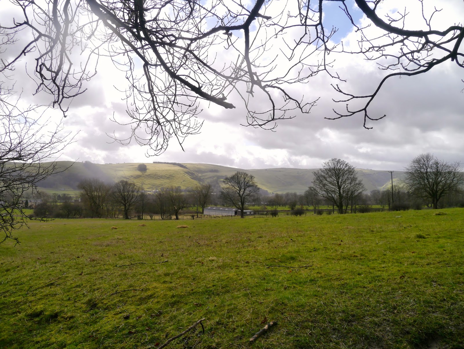
So we pile into my car (I know the way to the parking!) and drive back down the road and turn towards Bamford before taking a left turn and winding upwards on the small road to the pull-in place. Here we have some excellent views of the valley and the hills beyond.

The stile to the start of our walk is immediately on our left and we are soon over it and heading uphill. We have a choice of paths but the 'straight and true'  is the one we choose. We like to get the climbing done early while we still have breath and energy.

The bracken is high but the views are starting to open out. There's a slight haze but we can still see a long way. And we have plenty to talk about.


The heather is in bloom and the hills are swathed in purple. The rugged gritstone of Bamford Edge is ahead of us as we climb a little higher onto the ridge above it. We walk along a little way before descending through the heather and onto Bamford Edge itself. The views from here are spectacular.


Despite it still being the holiday season we have the whole ridge to ourselves and can keep stopping to admire the views, at least, we do when we stop talking for long enough! The purple heather reaches right up to the edge and we soon have views along the reservoirs.

The further we walk the more we can see of Ladybower and of Crook Hill in the distance.


The path dips and starts to fall away from the edge, at the same time becoming narrower and less distinct. There is no proper, official path here, but it is access land and we know where we are heading, more or less. There are a few sheep here too, but they aren't particularly interested in us.


The path takes us to a wall and whilst there is a track beyond it we stop to take stock. It does look vaguely familiar, but not in a good way. We decide to have a quick scout on the path to see if it is the one we want, but we don't have to go more than a few yards to find that all it does is take us across the moor and through thick undergrowth. We back-track and take another narrow path continuing in the direction we had initially been heading. Again, we cross a wall but this time the path is much more promising. Still narrow, and cutting through very high bracken, we follow the line of an unnamed stream that has cut deep into the moor and flows a way below us. We find a crossing point over some stepping stones and head towards what is marked on the map as Pillars. All we can see are two stone built pillars, neither very tall, and a rocky ridge suitable for our lunch stop. We have made much better time than we had expected, although it is starting to drizzle. 

Our course, no walk is complete without buns, and this week, for our first walk back, it is fat choux buns oozing with fresh cream and topped with a swirl of chocolate. They go down extremely well with our coffee after the sandwiches.


After lunch, with the soft rain barely making any difference to us, we continue on our way. The bracken is, if anything, even higher here and the path less distinct. We follow the line of a drystone wall then, at last, it becomes a little clearer. The path keeps to the contour line of the hill, passes by a lone tree, then starts to descend to Jarvis Clough. 

It is a little slippy here, and once we reach the stream we have to make a long stride (with the help of walking poles) to get across. 
Then it is uphill for a short stretch to reach the wide, easy path which will lead us back to the road. It stops raining as we walk along and soon we are at Cutthroat Bridge heading back to the car. All we have to do now is drive back to join car number 1.

The walk has taken far less time than we had anticipated, but it has been an excellent one nonetheless. We are eager to plan for next week too.




Friday, 8 May 2015

AND NOW FOR SOMETHING COMPLETELY DIFFERENT

We couldn't have known as we fought the gales at Castleton that we would be on our last walk of the season. Sadly, we are both of an age where elderly parents cause more loss of freedom than our children ever did, and we have both had to cancel too many times due to the demands of PC's father and my mother.

After much nail-biting and frantic phoning PC finally managed to call someone in to help with her father just before she was due to go out to her boat. So she has escaped. I, alas, have not.

I had been hoping to get out walking for a few days but have been unable to, and this morning seemed to be going the same way. But in the end I decided that I needed to get away, if only for a couple of hours, so instead of the Peak District I headed for the Dukeries, and Clumber Park, which is less than half an hour away.

It is at this time of year that PC always wants to go on a bluebell hunt, so with the sun shining and a small bag packed, I set off with a mission. This walk is for her! (I know she will understand).

I drove into Clumber at the Carburton end; the main road that bisects the park is a national road, known as Lime Tree Avenue, so is free to drive on, though parking anywhere in the park will cost you £6.80 unless you are a NT member (or can avoid the cash collectors on their bikes). Luckily today is a quiet day so even though I park between the trees just off the road there doesn't seem to be anyone about.


I decide to try to bed in my newish boots. I've had them a while but they steadfastly refuse to turn comfortable, and as such I have been wary of using them on anything other than gentle strolls. So on they go - nope, still not comfortable - grab my camera and bag and set off.

Within a couple of minutes I am in the trees on a tiny path, enjoying the silence and the freedom that comes of being alone.
Of course, what I am looking for is that quintessential English spring flower, the bluebell, and from regular walks in these woods in years gone by I know there should be some nearby.

The path takes a couple of turns and then I spot a large clump over to my left. A few paces and I am close enough for some photos.
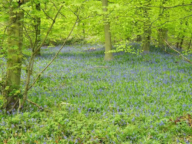
But I know that the best is yet to come. A little way further along the tiny path meets a larger one, and there in front, and to the right, is the huge swathe of bluebells I have been looking for. They are superb, and the camera cannot even begin to do them justice.
 I stand in the middle of them an inhale the soft sweet scent. It is quite magical.
The flowers are all around me, and a panorama shot is called for.
I find it really hard to give up on the flowers, there is no one around and I wander through the bluebells enjoying the scent, the silence, the feeling of peacefulness. 
It is hard to take my eyes off the carpet of blue at my feet, but when I do I see the soft, zingy-green leaves of new beech trees. Their colour contrasts sharply with the flowers.

Eventually I wander back to the path and set off deeper into the woods. The bluebells are still on my left, along with beech and pine. I hear my first cuckoo too!

The path is straight, easy to follow and completely hemmed in by trees. I know some people find woodland eerie, probably a throwback to tales of Red Riding Hood and the like, but I feel totally at ease here.
A take a right turning and wander along another path. The bluebells are diminishing now but there is still plenty to see. A butterfly decides to accompany me, fluttering alongside, stopping a while, then flying again.
After a while it gets bored of my company and disappears. 

I have a number of tracks to choose from, and eventually take one one my right. Then the cuckoo starts calling again, and this time keeps it up for a considerable length of time. The echoes amongst the trees make it hard to work out where the sound is coming from, at first I thought it was ahead of me but I eventually realise that it is somewhere behind. 

This path is very rough and there are a lot of tall, spindly birch saplings here, replacements for the occasional clearance of older trees. There are a few other trees too, including pine, showing off their young cones.
I am pretty sure that I am not far from the car now, even though the woods have thickened up all of a sudden and the path seems to have diminished into nothing. I look around, spot a clearing through the trees and head for it. Sure enough this clearing opens out and there are a number of paths radiating from it. I get my bearings and walk towards, what I hope is, the direction of the road.

Yes, I'm right. I emerge onto Lime Tree Avenue only a few hundred yards away from my car. I walk between the trees and enjoy the birdsong, the greenery, the sunshine.
I haven't been out for long, and I haven't walked very far, but it has been a much needed and very enjoyable walk nonetheless. With luck on my side I might just manage to get out into the Peak District again sometime soon.


Friday, 10 April 2015

ABANDON HOPE AND ENTER CAVEDALE

The best laid plans have been thwarted again and our promised hike from Hope up Win Hill has had to be postponed. This time, gales, heavy rain, sleet, hail - the works! A power cut where I live means no hot water and, worse still, no coffee. Fortunately a quick text to PC resolves this and she gamely brings along coffee as well as bun, and we also rearrange our walk; we don't want to be on high ground in these winds.

So, with Hope abandoned we decide to meet in Castleton instead and are surprised, given the weather, how busy it is. Already there are groups of bedraggled schoolchildren/Duke of Edinburgh walkers out, along with the Easter holiday-makers. 

As usual we park up on the road just past the Peak Cavern, drag on all our waterproof gear, then set off down the road heading towards Cavedale. 

As soon as we turn up between the houses to the dale entrance we have a taste of what is to come. The tiny lane is awash and the wind is funnelling down strongly. We push on through the gate and start our upward paddle, leaning against the wind. Strangely enough, the photos do not show how wet it really is!


We pause beneath the castle as a group of youngsters ahead of us stop, seemingly lost. Their discussion lasts a while before they set off again, on the only path ahead!


When we reach the spot where the group had been we realise why they had paused. It feels as though all the four winds have congregated in this one spot and it is extremely difficult to move forward. No wonder they were debating whether to go on or not. For us, though, there is no dilemma. We have every intention of forging ahead. I promise PC (without anything to back up my assertions, naturally) that further up the valley the wind will be less forceful. 

As we fight our way upwards against the wind and through a wide stream-bed there is a brief glimmer of sunshine. PC captures it perfectly. It makes the whole landscape look benign and pleasant.


 So, just to put the record straight, and get rid of the idea that maybe we were just making it up about the weather, I have added one of my own photos (from my phone) below. Yes, the river is the footpath!


As we climb up Cavedale against the tide (it certainly feels that way) the wind does actually lessen although there seems to be more and more water. It cascades over the limestone in a manner that would undoubtedly have made Capability Brown jealous, although he would probably have made the path around it rather than through it.

Eventually we make it through the gate at the top, relieved to have made it over the worst of the river-cum-path. A natural spring is gushing from the woods a little lower down on our left and beyond it is relatively dry (relative to the downpour and soggy ground). We pause to admire the view, have a nip from the secret flask as a reward, then press onwards.

It is nearing lunchtime so we decide to find somewhere sheltered to have food. It isn't easy, but eventually we managed to huddle up behind some rocks that give us sufficient protection from the wind. We are very close to the path, sadly, but that can't be helped. 

My first hot drink of the day (thank you, PC) goes down extremely well, then we follow with sandwiches and, joy of joys, yummy buns and a drink (it's my birthday walk, and PC is treating me!). The buns are fantastic, fat choux buns with fresh cream and sticky chocolate icing on top. And the drink is fizz. Bliss.
A surprising number of walkers come past us, most just say a quick hello, but one couple have no idea where they are or where they are going. The have come up from Castleton, they tell us (no, really!) but wonder where the path leads and if they can get back to Castleton, and how far, and where do they go, and how far have they come and how long will it take.........the questions go on. They have no map, no food, nothing to drink (they tell us with a kind of misplaced pride) and are hoping we will provide directions and instructions. We do the best we can and send them on their way whilst refraining from telling them to be better prepared next time.

The wind is still keen but the rain has stopped by the time we have finished lunch, so we carry on up the valley along the gentler, wide path. It is quite muddy in places and when we come to one of the gates we are in for a paddle. Mollie is the only one who is happy about it.
We continue ahead, avoiding the mud, then veering to the left where the wide swathe of the path climbs up. It is well walked (this is the Limestone Way, after all) but still grassy. As we reach the top of the rise the wind hits us again with renewed force. We are walking into it and feel as though we are pushing against treacle.

Through the gate and we turn right, then right again heading towards Winnat's Pass. The group of hikers we had remarked on earlier (and seen a couple more times) are at a standstill again close to Rowter Farm. It looks as though this time we might be in danger of catching up with them, but they set off again.

However, a few hundred yards later and they are, once more at a standstill. This time we do catch up and overtake them; a group of older teens debating their route. However, there isn't much choice, other than straight ahead.

They follow us to the end of the lane and as we open the gate to get onto the road they decide to take the stile. Seems a waste of energy, especially since they appear to need to stop every few hundred yards or so.

We turn right and head for Winnat's Pass, the group disappear to who-knows-where. The wind is behind us now but at least the rain has stopped.


It is a familiar walk down the winding Pass, and we keep to the left hand side where there is a path behind a wall. Slippery in places over the worn limestone it is important to be cautious.

Once through the gate at the bottom and onto the wide verge running alongside the road we realise that this might be the hardest part of the walk. The whole verge is a sodden mass with running water and slippery mud. PC has her walking poles which she needs to keep herself upright, and I eventually step onto the road with Mollie as it seems the safer option.
With the wind behind me I find myself being pushing into a jog, PC is quite surprised as I pass her but anything we might say to each other is whipped away by the gale.

Eventually I make it back onto the verge, steady myself against the wind which is pushing like crowd of schoolchildren trying to get onto the bus home. When PC catches up we round a small outcrop in the hope that it will protect us. It affords little help, and there is even more water here.

And then it happens: my turn to bite the dust - or rather, the mud and slush. A combination of wind, mud and rain has me on the skating rink to nowhere. I'm not hurt, fortunately, but it is a struggle to get enough purchase to stand up again, even with PC's help. 

No harm done, so we continue carefully down the slope towards the Speedwell Cavern car park. From here there is a pavement to lead us safely back to the cars. However, looking over our shoulders we see a storm coming, and our final stroll becomes a rush to get back before it reaches us. 

Hail and sleet, driven by the battering gale, hits just as we are getting into the cars. Within a couple of minutes the windscreen is white rimmed and visibility is down to a couple of hundred yards. It would be safe to say that we have made it back in the nick of time.

Saturday, 4 April 2015

HOPE TO CASTLETON - VIA STONEHENGE!

So we have managed it again; the worst possible day sandwiched between two glorious walking days. Rain, heavy cloud, wind and snow on the hills greets us as we park up in Hope and rapidly adjust our plans for the day.

Instead of heading up the Edale valley and onto the Win Hill ridge we choose instead to take a circuit along Hope Valley towards Castleton. Suitably dressed for the conditions (full waterproof gear, gloves and hats) we take the road at the side of the church, wary of the heavy lorries that thunder down this narrow road on their way to the cement works.

There is a footbridge over the river here which keeps us off the road, and we pass the old Pinfold on our right. A short climb up the road and we spy the footpath sign on the opposite side of the road. Across we go just as another huge lorry lumbers down the hill. We are glad to be out of the way.

The path is clear here, and fenced off from the adjacent fields, which means that we can let Mollie have a short stretch off the lead. She immediately picks up a stick (log!) and tries to persuade us to play with her. Nope, not going to happen. We are following the small, fast flowing river (is it big enough to be a river?) called Peakshole Water as we make our way towards the railway line.


Both PC and I are certain we have walked this way before, but neither of us can remember crossing the railway! Clearly our memories are playing tricks on us; either we have never walked here before, or we have forgotten a major part of the walk. (And looking back at the blog list I can't find it! Maybe we only thought we walked here.)

We reach the crossing, descend a few steps and, seeing that the amber lights are not flashing, proceed to cross. A couple are stood at the side of the line, waiting, and remark that they thought a train was coming. If they had read the sign (amber flashing lights mean a train is approaching, no lights = no train) they would have been well on their way but instead they stand there, slightly confused. They may be in for a long wait.

The next part of the walk crosses sheep fields, some of which have recently been spread with muck. They are fragrant, to say the least, but at least the footpath area is relatively clear. There are also a fair number of stiles on this stretch, either awkwardly high ones that require a fair amount of agility (which, sad to say, Mollie does not seem to possess in abundance), or narrow ones that necessitate great sucking-in of stomachs! 

It is not an unpleasant stroll, though, providing you discount the rain, and we are soon on the edge of Castleton. The path becomes a little muddier, then skirts a farmyard before emerging onto the road. Here we turn right, and a little way along cross over to the take the footpath heading straight towards Losehill Hall.

As we walk up the path PC notices something in the adjacent field, partly screened by trees and a high drystone wall. It is a replica of Stonehenge - along with a roundhouse. Bemused to find this in the middle of Derbyshire we nevertheless admire it. PC attempts to find a good spot to take photographs then, as she wonders aloud how on earth Losehill Hall managed to get this construction past the Health and Safety police, a sudden gust of wind sends one of the massive 'stones' rolling through the site like tumbleweed. We have our answer. Polystyrene - or something similar. Well, we were fooled! Though it was certainly very well done, painted to look like real, rough-hewn stone and undoubtedly great fun for those staying at the Hall.


At the top of the track we turn right and keep going until we come to Spring House Farm. Here we do a left turn, then right onto the footpath behind the stables. Mmm, this is clearly the bad part of the walk; boggy, muddy and deep puddles. We squelch and paddle our way though, watched by ponies in the next field, then once out of the mire we cross through the hedge line to see a sign telling us to take the path on the drier side of the hedge! Wish we had known that at the other end.


From here we are crossing grassy fields that, in places, are quite slippery, though none as wet as before. And, as luck would have it, the rain has stopped and the sun is even trying to shine. Behind us the views are lovely, and in front of us lies Hope. Unfortunately, though, we are unable to find somewhere suitable to have our lunch, which is long overdue and we are already feeling very hungry.


We come to a choice of two paths, and although they both seem to lead to the same place (they do!) we decide to follow the one with the yellow footpath arrow on it. PC goes first, and as I try to persuade Mollie to go through the kissing gate I hear PC make a soft exclamation and look up to see her on the floor. She says it was a graceful slide down rather than a fall, and I believe her. She is rather muddy though.


As soon as we are across the field and through the exit we realise we could have avoided the slippery patch - ah well, live and learn. We are close to the outskirts of Hope now, and there are small groups of teenagers walking past - probably Duke of Edinburgh students (Who else would be out walking on a day like this? asks PC. Er, us, actually.)


We come to a bridge over the railway, it dips ominously in the middle although it must have been constructed that way, but the sign saying no more than 20 people on the bridge at once makes us pause to wonder. 

At the far side the next stile is a broken, ramshackle and quite dangerous affair with a deep, steep sided muddy puddle at the far side. From here, though, it is a fairly easy walk crossing numerous small fields, into Hope. 

We come out adjacent to the school, make our way to the Edale Road then it is a short walk back to the cars.

It is late for lunch, but we have no intention of missing it. Once divested of our muddy outerwear we settle down in the car to superb coffee, sandwiches and fresh cream eclairs. It all tastes wonderful, probably because we have worked up such an appetite. 

By the time we are ready to leave the sun is out and the last vestiges of snow have melted. We are hoping to meet here again next week to do the walk we originally intended. Fingers crossed.


Monday, 23 March 2015

BURBAGE TO STANAGE AND BACK

Well, it happened again. Cancelled walks - this time due to my mother falling and being hospitalised - and a long wait before we are able to get out again. Then PC succumbs to the recent bug/chest infection which means choosing something steady.

So we park up at Upper Burbage Bridge after passing coach-loads of school children - must be that time of year again when Geography teachers get to introduce their pupils to the Great Outdoors. It's actually quite chilly and murky this morning, although when I left home the sun was trying to shine. Fingers crossed the weather will improve.

Plenty of layers, then, as a guard against the cold, after which we need to restrain Mollie who is more than eager to go.

We cross the road and walk along the verge to the level path that is part of the Sheffield Country Walk. A woolly-legged grouse scuttles off in front of us as we do our usual catch-up talk. When we come to the rise up onto the first part of the edge we have to be careful due to the large stones and boulders that appear to be ready to be used for path repairs.


Once over these we climb up onto the start of the edge with the wide rocky slabs of gritstone and peaty puddles. We very quickly arrive at the trig point but the view, usually so good, is disappointing. A widespread murk covers everything in sight. PC gamely takes a few photos, though, before we set off along the edge.

This is oh-so-familiar, we have lost count of the number of times we have walked here, but it makes for steady - if uneven - walking which is ideal for PC. We are fairly early and the usual crowds have yet to arrive so we pretty much have the paths to ourselves.

We walk on for a while before deciding to sit on one of the rocky outcrops for a coffee and to admire the - well, the murk actually. Spiced vanilla latte again, which is lovely though a little on the thick side today. No idea why, maybe too much milk to water, but it goes down well.

As we continue we consider the best options. PC doesn't really feel up to a long haul uphill which would be the case if we drop off the edge (not literally!) and walk up the road, so we decide that after lunch we will turn back, descend a little way and hopefully not lose too much height.


Our lunch stop is familiar, yes, we even have our favourite eating places up here, where we can admire the view along the edge (not quite as murky now) and keep a little sheltered from the gentle breeze.

Sandwiches, coffee and pre-Easter hot cross buns, but this time with fresh cream and jam filling. Yum. Mollie devours her biscuits and drinks out of her new, collapsible water bowl.


Then it is back on with our gear and retracing our steps. Unsurprisingly there are now loads of people out walking so it is good when we find a descent a little south of Stanage Plantation  along what seems to be a stream bed, but is actually a path that just happens to drain water from the top.


Soon we are walking through the dry, rusty bracken beneath the Edge and can see the climbers scaling the cliffs. The path comes and goes, in places it is indistinct, but it is uninterrupted walking. At last we see an incline and decide to go up it to avoid PC having to slog up the road further on.


A few steps later and we are back on the top, with minimal effort, but after a short distance we once again choose to go down and find a way to skirt the uppermost point where the trig point is along with a lot of people. We're successful, and make our way through the bracken and around rocks to emerge on a broad path which takes us to some roadside parking.

We cross the road and walk along it until we can cut across and go through the gate at Fiddler's Elbow, which suits Mollie much more than road walking.


It isn't far now and in no time we are back at the cars. PC is in fine shape, the walk hasn't been strenuous and she hasn't had a relapse so it has all been worth while. Just a pity about the views.

OVER HADDON TO CONKSBURY CIRCUIT

Well we've managed it, the only wet (very wet!) day in a week of clear skies. Nice to see we haven't lost the knack.

Mollie is back with us today as we meet in the comparatively large car park at Over Haddon. We've only ever parked in the upper section as there have never been many cars when we've walked, but we can imagine it gets pretty full at the weekend. Of course it is a Pay and Display but it also has the benefit of toilets that are open.

Once we've togged up - waterproofs from the start today - we set off down the steep road to Lathkill Dale with the rain running in rivulets by our feet.

At the foot of the road we come to the River Lathkill which, no surprises, is flowing swiftly. It looks lovely despite the starkness of the winter landscape, and with the added addition of snowdrops on its scrubby banks. In fact, today turns out to be a very snowdroppy walk as we see them everywhere.


After some photos we cross over the clapper bridge and head upwards through the trees on the distinct track. This turns a sharp right then takes us higher still until we go through a gate and into a field which, thankfully, is devoid of cattle!


We cross the field and head towards the farm of Meadow Place Grange, once a monastic holding (see previous blog post) where we go through another gate and through a muddy yard. We then head for the track on our left which is relatively dry, unlike the muddy field path ahead. Glad we aren't going that way today.


As we walk along the farmer approaches with his tractor so we step aside out of his way. He waves his thanks as he passes and as I turn to see what PC is up to I see, for the first time despite looking for years, the distinctive outlines of Conksbury Medieval Village on the opposite hillside. Trees have obscured our view before though it is probably more obvious if walking from the opposite direction.

The link below gives the English Heritage listing for the site with more information.http://list.english-heritage.org.uk/resultsingle.aspx?uid=1014589
I have tried to find an aerial photo of the site but sadly had no success.

We continue along the track to the road, which tends to be quite busy for a small rural road, and go down it a little way before hopping onto a track on our right. We walk along a little way through some trees to a gate but decide to turn back as this clearly leads towards Alport and that isn't in our plan for the day.


Back at the road we walk downhill towards the impressive Conksbury Bridge and once at the far side we make a bee-line for the benches. They are wet but slightly sheltered from behind, and I have brought a large umbrella with just this scenario in mind. So, beneath the brolly we have a nip from PC's secret flask (the last of the Cointreau), a cup of coffee and two of today's buns (which are quite small, honest).


Sadly, despite appearances to the contrary, they are not up to the standard expected. They are quite dry and in need of a quick zap in the microwave. Not that it stops us eating them.

So with us set up and Mollie having had some biscuits we put down the brolly and take the path at the side of the Lathkill. There are a few walkers about now, but this is a lovely path which opens up to lovely views up the river. There are a pair of swans in the distance and moorhens bobbing around.


We scramble up the slippery slope on our right to find a makeshift seat on a fallen tree (been here before) and up comes the brolly again as we settle down for lunch proper. And it's a good job we have the brolly too as the heavens open and it absolutely pours down.

Salad, sandwiches, coffee and the last two buns which leave us with a sense of disappointment. Ah well, we'll know for next time.


By the time we have finished eating the rain does ease a little so we carefully step down the slope and back onto the path. Now we follow the river and as the path climbs up I avoid looking at the young cows, then we take care on the downward stretch and the limestone underfoot can be very slippery when wet.
We aren't far from the clapper bridge now but we still have the delights of huge clumps of snowdrops to enjoy. Then it is just the steady trudge up the steep hill and back to the car park.
Naturally, as soon as we are ready to leave the rain stops, and by the time I am half way home the sun even starts to shine. A fairly typical day's walk for us!