Stanage
Showing posts with label Hope. Show all posts

Tuesday, 17 November 2015

A FOGGY DAY AROUND EDALE VALLEY

The best laid plans are sometimes thwarted, and such is the case for us today. We had hoped to park in a little turning on a tiny lane, one that we had seen on a previous walk many moons ago and which is even noted in some walking books. So we drive in a convoy of two towards the parking space, only to find that a farmer had made certain that it was unusable. 

A bit of nifty reversing and manouvering before we pull up to discuss our options. There is very limited parking between Hope and Edale, just a few laybys, so we decide to drive to the next layby before considering further.

Quite some way down the road, passing some tempting footpaths but no chance of parking to walk them (we have Mollie with us, and her aversion to roads and traffic makes her a liability on narrow, speedy roads like this), we find a large pull in. Out come the maps, then we're off again, this time to nab the last couple of spaces at Nether Booth. It's a good job we are early today.

It's murky and foggy and not a terribly pleasant day, but we are undeterred.

Once we are suitably togged up we take the path signposted 'Youth Hostel' then off of this tarmac track we turn left through a small gate onto a barely discernible path. We're going through a sheep field in the general direction of Edale.

One or two gates are easily negotiated, and the path appears to be straight and easy. We come to a field, fenced off from the path, with a particularly morose looking ram. He poses for a portrait with extreme disinterest.
The weather is dank, that chilly almost-but-not-quite damp, which doesn't encourage PC to take loads of photos, though it doesn't stop us talking. We pass through a farmyard at Ollerbrook Booth with a very well behaved farm dog - it didn't even bark once at us - maybe it is as miserable as the ram.

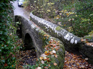
As we come to the outskirts of Edale, or rather Grindsbrook Booth, we find ourselves on a little path that leads downhill to a beautiful little bridge over the lower reaches of Grinds Brook. It is only wide enough for one person at a time but we do pause to admire the view up and down the stream.
The path brings us out at the back of the village pub, the Nags Head, where we meet another lady walker who is deciding where to go today. We oblige by taking her photo for her then we head off in opposite directions.
We take the track that is grandly signed as the 'Start of the Penine Way' - not that we have ever noticed the sign before as we usually return this way - and we are under a tunnel of trees next to a stream. Mollie can have a few minutes off the lead - no sheep here - and goes for a paddle.
This is very familiar territory as we leave the shelter of the trees and find the stile on our left which is the well-walked beginning of the Pennine Way, suitably paved with huge flagstones.
It is a very gentle incline up through fields and gates, and we soon come to one of the very few benches on this stretch of the walk. Not noon yet, but we have time enough to sit and enjoy a coffee before lunch, and enjoy the slightly hazy view. But I have forgotten the coffee cups! And a spoon for the sugar. But we improvise, sharing the cup from the top of the flask and stirring the sugar with a fork. With coffee drunk we have managed to spin out enough time to eat lunch, and bun of course. A very tasty fresh cream eclair.
Despite being murky and dank it isn't particularly chilly, but we decide we had better move on. The path is level to begin with, then climbs a little to a viewpoint beneath Broadlee-Bank Tor.
Next we are on the downward slope towards Upper Booth, with Mollie delightfully chasing stones down the rain-rutted track. As we enter Upper Booth we decide to take a path through a gate on our left, and through a field with a couple of horses in. It isn't a terribly clear path on the ground, but it is reasonably straight forward.
The path heads towards the railway line, and when we are partway there it starts to rain with a little more gusto. Not too much yet, but enough to make us zip up. For a short stretch the path runs alongside the railway then goes up and over a bridge before entering Barber Booth. It must be a little disconcerting for the people living in the property facing the path as walkers have a direct view straight into their kitchen.

We now have to wind our way around Barber Booth, avoiding the main road, then take the path back over the next railway bridge. And by now the rain has set in.

We cross fields until we come to a point where the path divides, and choose the bottom path which takes us to Edale.
The path brings us out near to the church with views of the hills behind obscured by the mist. At least the rain has eased a little.

We go up the road a short distance and take the footpath on the opposite side of the road, after the activity centre and before the church.

This is another surprise, a beautiful little path with very pretty views upstream. As we press onwards towards Ollerbrook Booth though it begins to rain again. And this time it really means it.
From Ollerbrook Booth we retrace our steps with a degree of determination. The rain is pounding down now. Further along the path we meet the lady we had spoken to earlier in the day, she on her return journey towards Edale. 

Soon we are back at the cars, sodden but satisfied. It has been a low-level walk, and a soggy one, but a surprisingly good one to say that it was a last minute choice. Certainly one to remember for another time.

Friday, 10 April 2015

ABANDON HOPE AND ENTER CAVEDALE

The best laid plans have been thwarted again and our promised hike from Hope up Win Hill has had to be postponed. This time, gales, heavy rain, sleet, hail - the works! A power cut where I live means no hot water and, worse still, no coffee. Fortunately a quick text to PC resolves this and she gamely brings along coffee as well as bun, and we also rearrange our walk; we don't want to be on high ground in these winds.

So, with Hope abandoned we decide to meet in Castleton instead and are surprised, given the weather, how busy it is. Already there are groups of bedraggled schoolchildren/Duke of Edinburgh walkers out, along with the Easter holiday-makers. 

As usual we park up on the road just past the Peak Cavern, drag on all our waterproof gear, then set off down the road heading towards Cavedale. 

As soon as we turn up between the houses to the dale entrance we have a taste of what is to come. The tiny lane is awash and the wind is funnelling down strongly. We push on through the gate and start our upward paddle, leaning against the wind. Strangely enough, the photos do not show how wet it really is!


We pause beneath the castle as a group of youngsters ahead of us stop, seemingly lost. Their discussion lasts a while before they set off again, on the only path ahead!


When we reach the spot where the group had been we realise why they had paused. It feels as though all the four winds have congregated in this one spot and it is extremely difficult to move forward. No wonder they were debating whether to go on or not. For us, though, there is no dilemma. We have every intention of forging ahead. I promise PC (without anything to back up my assertions, naturally) that further up the valley the wind will be less forceful. 

As we fight our way upwards against the wind and through a wide stream-bed there is a brief glimmer of sunshine. PC captures it perfectly. It makes the whole landscape look benign and pleasant.


 So, just to put the record straight, and get rid of the idea that maybe we were just making it up about the weather, I have added one of my own photos (from my phone) below. Yes, the river is the footpath!


As we climb up Cavedale against the tide (it certainly feels that way) the wind does actually lessen although there seems to be more and more water. It cascades over the limestone in a manner that would undoubtedly have made Capability Brown jealous, although he would probably have made the path around it rather than through it.

Eventually we make it through the gate at the top, relieved to have made it over the worst of the river-cum-path. A natural spring is gushing from the woods a little lower down on our left and beyond it is relatively dry (relative to the downpour and soggy ground). We pause to admire the view, have a nip from the secret flask as a reward, then press onwards.

It is nearing lunchtime so we decide to find somewhere sheltered to have food. It isn't easy, but eventually we managed to huddle up behind some rocks that give us sufficient protection from the wind. We are very close to the path, sadly, but that can't be helped. 

My first hot drink of the day (thank you, PC) goes down extremely well, then we follow with sandwiches and, joy of joys, yummy buns and a drink (it's my birthday walk, and PC is treating me!). The buns are fantastic, fat choux buns with fresh cream and sticky chocolate icing on top. And the drink is fizz. Bliss.
A surprising number of walkers come past us, most just say a quick hello, but one couple have no idea where they are or where they are going. The have come up from Castleton, they tell us (no, really!) but wonder where the path leads and if they can get back to Castleton, and how far, and where do they go, and how far have they come and how long will it take.........the questions go on. They have no map, no food, nothing to drink (they tell us with a kind of misplaced pride) and are hoping we will provide directions and instructions. We do the best we can and send them on their way whilst refraining from telling them to be better prepared next time.

The wind is still keen but the rain has stopped by the time we have finished lunch, so we carry on up the valley along the gentler, wide path. It is quite muddy in places and when we come to one of the gates we are in for a paddle. Mollie is the only one who is happy about it.
We continue ahead, avoiding the mud, then veering to the left where the wide swathe of the path climbs up. It is well walked (this is the Limestone Way, after all) but still grassy. As we reach the top of the rise the wind hits us again with renewed force. We are walking into it and feel as though we are pushing against treacle.

Through the gate and we turn right, then right again heading towards Winnat's Pass. The group of hikers we had remarked on earlier (and seen a couple more times) are at a standstill again close to Rowter Farm. It looks as though this time we might be in danger of catching up with them, but they set off again.

However, a few hundred yards later and they are, once more at a standstill. This time we do catch up and overtake them; a group of older teens debating their route. However, there isn't much choice, other than straight ahead.

They follow us to the end of the lane and as we open the gate to get onto the road they decide to take the stile. Seems a waste of energy, especially since they appear to need to stop every few hundred yards or so.

We turn right and head for Winnat's Pass, the group disappear to who-knows-where. The wind is behind us now but at least the rain has stopped.


It is a familiar walk down the winding Pass, and we keep to the left hand side where there is a path behind a wall. Slippery in places over the worn limestone it is important to be cautious.

Once through the gate at the bottom and onto the wide verge running alongside the road we realise that this might be the hardest part of the walk. The whole verge is a sodden mass with running water and slippery mud. PC has her walking poles which she needs to keep herself upright, and I eventually step onto the road with Mollie as it seems the safer option.
With the wind behind me I find myself being pushing into a jog, PC is quite surprised as I pass her but anything we might say to each other is whipped away by the gale.

Eventually I make it back onto the verge, steady myself against the wind which is pushing like crowd of schoolchildren trying to get onto the bus home. When PC catches up we round a small outcrop in the hope that it will protect us. It affords little help, and there is even more water here.

And then it happens: my turn to bite the dust - or rather, the mud and slush. A combination of wind, mud and rain has me on the skating rink to nowhere. I'm not hurt, fortunately, but it is a struggle to get enough purchase to stand up again, even with PC's help. 

No harm done, so we continue carefully down the slope towards the Speedwell Cavern car park. From here there is a pavement to lead us safely back to the cars. However, looking over our shoulders we see a storm coming, and our final stroll becomes a rush to get back before it reaches us. 

Hail and sleet, driven by the battering gale, hits just as we are getting into the cars. Within a couple of minutes the windscreen is white rimmed and visibility is down to a couple of hundred yards. It would be safe to say that we have made it back in the nick of time.

Saturday, 4 April 2015

HOPE TO CASTLETON - VIA STONEHENGE!

So we have managed it again; the worst possible day sandwiched between two glorious walking days. Rain, heavy cloud, wind and snow on the hills greets us as we park up in Hope and rapidly adjust our plans for the day.

Instead of heading up the Edale valley and onto the Win Hill ridge we choose instead to take a circuit along Hope Valley towards Castleton. Suitably dressed for the conditions (full waterproof gear, gloves and hats) we take the road at the side of the church, wary of the heavy lorries that thunder down this narrow road on their way to the cement works.

There is a footbridge over the river here which keeps us off the road, and we pass the old Pinfold on our right. A short climb up the road and we spy the footpath sign on the opposite side of the road. Across we go just as another huge lorry lumbers down the hill. We are glad to be out of the way.

The path is clear here, and fenced off from the adjacent fields, which means that we can let Mollie have a short stretch off the lead. She immediately picks up a stick (log!) and tries to persuade us to play with her. Nope, not going to happen. We are following the small, fast flowing river (is it big enough to be a river?) called Peakshole Water as we make our way towards the railway line.


Both PC and I are certain we have walked this way before, but neither of us can remember crossing the railway! Clearly our memories are playing tricks on us; either we have never walked here before, or we have forgotten a major part of the walk. (And looking back at the blog list I can't find it! Maybe we only thought we walked here.)

We reach the crossing, descend a few steps and, seeing that the amber lights are not flashing, proceed to cross. A couple are stood at the side of the line, waiting, and remark that they thought a train was coming. If they had read the sign (amber flashing lights mean a train is approaching, no lights = no train) they would have been well on their way but instead they stand there, slightly confused. They may be in for a long wait.

The next part of the walk crosses sheep fields, some of which have recently been spread with muck. They are fragrant, to say the least, but at least the footpath area is relatively clear. There are also a fair number of stiles on this stretch, either awkwardly high ones that require a fair amount of agility (which, sad to say, Mollie does not seem to possess in abundance), or narrow ones that necessitate great sucking-in of stomachs! 

It is not an unpleasant stroll, though, providing you discount the rain, and we are soon on the edge of Castleton. The path becomes a little muddier, then skirts a farmyard before emerging onto the road. Here we turn right, and a little way along cross over to the take the footpath heading straight towards Losehill Hall.

As we walk up the path PC notices something in the adjacent field, partly screened by trees and a high drystone wall. It is a replica of Stonehenge - along with a roundhouse. Bemused to find this in the middle of Derbyshire we nevertheless admire it. PC attempts to find a good spot to take photographs then, as she wonders aloud how on earth Losehill Hall managed to get this construction past the Health and Safety police, a sudden gust of wind sends one of the massive 'stones' rolling through the site like tumbleweed. We have our answer. Polystyrene - or something similar. Well, we were fooled! Though it was certainly very well done, painted to look like real, rough-hewn stone and undoubtedly great fun for those staying at the Hall.


At the top of the track we turn right and keep going until we come to Spring House Farm. Here we do a left turn, then right onto the footpath behind the stables. Mmm, this is clearly the bad part of the walk; boggy, muddy and deep puddles. We squelch and paddle our way though, watched by ponies in the next field, then once out of the mire we cross through the hedge line to see a sign telling us to take the path on the drier side of the hedge! Wish we had known that at the other end.


From here we are crossing grassy fields that, in places, are quite slippery, though none as wet as before. And, as luck would have it, the rain has stopped and the sun is even trying to shine. Behind us the views are lovely, and in front of us lies Hope. Unfortunately, though, we are unable to find somewhere suitable to have our lunch, which is long overdue and we are already feeling very hungry.


We come to a choice of two paths, and although they both seem to lead to the same place (they do!) we decide to follow the one with the yellow footpath arrow on it. PC goes first, and as I try to persuade Mollie to go through the kissing gate I hear PC make a soft exclamation and look up to see her on the floor. She says it was a graceful slide down rather than a fall, and I believe her. She is rather muddy though.


As soon as we are across the field and through the exit we realise we could have avoided the slippery patch - ah well, live and learn. We are close to the outskirts of Hope now, and there are small groups of teenagers walking past - probably Duke of Edinburgh students (Who else would be out walking on a day like this? asks PC. Er, us, actually.)


We come to a bridge over the railway, it dips ominously in the middle although it must have been constructed that way, but the sign saying no more than 20 people on the bridge at once makes us pause to wonder. 

At the far side the next stile is a broken, ramshackle and quite dangerous affair with a deep, steep sided muddy puddle at the far side. From here, though, it is a fairly easy walk crossing numerous small fields, into Hope. 

We come out adjacent to the school, make our way to the Edale Road then it is a short walk back to the cars.

It is late for lunch, but we have no intention of missing it. Once divested of our muddy outerwear we settle down in the car to superb coffee, sandwiches and fresh cream eclairs. It all tastes wonderful, probably because we have worked up such an appetite. 

By the time we are ready to leave the sun is out and the last vestiges of snow have melted. We are hoping to meet here again next week to do the walk we originally intended. Fingers crossed.


Wednesday, 21 November 2012

BEYOND HOPE LIES DESPAIR - AND AN OLD ROMAN FORT

Or at least a fair amount of mud ... a round walk from Hope to Brough and Bradwell
Pastures new for us this week with only a vague plan of our exact route. The title of the post is courtesy of PC's husband, and when we hit the muddy patches we couldn't do any more than agree with him.

It isn't a particularly inspiring day; overcast in places, foggy in others, and cold. We're without dog again - Mollie nowhere to be found when PC went to collect her (she must have been hiding since she was in her basket when PC checked on her return journey!) so we know we don't have to worry too much about traffic, which Mollie hates.

We meet in Hope and as soon as we're booted up we head to the toilets, only to find them closed. And on a cold day too...

We amble past the church then walk down the narrow lane at the side before coming to the bridge over a wide stream (Peakshole Water?) and pause to admire the admittedly small Pinfold on the opposite side of the road. Then we're off up the road and taking the first turn on the left.


It's uphill at this point but once we've passed a huge, steaming pile of manure (yes, really) we turn left again and climb over a stile into an only-slightly muddy field with excellent views back 


towards Hope and up towards Lose Hill and Win Hill. The large grassy field is full of sheep, and I'm only grateful that they aren't cattle, or we'd be looking for another way around.

Marked on the OS map is an old cross (remains of) and we wonder if we have found it when we come up against a single post standing in the ground. PC takes a photo for our records then we're on our way again.

The indistinct path takes us slightly uphill and through a gateway, which is a little muddier than the last one. Soon we crest the small rise and can look along a broad sweeping field with sparse woodland on our right and the River Noe away to our left. We keep close to the tree line as the path is invisible here, and soon we are rewarded with the sight of a wooden bridge.


The colours of the leaves, deep buttery yellow, stand out against the dark background of the enclosed bridge. The bridge, however, is not the easiest to cross since it doesn't have a stile, just some rails to clamber over. The stream which it spans appears to be lined with stone, so once over the other side I decide to consult the map. That is, after I have ploughed through the mud! In the field on this side of the stream are horses. Nothing wrong with that, but they do have a tendency to churn up the ground and they have made a spectacular job of it here.


Once I'm through the mud I wait for PC and peruse the map, coming to the conclusion that we have, in fact, found the roman fort of Navio. All that remains now is a raised square platform with some broken stones in the centre - and although they don't look too impressive these mark the entrance to the roman underground strong room. There is quite a bit of information on the web for Navio, and some good ariel photos, but for some background information that isn't too heavy try looking at:  www.peakdistrictonline.co.uk/navio-rom

After spending a little time wandering around the old fort, and fending off the curious horses who are determined to act as our guides, we continue south into the village of Brough. Here we turn left on the road, over the swift running Bradwell Brook, then cross the road and take the lane opposite.

Here we head uphill, and it really is uphill, all the way!

Part way up the hill the road turns at a right angle, and continues to climb. We push on, enjoying the opening views, though we aren't so thrilled about the sight of the cement works. It is cathedral-like in stature, and dominates everything. But so ugly.

There are some walkers ahead of us, and we deliberately keep our pace slow so that we don't catch up with them. For if we did, and then overtook them, we'd be forced to push our pace, and we don't want to do that! As we follow in their (slow) footsteps we discover that they have dropped a piece of paper. Picking it up we see that it is a walk description from The Sheffield Star newspaper. Well, there's no way we're sprinting after them to return the paper but we tuck it into our map holder just in case we catch up with them at some point.


It's a long haul up the steep hill but the views are good, if not particularly photogenic. It is probably an old pack horse road, and is called Brough Lane on the map.

Sure enough, as the track levels off a little we see the three walkers ahead pausing at a stile. It's the route they should be taking (if they are following the Star walk) but after a discussion they ignore the path and carry on. We're determined not to rush to catch up. We know the path we want, and it's the next one along.

By the time we reach 'our' path the three men are dithering at the stile. As we approach (there's a limit to how slow we can walk) one of them says that he hopes we aren't following them as they're lost (bloody cheek!) At that we produce their scrap of paper - to their great delight - and we explain to them where they are and where they need to go. Needless to say they don't have a map with them, assuming that the vague newspaper route is sufficient. Hmmmm.

We point them in the right direction and let them go on ahead as we saunter behind and look for a place to stop for lunch. At last we squeeze through a gate and find a lovely spot with our backs to a drystone wall and a view over the village of Bradwell and the surrounding countryside. Even the sun has started to shine for us.


We start off with a nip from the secret flask. The sun may be shining but it isn't exactly warm. Then it's coffee before the sandwiches. We eat the sandwiches quickly, mainly because we're keen to get to the buns which are, hopefully, better than last week's.

Sticky Nutty Cheesecake Wedges. There's a first time for everything and although these don't look too impressive they do taste very good. A gooey caramel topping and a very tasty nutty and caramel cheesecake filling. We proclaim them to be excellent, and decide to finish off with another coffee. At this point, PC's husband comes in for a fair amount of stick since there isn't enough coffee in the flask for another cup, and he's the one who so generously made it this week - for the first and last time! So we are forced to have another nip from the other secret flask to compensate for the lack of coffee.


By now it's time to move on so we haul ourselves upright and set off down the hill. The path is very distinct, though narrow, and most unpleasant. It is extremely muddy with a high potential for slips and slides. We manage to stay upright but at times it's a close run thing. It seems a very long way to walk when you're having to watch every step, and avoiding some of the worst sections isn't easy. Finally, with very muddy boots, we make it to the tarmac road at the bottom of the hill.

We've never been to Bradwell before and as we walk through the village we are surprised at how lovely it is. Narrow streets, attractive cottages, and quiet. And you can't actually see the cement works.

We meander down to the main road, pause at the bridge crossing over the Bradwell Brook, and admire the curious street names. It really is a lovely village.

We have to follow the main road for a while before crossing over and turning left onto a narrow road. This will take us all the way back to Hope. It passes between some old quarry lakes, and we read a sign on a fence post about a boy who fell into one of the lakes and drowned as emergency services were unable to reach him. Tragic.


There is quite a bit of traffic on the road, probably because it provides a perfect short cut between the two villages but there is enough room to walk too. It doesn't take us long to arrive back at the large manure heap - a steaming beacon to mark our way - then drop down to the main road into the village.


It's only a short walk now past the church and to our cars. We're muddy, but we've been worse, and we're pleased to have done the walk although we wouldn't really call it one of our favourites. PC is keen to set off to check if Mollie is OK (she is, and seemingly very sheepish for a collie!) but we have time to plan our walk for next week. Since it will be PC's birthday week she has chosen one of her favourites, Win Hill, so we're keeping our fingers crossed for good weather since the last time we were there it was pretty grim! Hopefully we'll avoid the snow and the sun will shine on us.

Saturday, 10 December 2011

ABANDON ALL HOPE


FROM HOPE TO WIN HILL IN HIGH WINDS, SLEET AND RAIN

First of all I must point out that this week's walk was all PC's idea, and she must take full responsibility for it. Even her suggestion when we meet, before 10am, that 'we go to the pub for the day' does not absolve her in any way.


We've had a week off and our last walk, which was windy but mild, had lulled us into a false sense of well-being. Since then we've had snow, rain and gales so on the drive to Hope we aren't surprised to see the peaks liberally covered with the white stuff. And the forecast isn't promising: gales in Scotland, possibly filtering down to us later. Hence PC's suggestion that we sit out the day in the pub. Tempting, but she isn't getting off that easily. So we layer up, consult the map and set off.


At the moment there isn't any rain and although it is cold there's barely a breeze, so we're feeling fairly confident. We walk up Edale Road and turn right onto the small road leading to the cemetery. We cross the bridge spanning the River Noe which is flowing fairly fast, ignore the path running alongside it and take the next right hand path which takes us past the cemetery.


The path goes through a gate then underneath the railway line. From here the wide path takes us gently uphill and past a neatly kept patch of land that looks like a small site for caravans. Sure enough, when we arrive at the top of the path and pass Fairfield Farm we see the sign at the end of the driveway that indicates a Caravan Club CL site (5 caravans only). That's one worth remembering.


At the end of the drive we turn left onto the narrow road leading towards Aston and it's a little more noticeably uphill. By the time we take the left hand turn (signposted Hope Cross) PC is removing a layer. We wonder if this part of the old roman road, but careful study of the map makes it seem unlikely as the road appears to be lower down.


We press on uphill and start to see the wonderful views over towards Mam Tor and Lose Hill with their snow covered tops. We're so glad we aren't up there this week!


At the top of the tarmac lane we turn left onto the rough track which leads up - eventually - to Hope Cross. A fat squirrel crosses our path and scurries away as a ginger cat eyes us suspiciously. Do they know something we don't?


The first section of this path is very stony, and wet. It's a sign that there's been a lot of rain lately as there are rivulets of water running downhill, but it's easy enough to avoid the streams and we continue dry-shod. There are trees to our left, sheltering us from the view of the cement works (thank goodness) but every now and then there is a break which gives us ever-improving views towards the snowy peaks of the Great Ridge.


An abandoned, ruined farm building hunches at the side of the path, then we go through a gate and onto a path which cuts across a rough field. It is slippery, slick and muddy and although the uphill gradient is minor it takes effort not to slide around too much. At this point we are unaware that worse is yet to come!


Above Twitchill Farm and at a crossroads of paths, not very distinct but there is a signpost, we pause to admire the views - and the gathering clouds. PC snaps away with her phone (did I mention that she forgot the camera?) and we agree that it is wonderful to be out enjoying such glorious scenery. After a brief debate we decide to continue straight on rather than climbing steeply uphill towards Win Hill, as we want to enjoy the vista opening up in front of us.


Apart from the slippery ground the walking isn't hard and we find it easy to avoid the numerous puddles on the path. We pass through another gate and we're finally onto open moor. It's a little bit breezy here, but nothing to worry about. It's a steady but easy climb and we've made the right decision as we can now see beyond the Great Ridge to the Kinder Plateau which looks spectacular with drifts of snow emphasising the contours of the land.


We feel a couple of spots of rain so PC decides to put her coat back on, and when I see the rapidly looming grey clouds I follow suit by dragging on my waterproof trousers. Just in time too. Almost as soon as we're dressed we're hit by rain, sleet and hail. And wind. Where did that come from all of a sudden?


We press on uphill expecting the wind to ease, but it doesn't. Nor does the rain and sleet. The higher we go the harder it is to keep our footing as we're constantly being pushed sideways into the hill. For once talking has ceased as we keep our heads bowed and plough on.


As we hit the top of the path we're struggling to stay upright. The wind is so fierce that we are seriously beginning to doubt our sanity (not for the first time) but there's no turning back. The Kinder Plateau is completely obscured by ominously thick clouds and it's impossible to look in the direction of Mam Tor because that is where the driving sleet is coming from, so it doesn't look as though we're in for a respite.


Turning towards Win Hill we set off again; one step forwards, two steps sideways. Enormous puddles cover the width of the broad path and rivers link one puddle to the next. We manage to avoid them, but we have to use sign language to communicate as we can't make ourselves heard over the wind. We've reached the snow line too, with slush on the puddle-free sections of track and white fluffy sheets on the heather.


After a while we realise that the sleet has stopped and bracing ourselves against the wind (which hasn't stopped) we turn around 360 degrees to admire the view. PC spies Ladybower reservoir looking full for a change, and across the valley Crook Hill looks stark and uninviting. To the north-west we can see the roman road heading to Hope Cross. Strangely enough, there are no other walkers on this popular path. I wonder why not?


There's a long wall crossing the path with the option of a stile or gate. Naturally we choose the gate, and at the far side we fall gratefully into the shelter of another wall which runs at the side of the path. At last we're able to stand upright without effort, though our leg muscles are aching with the unaccustomed requirement to fight for balance whilst walking forward. As we rest we reward ourselves; cointreau from PC's secret flask (it's easier to get to than mine). A couple of hefty nips soon makes everything seem warmer and rosier.


Walking is a lot easier now with the benefit of the wall on the windward side, and the cointreau on the inside. However, as soon as we lose the wall we're completely exposed again and the full force of the gale makes itself felt. Win Hill doesn't look terribly promising so we prudently decide not to go right over top but keep to the path which skirts around the southern side. Before we reach it, though, we see two other walkers coming up from the south and heading right for the summit. They manage it so far, then turn and hunker down on the leeward side against the wind.


As we approach the slope of Win Hill it becomes increasingly difficult to stay upright. Every footstep has to be carefully judged but every pause is punished by the hammering gale. Its a case of heads down, watch your feet and don't look back. Just below the trig point I manage to sit on a boulder to wait for PC to catch up. When she reaches me she sits on another boulder a little higher up. After a brief break we have to fight to stand up and regain our balance before setting off again. Tempted to look back at the view I'm almost knocked off my feet, so I carry on, but PC is more successful and manages to take some photos. She's not sure she's been able to keep still enough, though, since the wind was rocking her so much.

It's downhill now, but quite worrying as the steeply sloping steps are covered in snow, slush and running water. I make it to the bottom first and wait for PC to catch up (she's been taking pictures), then we continue down towards Winhill Plantation. All of a sudden the wind stops. Completely. Under no illusions we know that we have dropped down sufficiently to be protected by the lay of the land, but it is very strange to suddenly be able to hear, talk and stand upright without effort.


We pause to consider our options. Namely, we're hungry and need somewhere to sit for lunch. Fortunately, just in the edge of the plantation are a couple of fallen trees, so we cross the snow and heather towards them. It's a perfect spot; sheltered with seating provided.


Sandwiches are dispatched with alarming speed, followed by a warming cup of coffee. PC suggested leaving the buns until later, but we're too hungry, so out they come. These are a first. Pear tarts - buttercrust pastry with half a pear and a frangipani sponge. They taste wonderful and are extremely satisfying.


As we finish off our buns, and our second coffee, a bedraggled group trudge up the path towards Win Hill. Most of them seem to be well equipped but a couple are without rucksacks or waterproofs. They'll be in for a serious shock when they climb out of this sheltered buffer zone.


Even though we're out of the wind here it is getting chilly, so we don't need much encouragement to pack up and move on. We return to the path through the snow and continue downhill where, instead of going through the gate and down Parkin Clough, we turn right across the moor.


No sooner are we out of the cover of trees the rain starts again, and looking at the grey expanse of cloud it seems that it will be set in for a long time. There's more wind here too, so we're treated to the double-whammy of stinging rain being blown into our faces. Lovely - not. We risk looking back towards Ladybower, but there's too much rain to see clearly and all we can make out are a few murky shapes.


Heads down we walk on. The path is grassy and level, but soggy and very exposed. Parts are flooded and we have to detour through the heather. Soon we come to a signpost where we have to turn right and cross through a broken section of drystone wall as we take the path signposted 'Aston'. The first part is narrow but it widens as it goes sharply downhill between high banks.


As we reach the bottom and prepare to climb over the stile in the wall (very long legs required) the weather takes a sudden and dramatic turn for the worse. Snow and sleet on a driving gale hits us squarely and forcefully. Visibility diminishes to a few feet and all we can do is turn our backs to it like a couple of miserable pack-horses and hope it will pass.


The wind dies a little and the sleet eases so we make the effort to cross the (high) stile. I get over, but as PC climbs over her phone rings and, distracted, she bangs her shin. Turns out her husband is worried about the weather conditions. We're not worried, we're actually past caring. The back of my neck is damp and one boot is starting to squelch. PC thinks her boots are OK but she's looking very soggy.


Half way across the next field is a cistern to collect water, and it is overflowing to such an extent that a wide river is running downhill from it. It follows - naturally - the exact line of the footpath. And it runs - obviously - right underneath the stile we have to cross. Then it continues - of course - all the way through the next fields exactly where we need to walk.


By the time we have to paddle (yes, paddle) to the last stile into Aston we are at the point where we can't actually get any wetter. It's still raining, we are well and truly soaked, and we are beyond caring. At least we're out of the wind!


As we squelch soggily through Aston we aren't surprised that there's no one about. There's a minor flood across the road (yes, we paddle through it) and a waterfall pouring down a bank from a field drain. The road winds around (and up and down much to PC's disgust) until we're back at the drive to Fairfield Farm. It's just a case of retracing our steps - somewhat wetter than on the way out - and as we eventually cross over the River Noe we notice how much fiercer the water is flowing. PC remarks that it could turn into flood conditions like in 2007 - I hope she's wrong.


By the time we reach the cars the cold and the wet has actually got through to us. I can't feel my fingers and struggle to get my car keys out of my pocket. PC heads for the loos to get changed. We both agree that we are totally mad - but in a good way (naturally).


Next week will be our last walk before the festive season, and we're keeping fingers crossed that the weather isn't quite as bad as it has been today. We've been out before in high winds (stanage edge) and torrential rain (ladybower) but we don't think we've ever had the combination we've encountered today. But it hasn't stopped us, and we've actually enjoyed it. Perhaps we're certifiable after all.

Wednesday, 13 July 2011

LOSE SOME - NOT QUITE A CIRCUIT AND NOT COMPLETELY DRY


We're doing something very sensible for this walk, although we tend to consider it a bit of a cheat. We meet up at the base of Winnats Pass, abandon one car, transfer rucksacks, walking gear and bodies (ours) into the other car, then drive to Hope where we park and get ready to walk.


We start off along Edale Road which is narrow enough to provide some close encounters with a few passing vehicles, but it's the kind of easy, level walking that's just right for warming up the muscles.


Just before we reach Townhead Bridge we take the left hand track which leads, not surprisingly, to Townhead and, ultimately, Lose Hill. We pause to admire a garden's flourishing patch of Bears Britches (Acanthus spinosus) before pressing on up the gentle incline. As we come to a fork in the track, and knowing we need the left hand path, we see a group of half a dozen teenage lads sorting out their gear. On seeing us they hurry up and continue on their way, no doubt expecting to outstrip us easily. We expect them to outstrip us easily too.


We pause to remove a layer, it is warm and despite a few smatterings of rain we don't want to don waterproofs, then continue up hill. A short while later - and it is a short while - we reach the stile which takes us onto an enclosed track. The stile is decorated with half a dozen resting teenagers. We can almost hear their groans of horror as they pick up their rucksacks and stagger over the stile as we wait for them to get a move on.


We give them a couple of minutes start before we follow. The track feels very old, hollowed out by the passage of many feet with banks at either side and arching trees meeting overhead like the soaring columns of a natural cathedral. We have splendid views across the valley and can clearly see the line of the old Roman Road on the opposite hill.


It's a steady pull up this track and we pause a number of times to admire the view - and to let the boys ahead get out of the way. They are really very slow.


Eventually we see the top of the track where, once through a gate, the path emerges onto open moorland in the final pull up to Lose Hill. When we pass through the narrow gate we find the boys laid out on the damp grass looking rather the worse for wear. We, naturally, nimbly skip past them and power up the next patch of ground, just to show them how it should be done.


We pause to admire a stand of foxgloves (yes, and to get our breath back, we're not made for power-walking) then continue to meander up the very steep hill. We're above the trees here and the views are extensive, reaching all the way along the first loop of the Edale valley. We do keep looking back, still no sign of the boys.


Naturally, we have a few pauses on the way uphill, no point in rushing and missing the view. After a while the boys come into range again, only for them to all collapse in a heap once more. This sorry sight is repeated a few times on the way up. They obviously didn't have their Weetabix for breakfast!


We, on the other hand, are making excellent time, so we decide to stop and have a drink and a bun. Ah yes, it's turned into a double bun day purely by accident. It's PCs turn for coffee, but she wasn't sure so brought buns as well - just in case. Being my turn for buns I'd brought buns and had also remembered to fill the secret flask (with the last of the Ramblers Restorative, I must make some more). So we sit and enjoy a nip from the flask, some coffee and a fresh cream scone.


(Whilst doing so the boys - after another rest 20 yards south of us - manage to stagger past us to rest, again, 20 yards north of us. They eat lunch in almost total silence, the lack of noise suggesting they have little breath left for talking.)


Dark clouds are looming so we decide to press on - having ascertained that the boys have already gone before and have a good enough lead for us not to catch up with them again. It was beginning to get embarrassing - for them!


As we reach the final stile on the route to the summit we do the sensible thing and pull on our waterproofs. The wind is starting to make itself felt and the dark clouds are racing across the sky. It all looks very dramatic.


Sure enough, the heavens open, but not for long. We could have managed without the waterproofs, but now they're on we'll leave them for a while. The sky hasn't cleared and we could be in for more rain.


By the time we reach the summit of Lose Hill we have a magnificent 360 degree view around us, including of Win Hill, the Great Ridge and Mam Tor, Castleton, and the less than impressive cement works. And the sun is shining too. This is what walking is all about.


Descending from the summit is quite direct and height is lost quickly. The path is fenced in by post and wire on one side and a semi-dilapidated stone wall on the other. For some odd reason there are large way-marking cairns at the side of the path, pretty pointless as it would be almost impossible to lose your way on this part.


As we cross the ridge we can see the dark clouds gathering again at the head of Edale and the telltale signs of rainfall at Grindsbrook. Then it all turns very eerie. As the rain starts to sweep down the valley the cloud drops and everything is completely obscured behind a sheet of white.


Its like looking through a fog, or a blizzard, but turning eyes right we can still see bright sunshine at the other end of the valley.


Then the rain hits us. Wow, it really means it. Thank goodness we'd kept out wet-weather gear on as we definitely need it. It's still pouring as we start our decent of Back Tor but thankfully it starts to ease off as we pick our way down the rocky hill being especially careful now that it's turned slippery.


By the time we reach the bottom the rain has stopped and we climb over the stile as the sun breaks out again. And when the sun shines it really is warm, and a bit steamy too.


It's been a while since the bun stop so we find a good place for lunch using some flat stones on top of the dry stone wall. It's very comfortable with a good view down to Castleton, although it isn't that easy to pick out the castle. After sandwiches, though, we decide to carry on before having coffee and second buns (do we sound like Hobbits?) so we walk to Hollins Cross narrowly missing a group of teenagers (no, not the same ones - they've disappeared off the face of the earth) then take the path down towards the base of Mam Tor.


Eventually we find a comfortable mound to sit on where we while away the time drinking coffee and eating fresh cream chocolate muffins. We feel as though we deserve them. In the distance we see yet more school groups enjoying the great outdoors and down on the Castleton Road, there are at least half a dozen coaches parked, with probably more in the main car park. It seems as though every school trip, Duke of Edinburgh outing and groups of Lost Boys has congregated here today.


We check our watches and realise that we need to get a move on. We dispense with the waterproofs, the sun is out and everything has warmed up dramatically, and we make our way over a couple of boggy patches to the remains of the old road, most of which has been destroyed by the Shivering Mountain.


As we walk down the road to car number one (narrowly avoiding being run over by a coach) we start to sniff. Not because we have a cold, or hayfever, but because there is a wonderful, sweet smell. We study the hedgerows, peer over walls - nothing. Then inspiration strikes. Plucking a clover flower we discover the source of the perfume. Red and white clover on the sparse grass verges are almost impossibly fragrant. Neither of us have ever been aware of the sweet smell of this common weed.


All too soon we're back in the car and driving through the heaving main road of Castleton towards Hope where we're reunited with car number two. It's been an excellent walk and it's been a good way of doing it. We'll have to cheat a little more often.