Stanage

Thursday, 5 July 2012

STORMY WEATHER - THE MONSAL TRAIL AND TUNNELS


Our usual excellent forward planning had deserted us so this walk was planned very hastily last night after we'd heard the rather grim weather forecast. Thunderstorms and heavy rain! Fortunately, PC came up with a suitable plan - visit the newly opened tunnels (see previous Monsal blog) on the Monsal Trail.

The decision to park in the laybay just past the bridge on the Great Longstone road (Longreave Lane?) is a good one, saving us driving through Great and Little Longstone as well as allowing us to follow the walk for a greater distance. However, given PC's legendary navigational skills I consider it prudent to be there before her so she doesn't miss the spot! Whilst waiting (yes, I make it first, an uncommon occurrence) the cloudy but dry day turns damp, then proceeds to become progressively wetter and wetter. By the time PC arrives we have to haul on all the waterproofs. Then I discover, to my dismay and PC's horror, that I've forgotten the umbrella. It would have been perfect on this steady, level walk.


Still, nothing we can do about it so we set off up the slight slope that leads us onto the bridge and the Monsal Trail just as we see a bright flash of lightening dropping onto Bakewell and hear the accompanying, ominously loud rumble of thunder.

The thunder rumbles around us as we walk along, and the rain hammers down. I'm seriously regretting forgetting the brolly as I'm sure my waterproof coat leaks but at least it is summer (supposedly) and warmish so I doubt I'll suffer too much.


The track sides of the trail are a mass of colour at this time of year (yes, rain-washed colour) with brilliant blue meadow cranesbill (geranium pratense) and bushes of climbing roses in whites and all shades of pink. The meadowsweet isn't out yet but later on we'll find spikes of lilac orchids - a rare treat.

We pass the village of Great Longstone over on our right, partly obscured by the rain, then under the bridge and past the old station. We walk on and pass the stile leading to Little Longstone which we'd always had to cross in the past as from this point the trail was closed. Not any more.

As we continue the rain eases a little and we pause to watch the tractors in one of Little Longstone's fields, then are quite surprised to see them going over a bridge that we're about to go under. A little way further on and we get our first glimpse of the Headstone Tunnel with its arched, protective cage to shield it (and those entering) from rock falls.

It's quite eerie walking up to the dark, bleak tunnel. There are lights along the roof but the far end cannot be seen as it curves away along its length. Along the approach the high walls of rock have insets of masonry making it look like something out of Lord of the Rings.! Very atmospheric.

OK, I'll admit it, I find it spooky but PC is in her element, snapping away with the camera while I try to get over the creepy, cold-fingers-down-the-spine feeling whilst trying to appreciate being out of the wet. Not that it's a lot drier under the tunnel as water is drip-dripping from the ceiling and running down the walls. It's quite a lot colder here too, though it's hardly a blisteringly hot summer's day outside, and we ponder on the suitability of using the tunnel for a wine cellar.

Sound carries very well and we can hear others entering from the far end long before we see them, and no doubt they can hear us and our rambling discussions too. We stop at the mid-point where we can just about see light at both ends of the tunnel, and PC attempts to take a series of panoramic shots.

We emerge from the tunnel at the iconic Monsal Head viaduct and peer through the high railings to watch the misty haze rising from the River Wye down in the dale. It isn't raining quite so much, but we hear another rumble of thunder which heralds a heavier downpour to come so we stride out along this familiar stretch of path to seek shelter in the last remaining building standing at the old Monsal Station. Just before we reach it - and with the promised rain keeping off for now, we discover a veritable field of toadstools emerging from some very damp wood chippings. Again, PC is in her element trying for a good photo.

The windowless, doorless station shelter provides a good place in which to enjoy a nip from the secret flask. Bit of a change today (in a rush to leave this morning so it was filled with the first bottle I put my hands on) so we treat ourselves to some homemade 'Red Arrow' (my name for raspberry gin). It's a while since I've had some and I'd forgotten how good it tastes. PC and I decide to savour a few sips to help to banish the gloom.

Maybe the gin hasn't helped the rain to stop but we feel a bit brighter and more summery for it and before long we reach the second opened tunnel, the Cressbrook Tunnel. It doesn't feel as long nor as gloomy as the Headstone, and there are a few more people about even though the rain is bucketing down again. Emerging at the far side we are high up above Water-cum-Jolly Dale and enjoying a view that we've never experienced before. It's quite magical - especially so when this is where we see the orchids.

Despite the continuing rainfall it's very pleasant walking along a brand new track (to us) but we haven't gone very far before we reach Litton Tunnel which we enter like old hands. We're beginning to feel hungry and do consider stopping in the tunnel for lunch, but it isn't terribly inviting so we decide to wait. Luckily, by the time we emerge the rain has slowed down considerably and looks ready to stop. By the time we reach our usual path down to Litton Mill (which we're not following today) the rain has actually stopped so we commandeer the bench at the side of the path and prepare for lunch.

We pass on another nip from the secret flask - it is possible to have too much of a good thing - and start off with a warming coffee. It's a good one this week, made by PC and far better that my dismal mix from the week before. Then it's lunch - a rapidly consumed sandwich for PC and a heavy salad for me (old joke) - followed by the buns. I'd been spoiled for choice on the bun-run this morning and eventually settled for individual banoffee pies - shortcrust pastry, bananas, caramel and fresh cream. I'd even brought forks to eat them with, but they weren't needed, the pies went down very quickly and very well.

A slight panic mid-lunch (another ominous rumble of thunder) made PC fetch out a small, flimsy brolly with a broken handle to cover us (and our buns) while we ate. It managed to do the job, saving us from soggy pies and diluted coffee.

The rain, though heavy, doesn't last long and by the time we've finished eating and drinking it has stopped and we're free to pour the rainwater from food containers and refill the rucksacks.

We've never walked this far along the trail before so, again, we have the benefit of newness. And as we walk we look up to see a glimmer of blue sky. Does this mean that the day is actually going to turn out nice after all?

The clouds gradually shift away and the grey murk starts to lift. We pause to admire the views at Ravenstor and a couple pass us in shirt sleeves and shorts - a sure sign that the weather is improving. Further along we see a metal speaker on a stand which turns out to have information on it 'Monsal Memories' - a series of six ten minute podcasts about the Monsal Line. It's a shame we don't have time to listen to them.


A little further on we decide it's time to turn around. It would be good to travel further, the sun is shining after all, but we have the same distance to travel back and we really can't be out too late. So we retrace our steps and see, a short way back, some wild strawberries. Tiny and sweet they are too good to miss so I    scramble up a slope and pick them. A real taste of summer. Further along  we see a huge swathe of them and temptation is too great. We have to stop and pick. It takes no time at all to gather a large handful - still plenty behind (oh, for more time) - and it really feels good to be eating them as we walk along. How come we missed them on the way out? And how come more people haven't seen them and devoured them? It's a very short season for the wild strawberries, so we're just grateful to have been lucky enough to find them. 


We're making good time, and enjoying the returning views though    PC's camera isn't too happy about getting soggy and will probably need some drying out when she gets it home. As we approach Cressbrook Tunnel we're greeted by swirling mist rising from the entrance and PC jokes that maybe the trains are still running. It certainly looks as though a ghostly train is on its way, but it's merely the effects of the warm moist air meeting the colder air of the tunnel. We can feel a distinct chill as we approach and the swirling fog extends some way inside before dissipating. Eerie.


We're on a bit of a march now so although we're enjoying the sights and the sun we don't have time to loiter. There are plenty of cyclists and walkers out, an indication of the popularity and accessibility of this trail. We pass a straggling group of primary school children who look as tired as their teachers, then we heading down the slope off the trail towards our cars. It's good to be able to take off soggy coats and boots although it doesn't look as though the rain has done with the day. A few more spots fall as we drive away.

Thursday, 28 June 2012

SERIOUSLY SOGGY AROUND CASTLETON

A Wet Return After An Unexpectedly Long Break


It feels as though it's been forever since we last managed to get out on a walk (or posted on the blog), and it's been a grim few weeks. My father died in May, which would have been hard to deal with at any time, but his death fell right in the middle of school exams which made it particularly difficult for everyone. Now, however, despite still having a lot of sorting out to do we seem to be returning to something like normal. The exams are over (GCSEs for mine, A levels for PC's - and NO, they are NOT getting easier despite the media/political whinging) and we are all breathing a huge collective sigh of relief. Of course, now we have to wait for results day...

But for today we are determined to chill, and given the amount of rain falling on the drive to Castleton, chill is exactly what we will experience.

After a brief stop in the car park (excellent loos but coach loads of school trippers) we drive up towards Winnats Pass and the side of road parking spaces (free in the week, charges bank holidays and weekends). Then it's time to don all our wet weather gear. Admittedly we are currently in a 'window' without rain, but we're not expecting it to last. We debate on whether to take the brolly or not, PC has become a huge fan of it as a lunch shelter (she doesn't have to carry it!) so I relent and drag it out of the boot. Then we're off. Freedom!

This is a walk we've done before, but never in this direction, and we've chosen it because of its relative ease and time constraints. We set off up towards Winnats Pass, grateful that there is a pavement and surprised at how many cars are emerging from the mist on the pass. We haven't gone far before it starts to rain - the 'window' was obviously a small one.

The low cloud clinging to the tops of the cliffs looming over the pass stops looking pretty and begins to turn ominous, a long smothering blanket of grey. By the time we've passed the entrance to Speedwell Cavern the rain has turned torrential and the umbrella goes up. This could be distinctly unpleasant, but we're distracted by the amount we have to talk about and catch up on.

It's hard going today, a sign that we've lost a great amount of our fitness with the enforced break, but the weather (and balancing a big umbrella that we're both trying to stay under) isn't helping. We're actually walking in the misty murk now so even if the rain does stop (no promises there) we're still going to get a soaking. Good job we have all our wet weather gear.
Not much point stopping to admire the view - there isn't one - but we do have to be careful as we pick our way over the limestone outcrops near the cattle grid at the top of the pass, they are extremely slick and slippery in the wet.

By the time we reach Winnats Head Farm we can no long pretend that it's misty. This is fog, and not very pleasant when we need to walk a section on the road.

We follow the left hand main road then go through the gate on the left on the path signed Rowter Farm. We're into serious fog now, and are only aware of a farm truck coming towards us because we can hear it, it's invisible until it's almost on top of us. The rain has eased a little, not that it's much consolation. The sheep are looking as soggy as we feel. At least the track is straight and easy to walk on.

We pass the farm on our left (can't see it through the fog!) and continue straight on through a gate. There's a field full of buttercups on our right, and swallows skimming over the surface, but all we can see ahead is fog. We continue, we can't go wrong, surely. 


When you can't see where you're going everything seems to take so much longer and we begin to doubt that we're on the right path. Then, ahead, we see cows. I spot them first (my natural aversion to them obviously means that I am attuned to their presence) and we're a few yards further along before PC sees them. Fortunately they're behind a wall and gate, but PC stops to photo them. There haven't been many photo opportunities today.

Still the path seems unfamiliar, though we reason that we can't have gone wrong. After skirting some seriously large puddles we wrestle with another gate and find the left hand turning that we wanted. Of course we were on the right path, we knew it all along!

We wonder if this bit will be tricky - thick fog and a barren field to cross. But fortunately the wide, grassy path is clear enough (it is part of the Limestone Way) and we're able to progress confidently, brolly held aloft. The path slopes down and we're on the familiar, one-way track leading down towards Cave Dale and Castleton.

It's lunch time, but the rain is hammering (nothing new) and we would like somewhere a little sheltered before we stop to eat. Before we start the descent into Cave Dale we clamber up to our left and find ourselves a comfortable(ish) ledge to sit on with rocks behind us. After much juggling we manage to position the brolly over us and fetch out our supplies.

Naturally we start off with a warming nip from the Secret Flask. It's a mixture of Ramblers and Cointreau (long story) and is very good, just what we need to brighten up a chilly day. We follow this with the first cup of coffee (looks strange but tastes fine) then the sandwiches. Talk about working up an appetite. It's PCs turn to supply the buns and she's brought wonderful, gooey, rich chocolate muffins. They are excellent, and we'd almost forgotten the joys of eating special buns out in the open. What a treat. We finish off with another coffee, and despite the continuing rain we pack up to go, conscious of having to be early.

The walk down Cave Dale is interesting. The path, slippery limestone at the best of times, has deteriorated into a river bed, something we'd suspected might happen, so we're having to be especially careful. The Dale does look wonderfully atmospheric, though, with Peveril Castle perched high on the rocks like an avenging eagle.

It doesn't take us too long to reach the bottom of the Dale, which is always dark and gloomy, then we're out into Castleton.


A group of schoolchildren are huddled around the cross, soggy papers in hand, looking very miserable. We march straight past heading back to the cars.

Naturally, as we head back the rain eases, and by the time we reach the cars the sun is even making an effort to emerge. Meanwhile we're steaming as the temperature increases. (It doesn't last, by the time we're driving home it's pouring again.)

Despite the weather it has been a good, much needed, therapeutic walk. Fingers crossed we'll be out again, somewhere, next week.

And if you were wondering where Mollie is, she's off on her holidays with her owners. She'll be back soon.


Sunday, 13 May 2012

HOWDEN AND DERWENT CIRCUIT


We had a plan. A good one. Then we heard the weather forecast, and the pelting rain hammering on the windows overnight, so we had a rapid re-think and the plan changed. Instead of exploring the heights of Kinder Scout we opted for a safer option - meet at the side of Ladybower and see if inspiration strikes.

It's no longer raining when we pull up in our usual car park so we're feeling hopeful. The bluebells aren't out yet (PC has a thing about walking through the bluebells) so the suggestion of doing a complete circuit of Howden and Derwent reservoirs is accepted as a good alternative to Kinder.

As we get ready Mollie decides to decamp and visit a group of walkers getting ready at the other end of the car park. Endless calls and shouts fail to bring her back so PC has to go and fetch her and although Mollie looks sheepish she is clearly unrepentant.

Finally we're ready, after a brief debate as to whether we need the umbrella today. It was such a success on the last walk that I'm persuaded to take it (rain forecast, apparently, for lunch time so we'll need the shelter) so it's fixed onto the back of my increasingly heavy rucksack. I really must empty it out sometime.


First stop is Fairholmes and we're already surprised at how many walkers and cyclists are out today. Either the poor weather hasn't deterred them or they were all planning different walks but have made the same decision as us to avoid potential problems.

Leaving Fairholmes we've decided to walk the route anti-clockwise so we make our way down towards Derwent Dam. Even from a distance we can see the foamy, white wall of water completely blanketing the dam. Wow! It's a long time since we've seen this amount of water coming over the top, and it's a sign of how much rain we've had that the reservoirs are full to brimming. Closer to the wall we can even feel the spray coming off it. Impressive, and just a bit scary too.

The steep steps at the side of the dam are familiar but no less unwelcome but we're soon at the top and on the level roadway skirting the side of the reservoir. Now it's easy walking and a familiar outlook which means we can spend our time constructively - talking about everything from Art to University.


By the time we reach Abbey Tip Plantation we've lost all the foot traffic (we will only see one more walker on this side) and only have to contend with the few cyclists who circuit the reservoirs. And here we have a swathe of late daffodils, all a bit knocked and battered from the recent heavy rain but they are a lovely, cheerful sight. The daffodils have just about ended everywhere else so these are a treat.


We cross the bridge where the Abbey Brook flows into the reservoir. It's running very fast today but the banks of gloomy rhododendrons don't make it a good photo opportunity.


 Around the next corner and we're in sight of Howden Dam, and close enough to hear the thunderous rumbling of water pouring over the edge. Yes, Howden is full to bursting and its dam wall is, like Derwent's, a solid sheet of white. We choose not to take the small side path which leads to the base of the wall instead keeping on our planned route.

We're under a sparse canopy of trees here, insufficient to shelter us from the fast approaching rain that we can see coming from the direction of Alport and Bleaklow, blocking the view with a grey mist. Luckily, though, the brolly doesn't have to come out as the shower is short-lived and hardly makes us damp. It looks as if this will be the order of the day from now on - brief showers and an overcast sky.

We round the corner at the base of Howden Clough (the water here looks particularly grim; scummy with debris floating on it) to take the slight incline before the level returns as we walk past Ronksley Wood and out into the open at Cold Side. Here we can see the River Derwent rushing down to the reservoirs, and spring lambs running around the hillsides with their mothers, managing to look unbelievably cute.


The Slippery Stones Bridge is in sight now (it takes its name from the large slabs of stone that were the only means of crossing the Derwent in the past. The bridge dates from the 17th century and was classified as an ancient monument so when the valley was flooded the bridge was dismantled, stored and rebuilt here in 1959) so we hasten down to it, cross over - admiring the fast flowing river as we do - then settle down on the western bank of the river for lunch.

First its a nip from the secret flask. We don't need it to warm us up, but we do deserve a treat! (Mollie isn't forgotten, she has her biscuits.) Then it's a cup of coffee followed by sandwiches and the bun - very light doughnuts with fresh cream and oozing jam, all patriotically wrapped in a Union Jack box! Excellent - could have eaten more than one though. After a second coffee - and a very light shower of rain - we pick up our rucksacks again. How come mine doesn't feel any lighter?

This is such a familiar section of the walk for us, but this time we haven't even made the halfway point of the walk whereas we're usually on the way back to the cars by now. Naturally there are more people about now even though the clouds seem to be gathering.

We cross over the broad bridge at the base of Linch Clough noting that the water is very high, then it's up to the gate onto the long, narrow road skirting the west of the reservoirs. There are a few cars parked here, not many, and most of the drivers and passengers are sat inside rather than getting out and enjoying the fresh air while they can.

The road is long and winding which makes this side of the reservoirs much longer than the east. Added to the distance is the number of cars driving up today, we don't think we've ever seen so many on one day, and since they aren't walkers they go to as far as the end of the road, maybe park up for a while, then drive back so we have to avoid them twice. Some are very courteous but others don't seem to notice us and drive past fast (and we are very noticeable). To add to the problems the rain has decided to make a more determined effort. It isn't prolonged but the showers are heavier and longer. Still not bad enough to use the brolly (it will stay in the car next time) but we've donned waterproof coats and hoods.

We pass  a clump of gorse bushes in full, yellow bloom and stop for a sniff. It was only back at Easter that I realised that the flowers had a wonderful coconut scent - so I shared this we PC and we stand sniffing as a couple of cars passed us giving us strange looks.


When we reach the eastern side of Howden Dam we can see the spray from the edge being blow upwards and backwards - it would be easy to imagine a whale 'blowing'. It takes a while for PC to get a good shot of it, and when we drop down to the house at the side of the dam (Beavers Croft, a holiday cottage) she takes some more pictures across the lovely gardens to the dam.

The high rainfall we've had recently is very evident from here onwards. Water pouring off the hillside is reaching the tarmac road and running in rivers along its length. Sometimes it manages to cross over where it rushes down to the reservoir, but in other places it pools into mini fords. Sporadic rainfall is adding to it.

We press on, pass the remains of Tin Town (constructed for workers building the dams then demolished afterwards) which are easy to miss, especially if you are in a car. Then it's the final haul along to Derwent again. We're tiring, the hard, solid surface of the walk is beginning to take its toll, and Mollie is seriously muddy. Glad she won't be in my car.

There are quite a few people parked at the top of Derwent Dam admiring the cascading water, but we can ignore it now as we detour down to Fairholmes for a pre-journey-home stop. It's tempting to sit on the benches, but they're wet and getting up again could be a problem anyway.

Strange how the last few hundred yards to the cars is the hardest of the lot! However, we make it and gladly remove rucksacks and walking gear. It's been a long haul today (one source says 16.7 km) and we're out of condition having missed a few walks these past weeks. Next week is going to be a miss, too, and our schedule will be erratic for a while. Exam season is on us - GCSEs and A levels - so we'll have to squeeze our walks in when we can.


We've managed to miss the worst of the weather, but only just. On the way home I drive through some torrential rain storms and consider how lucky we've been!

Thursday, 3 May 2012

WET WEATHER ON A MONSAL HEAD CIRCUIT

Right, the Easter break is over and it seems half a lifetime since we were last walking so we're especially keen to be out today. However, it is raining, and has been doing so for quite a few days and at a considerable rate. We fully expect to get drenched.

We drived through heavy rain, light rain, drizzle and threatening clouds to arrive at Monsal Head, parking up on the road rather than using the car park and falling foul of the parking fees and potential to outstay our (paid for) welcome. Our first discussion - after the 'yippee, we're free' moment of glee - is a debate as to whether we don waterproof trousers now or later. We look up at the clouds and choose now. Within a few minutes it's raining again.

Along with our gear today I've included a large umbrella. It might seem a strange thing to take hiking but if Nicholas Crane (Coast) can do it, so can we. But with more style. There is a method in the madness here. Any downpour leaves us cowering beneath hoods that cut off all decent conversation, drip water down our faces and obscure vision. Also even the best waterproof coats let in some wet when constantly chafed by rucksack shoulder straps. Hopefully the brolly will prevent this. PC reckons it will be ideal for sitting under at lunchtime - she certainly has her priorities straight.


Off we go, a spring in our step, to Monsal head and after the briefest of pauses for a photo we head off. Only once we passed through a gate and are still on relatively level ground do we realise that we've taken the wrong path. Duh! Too busy talking and not enough paying attention. And it isn't as though we haven't made the same mistake in the past, so no real excuses other than that we're so giddy with excitement at being out. We backtrack quickly and take the proper path down to the viaduct. Mollie is let off the lead to scamper in front terrorizing stones as we need to be careful on the slippery limestone.

At the bottom of the track we're out onto the Monsal Head Viaduct, and we're in for a surprise. Headstone Tunnel, closed for so many years, is now open! A couple were coming through as we looked on and we stopped for a chat. It appears that the other tunnels along the trail have been opened too with lights (on at dawn, off at dusk) in the longer ones. There is a possibility, in winter particularly, that the tunnels may have to be closed at short notice, and for anyone wanting further details please check the following website:  www.peakdistrict.gov.uk/visiting/cycle/monsaltrail  It gives information for walkers, cyclists and horse riders.

On with our walk, we cross the viaduct and turn left through a gate and start to climb uphill along a rubble strewn path. It's raining, but not too bad so we keep pausing to enjoy the views behind us. After a while we pause for a bit longer, to remove a layer of clothing. It's warm work walking uphill.

We pass through a small belt of trees and out into the open, still climbing but we know the top isn't too far away. Four soggy walkers pass us going downhill, and these are the last people we'll see until returning to the Trail at the end of our walk.


Once we're at the top of the climb we know we've done the worst of the walk. We've reached the easy-to-walk track that will take us towards Brushfield and skirts the aptly named area of High Field. It's pretty exposed up here and the rain is coming in bursts. The brolly is being put to good use, but it's a good job it isn't windy.Across the valley is Fin Cop Iron Age Hillfort (plenty of info on the web) but it is pretty much shrouded by sheets of rain. Closer to us, however, is a field with cowslips so PC goes into photographer mode and is down on her knees to capture them on film.


Back on the track we have to skirt a few path-wide puddles but none present much of a problem. The rain can't really make up it's mind and we seem to be having a couple of minutes clear then a couple of minutes wet. So far, though, we haven't had a deluge.


We come to a crush-stile next to a gate, and after I've squeezed through the crush PC calmly opens the gate for the easy option. We ignore the left hand path to Brushfields Hough, which we've taken in the past, this time carrying on straight ahead. The track dips a little and takes us towards some trees. Now it starts to rain as though it really means it. Perhaps we shouldn't have mentioned not having had a deluge.


At this point we're somewhere above Taddington Dale and the main A6. Although we can hear some traffic noise (not much over the sound of the rain) we don't pause to attempt to look at the map - the map-cover is liberally covered with raindrops obscuring all details beneath.


  We go through another gate to find ourselves on the approach to Brushfield, a very attractive collection of farms and cottages, all very neat and tidy. One in particular has a small but beautifully tended garden which makes us pause in admiration. At the end of the driveway we turn right and are once more going uphill. We pass Middle Farm holiday cottages (they look very nice) and continue along the track to Top Farm. Despite the lack of signposts we guess we're on the right path, following it behind the farm buildings to come out above High Dale. The rain has stopped again giving us some excellent views.


It's a straight, easy path again with a few dips and rises although in one dip the whole path is covered in water. We manage to skirt it on a high verge that is very muddy and are soon at the other side. A quick wipe of the map-cover to check the map and at the top of the track turn right to climb over a stile (one of the awkward ones with a tiny gate on top). We've just entered Priestcliffe Lees Nature Reserve (SSSI). The only nature we can see at the moment are a small flock of soggy sheep running away from us.

We're in a long, narrow field with a series of humps and hollows, which may be evidence of past lead mining. The path takes us downhill, through another stile then into another, larger field with more humps (fewer hollows). These are lead spoil heaps and provide a special place for wild flowers, which we see straight away when we spot clumps of wild yellow pansy. Even on a soggy day their small flowers are so cheerful.
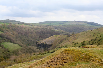

This is a perfect spot for lunch, especially since the rain has stopped, so we find a suitable vantage point to sit down overlooking distant Litton Mill with Millers Dale on the right and Tideswell Dale to the left. Out comes the Ramblers - we've earned it today - followed by sandwiches and buns. Our post holiday treats are lemon scones - plain scones with lemon curd and fresh cream. Yum. As we start on our first cup of coffee the rain starts, so up goes the umbrella and we sit there snug and dry waiting for it to pass. We wait, and wait, and wait. After the second cup of coffee the rain eventually abates so we pack up our gear ready to set off.

Within a couple of minutes the sun is out; full, bright spring sunshine that makes us start to steam. But not for long. A couple more minutes, on the slippery downward slope, and it's raining again. By the time we reach the stile leading to the Monsal Trail at Litton Mill it's pouring. Five more minutes and we've crossed the trail to descend to the bridge spanning the very wide, full, fast flowing River Wye - and the rain has stopped again.


We turn right at the end of the bridge over the river and walk past the old mill buildings to take up the path at the side of the river. The last time we were here the river was calm and clear, not so today. It is an angry river, although a brown and white Dipper doesn't seem to be the slightest bit troubled as it skims the fiercely flowing water to land on a rock in the middle of it all.

This path is wide, level and so easy to walk, perfect on a good day for just about every member of the family, but fairly popular at any time. We don't even wonder why there are no other walkers on this path today, until we round the bend towards Water-cum-Jolly Dale and find that the path has disappeared. It is all under water. Not a happy prospect near the end of a walk!


At first we scout next to the cliff to see how deep the water is - very. Almost up to Mollie's belly. Then PC decides to try the submerged hedgerow/verge next to the river and pond. It's one of those hold-your-breath moments as she slowly feels her way along, using her walking poles to guage the depth. She sees clear path ahead, around the bend, but there's a lot more water to get through first and we don't know how bad the path is further on. I'm not keen as we still have quite a distance to go.


Then a walker on the opposite side, high up on the cliff, shouts down to us that the path is completely submerged further on too. Thank you walker in the blue jacket, you saved us finding out the hard way. We now have no choice but to back-track and make our way to the road. It's going to add a considerable time to our walk, but it can't be helped.

However, a little way back I spot a sign at the side of the path (unnoticed in the opposite direction) and it's pointing out an alternative route for 'when the path is flooded'. Obviously a regular occurrance. The alternative, though is a steep uphill climb over slippery smooth limestone. This calls for good boots, stamina and handholds. Mollie, naturally, thinks it's a perfect place for finding stones and rolling them downhill. Under our feet. One way to become a very unpopular dog!


 The climb is short and sharp but we're soon well above the river. The path leads us to a stile (a fence rail with a stone on either side - handy if your legs are long, not so good if they aren't) and a field skirting Cressbrook Hall. Wow. What a gorgeous house. We've seen it before from the opposite sideof the Wye valley, but it is far more impressive close up. The path passes a sloping bank on which there are primroses and in a wooded area we see the first bluebells of the year.


The path takes us around the edge of the hall then down a steep step to follow it through the light woodland towards Cressbrook Mill. We're walking through ramsons here though they aren't in flower yet so their heady garlic scent isn't apparent. It seems that the path will take us right down to the water's edge again but instead it veers left and leads us out onto the road instead. No problem with cars today, though, as there is a 'road closed' sign higher up.

We walk down the road and choose to take the path through the Mill towards the huge pond at Water-cum-Jolly Dale to see how high the water is. Very! It's pouring over the weir in a torrent and we can see - or rather, can't see - where the path is completely submerged. It will take a time for that to clear.


We cross over the bridge, aware of the sheer volume of water rushing beneath our feet, then climb up the steps to the path. It's raining again - naturally. Soon we're heading back towards the Monsal Trail along the single-file track on the hillside. No one on it today - not surprising given the weather although it is more likely because the tunnels are now open and people don't have to negotiate this stretch.

Once back on the trail we're passed by two cyclists (are they cyclists if they are laying down on their bikes which have 3 wheels) whizzing along at a cracking speed. We walk along at a more sedate pace although it doesn't take long for us to reach the final climb up towards Monsal Head.

The sky has cleared at last and as we make our way back to the cars we're debating on where to go for our next outing. We're still undecided, so it will be a surprise for everyone. Just hope that the weather improves.

NORMAL SERVICE WILL RESUME - HOPEFULLY!

Sorry everyone, but we are having real problems with the new 'improved' Blogger.

We have a walk ready and waiting to upload, but the new style site is making life extremely difficult - refusing to save, preview and allow changes as well as photo issues. Is anyone else out there having problems?

Please bear with us. We aren't the most technically competent of people, but isn't the site supposed to be easy to use? Fortunately, help is forthcoming from more able family members so we hope to resume normal service soon. Fingers crossed.

Thursday, 29 March 2012

IN SEARCH OF THE LOST LAD


The unbelievable has happened. Today, our last walk before the Easter holidays, is sunny and warm. This must be the longest stretch we've had without a rainy walk. Ever. Good job too as we've planned a long one for today.


We meet up in our favourite car park at the side of Derwent, just up from the Fairholmes car park. We're early but the good weather has already dragged people from their snug hidey-holes and there are more folk around than usual. We tog up, stuffing as much as possible into our already bursting rucksacks, deposit a very exciting parcel in my car (to be opened on my birthday in a few days time - 21 again, plus some) and set off, almost immediately encountering a frog on the path. Ah yes, we'd forgotten about the abundance of frogs around here in Spring.


After a brief but necessary visit to the Fairholmes facilities we walk towards the dam, passing another frog before crossing the grass to the base of the dam wall. The steps up the side of the dam are quite steep and we're part way up before PC suddenly realises that she's left her walking poles in the car. She bravely decides to press on without them, even though this walk won't be an easy one, but the thought of sprinting back to the car for the poles was too off-putting.


Once we're up onto the top road we can relax. This is easy walking on a wide, surfaced track. Mollie is let off the lead and she immediately finds a log to carry, bringing it to us from time to time to throw for her. It's like tossing the caber! However, there is too much traffic here - cyclists, walkers and even a couple of rangers' Landrovers - so Mollie has to go back on the lead. Not that it stops her finding something heavy to play with. We keep stopping to enjoy the views, but the brightness does tend to prevent high quality photos as there is a slight heat haze over everything. Maybe it will burn off later.


Passing the first right hand footpath we continue on towards Howden Dam. Before we reach it we take the sweeping path up to the right at Abbey Tip Plantation, through a mass planting of daffodils. They may not all be native (there are some doubles here) and they aren't in full bloom yet as they are in shade, but they do look stunning. Amongst the daffodils are snowdrop leaves. Their flowers are long gone, but we must try to remember to come and see them at snowdrop time another year.
The path rises steeply through the trees up to a gate which opens onto moorland and here we have a choice of three paths; right to Abbey Bank and Derwent hamlet (the hard way), straight on across Greystones Moss towards Lost Lad or left circling Little Howden Moor. We have to study the map to make sure we choose the correct path (we have picked the wrong one here before) and once we're sure that the left hand path is definitely the one we want we pause to remove our jumpers. The day is warming up seriously.


This is a good path quite easy, running level with the contour lines and following a wall. We've never been on it before but as soon as we're around the first curve of the path and see the view opening up ahead we know we've picked a good one. There's a gate and a stile to negotiate, the stile has a handy rail to pull up to make it easier, and once on the other side it's time for me to unzip the bottom part of my walking trousers thereby exposing my legs to the whole world. This is not a decision I take lightly, and is a sure sign that temperatures are at a real high.


We're above the Abbey Brook valley with the melodious running water below us contrasting with the sound of the curlews calling. It's very peaceful here and we're all alone. Across the valley is New Close Wood and above the trees, circling high in the blue sky, is a buzzard. Magical.


The path is a gentle incline taking us upwards with minimal effort, which is good on such a warm day. At Cogman Clough the path dips sharply towards a ford, although today it isn't much more than a gentle stream easily crossed, even though PC manages to find the only wobbly stone to step on, then it's steep uphill again. However, when the short pull is over we're back on a moderately level path which leads us around the moor towards another stile.


Over the other side and we're circling Howden Dean in a steady, clear sweep high above Abbey Brook which we can only see if we peer downwards. The track turns slightly and on the other side is the sharp cleft of Gravy Clough. Presumably the water running down it is usually stained peaty brown, hence the name, but today it's clear and not a bit gravy-like. Our path winds away ahead of us and looking, as PC points out, like the road to Rivendell and it does have that otherworldly feel: no man-made structures in sight, just us and nature.


We are climbing a little now, and the path is becoming rockier in places. But the payback is that we're getting better views of the high moors and prominent features. With Berristers Tor across the valley our path turns sharply to the right and then splits: left over the stream of Sheepfold Clough or straight ahead on a track made for moorland management. We ignore the temptation of sitting by the stream and take the right hand track which leads across the moors. Yes, we're climbing now but it isn't too strenuous and the views are becoming more and more impressive as the panorama opens up around us. Pity about the heat haze which is shrouding everything, but we aren't complaining. There's quite a bit of fencing here, probably to segregate the areas used for rearing grouse, and there are plenty of grouse about with their strange croaking call and pantomime long-johns.


This is a wide swathe of a track and Lost Lad looks a very long way off, but it's surprising how quickly we're making time. It must be hunger driving us on, we've made a pact not to sit and eat until we know the bulk of the climbing is over. Too often we'd paid the price of eating early then lethargy setting in. We can't afford to do that today so we'll eat when we reach Lost Lad, and not before. We crest another rise and see the domed mound of Lost Lad with its prominent cairn over to our left, and know we haven't far to go. This is clearly a popular route as the path, which is peaty underfoot and will be grim in wet weather, has been paved. Not pretty but probably essential. A pause to admire the view then it's the push for the top. We race for it - Mollie is the outright winner (naturally), and I stand at the top with her as we wait for PC to catch up. She was spending longer admiring the views, obviously!

It's a splendid all round panorama here and we spend a few minutes taking it all in and savouring the feeling of accomplishment before finding a well placed rock to sit on. Lunch time, and do we need it!

PC pulls out a small bottle of pink champagne (what style!) and even has ice in a flask to chill the bottle and two posh glasses. This is high living at its very best! We pull on an extra layer of clothing (it's a bit breezy up here) then have a coffee before rapidly consuming the heavy salad and sandwiches, the chilling champers encouraging speed. Then PC does the honours and we're toasting my impending 21st (and some) as some other walkers reach the top of Lost Lad and give us a few curious glances. We don't care. This is good! Everything has taken on a mellow, rosy glow as we sip our drinks and smile at the world. Once we've lingered over the champagne we start on the sweet treats. Choc chip cookies smothered in the new Philadelphia cheese with chocolate. Sounds awful. Tastes wonderful. Then it's bun time - fat choux buns filled with fresh cream and topped with chocolate. They're like huge profiteroles and taste just as good. Suitably replete with finish off with another coffee, look at the time and realise, sadly, that we had better make a move. We're running short of time.


We head east towards the prominent rock formation of Back Tor with its white trig point (538 m) on top, firstly dropping down off Lost Lad then climbing sharply uphill before the paved path levels out. A few more steps up and we're level with Back Tor and walking along the edge towards our next path which turns right at Bradfield Gate Head. The path takes us gently down and we're disturbing plenty of grouse as we go. To our left are some weathered rocks and one looks surprisingly like Jabba The Hut from Star Wars. PC gives a shudder, obviously not one of her favourite characters.

Once we've dropped down a bit the path is long and descending steadily and it isn't long before we're all alone again. We're glad we didn't come up this way, it would have been a pretty featureless slog with little indication of progress. In poor visibility this route would be a nightmare. It's a longer path on the ground than it seems to be on the map, but eventually we meet up with the track coming off of Lost Lad (the shorter route) and we're heading on a clear, level track towards the reservoirs.


It's bleak and barren up here, although we're returning to the land of dry stone walls again and we can see across the Derwent Valley to the hills opposite. The path begins to dip and we reach the crossroads of paths above the derelict Bamford House and we have no option but to take the one straight down. The start of this path is not good; badly eroded, steep, rocky and with plenty of loose stones to catch under your boots and send you falling. If any path around here needs some work doing to it, this is the one. We're too busy watching where we put our feet to admire the scenery and PC is having to be especially careful as she doesn't have her walking poles to support her. However, we manage to make it down unscathed and we're soon through the gate which signals the end of the moors and the start of the reservoir.


It's just a steady walk back along the track now, though we're feeling a little weary. Even Mollie can't muster the enthusiasm to find a stick. Then it's down the steps at the side of the dam wall, across the grass at the bottom and rejoining the people who haven't wandered far from the car park. There are still frogs on the road (urgh) but we side-step them on our way back to Fairholmes then it's a short haul along the road to our cars.


Today has been amazing. The sun is still bright, it's still warm and we've had better walking conditions today than we've had on many summer walks. We're reluctant to leave, but we're already late so we have to pack up and go back to real life and responsibilities. The Easter break is close too, which means a break for us while the schools are out. But we have a great walk to look back on and sustain us during the lean weeks ahead.

Friday, 23 March 2012

A CIRCUIT OF BURBAGE AND HOUNDKIRK MOORS


Wow! We've done it again. The early fog has lifted and we have another fantastic day in prospect. This straight run of good weather is nothing short of miraculous, at the very least we expect a couple of walks leaving us soaking wet and squelching at this time of year (any time of year, to be honest) but we're not about to complain.


I'm late so PC is sat patiently in the car park at Upper Burbage Bridge waiting for me. Unfortunately she's forgotten the camera but has promised to take photos on her phone. Good job she's the techno one!


Despite the sunshine it is bitterly cold and at this high point (398m) we can really feel the wind. We both bemoan the fact that we'd been lulled into leaving one of our extra layers at home but with pull out hats, scarves and gloves as compensation. Mollie is clearly bored with waiting and is keen to be off, so much so that she's not too bothered by the traffic whizzing past.


We cross over Upper Burbage Bridge then turn through the gate onto the well-worn path which is part of the Sheffield Country Walk. However, instead of following the 'low road' we strike off to the left on the footpath which runs along the edge of Burbage Moor and Burbage Rocks.
It's a familiar route to us with its wonderful far-reaching views, but it is not as well used at the lower path, possibly due to the rougher terrain and the longer length. However, we enjoy being away from the crowds, and there are plenty of people about today.


We keep pausing to look over to Higger Tor and Carl Wark, and we can clearly see the spot where The Wood That Wasn't, isn't! (Must, must, must write about this at some point.)


The path descends to an unnamed stream, and Mollie pauses to have a drink before we hop over. It can be a little boggy around here, but today it isn't too bad and we're able to keep dry footed and mud free. Then it's up the slope at the other side and crossing the long path which runs from Hathersage to Whitelow at the other side of the Peak Park boundary. Once at the top of the slope we're amongst the rocks and find ourselves a suitable place to stop for a nip from PCs secret flask. Mine, alas, is empty as I forgot to refill it after last week, but PC has saved the day with her flask of Cointreau. It takes a bit of effort to unscrew the top, but the promised reward ensures our success and we're soon savouring the flavour of the Mediterranean whilst gazing over the Derbyshire Moors!


The breeze is still brisk so we pack up and move on. The path on this part of the walk is narrower with higher rock formations on the western side providing some shelter from the wind. Since the path is heading gently downhill we catch our first glimpse of Fox House in the distance and after a quick consultation we decide that we'd better stop for lunch here as there doesn't seem to be many promising spots further on.


We find ourselves an excellent seat and 'round table' amongst the brittle, brown bracken. A huge millstone, seemingly complete, lays abandoned and forgotten so we spread out on it for lunch. The usual sandwiches, heavy salad and coffee (biscuits and water for Mollie) are followed by fresh cream strawberry tarts - our bun of the day. The pastry is lovely and crisp, but it does make eating a little messy and Mollie is on the lookout for crumbs. We linger over coffee (longer than we should) then have to drag ourselves upwards and onwards.


The path leads us past a large, incomplete water trough - the outside perfectly shaped but the inside only partly hollowed - then down towards a gate onto the A6187. Mollie isn't so happy now that we've come to the road so we cross over and take the path through the top part of the Longshaw Estate to avoid the traffic. Even though the trees are yet to come into leaf it still feels like spring here and it is a lovely place to walk, although at weekends it is probably heaving with activity. The path leads us out onto the Grindleford Road (B6521) which we cross to skirt through the top edge of Longshaw to reach Fox House.


It's pretty grim trying to cross the road here, and the cars tend to hurtle past at a fair pace despite the blind bend, but we make it across then trudge up the A6187, cursing the parked cars which force us to walk on the road, until we reach the left hand unmade road (Byway open to all traffic) which is Houndkirk Road. Here we're able to walk danger-free again, unless we're assaulted by 4x4s.


Houndkirk Road seems to be a turnpike road built sometime in the 1750s, although I have seen a reference that it may, in fact be a Roman road. However, it's hard to find any detailed information on the internet due to the high number of forums etc devoted to the recent resurfacing/improvements to the road and the opinions of the wheeled community.


When we walk along the road, lovely and quiet today, we can see the evidence of the 'improvements' which includes the placing of large boulders to prevent motorised vehicles widening the road or driving on the moor. It is clear that the road has suffered greatly from heavy use and erosion making it a long winding scar across the landscape.


We're finding it quite pleasant, the wind has dropped (or maybe we've dropped out of the wind), and Mollie has plenty of stones to keep her amused. The landscape is pretty bleak and featureless but soon we see the distinctive mound of Houndkirk Hill which shields us from the sight of Sheffield's suburbs. The road seems to go on forever, but since it is reasonably evenly surfaced we make good time.


Eventually we turn left on another track which crosses Houndkirk (this is, I believe, Jumble Road) and we meet a man walking his huge 11 month old Great Dane. What an impressive dog! Very strong too, and it's owner has to keep a tight hold on this 'youngster'.


A little distance and we reach the edge of Lady Canning's Plantation, an extensive conifer wood filling the space between this track and Ringinglow. Although conifer woods are not the most attractive of places the lovely fresh pine scent (real, not manufactured!) fills the air.


We plan to walk the length of the lane, but are sidetracked (literally) by a narrow but distinct path through the heather. It isn't marked on the map but we decide to give it a go. It is running roughly in the right direction and if it turns out to be a blind alley we can always turn around.


As we walk forward we see a trig point (419m) and the huge wind sculptured stones known as the Ox Stones. These are definitely worth the detour as we wouldn't have known they were here if we hadn't made the effort. After a look around we decide not to follow the very muddy but vague path westwards (we aren't sure it actually goes anywhere useful) but follow a very clear path which takes us back towards our original destination, depositing us very nicely at the end of Jumble Road where it joins Ringinglow Road.


Now for the worst bit. We have to walk along the road back to the car park, but as it turns out it isn't that bad - although it seems less of a distance on the map than on the ground! The sun is dipping in the sky by the time we make it back to Upper Burbage Bridge and we've run out of time. We probably dawdled a bit too much on the outward stretch of the walk, then had to push the pace on the return, but we've thoroughly enjoyed it. Next week's walk will be a surprise - we haven't had time to plan it yet!
