Stanage
Showing posts with label Cold Side. Show all posts

Monday, 22 May 2017

Taking the Low Road

So, the plan is a second attempt to reach Lost Lad, and for the second time we accept defeat. Rain, drizzle and more rain, although it might clear later, apparently!

We're parked in our usual spot at the side of Ladybower deciding on an alternative. We aren't in any rush so decide to do the long circuit of the reservoirs; Derwent and Howden. 

Our route is predictable and easy to follow, so we cross beneath the Derwent Dam wall, climb the uneven steps and start along the track on the far side of the reservoir. It's already drizzling with rain and the dogs, Mollie and Scamp, are soggy.
Needless to say, we don't have much of a view, although the low level of the reservoir is a bit of a surprise. Then it really starts to rain and we seek refuge beneath a stand of trees where I dig out my waterproof trousers from the bottom of the rucksack.

We stand there a while, hoping it will pass over, but it really is bucketing it down. In the end we decide to go for it. We have waterproofs, we shouldn't get too wet. Should we?

To our relief the rain does start to ease off to a light drizzle and a potential of some clear - or rather, not wet - spells. We pass the point where out walk up to the Lad would have started and we admire the rather soggy daffodils.
We pass the Howden Dam wall and continue along, not meeting another soul. Perhaps the weather is keeping everyone under cover.

Mollie finds a discarded ball at the side of the path and gleefully picks it up to play with. She plays fetch for a while, with Scamp's little legs whirring to keep up.
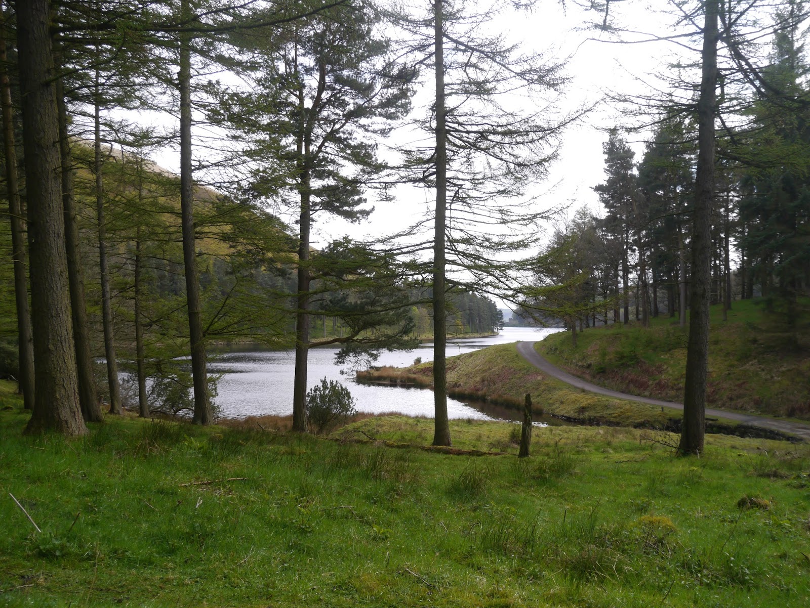
We pass the stream running down from Howden Clough and the dogs have a paddle before we turn the bend with the view down to the dam. It looks as though the water stops in mid-air, like at some upmarket hotel with their suspended swimming pools. Although this is undoubtedly much colder!
We see our first couple of walkers, then go through the gate where we put the dogs back on their leads. There's always the possibility of sheep.

And we see a helicopter coming down the valley - the first of a few we see through the course of the day.
Then, as we are walking along the long length of Cold Side, the sun comes out and the view clears. We have a superb view up the valley.
There's been a lot of planting done on the slope down to the water, and some up on the hillside on our right too. Mollie tires of carrying her ball and leaves it for some other fortunate hound that may follow in her pawsteps.
Soon enough we see the bridge at Slippery Stones and we know that we'll soon be able to stop for lunch. We go for the huge log cum bench at the far side of the bridge where we can sit in some comfort and enjoy our food, including quite messy but very nice custard slices.
There are sheep around here, good job the dogs are on their leads.
But as we walk around the views improve again.
Though the dogs are a little tired, there's still a way to go.
We are on tarmac now, much more tiring underfoot. The gorse is in glorious bloom though, and we hear a curlew up on the moors.
The dam wall looms ahead, and another helicopter goes overhead. As we pass the wall, and the cottages beneath, we enter into the woods where Tin Town was: the construction village for the dams. It's mainly wooded now, with little indication of the industry. A

And we hear a cuckoo - our first of the year. Does this mean it's Spring?
The last stretch of the walk always seems the longest, and is undoubtedly the slowest. But at least it isn't raining anymore.
 
It's a good job we weren't in a rush. We are quite late getting back to the cars. So late that we hit the rush hour traffic on our way home.

Sunday, 13 May 2012

HOWDEN AND DERWENT CIRCUIT


We had a plan. A good one. Then we heard the weather forecast, and the pelting rain hammering on the windows overnight, so we had a rapid re-think and the plan changed. Instead of exploring the heights of Kinder Scout we opted for a safer option - meet at the side of Ladybower and see if inspiration strikes.

It's no longer raining when we pull up in our usual car park so we're feeling hopeful. The bluebells aren't out yet (PC has a thing about walking through the bluebells) so the suggestion of doing a complete circuit of Howden and Derwent reservoirs is accepted as a good alternative to Kinder.

As we get ready Mollie decides to decamp and visit a group of walkers getting ready at the other end of the car park. Endless calls and shouts fail to bring her back so PC has to go and fetch her and although Mollie looks sheepish she is clearly unrepentant.

Finally we're ready, after a brief debate as to whether we need the umbrella today. It was such a success on the last walk that I'm persuaded to take it (rain forecast, apparently, for lunch time so we'll need the shelter) so it's fixed onto the back of my increasingly heavy rucksack. I really must empty it out sometime.


First stop is Fairholmes and we're already surprised at how many walkers and cyclists are out today. Either the poor weather hasn't deterred them or they were all planning different walks but have made the same decision as us to avoid potential problems.

Leaving Fairholmes we've decided to walk the route anti-clockwise so we make our way down towards Derwent Dam. Even from a distance we can see the foamy, white wall of water completely blanketing the dam. Wow! It's a long time since we've seen this amount of water coming over the top, and it's a sign of how much rain we've had that the reservoirs are full to brimming. Closer to the wall we can even feel the spray coming off it. Impressive, and just a bit scary too.

The steep steps at the side of the dam are familiar but no less unwelcome but we're soon at the top and on the level roadway skirting the side of the reservoir. Now it's easy walking and a familiar outlook which means we can spend our time constructively - talking about everything from Art to University.


By the time we reach Abbey Tip Plantation we've lost all the foot traffic (we will only see one more walker on this side) and only have to contend with the few cyclists who circuit the reservoirs. And here we have a swathe of late daffodils, all a bit knocked and battered from the recent heavy rain but they are a lovely, cheerful sight. The daffodils have just about ended everywhere else so these are a treat.


We cross the bridge where the Abbey Brook flows into the reservoir. It's running very fast today but the banks of gloomy rhododendrons don't make it a good photo opportunity.


 Around the next corner and we're in sight of Howden Dam, and close enough to hear the thunderous rumbling of water pouring over the edge. Yes, Howden is full to bursting and its dam wall is, like Derwent's, a solid sheet of white. We choose not to take the small side path which leads to the base of the wall instead keeping on our planned route.

We're under a sparse canopy of trees here, insufficient to shelter us from the fast approaching rain that we can see coming from the direction of Alport and Bleaklow, blocking the view with a grey mist. Luckily, though, the brolly doesn't have to come out as the shower is short-lived and hardly makes us damp. It looks as if this will be the order of the day from now on - brief showers and an overcast sky.

We round the corner at the base of Howden Clough (the water here looks particularly grim; scummy with debris floating on it) to take the slight incline before the level returns as we walk past Ronksley Wood and out into the open at Cold Side. Here we can see the River Derwent rushing down to the reservoirs, and spring lambs running around the hillsides with their mothers, managing to look unbelievably cute.


The Slippery Stones Bridge is in sight now (it takes its name from the large slabs of stone that were the only means of crossing the Derwent in the past. The bridge dates from the 17th century and was classified as an ancient monument so when the valley was flooded the bridge was dismantled, stored and rebuilt here in 1959) so we hasten down to it, cross over - admiring the fast flowing river as we do - then settle down on the western bank of the river for lunch.

First its a nip from the secret flask. We don't need it to warm us up, but we do deserve a treat! (Mollie isn't forgotten, she has her biscuits.) Then it's a cup of coffee followed by sandwiches and the bun - very light doughnuts with fresh cream and oozing jam, all patriotically wrapped in a Union Jack box! Excellent - could have eaten more than one though. After a second coffee - and a very light shower of rain - we pick up our rucksacks again. How come mine doesn't feel any lighter?

This is such a familiar section of the walk for us, but this time we haven't even made the halfway point of the walk whereas we're usually on the way back to the cars by now. Naturally there are more people about now even though the clouds seem to be gathering.

We cross over the broad bridge at the base of Linch Clough noting that the water is very high, then it's up to the gate onto the long, narrow road skirting the west of the reservoirs. There are a few cars parked here, not many, and most of the drivers and passengers are sat inside rather than getting out and enjoying the fresh air while they can.

The road is long and winding which makes this side of the reservoirs much longer than the east. Added to the distance is the number of cars driving up today, we don't think we've ever seen so many on one day, and since they aren't walkers they go to as far as the end of the road, maybe park up for a while, then drive back so we have to avoid them twice. Some are very courteous but others don't seem to notice us and drive past fast (and we are very noticeable). To add to the problems the rain has decided to make a more determined effort. It isn't prolonged but the showers are heavier and longer. Still not bad enough to use the brolly (it will stay in the car next time) but we've donned waterproof coats and hoods.

We pass  a clump of gorse bushes in full, yellow bloom and stop for a sniff. It was only back at Easter that I realised that the flowers had a wonderful coconut scent - so I shared this we PC and we stand sniffing as a couple of cars passed us giving us strange looks.


When we reach the eastern side of Howden Dam we can see the spray from the edge being blow upwards and backwards - it would be easy to imagine a whale 'blowing'. It takes a while for PC to get a good shot of it, and when we drop down to the house at the side of the dam (Beavers Croft, a holiday cottage) she takes some more pictures across the lovely gardens to the dam.

The high rainfall we've had recently is very evident from here onwards. Water pouring off the hillside is reaching the tarmac road and running in rivers along its length. Sometimes it manages to cross over where it rushes down to the reservoir, but in other places it pools into mini fords. Sporadic rainfall is adding to it.

We press on, pass the remains of Tin Town (constructed for workers building the dams then demolished afterwards) which are easy to miss, especially if you are in a car. Then it's the final haul along to Derwent again. We're tiring, the hard, solid surface of the walk is beginning to take its toll, and Mollie is seriously muddy. Glad she won't be in my car.

There are quite a few people parked at the top of Derwent Dam admiring the cascading water, but we can ignore it now as we detour down to Fairholmes for a pre-journey-home stop. It's tempting to sit on the benches, but they're wet and getting up again could be a problem anyway.

Strange how the last few hundred yards to the cars is the hardest of the lot! However, we make it and gladly remove rucksacks and walking gear. It's been a long haul today (one source says 16.7 km) and we're out of condition having missed a few walks these past weeks. Next week is going to be a miss, too, and our schedule will be erratic for a while. Exam season is on us - GCSEs and A levels - so we'll have to squeeze our walks in when we can.


We've managed to miss the worst of the weather, but only just. On the way home I drive through some torrential rain storms and consider how lucky we've been!

Friday, 4 November 2011

AROUND THE RESERVOIRS


A CIRCUIT OF HOWDEN AND DERWENT


We're back after the enforced absence caused by school holidays and we've got a good one planned. Or rather, we'd planned a different good one, but you know what they say about the best laid plans...


Our original intention had been to go up onto Howden Edge - a long and pretty tough walk given the time constraints and our fitness (lack of) levels. However we'd decided we were up to it, until the torrential rain of the two previous days and nights planted the seeds of doubt and watered them thoroughly.


We meet up at the Fairholmes Car Park under glorious blue skies, avail ourselves of their excellent facilities, then return to our cars for the long winding drive along the western side of the reservoirs (this road is not open all the time although there is a bus service for walkers when the road is closed to traffic). On the way something becomes very evident. We have hit upon the perfect time to observe the most glorious autumn colour, something we hadn't expected to experience this year. So when we finally reach the end of the road (literally) and park up we decide on a change which will enable us to make the most of the sunshine and trees. We'll walk around the reserviours.


Naturally, being seasoned hikers we load everything into our rucksacks, just in case the weather changes or we get lost and have to camp out for a week. PC chooses the direction - clockwise - to make the most of the way the light is illuminating the trees.


We follow the bridleway, broad and easy walking, to the Stepping Stones bridge, and whilst PC stops to take some photos we realise that the sun has disappeared. Undeterred by this minor hitch we decide that it makes no difference, and it might clear up later, so we cross the bridge and continue on the bridleway which doubles back and climbs slightly up onto Cold Side (marked 'cycle route'). Below us the fledgling River Derwent is starting to broaden out, and the contrast between the dark green conifers, golden leafed beech, yellow birch and russet moors is stunning. It's a shame that the sun has gone, but the scenery is no less spectacular for it.


A few cyclists pass us, but there are never very many walkers on this part of the circuit - it's a long way from Fairholmes on foot and most people who drive up the valley as we have done tend to pause for long enough to admire the view only before heading back. So we're finding it extremely peaceful as we catch up on news and discuss everything from school awards to medical students.


We pause frequently to watch the changing scenery and colours, as well as take photos. We pass the path that leads up to Howden Clough, which would have been our downward route had we gone onto Howden Edge, and when we reach the stretch of woods known as The Coppice it's time to remove a layer. And naturally, since the rucksack has to be taken off, I delve for the Secret Flask and we treat ourselves to a swig of Ramblers' Restorative. Oh yes, that is so right, like a burst of sunshine in the stomach radiating out to all points and vying with the copper and golden leaves for brightness!


Suitably restored we trek on ignoring the light shower of rain that does absolutely nothing to dampen our spirits. It only lasts a few minutes and by the time we reach Howden Dam it has stopped. Here we meet the first of the walkers up from Fairholmes who are already turning back. It's funny to think that this is as far as we made it a few months back when PC was getting started after her hip operation. We're certainly doing a lot more today!


As we round the inlet where Abbey Brook joins Derwent we realise how low the reservoir is. There are huge swathes of greenery on the muddy ground which should, at this time of year, be underwater. This newly reclaimed land stretches almost all the way across the valley with only a thin river of water (and the mud) separating the two sides. It will take a lot of rain to re-submerge this area.


We're halfway down the length of the Derwent Reservoir on the eastern side and we're beginning to feel heavy legged and tired. There's no way we can stop to eat yet, we aren't even half way around, and we are wondering if we're tackling a bit too much for our first outing in 3 weeks, but we remain stoically silent about our discomforts (we'll only admit it later) as there's absolutely nothing we can do about it other than turn around or press on. We choose to press on, distracting ourselves with 'what we did on our holidays' which, for PC, seems to have involved a lot of water!


The rain makes a few more attempts to get going but it hasn't really managed very much and we soon reach the steps leading down at the side of the Derwent Dam. We've been here with the water gushing over the top but today the stones are dry. It will be some time before the water levels are high enough to produce the spectacular waterfall.


Once across the grassy field at the base of the dam wall we turn sharp right and up the steep, stepped path to reach the western road. It makes us puff a bit, but the good thing is that we have managed to push our way through the 'walkers wall' and no longer feel as though we're on our last legs. Good job too. Although we've past the turning point of the walk and are on the way back, we aren't yet half way around as the western road is considerably longer than the eastern track.


At the side of the dam wall there are relatively new information boards about the dam busters and mention of the Derwent Dam museum. We've never heard of it - but a quick trawl on the internet reveals that it is situated in the west tower of the Derwent Dam (yes, I know, we were stood right next to it) but it is only open on Sundays and on Bank Holidays, 10am - 4pm. Admission is free, although they welcome donations and they have an interesting web site (http://www.derwentdammuseum/).


There are a few more cars driving along the road now than earlier, so we have to be careful until we pass Gores Farm where there is a wide verge to walk on. We haven't walked far before the rain starts again, and this time it seems to be more determined, so we pause to drag on our waterproof coats. As soon as we're togged up and walking again it stops. Typical. But we decide not to bother removing our waterproofs because we've seen something interesting. A bench which beckons two very hungry hikers. (Us.)


Yes, we've sat here before, and enjoyed the same view - give or take some sunshine, tree colour, fungi etc - but today it seems especially welcome. First it's coffee, then sandwiches, then the buns. Oh, how we've waited for the buns. Today they are especially low calorie (honest) cream doughnuts. Plenty of jam in the bottom, and a convenient shape for eating. They go down extremely well, and very quickly. A second cup of coffee follows then we're packing up ready to go. No time to linger today. We still have a long way to walk, and if we sit for too long we're likely to sieze up!


We have cars coming at us both ways now, those intent on reaching the end to take a photo, and those that have taken their photos and are on the return. But there aren't too many of them. The rain is making more of an effort to keep going and although we're having drizzle then dry, it isn't they type of weather to encourage people to come out for a drive.


We turn the corner near Birchinlee and have a straight run towards Howden Dam. Here the trees are particularly spectacular, and PC stops to take lots of photos of their sweeping black braches laden with glinting golden leaves like pirate treasure.


It's a short haul up a slope at the side of the Howden Dam, then it's the long road along the narrow valley that ultimately leads to Westend Moor (although the road doesn't go that far). The worst thing about it is that we know we have to walk up the full length at the other side too. And it's raining again. Really raining. That doesn't stop us pausing to admire the cathedral arches of beech trees above the road at Hern Side, a marvellous sight despite the rain.


This is a long haul, especially now the rain has set in. The sky is dark and it feels like dusk rather than the middle of the afternoon. There are no cyclists, no cars and we passed the last walkers a while back. We're certainly on our own.


At the bottom of the road we cross the narrow stone bridge and double back on the opposite side of the valley. We know it isn't too far to go now and despite everything we manage to push the pace a little. When we round the point between Ridge Wood and Nether Wood Plantation we know that the end isn't too far away. It's a straight, easy stretch and our two lonely cars have never looked so welcoming.


Yes, it's been a long tiring walk. We're pretty much soaked and our feet ache, and we'll probably not be able to move like normal human beings in the morning. But we both have that silly smile on our faces that confirms that it's been a wonderful day's walking, with autumn colour that we'd have been daft to miss. Will we do it again? Definitely - but not until we've had a while to recover.