
Stanage
Showing posts with label Back Tor. Show all posts

Saturday, 27 May 2017

LOST LAD FINALLY FOUND!


Working on the principle of third time lucky, and with a weather forecast in our favour, we are heading up to Lost Lad today, our last chance and last walk before PC heads off onto her boat for a few weeks of guaranteed sunshine.

We are going up by the same route we used last time, a few years back now. It is quite a long way around, nothing like the shorter routes that  most people use, but we are looking forward to it, especially given the sunshine.

There are a lot of people out today, most of them clustered around Fairholmes, but we doubt that many of them will be heading up on our route.

We take the usual path away from Fairholmes and along the bottom of the Derwent Dam wall, then up the steps at the side. When we emerge on the track at the top of the wall we can see the low level of the water. It is some time since we have seen it this low and we wonder if it is partly due to the recent hydroelectric works around here, though it is pretty extreme.


Derwent Reservoir
The waterline is so low, it looks as though there are huge beaches to lounge on. And approaching the Howden Dam it is even more apparent, though the top and bottom reservoirs (Ladybower and Howden) are pretty high.

Approaching Howden Dam

We find our path on the right of the track and walk up to the gate at the top leading onto access land. Although there is a clear path straight ahead which, yes, goes up to Lost Lad, we take the left hand footpath which follows the line of trees and a stone wall. Soon, we are over a stile and onto a path surrounded by the open moors.

We have superb views down to Abbey Brook in the valley below, and the Howden Moors ahead.
The path has a fairly steady incline, though in places there are some quite big downs, with big ups to follow - which does mean we end up divesting ourselves of as many layers as possible. It is warm enough with the enclosing hills adding to the heat, though in reality it is very pleasant. A 'no-coat' walk is a real treat.

Cogman Clough

 We have a dip down to Cogman Clough, then back up again. We see a pesky grouse up ahead, which keeps on bobbing up and down on and off the path. Though it did pause long enough to have its photograph taken.

We are finding that this route is longer than we remember it. Still, it doesn't really bother us. The day is wonderful and there isn't another soul in sight. Just us, a path and the moors. Perfection.
Once we've done most of the ups and downs the path is pretty much smooth and level. There is an immense feeling of freedom when the only sound is from the slight breeze, the curlews and the occasional bleat of a sheep - oh yes, and our conversation, naturally!
 
The path narrows and begins to wind a little as we begin to circuit around Howden Dean with Howden Edge over to our left. We must get back up there again sometime soon.

We look back the way we have come, and realise that the next time we'll do this walk in reverse and get the different views.
Looking down the Abbey Brook valley
 
From here it is a short walk to the small crossing over Abbey Brook, but although this is the route of the footpath we veer off to the right and up Sheepfold Clough. There is a path of sorts here, or rather, more than one path, and a number of fences for the sheep but with the gates open, so a bit of careful navigation is needed to keep on track. Basically, go straight ahead, through the first fence in front (the gate was open, but there is a flimsy stile) then keep the second fence to your right and it's plain sailing.

Panorama from Sheepfold Clough

 (The stile can just been seen on the far left of the panorama shot above)

From here it is a bit of a slog. Not because the walking is particularly difficult, but because we haven't stopped to eat. This is mainly because if we do, we won't want to get going again. We prefer to enjoy our food when we know all the climbing has been done. I have, however, succumbed to a piece of Kendal Mint Cake but PC declares that she isn't that desperate. She really doesn't like it one bit. Mollie has had a few biscuits to keep her going.

We debate stopping for a coffee, our pauses are getting more frequent, but Lost Lad is on the near horizon and we know that we will be better just keeping going. 

Sure enough, with a last pull uphill we make it. There's only the three of us (PC, Mollie, Me) and we are, honestly, quite surprised. It's a wonderful day, why aren't there more people up here? Never mind, we take some photos, enjoy the views, then drop down to a comfy spot to enjoy a very very late lunch.
Lost Lad summit
Mollie enjoys a drink and biscuits, then finds a clump of coarse grass and promptly does the sensible thing, and falls asleep!
Remarkably, PC has found a small bottle of wine in the bottom of her rucksack so we not only have coffee, sandwiches and buns (strawberry and fresh cream charlottes) but a welcome tipple too. Bliss.

Panorama, Lost Lad cairn in centre, Back Tor on right, Howden Dean on left with Howden Edge beyond

There is a huge temptation to sit here for hours. After all, there's plenty of daylight, and we have earned a linger. But eventually we decide we ought to pack up and move along.

As we set off a young couple reach Lost Lad from Back Tor. They pause for just a moment before starting to descend. We stand aside and let them go past. They clearly have no intention of hanging around to enjoy the views, they aren't even walking closely together. It's yomp on.

PC and I have never really understood the need to complete a walk as fast as possible, unless you're in training for something. After all, who are these speedy walkers competing with? Themselves? The clock? Life? They must miss out on so much, all those magic moments to breathe and look, those small easily missed treasures, the chance to talk and enjoy shared companionship. Ah well, everyone to their own. Perhaps age helps you to reflect more, and be more thankful for such simple pleasures.

Down from Lost Lad

It is, as they say, all downhill from here. The path continues along then curves around to the left heading towards Green Stitches before joining the footpath from Bradfield Gate Head.

From here it is simply a case of following the path. It splits and we take the right hand footpath which soon brings us up above Derwent Reservoir and very familiar territory.
 
The large cairn gives us an option of routes and PC opts for the 'straight down, it isn't that steep' route.
Actually, it is that steep, and rutted, but it is the quickest way down. To our surprise we pass two sets of walkers on their way up, neither particularly well shod for such a rough path.

However, we soon reach the bottom, where we hit the path at the side of the reservoir, and more people than we have seen all day. The lovely weather has brought people out in droves, and who can blame them. It is a perfect late afternoon for a stroll with the family.

We, however, head back to the cars extremely satisfied with our walk, and a little tired. But it has been worth it. A perfect walk on a perfect day.

Saturday, 5 October 2013

MAM TOR TO LOSE HILL - THE GREAT RIDGE

Walking again this week, and what a treat we have in store for ourselves, especially given that the weather looks as though it is going to stay fine.

Of course, you know what they say about the best laid plans!

We were to meet at Edale, an earlyish start, and hike up onto the Kinder Plateau. But events were conspiring against us. As I arrive in Hope a text message comes through. I pull up - PC will be late as she has gone to collect Mollie, but Mollie's owner has had a bereavement which will, naturally, delay her. Added to that, the road from Hope to Edale is closed! A quick message to PC informs of her a potential change of plan and that I'll meet her at Castleton.

When PC manages to arrive at Castleton we decide that it is too late for us to drive up Winnats Pass and down to Barber Booth, then face the Kinder walk in the time we have allotted to us. So we do a quick recalculation, drive up towards Treak Cliff Cavern, park up on the road and ready ourselves for the Ridge, one of our definite favourites.


Mollie is very keen to get out walking, it seems forever since she's been with us, but she clearly hasn't forgotten, nor has she forgotten the dog biscuits in my pocket! She has a new harness today and we're wondering how well it will work as she can be quite a puller.

We set off up the road and start catching up on gossip. It may only be a couple of  weeks since we last saw each other but a lot has happened. How did we manage so many months apart?

There are quite a lot of people out today, unsurprisingly as the weather is bright and clear, and everyone seems cheerful. We decide that we're going to walk up the 'old' road, the one that the Shivering Mountain has managed to destroy, and it teaches us a very interesting lesson about the power of nature. The road was eventually closed in 1979 when the Highways Dept realised that they couldn't keep up with the constant, on-going repairs needed to keep it open to traffic.


We follow the destroyed road-line to where there is safe tarmac again, and cars parked to enjoy the view as well as visit the Blue John Cavern. There are still a lot of tourists about, which has to be good for the local economy.

For some reason both PC and I are finding it heavy going today. Maybe it is walking on tarmac, or maybe the months of idleness are now manifesting themselves. We definitely need to get fitter.


Pretty soon we're off the road and walking up the steep, grassy path towards the base of the steps leading to the summit of Mam Tor. We're already enjoying wonderful views all around us, and stopping to enjoy them gives us the chance for a breather, but we're getting into our stride now. Much easier off the tarmac.

We head up the steps climbing to the summit where a small group are taking forever to snap a few photos. We look around, enjoy the views, wait patiently, but they seem determined to monopolise the trig point so we eventually move on. A minute later they start to follow us!


It's breezy up here, but it isn't particularly cold and the views are, as usual, spectacular. There is a large group of school/college kids ahead of us, no doubt dragged out on one of many field trips that are greeted with so little enthusiasm. We pass them and continue along the ridge, the path going downhill a little way. There is a gate, which we open then wait for a cyclist to go whizzing through before we follow.

At Hollins Cross we continue straight ahead as there are still too many people about, and we prefer to eat lunch where it isn't so busy. It's a climb uphill from here, and the path is badly eroded, but it isn't difficult, and by the time we reach the top we realise that we have left most of the other walkers behind. The shorter circuit from Mam Tor to Hollins Cross and around is clearly the more popular one.


A little way further and we decide to stop for lunch. Yes, we sit at the side of the path, but there is a broken stone wall which makes a perfect bench, and there are too few people to trouble us.

A nip of Ramblers Restorative first, that casts a rosy glow over everything, followed by a coffee. Not my best coffee, I think I'm overdue a new flask. Then we eat our sandwiches and salads (PC with the healthy salad, not me) and Mollie devours her biscuits. Then it is the bun of the day: Strawberry Oysters - shortcrust pastry, custard middle, a strawberry then cream on top. It's like the last taste of summer. We finish off with another coffee as Mollie starts to get a little twitchy. The para-gliders are out again, this time over Mam Tor and the ridge, and Mollie clearly doesn't like them one bit so we pack up and move on.


When we reach the base of Back Tor we pause to consult the map before deciding that we will continue. We've enough time if we don't dawdle.

Despite our concerns about our fitness, or lack of it, early in the walk, the stepped side of Back Tor presents no problems and we quickly reach the summit, then stride on towards Lose Hill.

Although we can see other walkers in the distance there is no one else on the path now, it is as though we have the ridge to ourselves. It's a short pull up to the trig point on the top of Lose Hill and we pause to enjoy the 360 degree views. No time to linger, though, so we're off downhill in the direction of Hope, and once we're over the stile and fence we veer right towards a cairn and the start of the return path through the fields towards Back Tor Wood.

We're making really good progress now, and when we are once again at the base of Back Tor we take the left hand path going down in the general direction of Castleton.

The path is fairly distinct but once we reach the bottom (after some slithering at one point) we find the gate onto the path we think we want. It is all very familiar, and once we have gone past the point of no return we realise that we are on Hollowford Road whereas we had wanted the next path along! It doesn't matter, though, this is an easy path to take and it won't add too much to our walk.

The deserted road takes us down into Castleton and in the village we turn left to arrive at the car park the 'back way'. From here we need only walk on up the road to where we have parked our cars.

The sun is still shining, the sky is still blue and there are still plenty of people about, but it is time for us to head homewards. Mollie is very keen to get in the car but we're sure she'll be eager to come out with us next week. Fingers crossed that we get another brilliant day.


Thursday, 29 March 2012

IN SEARCH OF THE LOST LAD


The unbelievable has happened. Today, our last walk before the Easter holidays, is sunny and warm. This must be the longest stretch we've had without a rainy walk. Ever. Good job too as we've planned a long one for today.


We meet up in our favourite car park at the side of Derwent, just up from the Fairholmes car park. We're early but the good weather has already dragged people from their snug hidey-holes and there are more folk around than usual. We tog up, stuffing as much as possible into our already bursting rucksacks, deposit a very exciting parcel in my car (to be opened on my birthday in a few days time - 21 again, plus some) and set off, almost immediately encountering a frog on the path. Ah yes, we'd forgotten about the abundance of frogs around here in Spring.


After a brief but necessary visit to the Fairholmes facilities we walk towards the dam, passing another frog before crossing the grass to the base of the dam wall. The steps up the side of the dam are quite steep and we're part way up before PC suddenly realises that she's left her walking poles in the car. She bravely decides to press on without them, even though this walk won't be an easy one, but the thought of sprinting back to the car for the poles was too off-putting.


Once we're up onto the top road we can relax. This is easy walking on a wide, surfaced track. Mollie is let off the lead and she immediately finds a log to carry, bringing it to us from time to time to throw for her. It's like tossing the caber! However, there is too much traffic here - cyclists, walkers and even a couple of rangers' Landrovers - so Mollie has to go back on the lead. Not that it stops her finding something heavy to play with. We keep stopping to enjoy the views, but the brightness does tend to prevent high quality photos as there is a slight heat haze over everything. Maybe it will burn off later.


Passing the first right hand footpath we continue on towards Howden Dam. Before we reach it we take the sweeping path up to the right at Abbey Tip Plantation, through a mass planting of daffodils. They may not all be native (there are some doubles here) and they aren't in full bloom yet as they are in shade, but they do look stunning. Amongst the daffodils are snowdrop leaves. Their flowers are long gone, but we must try to remember to come and see them at snowdrop time another year.
The path rises steeply through the trees up to a gate which opens onto moorland and here we have a choice of three paths; right to Abbey Bank and Derwent hamlet (the hard way), straight on across Greystones Moss towards Lost Lad or left circling Little Howden Moor. We have to study the map to make sure we choose the correct path (we have picked the wrong one here before) and once we're sure that the left hand path is definitely the one we want we pause to remove our jumpers. The day is warming up seriously.


This is a good path quite easy, running level with the contour lines and following a wall. We've never been on it before but as soon as we're around the first curve of the path and see the view opening up ahead we know we've picked a good one. There's a gate and a stile to negotiate, the stile has a handy rail to pull up to make it easier, and once on the other side it's time for me to unzip the bottom part of my walking trousers thereby exposing my legs to the whole world. This is not a decision I take lightly, and is a sure sign that temperatures are at a real high.


We're above the Abbey Brook valley with the melodious running water below us contrasting with the sound of the curlews calling. It's very peaceful here and we're all alone. Across the valley is New Close Wood and above the trees, circling high in the blue sky, is a buzzard. Magical.


The path is a gentle incline taking us upwards with minimal effort, which is good on such a warm day. At Cogman Clough the path dips sharply towards a ford, although today it isn't much more than a gentle stream easily crossed, even though PC manages to find the only wobbly stone to step on, then it's steep uphill again. However, when the short pull is over we're back on a moderately level path which leads us around the moor towards another stile.


Over the other side and we're circling Howden Dean in a steady, clear sweep high above Abbey Brook which we can only see if we peer downwards. The track turns slightly and on the other side is the sharp cleft of Gravy Clough. Presumably the water running down it is usually stained peaty brown, hence the name, but today it's clear and not a bit gravy-like. Our path winds away ahead of us and looking, as PC points out, like the road to Rivendell and it does have that otherworldly feel: no man-made structures in sight, just us and nature.


We are climbing a little now, and the path is becoming rockier in places. But the payback is that we're getting better views of the high moors and prominent features. With Berristers Tor across the valley our path turns sharply to the right and then splits: left over the stream of Sheepfold Clough or straight ahead on a track made for moorland management. We ignore the temptation of sitting by the stream and take the right hand track which leads across the moors. Yes, we're climbing now but it isn't too strenuous and the views are becoming more and more impressive as the panorama opens up around us. Pity about the heat haze which is shrouding everything, but we aren't complaining. There's quite a bit of fencing here, probably to segregate the areas used for rearing grouse, and there are plenty of grouse about with their strange croaking call and pantomime long-johns.


This is a wide swathe of a track and Lost Lad looks a very long way off, but it's surprising how quickly we're making time. It must be hunger driving us on, we've made a pact not to sit and eat until we know the bulk of the climbing is over. Too often we'd paid the price of eating early then lethargy setting in. We can't afford to do that today so we'll eat when we reach Lost Lad, and not before. We crest another rise and see the domed mound of Lost Lad with its prominent cairn over to our left, and know we haven't far to go. This is clearly a popular route as the path, which is peaty underfoot and will be grim in wet weather, has been paved. Not pretty but probably essential. A pause to admire the view then it's the push for the top. We race for it - Mollie is the outright winner (naturally), and I stand at the top with her as we wait for PC to catch up. She was spending longer admiring the views, obviously!

It's a splendid all round panorama here and we spend a few minutes taking it all in and savouring the feeling of accomplishment before finding a well placed rock to sit on. Lunch time, and do we need it!

PC pulls out a small bottle of pink champagne (what style!) and even has ice in a flask to chill the bottle and two posh glasses. This is high living at its very best! We pull on an extra layer of clothing (it's a bit breezy up here) then have a coffee before rapidly consuming the heavy salad and sandwiches, the chilling champers encouraging speed. Then PC does the honours and we're toasting my impending 21st (and some) as some other walkers reach the top of Lost Lad and give us a few curious glances. We don't care. This is good! Everything has taken on a mellow, rosy glow as we sip our drinks and smile at the world. Once we've lingered over the champagne we start on the sweet treats. Choc chip cookies smothered in the new Philadelphia cheese with chocolate. Sounds awful. Tastes wonderful. Then it's bun time - fat choux buns filled with fresh cream and topped with chocolate. They're like huge profiteroles and taste just as good. Suitably replete with finish off with another coffee, look at the time and realise, sadly, that we had better make a move. We're running short of time.


We head east towards the prominent rock formation of Back Tor with its white trig point (538 m) on top, firstly dropping down off Lost Lad then climbing sharply uphill before the paved path levels out. A few more steps up and we're level with Back Tor and walking along the edge towards our next path which turns right at Bradfield Gate Head. The path takes us gently down and we're disturbing plenty of grouse as we go. To our left are some weathered rocks and one looks surprisingly like Jabba The Hut from Star Wars. PC gives a shudder, obviously not one of her favourite characters.

Once we've dropped down a bit the path is long and descending steadily and it isn't long before we're all alone again. We're glad we didn't come up this way, it would have been a pretty featureless slog with little indication of progress. In poor visibility this route would be a nightmare. It's a longer path on the ground than it seems to be on the map, but eventually we meet up with the track coming off of Lost Lad (the shorter route) and we're heading on a clear, level track towards the reservoirs.


It's bleak and barren up here, although we're returning to the land of dry stone walls again and we can see across the Derwent Valley to the hills opposite. The path begins to dip and we reach the crossroads of paths above the derelict Bamford House and we have no option but to take the one straight down. The start of this path is not good; badly eroded, steep, rocky and with plenty of loose stones to catch under your boots and send you falling. If any path around here needs some work doing to it, this is the one. We're too busy watching where we put our feet to admire the scenery and PC is having to be especially careful as she doesn't have her walking poles to support her. However, we manage to make it down unscathed and we're soon through the gate which signals the end of the moors and the start of the reservoir.


It's just a steady walk back along the track now, though we're feeling a little weary. Even Mollie can't muster the enthusiasm to find a stick. Then it's down the steps at the side of the dam wall, across the grass at the bottom and rejoining the people who haven't wandered far from the car park. There are still frogs on the road (urgh) but we side-step them on our way back to Fairholmes then it's a short haul along the road to our cars.


Today has been amazing. The sun is still bright, it's still warm and we've had better walking conditions today than we've had on many summer walks. We're reluctant to leave, but we're already late so we have to pack up and go back to real life and responsibilities. The Easter break is close too, which means a break for us while the schools are out. But we have a great walk to look back on and sustain us during the lean weeks ahead.

Sunday, 27 November 2011

ALONG THE RIDGE TO LOSE HILL


After our great walk last week we decided that we really ought to carry on along the Great Ridge and go to visit Lose Hill so, in a repeat of last week, we meet up in Castleton (for the conveniences) then drive up the road to park past the turn off to Winnats Pass, close to Treak Cliff Cavern.


We're lucky, again, as we've managed to arrange for another fine day. Not quite so clear as last week, nor as mild, but an excellent walking day. We have to layer up against the wind but we're soon setting off up the road in good spirits. We haven't gone far (we're just across from the car park for Treak Cliff Cavern) when we spot a nuthatch in a tree, its plumage beautiful. It hops up and down oblivious to us, but as soon as PC has her camera ready it disappears. Obviously camera shy!

We're taking a familiar route today, past Odin Mine (a protected archaeological site) and its adjacent crushing circle which produced lead ore for a considerable length of time, along the old road then off on the path to the right near Mam Farm.


There hasn't been much rain lately but the narrow path is quite slick and slippery. PC pauses to remove a layer, we are going steadily uphill, and we pause to admire some vivid orange toadstools.There are sections of this path that are always boggy, and although we negotiate the first stretch easily the second is more problematical. Whilst PC pauses to take a photo of the view I forge ahead and after some nifty footwork manage to stand on uneven muddy ground which takes my feet from me. Fortunately I put out a hand to save myself, which sinks wrist deep into mud, but at least I haven't sat in it! Naturally, PC crosses without a hitch.


Once I've washed the muddy glove in a stream we carry on up the slope towards Hollins Cross.


We really aren't finding these climbs as difficult as we used to, which much be a good sign. At the top we pause to enjoy the far reaching views ahead to Edale, then decide it's time to sit down for a coffee, so we make our way to the shelter of a wall and the place we'd sat last week.


First out is the Ramblers Restorative - not that we need restoring just yet, but there are other treats in store for later in the walk and we don't want to miss out on our 'fix'. After sampling the warm, fuzzy glow left by the Ramblers we then have a coffee. PC's turn to make it today, which means it's scalding hot and the cups are too hot to hold.


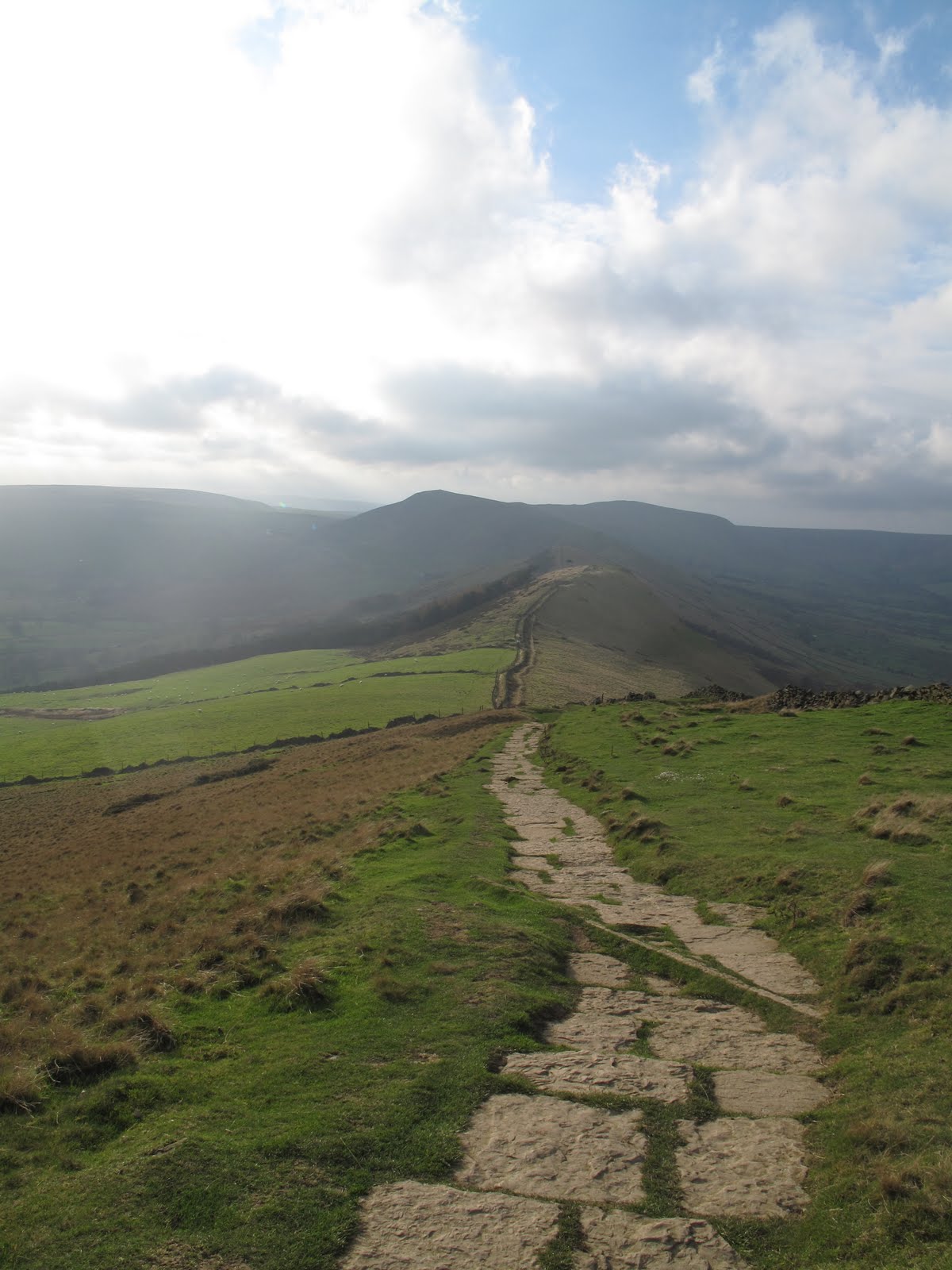
While we sit waiting for the coffee to cool, and enjoying the view, and talking, a large group comes along the path from Mam Tor and turns down towards Edale. "Don't look now," says PC, "but they have Tigger with them." Sure enough, when I am allowed to look, there is Tigger, bouncing away down the path, and there seems to be a polar bear too. Well, at least they seem to be warm!Once the coffee is finished we pack up and set off again, this time up Barker Bank towards Back Tor.

This seems to be the busy time of day as there are quite a few people on the path here, most are coming towards us and most have come down Back Tor. As we approach the path veering off to the left towards the Tor a large dog comes snuffling up behind us, nudging the back of our legs. its owners completely unconcerned. It's a good job we aren't dog-phobic, and the hound seems genuinely docile, but it could quite easily have given someone a fright - and it's a shame the owners aren't very considerate of other walkers or of sheep.


Instead of going up Back Tor we decide to take the lower path which goes through Brockett Booth Plantation instead. A deliberate break in the trees would provide an excellent view of Peveril Castle if the sun wasn't shining so brightly in our eyes, but it isn't bright enough to block the view of the hideous Cement Works. Will we never be rid of the blight.


At the other side of the woods we clamber over a stile and cross some fields. The height of Lose Hill is ahead of us but we are skirting around its base first to approach from the SE. One stile forces us to perform near miraculous feats of athleticism to climb over it, as it seems it was made for giraffe-legged people, not mere mortals such as us.


Soon we're at the base of Lose Hill with the long 'flight of steps' leering down at us. There's nothing for it but to grit our teeth and go for it.


We surprise ourselves. With only a couple of stops (to admire the views, of course) we make it almost to the top. With the wind howling we decide to stop for lunch before reaching the summit to avoid being blown about too much, and we skirt around to the eastern side of the hill where the wind is barely a breeze and we can see for miles.


Out comes lunch - a celebration lunch as PC's birthday is approaching. 21 again! Sandwiches are accompanied by a glass (actually a plastic cup, but it doesn't sound so good) of red wine - very welcome. Then it's time for the special birthday bun. Excessively high calorie Belgian Chocolate Cheesecake complete with a white chocolate swirl on top. Under normal circumstances it would be too rich and too fattening, but somehow today it has the Goldilocks factor. It is just right!


After the wine and the bun it is very tempting to just sit and talk (and maybe have an afternoon nap) but time forces us on. We clamber up the side of the hill and once away from the cosy wind-free picnic spot we are hammered by the full force of the wind. Wow, it really has increased in strength, and has become bitterly cold too.We don't linger on the summit but press on down the ridge to a slightly less buffeted spot where we drag on an extra layer. Feeling warmer we continue on the path. There's hardly anyone out now and we have the strange sensation of having the whole ridge to ourselves.


As we make our way very carefully down the steep, rugged slope of Back Tor, we're talking about ballroom dancing. Probably not appropriate under the circumstances.


At the bottom of the Tor we take the path leading away from the ridge and downhill, and by now we're onto the subject of posh frocks. Not that we have a great deal of experience of posh frocks, but we share what experiences we have endured.


This track takes us to the Hollowford Road gate, exactly where we'd been last week, and all we have to do now is follow the same route to Castleton then back to the cars. In Castleton some of the Christmas trees are already lit up, and it's a pity we don't have the time to wait until dusk as we're sure it must look lovely.


As we press on up the road to the cars we make our plans for our next walk. Not for next week, family commitments, but the week after. Fingers crossed the weather will be kind again.


Saturday, 19 November 2011

THE RIDGE IN REVERSE


WINNATS PASS TO MAM TOR - UPHILL FIRST

On planning today's walk we realised that, although it is one of our favourites, we had never done it in reverse.

To remedy this oversight we meet up in Castleton (good loos) then drive along up the road to park near the Speedwell Cavern car park (no parking fees on the road except for weekends and bank holidays). We're quite giddy with excitement, the sky is brilliantly clear and blue with hardly a cloud in sight. And the shadows cast by the early sunlight are nothing short of spectacular sending the limestone sculptures of the rocks into sharp relief.

Another relief is that PC has brought a rucksack today - no need for me to carry double then!

And one more thing PC has brought is a bottle of Cointreau. No, the plan isn't to drink our way down it through the day (though it is tempting) but to fill up the secret flask. However, there's no need. There's still plenty of Ramblers Restorative in the flask, and it doesn't do to mix spirits, so instead we have a nip before we set off. Gorgeous. Just like breakfast orange juice, but with a glow.

Glowing, we set off along the footpath which crosses the field between the road and the Speedwell Caverns site. The grass is sodden with early morning dew so we get a little damp, and at the top we come out onto an area which is being tarmacked. As we gingerly tip toe across the still warm and springy surface someone hurries out of the shop opposite to stick signs on the footpath gate to say it is shut. So we were just in time, then, but we were given some resentful looks by the workmen.

Now it's all uphill. We usually come down Winnats in the afternoon at the end of our walk, and it is really good to see it in different light and from a different perspective. We notice things we've not seen before, like a huge fallen gatepost which would make a wonderful seat for weary walkers. We, naturally, aren't that weary, though the uphill is keeping us warm (or maybe that's the cointreau).

In a surprisingly short length of time we find ourselves at the top of the pass and adjacent to Winnats Head Farm. That was pretty painless but we don't congratulate ourselves too soon, we've plenty more uphill climbing to do.

We cross over the road and head for the footpath crossing Windy Knoll. There are two horses in the adjacent field, dozing in the sunshine, but they both manage to perk up when they see us, ever hopeful that a stray polo mint may come their way. They're disappointed, so we give them a consolation pat and continue on our way.

The disused quarry on our right is in deep shadow as we head for the gate onto the road. Up to now we've been discussing all things educational including recent parents' evening, prize giving events and the ways schools seem to want to celebrate mediocrity over genuine achievement. It's good to be able to let off steam (my turn this week) as we are then able to approach life with an enhanced sense of calm. It just shows how beneficial walking can be. Once across the road we're starting the long, steady climb up the slopes of Mam Tor. Since we're still talking (to be honest, we rarely stop talking) we hardly notice the steepness of the slope and we're at the base of the 'staircase' to the Mam Tor summit before we know it. We pause for a breather and to admire the far reaching views. And the view of the cement works!

Now we start the steady climb up the well maintained steps up the hill.
Inset into some of the steps are small brass plaques - we see a torq then one of a roundhouse. We've never noticed this one before (probably because we've always been going downhill and gathering speed) and it is particularly fine, so PC takes a picture.

Again, it takes us very little time to reach the summit but rather than go up to the trig point where everyone and their grandmothers seem to be gathering, we skirt the top hunting for a hollow in which to sit out of the wind and enjoy a coffee. Yes, the sun is shining and the sky is clear, but up here there's a stiff breeze blowing. We're unsuccessful on the Edale side of the slope so we cross over to hunt out somewhere on the Castleton side. We drop down a way to where the side of the hill has slipped away, peer cautiously over the edge, then find a convenient sitting place where the hillside has dipped but not yet fallen. We hope our weight won't provide the incentive for it to head downwards!

Naturally the secret flask comes out. After all, we have something to celebrate, we've done all the climbing well before lunch and with relatively little effort. We must be getting fitter, so a couple of nips of the Ramblers Restorative is our reward. Then we have a coffee and a natter (yes, we're still talking) whilst enjoying the view.

It's a wonderful wide vista from here and we can see for miles. The only blot is the ugly cement works - how on earth did they get permission to build such an eyesore? In its heyday Peveril Castle, whitewashed to stand out and be noticed, would have been considered ugly (and very threatening), but in no way could it compete with the monstrosity of the cement works.

By the time we've mused on the landscape, spotted a heron wading in a large puddle and watched a group of children way below us, no doubt on a geography field trip, we've passed enough time to consider getting out the sandwiches. Maybe it's a bit early (but not before noon, we don't want to upset the Picnic Police) but it seems preferable to eat now while we're comfortable than try to find a better spot. However, once the sandwiches are eaten we decide to wait a while for the buns (extreme willpower in force here) so we pack up and set off once more.

It's a long steady walk down towards Hollins Cross with us going against the flow of people. Most of them are puffing on their way up, which makes us feel quite smug. We have spectacular views to Lose Hill and Back Tor but by the time we reach Hollins Cross all we can think about are the buns. So we fine ourselves a wind free hollow on the Edale side and settle down. The buns today are fresh cream apple turnovers; just enough tart in the apples to balance the sugar on the top of the pastry and one of our five a day! They go down extremely well, along with another coffee, and we're glad that we waited a while for them.

After a long, lazy break we go back up to Hollins Cross and take the path that leads to the Hollowford Road. We've never been on this stretch of the path before and we're glad we're not doing it in the wet. Although it has been paved and repaired the steps are uneven and, in places, narrow which means we have to watch where we are putting our feet. It's also quite steep and is one of those cases where it is probably better going uphill than down. A couple pass us in a bit of a lather; they have half an hour to get to Castleton to catch their bus. We wish them luck and dawdle to let them get well ahead of us.

We come off the moor and onto the narrow gully which is the top part of Hollowford Road. It's narrow and running with water, but much better than the one and only time we'd been on this path before when it had been extremely muddy and very wet. At the bottom we come out onto a tarmac lane and pause to read an information board pointing out landmarks and explaining that we'd been on the 'coffin road' from Edale to Castleton from the time before Edale had its own church.

We wander down the road and are soon, seamlessly, back in the centre of Castleton. As we walk through the village we look in a few of the shops selling their Blue John jewellery before heading up the road towards our cars. The sun is dipping behind the hills now and the warmth is suddenly sucked out of the day. All the wonderful shadows and contrasts are gone and Winnats Pass is mired in gloom once again.

We're pleased we've done this reverse walk, it's meant that we've been able to look on it all with fresh eyes. And what's even better, we aren't even tired.

Wednesday, 13 July 2011

LOSE SOME - NOT QUITE A CIRCUIT AND NOT COMPLETELY DRY


We're doing something very sensible for this walk, although we tend to consider it a bit of a cheat. We meet up at the base of Winnats Pass, abandon one car, transfer rucksacks, walking gear and bodies (ours) into the other car, then drive to Hope where we park and get ready to walk.


We start off along Edale Road which is narrow enough to provide some close encounters with a few passing vehicles, but it's the kind of easy, level walking that's just right for warming up the muscles.


Just before we reach Townhead Bridge we take the left hand track which leads, not surprisingly, to Townhead and, ultimately, Lose Hill. We pause to admire a garden's flourishing patch of Bears Britches (Acanthus spinosus) before pressing on up the gentle incline. As we come to a fork in the track, and knowing we need the left hand path, we see a group of half a dozen teenage lads sorting out their gear. On seeing us they hurry up and continue on their way, no doubt expecting to outstrip us easily. We expect them to outstrip us easily too.


We pause to remove a layer, it is warm and despite a few smatterings of rain we don't want to don waterproofs, then continue up hill. A short while later - and it is a short while - we reach the stile which takes us onto an enclosed track. The stile is decorated with half a dozen resting teenagers. We can almost hear their groans of horror as they pick up their rucksacks and stagger over the stile as we wait for them to get a move on.


We give them a couple of minutes start before we follow. The track feels very old, hollowed out by the passage of many feet with banks at either side and arching trees meeting overhead like the soaring columns of a natural cathedral. We have splendid views across the valley and can clearly see the line of the old Roman Road on the opposite hill.


It's a steady pull up this track and we pause a number of times to admire the view - and to let the boys ahead get out of the way. They are really very slow.


Eventually we see the top of the track where, once through a gate, the path emerges onto open moorland in the final pull up to Lose Hill. When we pass through the narrow gate we find the boys laid out on the damp grass looking rather the worse for wear. We, naturally, nimbly skip past them and power up the next patch of ground, just to show them how it should be done.


We pause to admire a stand of foxgloves (yes, and to get our breath back, we're not made for power-walking) then continue to meander up the very steep hill. We're above the trees here and the views are extensive, reaching all the way along the first loop of the Edale valley. We do keep looking back, still no sign of the boys.


Naturally, we have a few pauses on the way uphill, no point in rushing and missing the view. After a while the boys come into range again, only for them to all collapse in a heap once more. This sorry sight is repeated a few times on the way up. They obviously didn't have their Weetabix for breakfast!


We, on the other hand, are making excellent time, so we decide to stop and have a drink and a bun. Ah yes, it's turned into a double bun day purely by accident. It's PCs turn for coffee, but she wasn't sure so brought buns as well - just in case. Being my turn for buns I'd brought buns and had also remembered to fill the secret flask (with the last of the Ramblers Restorative, I must make some more). So we sit and enjoy a nip from the flask, some coffee and a fresh cream scone.


(Whilst doing so the boys - after another rest 20 yards south of us - manage to stagger past us to rest, again, 20 yards north of us. They eat lunch in almost total silence, the lack of noise suggesting they have little breath left for talking.)


Dark clouds are looming so we decide to press on - having ascertained that the boys have already gone before and have a good enough lead for us not to catch up with them again. It was beginning to get embarrassing - for them!


As we reach the final stile on the route to the summit we do the sensible thing and pull on our waterproofs. The wind is starting to make itself felt and the dark clouds are racing across the sky. It all looks very dramatic.


Sure enough, the heavens open, but not for long. We could have managed without the waterproofs, but now they're on we'll leave them for a while. The sky hasn't cleared and we could be in for more rain.


By the time we reach the summit of Lose Hill we have a magnificent 360 degree view around us, including of Win Hill, the Great Ridge and Mam Tor, Castleton, and the less than impressive cement works. And the sun is shining too. This is what walking is all about.


Descending from the summit is quite direct and height is lost quickly. The path is fenced in by post and wire on one side and a semi-dilapidated stone wall on the other. For some odd reason there are large way-marking cairns at the side of the path, pretty pointless as it would be almost impossible to lose your way on this part.


As we cross the ridge we can see the dark clouds gathering again at the head of Edale and the telltale signs of rainfall at Grindsbrook. Then it all turns very eerie. As the rain starts to sweep down the valley the cloud drops and everything is completely obscured behind a sheet of white.


Its like looking through a fog, or a blizzard, but turning eyes right we can still see bright sunshine at the other end of the valley.


Then the rain hits us. Wow, it really means it. Thank goodness we'd kept out wet-weather gear on as we definitely need it. It's still pouring as we start our decent of Back Tor but thankfully it starts to ease off as we pick our way down the rocky hill being especially careful now that it's turned slippery.


By the time we reach the bottom the rain has stopped and we climb over the stile as the sun breaks out again. And when the sun shines it really is warm, and a bit steamy too.


It's been a while since the bun stop so we find a good place for lunch using some flat stones on top of the dry stone wall. It's very comfortable with a good view down to Castleton, although it isn't that easy to pick out the castle. After sandwiches, though, we decide to carry on before having coffee and second buns (do we sound like Hobbits?) so we walk to Hollins Cross narrowly missing a group of teenagers (no, not the same ones - they've disappeared off the face of the earth) then take the path down towards the base of Mam Tor.


Eventually we find a comfortable mound to sit on where we while away the time drinking coffee and eating fresh cream chocolate muffins. We feel as though we deserve them. In the distance we see yet more school groups enjoying the great outdoors and down on the Castleton Road, there are at least half a dozen coaches parked, with probably more in the main car park. It seems as though every school trip, Duke of Edinburgh outing and groups of Lost Boys has congregated here today.


We check our watches and realise that we need to get a move on. We dispense with the waterproofs, the sun is out and everything has warmed up dramatically, and we make our way over a couple of boggy patches to the remains of the old road, most of which has been destroyed by the Shivering Mountain.


As we walk down the road to car number one (narrowly avoiding being run over by a coach) we start to sniff. Not because we have a cold, or hayfever, but because there is a wonderful, sweet smell. We study the hedgerows, peer over walls - nothing. Then inspiration strikes. Plucking a clover flower we discover the source of the perfume. Red and white clover on the sparse grass verges are almost impossibly fragrant. Neither of us have ever been aware of the sweet smell of this common weed.


All too soon we're back in the car and driving through the heaving main road of Castleton towards Hope where we're reunited with car number two. It's been an excellent walk and it's been a good way of doing it. We'll have to cheat a little more often.