Stanage
Showing posts with label Peveril Castle. Show all posts

Tuesday, 26 February 2019

Castleton and Cavedale

We manage another dreary start for our walk today, hardly surprising given that it is winter and it has been raining. So the water running through the village is high and we are well wrapped up against the cold. We aren't expecting a spectacular walk, it is one we have done before, but it will still good to be out and about.

We park, as usual, on the road just past the entrance to the Peak Cavern where, on weekdays, the parking is free. We head off through the car park adjacent and at the far end we are in the village. Before walking through we are, as always, tempted to window shop in the small interesting shops tucked away in these quiet back lanes.

Next we go through the village centre and turn right between the two cottages to the start of Cavedale. As expected on such a grim day it is fairly quiet, and after so much rain, pretty wet. The views are familiar, but no less welcome for that.

Up the steeper stretch of the Dale is always interesting after rain given that you have to walk up the streams that flow down, and with slippery limestone underfoot it can catch out the unwary. But it isn't as bad today as we have seen it in the past, and the backward view is a good one of the Peveril's Castle.


Once through the gate at the top of the Dale the landscape opens out. The muddy path is slick underfoot and the wind is blowing in our faces. Also, a few drops of rain to add to the atmosphere.
The path eventually sweeps around to the left and heads for the gate onto the lanes at the top. We turn left and follow the wide track, probably used by farmers, quarry vehicles and some 4 x 4 enthusiasts. We meet none of them.

We find a wide turning circle/layby/quarry and decide to find somewhere to sit out of the wind and have lunch. It is a brisk affair given that the temperature seems to have dropped.
Suitably refreshed we head onward down the rubbly track. We get a wonderful close-up view of the cement works 😒 and continue down the now tarmac road. There is a shortcut path on our left, over a stone wall, but we have done it before and the final stretches are very steeply downhill through the slippery field. Given recent rain we decide to stick to the road.

It is pleasant enough to walk down and back to Castleton where we observe that there appears to be a very high number of Mini owners here. Perhaps Castleton will become the Mini capital of Derbyshire.

And, as usual, by the time we get to the cars it has started to rain. If anything, that is what defines Castleton for us.


Friday, 10 April 2015

ABANDON HOPE AND ENTER CAVEDALE

The best laid plans have been thwarted again and our promised hike from Hope up Win Hill has had to be postponed. This time, gales, heavy rain, sleet, hail - the works! A power cut where I live means no hot water and, worse still, no coffee. Fortunately a quick text to PC resolves this and she gamely brings along coffee as well as bun, and we also rearrange our walk; we don't want to be on high ground in these winds.

So, with Hope abandoned we decide to meet in Castleton instead and are surprised, given the weather, how busy it is. Already there are groups of bedraggled schoolchildren/Duke of Edinburgh walkers out, along with the Easter holiday-makers. 

As usual we park up on the road just past the Peak Cavern, drag on all our waterproof gear, then set off down the road heading towards Cavedale. 

As soon as we turn up between the houses to the dale entrance we have a taste of what is to come. The tiny lane is awash and the wind is funnelling down strongly. We push on through the gate and start our upward paddle, leaning against the wind. Strangely enough, the photos do not show how wet it really is!


We pause beneath the castle as a group of youngsters ahead of us stop, seemingly lost. Their discussion lasts a while before they set off again, on the only path ahead!


When we reach the spot where the group had been we realise why they had paused. It feels as though all the four winds have congregated in this one spot and it is extremely difficult to move forward. No wonder they were debating whether to go on or not. For us, though, there is no dilemma. We have every intention of forging ahead. I promise PC (without anything to back up my assertions, naturally) that further up the valley the wind will be less forceful. 

As we fight our way upwards against the wind and through a wide stream-bed there is a brief glimmer of sunshine. PC captures it perfectly. It makes the whole landscape look benign and pleasant.


 So, just to put the record straight, and get rid of the idea that maybe we were just making it up about the weather, I have added one of my own photos (from my phone) below. Yes, the river is the footpath!


As we climb up Cavedale against the tide (it certainly feels that way) the wind does actually lessen although there seems to be more and more water. It cascades over the limestone in a manner that would undoubtedly have made Capability Brown jealous, although he would probably have made the path around it rather than through it.

Eventually we make it through the gate at the top, relieved to have made it over the worst of the river-cum-path. A natural spring is gushing from the woods a little lower down on our left and beyond it is relatively dry (relative to the downpour and soggy ground). We pause to admire the view, have a nip from the secret flask as a reward, then press onwards.

It is nearing lunchtime so we decide to find somewhere sheltered to have food. It isn't easy, but eventually we managed to huddle up behind some rocks that give us sufficient protection from the wind. We are very close to the path, sadly, but that can't be helped. 

My first hot drink of the day (thank you, PC) goes down extremely well, then we follow with sandwiches and, joy of joys, yummy buns and a drink (it's my birthday walk, and PC is treating me!). The buns are fantastic, fat choux buns with fresh cream and sticky chocolate icing on top. And the drink is fizz. Bliss.
A surprising number of walkers come past us, most just say a quick hello, but one couple have no idea where they are or where they are going. The have come up from Castleton, they tell us (no, really!) but wonder where the path leads and if they can get back to Castleton, and how far, and where do they go, and how far have they come and how long will it take.........the questions go on. They have no map, no food, nothing to drink (they tell us with a kind of misplaced pride) and are hoping we will provide directions and instructions. We do the best we can and send them on their way whilst refraining from telling them to be better prepared next time.

The wind is still keen but the rain has stopped by the time we have finished lunch, so we carry on up the valley along the gentler, wide path. It is quite muddy in places and when we come to one of the gates we are in for a paddle. Mollie is the only one who is happy about it.
We continue ahead, avoiding the mud, then veering to the left where the wide swathe of the path climbs up. It is well walked (this is the Limestone Way, after all) but still grassy. As we reach the top of the rise the wind hits us again with renewed force. We are walking into it and feel as though we are pushing against treacle.

Through the gate and we turn right, then right again heading towards Winnat's Pass. The group of hikers we had remarked on earlier (and seen a couple more times) are at a standstill again close to Rowter Farm. It looks as though this time we might be in danger of catching up with them, but they set off again.

However, a few hundred yards later and they are, once more at a standstill. This time we do catch up and overtake them; a group of older teens debating their route. However, there isn't much choice, other than straight ahead.

They follow us to the end of the lane and as we open the gate to get onto the road they decide to take the stile. Seems a waste of energy, especially since they appear to need to stop every few hundred yards or so.

We turn right and head for Winnat's Pass, the group disappear to who-knows-where. The wind is behind us now but at least the rain has stopped.


It is a familiar walk down the winding Pass, and we keep to the left hand side where there is a path behind a wall. Slippery in places over the worn limestone it is important to be cautious.

Once through the gate at the bottom and onto the wide verge running alongside the road we realise that this might be the hardest part of the walk. The whole verge is a sodden mass with running water and slippery mud. PC has her walking poles which she needs to keep herself upright, and I eventually step onto the road with Mollie as it seems the safer option.
With the wind behind me I find myself being pushing into a jog, PC is quite surprised as I pass her but anything we might say to each other is whipped away by the gale.

Eventually I make it back onto the verge, steady myself against the wind which is pushing like crowd of schoolchildren trying to get onto the bus home. When PC catches up we round a small outcrop in the hope that it will protect us. It affords little help, and there is even more water here.

And then it happens: my turn to bite the dust - or rather, the mud and slush. A combination of wind, mud and rain has me on the skating rink to nowhere. I'm not hurt, fortunately, but it is a struggle to get enough purchase to stand up again, even with PC's help. 

No harm done, so we continue carefully down the slope towards the Speedwell Cavern car park. From here there is a pavement to lead us safely back to the cars. However, looking over our shoulders we see a storm coming, and our final stroll becomes a rush to get back before it reaches us. 

Hail and sleet, driven by the battering gale, hits just as we are getting into the cars. Within a couple of minutes the windscreen is white rimmed and visibility is down to a couple of hundred yards. It would be safe to say that we have made it back in the nick of time.

Sunday, 21 December 2014

PRE-CHRISTMAS SNOW, HAIL AND SLEET AT CASTLETON

This is to be our last walk before Christmas, and the last one of the year, so despite a postponement and the rough weather of the last few days we are looking forward to be out.


 We have chosen Castleton with the vague hope that a late finish may enable us to see the Christmas lights, and also knowing we have plenty of choices for walking. We park up on the road close to bottom of Winnat's Pass (free parking except at weekends and bank holidays) and decide, since we don't have Mollie but we have had a lot of rain, that a road walk will be in order. Mollie's fear of traffic makes it hard to do roads with her, and although the prospect of treading the tarmac doesn't usually appeal, nor does slogging through rivulets of water or bogs.


So after our exchange of prezzies (not to be opened until Christmas Day) we don our waterproofs - just in case of rain but also to keep the biting wind at bay - over many layers of clothes then set off up the road.

Yes, it is easy walking but we are also lucky that it is quiet - not the tourist season any more and a bit late in the year for the hoards of schoolchildren on geography field trips. It means we have lots of time to talk - something we are very accomplished at!

The road leads us past Treak Cliff Cavern and the disused Odin Mine then around the bulk known as Little Mam Tor. We ignore the turn off that we usually take across towards Hollins Cross and instead keep on the old road, now disused and broken up, courtesy of the unstable 'Shivering Mountain', Mam Tor.

The broken sections of road dip and twist but it is easy walking. Higher up there is a vehicle turning circle and a couple of benches. We decide to have a sit down, enjoy the view and have a sip from the secret flask (orange gin today) and share a box of Maltesers Well, it is almost Christmas.

As we sit we are visited by a hopeful jackdaw so we reward his (or her) persistence with some pieces of bread from my lunchtime sandwich. Ever hopeful he waits around until we are ready to leave, and gobbles down a couple more chunks as a parting gift.

The road makes easy walking past the Blue John Cavern then up to where it joins the main road. Here we decide to cross over the field at Windy Knoll then we do a quick right and left onto the track leading past Rowter Farm. We pass some walkers, only the second we have seen today and the last we will see until we get back, then find, to our surprise, snow. We knew there was snow on high ground during the very cold snap last week, but we weren't quite expecting to see any today. Admittedly there isn't a huge amount left, but sufficient to prove how cold it is. So here we are, above Castleton, and able to make the first snowball of the year.

We carry on along the track, and when we have a choice to drop down to Cave Dale we instead continue straight along towards Dirtlow Rake. On our left is a magnificent stretch of drystone wall currently under construction, and we pause to admire the wonderful workmanship. However, we also notice that, in the distance, the clouds are gathering so we press on.


As we approach the road that circuits the massive quarry - an offshot from Brough going through Smalldale to Pindale then Castleton - we see a stile on our left and, across a field, another stile in the fence line. There are no signs but, curiosity getting the better of us, we decide to see where they lead to and if there is anywhere to sit for a late lunch. 

Over the first stile (a bit of a stretch) then up the field to the second we find we are entering access land, not marked on my current map, which covers a large area from here to Castleton. The views from the highpoint pole are superb and well worth seeing, even though a camera can never do the 360 degree panorama justice. We hike over to a broken drystone wall hoping for shelter from the wind for lunch, but the only suitable places have been overused by sheep so we hunt around for somewhere else.

Eventually we are comfortably sat in a deep hollow with a cup of scalding hot coffee to keep us warm. Sandwiches are eaten then we have spiced apple and fresh cream muffins - the most Christmassy bun I could find this morning. They go down extremely well, followed by more coffee which helps to keep the dropping temperature at bay.

By now the clouds are really massing and we decide to continue ahead to meet the path at the head of Cave Dale rather than returning to our original route through Pin Dale. 


We follow a little-used vehicle track and then find a grassy slope that takes us easily onto the Cave Dale path. Then we come to a small junction with Cave Dale ahead and an upward sloping path onto access land to our left. In a spirit of adventure, and knowing how slippery the decent into Cave Dale can be in wet weather, we choose the path onto access land. 

Then it starts to hail.


Fortunately the hail doesn't last too long and we are out on the expanse of land at Cow Low. There is a footpath here, crossing the moorland straight to Castleton, but there is no clear sign of it on the ground so we start to make it up as we go along. By now the hail has turned to rain and we are careful of where we are walking. 

Eventually we find the straight track that appears to point directly to Peveril Castle, although it is hard to tell since the rain has turned to freezing cold sleet and it is coming at us almost horizontally. This part of the walk is grim, and we are extremely glad of our waterproofs.


When the castle looms at us from the murk we hunt around for the next path which is not particularly clear in the conditions. But find it we do, an almost 180 degree turn and going steadily downhill. The sleet has slowed to heavy rain now so we are careful not to slip (we do have a couple of 'Dancing on Ice' moments) and by the time we reach the bottom of the slope the rain has stopped and there is even some blue sky!

We take the muddy path next to the wall in the direction of Castleton and soon we are through a gate and into the village, looking rather muddy around the edges - so much for it being a road walk!

As we wander back through the village we browse in a few of the shops - Blue John is so pretty - and take time to look at the lights which, to be honest, are a bit of a let down. There are Christmas trees outside some of the shops with bright lights on them, but no central tree nor any other trimmings. A sign of austerity we suppose, not many places seem able or willing to provide the kind of Christmas show we remember from our childhoods.


Now all we have to do is walk the short stretch back to the car. It is dark now, both with the encroaching nightfall in the shortened day and because the rain clouds are back. We barely have time to divest ourselves of our outdoor gear, say our goodbyes and jump into the cars before the deluge starts again.

So that is it until next year.

We send everyone our Best Wishes for a Very Happy Christmas.

Sunday, 27 November 2011

ALONG THE RIDGE TO LOSE HILL


After our great walk last week we decided that we really ought to carry on along the Great Ridge and go to visit Lose Hill so, in a repeat of last week, we meet up in Castleton (for the conveniences) then drive up the road to park past the turn off to Winnats Pass, close to Treak Cliff Cavern.


We're lucky, again, as we've managed to arrange for another fine day. Not quite so clear as last week, nor as mild, but an excellent walking day. We have to layer up against the wind but we're soon setting off up the road in good spirits. We haven't gone far (we're just across from the car park for Treak Cliff Cavern) when we spot a nuthatch in a tree, its plumage beautiful. It hops up and down oblivious to us, but as soon as PC has her camera ready it disappears. Obviously camera shy!


We're taking a familiar route today, past Odin Mine (a protected archaeological site) and its adjacent crushing circle which produced lead ore for a considerable length of time, along the old road then off on the path to the right near Mam Farm.


There hasn't been much rain lately but the narrow path is quite slick and slippery. PC pauses to remove a layer, we are going steadily uphill, and we pause to admire some vivid orange toadstools.There are sections of this path that are always boggy, and although we negotiate the first stretch easily the second is more problematical. Whilst PC pauses to take a photo of the view I forge ahead and after some nifty footwork manage to stand on uneven muddy ground which takes my feet from me. Fortunately I put out a hand to save myself, which sinks wrist deep into mud, but at least I haven't sat in it! Naturally, PC crosses without a hitch.


Once I've washed the muddy glove in a stream we carry on up the slope towards Hollins Cross.


We really aren't finding these climbs as difficult as we used to, which much be a good sign. At the top we pause to enjoy the far reaching views ahead to Edale, then decide it's time to sit down for a coffee, so we make our way to the shelter of a wall and the place we'd sat last week.


First out is the Ramblers Restorative - not that we need restoring just yet, but there are other treats in store for later in the walk and we don't want to miss out on our 'fix'. After sampling the warm, fuzzy glow left by the Ramblers we then have a coffee. PC's turn to make it today, which means it's scalding hot and the cups are too hot to hold.


While we sit waiting for the coffee to cool, and enjoying the view, and talking, a large group comes along the path from Mam Tor and turns down towards Edale. "Don't look now," says PC, "but they have Tigger with them." Sure enough, when I am allowed to look, there is Tigger, bouncing away down the path, and there seems to be a polar bear too. Well, at least they seem to be warm!Once the coffee is finished we pack up and set off again, this time up Barker Bank towards Back Tor.

This seems to be the busy time of day as there are quite a few people on the path here, most are coming towards us and most have come down Back Tor. As we approach the path veering off to the left towards the Tor a large dog comes snuffling up behind us, nudging the back of our legs. its owners completely unconcerned. It's a good job we aren't dog-phobic, and the hound seems genuinely docile, but it could quite easily have given someone a fright - and it's a shame the owners aren't very considerate of other walkers or of sheep.


Instead of going up Back Tor we decide to take the lower path which goes through Brockett Booth Plantation instead. A deliberate break in the trees would provide an excellent view of Peveril Castle if the sun wasn't shining so brightly in our eyes, but it isn't bright enough to block the view of the hideous Cement Works. Will we never be rid of the blight.


At the other side of the woods we clamber over a stile and cross some fields. The height of Lose Hill is ahead of us but we are skirting around its base first to approach from the SE. One stile forces us to perform near miraculous feats of athleticism to climb over it, as it seems it was made for giraffe-legged people, not mere mortals such as us.


Soon we're at the base of Lose Hill with the long 'flight of steps' leering down at us. There's nothing for it but to grit our teeth and go for it.


We surprise ourselves. With only a couple of stops (to admire the views, of course) we make it almost to the top. With the wind howling we decide to stop for lunch before reaching the summit to avoid being blown about too much, and we skirt around to the eastern side of the hill where the wind is barely a breeze and we can see for miles.


Out comes lunch - a celebration lunch as PC's birthday is approaching. 21 again! Sandwiches are accompanied by a glass (actually a plastic cup, but it doesn't sound so good) of red wine - very welcome. Then it's time for the special birthday bun. Excessively high calorie Belgian Chocolate Cheesecake complete with a white chocolate swirl on top. Under normal circumstances it would be too rich and too fattening, but somehow today it has the Goldilocks factor. It is just right!


After the wine and the bun it is very tempting to just sit and talk (and maybe have an afternoon nap) but time forces us on. We clamber up the side of the hill and once away from the cosy wind-free picnic spot we are hammered by the full force of the wind. Wow, it really has increased in strength, and has become bitterly cold too.We don't linger on the summit but press on down the ridge to a slightly less buffeted spot where we drag on an extra layer. Feeling warmer we continue on the path. There's hardly anyone out now and we have the strange sensation of having the whole ridge to ourselves.


As we make our way very carefully down the steep, rugged slope of Back Tor, we're talking about ballroom dancing. Probably not appropriate under the circumstances.


At the bottom of the Tor we take the path leading away from the ridge and downhill, and by now we're onto the subject of posh frocks. Not that we have a great deal of experience of posh frocks, but we share what experiences we have endured.


This track takes us to the Hollowford Road gate, exactly where we'd been last week, and all we have to do now is follow the same route to Castleton then back to the cars. In Castleton some of the Christmas trees are already lit up, and it's a pity we don't have the time to wait until dusk as we're sure it must look lovely.


As we press on up the road to the cars we make our plans for our next walk. Not for next week, family commitments, but the week after. Fingers crossed the weather will be kind again.




Tuesday, 14 June 2011

CASTLETON, CAVEDALE AND PINDALE


With half term over - and the worst of the revision for GCSEs and AS levels behind us - we were fighting to get out walking again.


Naturally, delays are inevitable when we're desperate, so our meeting time turns out to be much later than planned. Never mind, the main car park at Castleton isn't too full since it's only just rained - and pretty briskly too - which means that most people are keeping away, for now. The car park has probably the best views in Castleton of Peveril Castle as it glares down on the village from its vantage point.


The original castle was built soon after the Conquest and is named after William Peveril who became The Bailiff of the Royal Manors of the Peak. The castle was passed from father to son through successive generations but in 1155 - one year after acceding to the throne - Henry II took the castle into his own possession and in 1176 the present stone keep was constructed. Since then it has either belonged to the Crown or the Duchy of Lancaster. It is an English Heritage site. Although now it is only a romantic, evocative ruin in its heyday it would have been alien, imposing and downright intimidating.


We set off hoping that it won't rain again, but prepared for the worst. The clouds are pretty gloomy. I'm taking hiking poles today (not my idea!) but so far I'm only carrying them as we walk through the village and up the road next to the church (and The George pub - will have to go back there sometime soon).


There's no need to map read as we head for a gap, a car's width, between some cottages to our right. As soon as we're off the road the whole atmosphere changes. The trees arc over the path and slabs of limestone studded with greenery rise up beside us.


We push open the gate and Cavedale opens up ahead of us - enclosed by cliffs - stark and wonderfully picturesque. The monotonous guttural caw of the crows only adds to the atmosphere.


It's uphill - a lot more of the uphill than we remember - so I use the walking poles. Still not sure if they're a help or a hindrance, but they make my arms ache.


It's the time of year for schools' geography field trips, so we aren't too surprised to see some 'land art' - limestone rocks and stones spelling out the names of young loves. It's likely that the stone names will outlive the youthful infatuations!


There's no one else in the dale yet, but we can hear voices from above. Looking up see people up on the castle walls peering down at us. It's quite sobering to think how it would have been when the castle was at its most active - no doubt we'd have been used as target practise.


A little way past the castle and there's a cave, barred and padlocked now, and we can hear a generator or pump working somewhere deep below ground. PC remembers stopping at this cave for a coffee many eons ago!


The dale narrows quite a bit here and underfoot it's very rocky. There's a trickle of water working its way downhill after this morning's rain, but we've been up here in the past and almost paddling.


We continue to climb to the gate at the top of the dale, then decide impulsively to head around on a track to see the castle from a new vantage point. We follow the drystone wall, hop over it where the sheep have demolished it, and find ourselves somewhere to sit for a break. A prolonged break.


We really couldn't have found a better spot. The castle is at eye level to our left, the woods are in front of us and we can see almost the full length of the steep sided dale below us. Magic.


So we sit and talk, and have a drink, and sit and talk some more until we realise that it's past noon. Pragmatic as always we fetch out our sandwiches and coffee, but hold back on the buns to add some incentive to continue. We do toy with the idea of lounging here all day then just ambling back to Castleton, but the hoards are reaching the dale and although most don't make it to the top we don't want to get caught up with them all. So we pull ourselves up, repack our rucksacks, return to the gate and carry on up the valley.
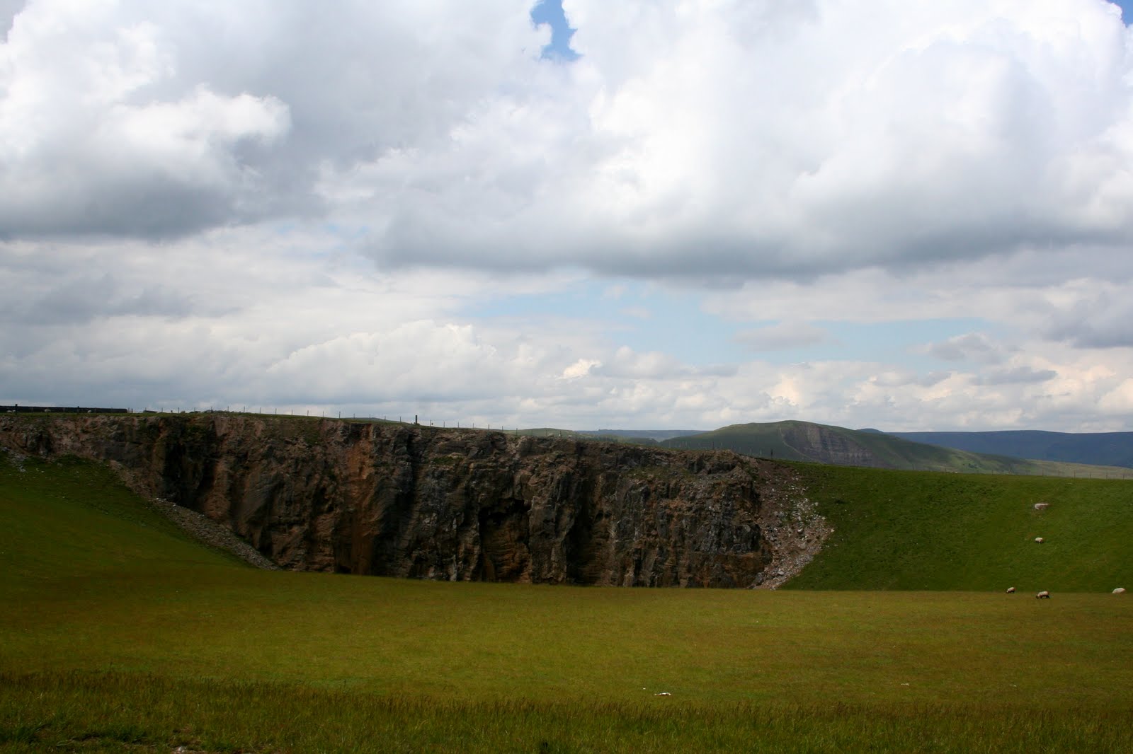


As expected, there are very few people here even though the walking is easy - the worst is behind us. We see a bird dart into a crack in a broken down wall, and hear the frantic cheep of young before the bird re-emerges but we don't go closer for fear of disturbing them.


Despite the sun coming out it is quite cold, the wind is channelling down the valley, but apart from a few ominous clouds and a couple of drops of rain the weather isn't bothering us. We have an interesting and very curious discussion about cloud-watchers. It clearly takes all sorts!


We have to go through a field of cows, but fortunately they're keeping their distance (they know I have the walking poles) and soon we're on the track that runs from Winnats to Pindale, and turn left.


This is very easy walking, level but high enough to have decent views all around. The beauty of this part of the walk is that we know we're unlikely to see anyone at all. The few people that do reach this point tend not to take the route we're following.


One thing we begin to notice is that where there is an absence of drystone walls there's lots of new-looking fencing.

However, before we think too much about it we see a herd of calves clustered close to the fence in a field next to the track. They're a little shy and skittish but very cute (especially as they're behind a fence) and I even manage to approach and touch one of the braver ones. Bravery ends there as both calf and I rapidly exit in opposite directions!


As we walk on we begin to get a feeling that something isn't quite right. Last time we were here there was a huge quarry spoil heap to our left, and now there isn't. We pause, consult the map, and puzzle over it. Surely we can't be lost. Looking at the sparse grass in the fields we deduce that the spoil has gone, been spread out and the land reclaimed.


Sure enough, a little way on we see a sign-board that confirms our suspicions. The former site of Dirtlow Rake has been levelled and returned to pasture, removing a million tonnes of waste and importing soil from Hope in the process. It has opened up views of Mam Tor and the surrounding area as well as restoring valuable agricultural land. A pity the even larger limestone quarry at Bradwell and the monstrosity of a cement works at Pindale are still around to blight the landscape.


We follow the track downhill, and it's getting worse as rain run off has gouged deep channels in the surface and dislodged stones making it hard to walk on. We skip onto the adjacent road instead and soon we see a couple of orchids growing on the verge. A few yards further and there's a field with clumps of the deep purple gems.


Undeterred by a stone wall PC decides to get up close for a shot.

Her agility and athleticism have to be commended, and with the bionic hip giving no trouble at all she gracefully scales the wall and returns triumphant after achieving a memorable photo.


After that we're starting to show signs of bun-deprivation, so as soon as we find somewhere to sit off the road we detour and unpack the coffee and fresh cream scones. What we don't realise is that we're sat on the local anthill - something that soon becomes apparent - so our break is short lived, the scones eaten and coffee drunk with unseemly haste, and we're back on our feet again for the home run.


To our left is a short-cut path across the fields which takes out the steep, severe loop in the road. What we don't realise until we reach it is that the path is obviously little used because it is so steep. Sheep watch us smugly as we carefully make our way down the slippery grass. Maybe it would have been better to take the road after all.


It isn't far to Castleton now and after we've passed the first few houses we pause to admire (with PC coveting) some huge plant pots in a beautiful small cottage garden. Very colourful but very tasteful too.


We know we're back in the village now, the sun has brought out the crowds. Sometimes we forget that the Peak District is a popular holiday destination, and June is a holiday month. For us it's 'local' and we'll be out at any time of year, commitments permitting.


The car park, naturally, is full to bursting point but we, thankfully, are leaving the hoards behind. Just enough time to plan our next walk, in two weeks, then drive off into the sunny afternoon.