Stanage

Thursday, 22 September 2011

WE'RE BACK WITH A GENTLE AMBLE AND A SPRINT FINISH


UNDER DERWENT EDGE TO LADYBOWER AND ASHOPTON


Summer is over and we're back - at last. There's so much to catch up on, so much gossip and so many happenings that we've planned an easy walk to give up enough breath to talk. Although we've both been keeping fit(ish) over the holidays (PC sailing and me walking) we've both managed to put on a bit of weight. Too many Cornish Pasties for PC while I've been enjoying the Cumbrian ale! Still, we're ready now, and raring to go.


Cutthroat Bridge is our familiar starting point and we have one of those wonderful autumn days where the air is crisp and fresh but the sun is bright. We had hoped that the heather would still be in full bloom - two weeks ago the moors were a vivid purple - but it's gone over and we've missed the best of the colour.
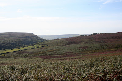


We avoid being run over on the A57 and make our way onto the bridleway at the opposite side of the road. We have an easy walk along this path which gives us plenty of time to start catching up on the last few weeks: holidays, exam results, family etc etc.


We haven't gone far before we have to stop - not to rest but to de-layer. The sun is starting to make itself felt and our fleeces and jumpers aren't needed. We're passed by some other walkers and a pair (or is it a tandem, brace, duo, couple?) of cyclists, and we remember that this time of the year is still the holiday season for many, especially those with no need to keep to the school term times.


It doesn't take us very long to reach the gap beneath Whinstone Lee Tor where we pause to take in the wonderful view, and to get out the map to decide what to do next. Our original plan (such as it was) would have taken us on the path over Lead Hill following the route of our very first blog. However, after a brief discussion we decide to continue on the bridleway which runs beneath Derwent Edge, something we can't recall ever having done before.


By now the sun really is shining and since we seem to have lost all the other walkers and cyclists (who prefer to keep high up on the Edge itself) we decide to find somewhere to sit for a coffee. Not quite as easy as we first thought as although there is a lot of heather and grass, all very wet from yesterday's rain, there's not much in the way of handy boulders on this part of the path. In the end we find a grassy platform where we make ourselves comfortable and fetch out the two flasks - the coffee and the secret flask. We savour the last of the Ramblers' Restorative (good job I have another batch almost ready at home) followed by coffee and enjoy the view along with a good talk.


We sit for longer than we intended, it's almost lunchtime, but buoyed up by our refreshments we press on, initially ignoring the path down to our left which leads to Ladybower and taking the narrow track straight on which flanks the drystone wall.


It's really warm now, and we're feeling peckish. Fortunately, there are a lot of boulders around here so we scramble through the bracken and heather to reach a huge slab of gritstone at convenient seat-height. Sandwiches, coffee and our first-of-the-season fresh cream scones are consumed with great satisfaction.


We don't really want to get up and move, it feels a really lazy day, but we know we can't sit around forever. Again, we consult the map and decide to retrace our steps and take the downward track towards Ladybower and Grindle Clough. We're onto the subject of books by the time we're on the broad path heading towards the woods.


The path is a bit stony, the usual case when a track is heavily used by mountain bikes, but it's easy enough to walk. We certainly wouldn't really fancy it uphill, though. We go through a gate then across the stream before reaching another gate which takes us into an old yard and barns, renovated by the National Trust.


The first building is Grindle Barn, now made into a shelter for walkers with a wonderful 'duck' bench and ceramic tiles set into the walls made by local schoolchildren back in 2002. Outside, above the entrance, is a carved wooden board showing life in the valley and on the hills. It really is worth seeing.


As we pass through the yard the last barn on our left has date carved into the lintel: 1647.


From here the downward path is paved, a bit strange and heavy on the feet, but it does stop erosion. By the time we're at the bottom on the Ladybower path we're onto the subject of the prices some charity shops charge for things they were given for free. Like £70 - yes, £70 - for a dress in Kendal. Needless to say, that one was left on the rack.


We're enjoying the view and the steady pace, but when we glance at the time we realise that we're later than planned and that we to get a move on. So we step up a gear, not fast, but we're making a bit more effort. Not easy when we've eaten all the food and drunk all the coffee (and the Ramblers').


It's a long, steady haul along the side of the reservoir, which is rather low despite us thinking we'd had a pretty grim summer. As we approach the long, multi-arched bridge we veer left past the houses at Ashopton and out onto the path beneath Ladybower Tor. It's single file on the narrow track until we're through the gate and in the shade cast by the trees behind the Ladybower Inn. The temperature is really high now and it feels more like mid-summer than early autumn.


It doesn't take us long to reach the broad stony path that runs parallel to, but above, the A57. Here I get a phone call from home - a sure sign we're late and with a fair walk back to the cars there's no likelihood of being home soon. Ah well, can't be helped.


The walk up the path is steeper than we remember, or maybe it's because it's so hot and we, quite honestly, are getting tired. Obviously, we ain't as fit as we thought! However, once we've hit the high point it doesn't take us long to yomp the rest of the way, completely ignoring the wide views and peace.


We make it back to the cars hot and sweaty, not a good look, and with the first rosy glimmers of sunburn. Yes, it really has been that hot. No time to hang around, though, so we make hurried arrangements for our next walk in two weeks time before heading our separate ways and a return to what passes for normality.

Sunday, 17 July 2011

END OF SEASON CHALLENGE - THE GRINDSBROOK HORSESHOE


OR: UP HIP AND AWAY.....


It's hard to believe that this is to be the last walk of our 'season'. School holidays put an abrupt end to our walking although we'll both be putting one boot in front of the other albeit separately and in different locations.


So, for our Grand Finale we meet up in Edale. It's a choice spot for high summer walks because of the long days, the large choice of routes and - hopefully - good weather. Today we seem to be in luck as despite a few dodgy clouds looming on the way here we seem to have lost them and the sun is shining out of an impressively blue sky. I'm even wearing shorts - scary!


We've decided to head up Grindsbrook and discuss our route as we walk. Normally we take the popular track up to the head of the Clough then make the steep climb up to the top, and once we even went up the Grindslow Knoll route (never again), but this time as we stride into the meadow after crossing the bridge over Grinds Brook and clambering up the steep steps at the other side, we choose to turn right on the path that climbs up towards The Nab, Ringing Roger and the edge of the Kinder Plateau.


The grassy path starts to climb immediately and we're soon feeling warm, and not just because of the sunshine. Soon the grass gives way to an eroded path which, in turn, leads us to a gate in the wall. Once through this we're really on the long haul upwards. The path has been laid over with stones because, no doubt, of severe erosion and we consider that a pretty good job has been done. The 'steps' are fairly even and of a reasonable stride length which makes climbing up so much easier. The path takes a sharp left and we continue to follow it as it zig-zags its way up the hillside. Naturally we keep stopping to admire the ever-widening view over Edale and the Great Ridge beyond.


When the path suddenly becomes easy, rather than be elated we tread suspiciously, and sure enough our suspicious thoughts are confirmed. Ahead lies the steep, eroded and rocky clamber up Ringing Roger. Of course, we could go around, there is a lower path, but we're making excellent time and aren't feeling even slightly weary, so onward it is.


Naturally, it isn't too easy. The erosion and loose stones make it a bit of a challenge, but it's well worth the effort and soon we've made it around the top and onto the path leading to the head of Golden Clough. Standing on the path overlooking the deep valley of Grindsbrook below, feeling the wind in our hair and the sun on our faces is one of the magical moments that makes us get out walking whenever we can.


It's only a short haul up to the very top now, and again the path has been paved against erosion though not as sensitively as at the bottom as some of the steps are high, others low making you walk unevenly. Still, it's a little matter once we're on the top and walking across Nether Tor.


The path is level and almost sandy with tiny pebbles of quartz scattered all around. The views are spectacular and some of the rock formations amazing. There are huge slabs of almost flat rock, then tortured, wind-sculpted monuments.


When we arrive at the superb rock formation called Hartshorn we manage to squeeze down out of the wind and threatening clouds to sit for lunch whilst enjoying the dizzying view.


Since it's our last walk the buns are really special and summery: shortcake pastry, creme anglaise and fresh strawberries. Funny how we go silent when we're eating something so nice!


The clouds are moving fast, changing from dark grey to white to grey again, so it's off with the sunglasses and on with a fleece as we leave our lunch spot and continue on our way. We've decided by now that we're going to go the for complete horseshoe. After all, going down the rocky wall at Grindsbrook Head isn't something we were particularly looking forward to and we don't reckon we'll lose much, if any, time going the slightly longer route.

The path meanders a bit in places to avoid having to cross deep water run-off from the plateau, although at time time of year there is barely a puddle or two to negotiate. We have to do a little bit of rock climbing (OK so we'd not picked up the 'easy' path but hey, no problems) and we're soon at Grindsbrook Head. No, we're definitely not going down that way.


As we walk around the top of the Head and photograph the mushroom shaped rock the sun comes out again and the grey clouds have disappeared. Wonderful.


It's an easy enough walk up to Grindslow Knott although PC decides to skirt around its side rather than go straight over the top, but the views from the top are amazing. There's a whole 360 degree panorama that no amount of photographs can do justice to. There's also splendid views of the far ridge we've just walked too.


Next is the descent, and the first bit can be a bit tricky although we manage well enough (utilizing hands, feet and bums) but it reminds us, as if we needed it, why we don't walk up this way any more. It is steep on the way down, and pretty relentless. Although really it is fairly easy it can make the legs ache.


Soon enough, though, the gateway is in sight and we're walking through the grassy sloping fields towards Grindsbrook Booth. The last section of the path is beneath a canopy of trees, then we're out on the road again and heading down to the car park at Edale.


It's been a marvellous walk to end a marvellous season. Little did we imagine back in the Winter when PC had her hip replacement that we'd be doing anything as good as this so soon. We'd both thought that a route such as today's would be out of the question for at least another year, but we're both pleased to have been proved wrong.


So that's it until September. Over the summer we might be able to get around to putting some more photos on the blog, or some details of older walks (and the Missing Wood), but we'll also be out walking, just not in the Peaks.


Happy Holidays.

Wednesday, 13 July 2011

LOSE SOME - NOT QUITE A CIRCUIT AND NOT COMPLETELY DRY


We're doing something very sensible for this walk, although we tend to consider it a bit of a cheat. We meet up at the base of Winnats Pass, abandon one car, transfer rucksacks, walking gear and bodies (ours) into the other car, then drive to Hope where we park and get ready to walk.


We start off along Edale Road which is narrow enough to provide some close encounters with a few passing vehicles, but it's the kind of easy, level walking that's just right for warming up the muscles.


Just before we reach Townhead Bridge we take the left hand track which leads, not surprisingly, to Townhead and, ultimately, Lose Hill. We pause to admire a garden's flourishing patch of Bears Britches (Acanthus spinosus) before pressing on up the gentle incline. As we come to a fork in the track, and knowing we need the left hand path, we see a group of half a dozen teenage lads sorting out their gear. On seeing us they hurry up and continue on their way, no doubt expecting to outstrip us easily. We expect them to outstrip us easily too.


We pause to remove a layer, it is warm and despite a few smatterings of rain we don't want to don waterproofs, then continue up hill. A short while later - and it is a short while - we reach the stile which takes us onto an enclosed track. The stile is decorated with half a dozen resting teenagers. We can almost hear their groans of horror as they pick up their rucksacks and stagger over the stile as we wait for them to get a move on.


We give them a couple of minutes start before we follow. The track feels very old, hollowed out by the passage of many feet with banks at either side and arching trees meeting overhead like the soaring columns of a natural cathedral. We have splendid views across the valley and can clearly see the line of the old Roman Road on the opposite hill.


It's a steady pull up this track and we pause a number of times to admire the view - and to let the boys ahead get out of the way. They are really very slow.


Eventually we see the top of the track where, once through a gate, the path emerges onto open moorland in the final pull up to Lose Hill. When we pass through the narrow gate we find the boys laid out on the damp grass looking rather the worse for wear. We, naturally, nimbly skip past them and power up the next patch of ground, just to show them how it should be done.


We pause to admire a stand of foxgloves (yes, and to get our breath back, we're not made for power-walking) then continue to meander up the very steep hill. We're above the trees here and the views are extensive, reaching all the way along the first loop of the Edale valley. We do keep looking back, still no sign of the boys.


Naturally, we have a few pauses on the way uphill, no point in rushing and missing the view. After a while the boys come into range again, only for them to all collapse in a heap once more. This sorry sight is repeated a few times on the way up. They obviously didn't have their Weetabix for breakfast!


We, on the other hand, are making excellent time, so we decide to stop and have a drink and a bun. Ah yes, it's turned into a double bun day purely by accident. It's PCs turn for coffee, but she wasn't sure so brought buns as well - just in case. Being my turn for buns I'd brought buns and had also remembered to fill the secret flask (with the last of the Ramblers Restorative, I must make some more). So we sit and enjoy a nip from the flask, some coffee and a fresh cream scone.


(Whilst doing so the boys - after another rest 20 yards south of us - manage to stagger past us to rest, again, 20 yards north of us. They eat lunch in almost total silence, the lack of noise suggesting they have little breath left for talking.)


Dark clouds are looming so we decide to press on - having ascertained that the boys have already gone before and have a good enough lead for us not to catch up with them again. It was beginning to get embarrassing - for them!


As we reach the final stile on the route to the summit we do the sensible thing and pull on our waterproofs. The wind is starting to make itself felt and the dark clouds are racing across the sky. It all looks very dramatic.


Sure enough, the heavens open, but not for long. We could have managed without the waterproofs, but now they're on we'll leave them for a while. The sky hasn't cleared and we could be in for more rain.


By the time we reach the summit of Lose Hill we have a magnificent 360 degree view around us, including of Win Hill, the Great Ridge and Mam Tor, Castleton, and the less than impressive cement works. And the sun is shining too. This is what walking is all about.


Descending from the summit is quite direct and height is lost quickly. The path is fenced in by post and wire on one side and a semi-dilapidated stone wall on the other. For some odd reason there are large way-marking cairns at the side of the path, pretty pointless as it would be almost impossible to lose your way on this part.


As we cross the ridge we can see the dark clouds gathering again at the head of Edale and the telltale signs of rainfall at Grindsbrook. Then it all turns very eerie. As the rain starts to sweep down the valley the cloud drops and everything is completely obscured behind a sheet of white.


Its like looking through a fog, or a blizzard, but turning eyes right we can still see bright sunshine at the other end of the valley.


Then the rain hits us. Wow, it really means it. Thank goodness we'd kept out wet-weather gear on as we definitely need it. It's still pouring as we start our decent of Back Tor but thankfully it starts to ease off as we pick our way down the rocky hill being especially careful now that it's turned slippery.


By the time we reach the bottom the rain has stopped and we climb over the stile as the sun breaks out again. And when the sun shines it really is warm, and a bit steamy too.


It's been a while since the bun stop so we find a good place for lunch using some flat stones on top of the dry stone wall. It's very comfortable with a good view down to Castleton, although it isn't that easy to pick out the castle. After sandwiches, though, we decide to carry on before having coffee and second buns (do we sound like Hobbits?) so we walk to Hollins Cross narrowly missing a group of teenagers (no, not the same ones - they've disappeared off the face of the earth) then take the path down towards the base of Mam Tor.


Eventually we find a comfortable mound to sit on where we while away the time drinking coffee and eating fresh cream chocolate muffins. We feel as though we deserve them. In the distance we see yet more school groups enjoying the great outdoors and down on the Castleton Road, there are at least half a dozen coaches parked, with probably more in the main car park. It seems as though every school trip, Duke of Edinburgh outing and groups of Lost Boys has congregated here today.


We check our watches and realise that we need to get a move on. We dispense with the waterproofs, the sun is out and everything has warmed up dramatically, and we make our way over a couple of boggy patches to the remains of the old road, most of which has been destroyed by the Shivering Mountain.


As we walk down the road to car number one (narrowly avoiding being run over by a coach) we start to sniff. Not because we have a cold, or hayfever, but because there is a wonderful, sweet smell. We study the hedgerows, peer over walls - nothing. Then inspiration strikes. Plucking a clover flower we discover the source of the perfume. Red and white clover on the sparse grass verges are almost impossibly fragrant. Neither of us have ever been aware of the sweet smell of this common weed.


All too soon we're back in the car and driving through the heaving main road of Castleton towards Hope where we're reunited with car number two. It's been an excellent walk and it's been a good way of doing it. We'll have to cheat a little more often.

Wednesday, 29 June 2011

WIN SOME - UP TO WINHILL PIKE


We'd felt a sense of panic when our normal walking day had to be suspended, but luckily we were able to rearrange and we chose to walk up Win Hill. Fine, except we haven't as much time as usual. Are we up to it?


The last few days have been unusually hot, but the forecast is for rain, so we've come prepared with sun cream and waterproofs. No lingering in the lay-by today, we need to get a move on, so from our parking spot on the road next to Ladybower we're soon on the way. Then PC realises she's forgotten her walking poles so she has to go back for them. While I wait I check out the best route.


Off again and we're crossing the dam. The earth-bank wall is covered with blanket of yellow flowers looking bright and cheerful.

At the other side, the water isn't too high.


At the far side of the dam we turn right then take the track that climbs up to the left. It's quite rocky underfoot, and in places a bit soggy after the heavy rain and thunderstorms of last night, but we're able to push on at a good pace.


On reaching the top we come to a gate, go through it then pause to remove a layer. We're down to shirt sleeves, a rare event this year!


We turn left on a broad track which starts to climb slowly but steadily through the trees. There's no one else about and we have the path to ourselves. The conifers aren't planted too closely together here, so the woods aren't too dense or gloomy, and there's a broad expanse of grass and bracken at either side of the path.


We're surprised at how easy the walking is and how soon we meet the path on Parkin Clough, where we turn right and climb steeply uphill. We once walked the whole length of Parkin Clough, from bottom to top, an unrelenting slog where we debated who was going to be Sam and who would be Frodo. Not sure we ever came to a decision.


Anyway, we climb up through the trees, through a gateway in a drystone wall, then up again. We're in the open now and having plenty of stops. Ahead is the much eroded and repaired path up to Win Hill. I'm not sure whether I like the stone 'steps' or not, but they are a necessity on such a well used route.


Looking back the extensive views across all the Edges are beginning to emerge. Sadly, we also get a full frontal view of the cement works. What an eyesore!


We're on the last push to the summit now where we stop to enjoy the 360 degree panorama. It's too early for lunch but we decide to sit down for a coffee just as a group of teens reach the trig point after walking up from Hope. We find a spot a little way from them where we can sit and savour the view, the coffee and the contents of the secret flask.


It's very pleasant sitting here, though we've had to put our layers back on as it is quite breezy. There are a few more people about - Win Hill is a bit of a people magnet - but it's still relatively peaceful.


However, we're watching the clock so we pack up and set off again. A slight error of judgement (no, we aren't lost!) means we have to scramble around some rocks to regain the path, which doesn't actually go over the summit but skirts it, but we're soon back to easy, level walking again.


We leave the path, even though it is tempting to keep straight on, and take a narrow track through the heather. This starts to take us downhill and eventually we come to a gate in a wall leading to a partially felled plantation. The cut off tree trunks make a tempting seat so we decide to stop for lunch. We remember stopping here some years ago, in the pouring rain, but before the trees had been taken down.


Buns today are a little scrambled due to the heat, but after some improvisation of cutlery and plates we manage to due them justice. Fresh cream strawberry tarts with creme anglaise. They may not look as good as they did in the shop but there's nothing wrong with the taste. Perfect.


It would be too easy to sit here all day. We've lost the breeze, the sky is very slightly overcast which makes it comfortable, and the birds are singing their hearts out. But our eyes on the time we have to pack up and move on.


The path keeps us going downhill, in place a bit slippy and precarious, but we're descending rapidly. In no time at all we've reached the bottom track which hugs the contour of the reservoir. The banks at the side of the track are filled with airy grasses and foxgloves, and there is a sweetly scented honeysuckle twined around a hawthorn.


In no time at all we're back at the dam and heading back to the cars. We can just see the peak of Win Hill over the tops of the trees, and we congratulate ourselves on having managed the walk and a couple of stops with time to spare.

Friday, 24 June 2011

LOOPING THE LOOP, OR, GOING ROUND IN CIRCLES


I get a text as I sit in the car in the lay-by near the Grouse Inn near Longshaw. It's PC. She's in Baslow and the Grouse Inn isn't where she thought it was. After a hastily composed reply with directions I wait until I see her car steaming up the hill. Sadly, she brings the rain with her so we delay our start and sit out the heavy shower before setting off.


To say it's only just after Midsummer's Day it's pretty grim. Cold, windy, showery. Waterproofs are likely to be needed.


Crossing the first few fields at the side of Grouse Inn we are confronted by the wonderful sight of an old fashioned meadow full of summer flowers. The photo can barely do it justice, as the flowers look even better at close quarters. In the second field there is even a flush of spotted orchids, their pyramid spires peering out above the long grass. What a pity we don't see more meadows like this.


At the corner of the field we pass into the woods, and debate on which way to go. The last time we were here we took a wrong turn almost immediately and ended up on a meandering mystery tour. This time, though, we get our bearings and set off on the right track. It slopes steeply downhill between steep banks and beneath a green leafy canopy. It's easy to imagine this being a very old path.


We're in Hay Wood, which we only find out as we exit it and are on the track behind the nice houses of Nether Padley. The path takes us onto a tarmac road which we only follow for a few paces before veering right onto a path uphill again. We're in Oak Wood this time, and there are plenty of dog-walkers' paths criss-crossing the main track which climbs steadily uphill.


At the top we come to a familiar looking gate in a stone wall, and once through it we're pretty sure we've been here before. Of course, now it starts raining, so we shelter beneath a broad tree and wait for the shower to pass. And wait. And wait. In the end we decide to put on our waterproofs and venture out.


We (foolishly) ignore the indistinct track to our left instead choosing to go straight ahead through a gate and across a sheep field. Luckily the rain soon passes, the sheep ignore us and looking back we have the most amazing views.


By this time we've realised that we're on the wrong path but choose to carry on instead of back-tracking. We'll manage to sort out a route.


At the top of the field we go through a gate and walk behind the high drystone wall. We find some large bilberry bushes laden with fat, juicy ripe bilberries, so we have to stop for a healthy snack.


Then we follow the track uphill and into some trees which eventually bring us out at the back of the Grouse Inn. Not what we'd planned, but making the best of it we carry on, go through a couple of gates and out onto the road. So ends the first loop.


It's only a short distance along the road to the entrance to the Longshaw Estate. Here the path is wide, clear and very easy to walk on. Within a relatively short distance we find a conveniently place bench made from a fallen tree trunk, and we settle down for lunch. Out comes the coffee, the sandwiches and the buns. The secret flask is employed for purely warming purposes (the wind is really chilly) and it gives everything a rosy glow. However, even the contents of the secret flask can't compete with the fresh cream strawberry scones. Delicious. After a brief debate, citing examples from various sources, we come to the overwhelming conclusion that Morrisons definitely have the best buns.


It's time to move on, and there are more walkers about now on this popular path. It's straight, easy to follow and with no chance to make a mistake. PC stops to photograph some wonderful old trees and we walk a little faster when we spot a herd of cattle. There are far reaching views across to Higger Tor and Carl Wark, and close to there are the huge clumps of invasive rhododendron bushes.


The path takes us to the Lodge, where we pause for a few minutes, then we skirt around the back, past some children building shelters in the woods (it looks fun) and follow the wide track towards the Wooden Pole. We find another bench, and stop again to finish off the coffee. An inquisitive old Red Setter comes to see what we're doing, but is disappointed when we have nothing to give it.


We rejoin the path, but instead of heading to the Wooden Pole we veer right and take the track past the car park and through a narrow gate back into the woods. Here we make a slight error of judgement when we end up following a sheep track instead of the proper path. Well, it's an easy mistake to make. However, after having a lovely tour of the top of the Longstone Estate, we follow a fence line down hill to arrive - yes, back on the track that we came in on. So ends the second loop.


From here it's easy going. We retrace our steps, emerge onto the road then walk along it past the Grouse Inn and to our cars. Typically, the weather has eventually cleared up and there is the promise of some sunshine.


We feel as though we've walked quite a distance today although we haven't actually managed to go very far. Not that we mind. Despite the weather, it's been good to be out.

Tuesday, 14 June 2011

CASTLETON, CAVEDALE AND PINDALE


With half term over - and the worst of the revision for GCSEs and AS levels behind us - we were fighting to get out walking again.


Naturally, delays are inevitable when we're desperate, so our meeting time turns out to be much later than planned. Never mind, the main car park at Castleton isn't too full since it's only just rained - and pretty briskly too - which means that most people are keeping away, for now. The car park has probably the best views in Castleton of Peveril Castle as it glares down on the village from its vantage point.


The original castle was built soon after the Conquest and is named after William Peveril who became The Bailiff of the Royal Manors of the Peak. The castle was passed from father to son through successive generations but in 1155 - one year after acceding to the throne - Henry II took the castle into his own possession and in 1176 the present stone keep was constructed. Since then it has either belonged to the Crown or the Duchy of Lancaster. It is an English Heritage site. Although now it is only a romantic, evocative ruin in its heyday it would have been alien, imposing and downright intimidating.


We set off hoping that it won't rain again, but prepared for the worst. The clouds are pretty gloomy. I'm taking hiking poles today (not my idea!) but so far I'm only carrying them as we walk through the village and up the road next to the church (and The George pub - will have to go back there sometime soon).


There's no need to map read as we head for a gap, a car's width, between some cottages to our right. As soon as we're off the road the whole atmosphere changes. The trees arc over the path and slabs of limestone studded with greenery rise up beside us.


We push open the gate and Cavedale opens up ahead of us - enclosed by cliffs - stark and wonderfully picturesque. The monotonous guttural caw of the crows only adds to the atmosphere.


It's uphill - a lot more of the uphill than we remember - so I use the walking poles. Still not sure if they're a help or a hindrance, but they make my arms ache.


It's the time of year for schools' geography field trips, so we aren't too surprised to see some 'land art' - limestone rocks and stones spelling out the names of young loves. It's likely that the stone names will outlive the youthful infatuations!


There's no one else in the dale yet, but we can hear voices from above. Looking up see people up on the castle walls peering down at us. It's quite sobering to think how it would have been when the castle was at its most active - no doubt we'd have been used as target practise.


A little way past the castle and there's a cave, barred and padlocked now, and we can hear a generator or pump working somewhere deep below ground. PC remembers stopping at this cave for a coffee many eons ago!


The dale narrows quite a bit here and underfoot it's very rocky. There's a trickle of water working its way downhill after this morning's rain, but we've been up here in the past and almost paddling.


We continue to climb to the gate at the top of the dale, then decide impulsively to head around on a track to see the castle from a new vantage point. We follow the drystone wall, hop over it where the sheep have demolished it, and find ourselves somewhere to sit for a break. A prolonged break.


We really couldn't have found a better spot. The castle is at eye level to our left, the woods are in front of us and we can see almost the full length of the steep sided dale below us. Magic.


So we sit and talk, and have a drink, and sit and talk some more until we realise that it's past noon. Pragmatic as always we fetch out our sandwiches and coffee, but hold back on the buns to add some incentive to continue. We do toy with the idea of lounging here all day then just ambling back to Castleton, but the hoards are reaching the dale and although most don't make it to the top we don't want to get caught up with them all. So we pull ourselves up, repack our rucksacks, return to the gate and carry on up the valley.


As expected, there are very few people here even though the walking is easy - the worst is behind us. We see a bird dart into a crack in a broken down wall, and hear the frantic cheep of young before the bird re-emerges but we don't go closer for fear of disturbing them.


Despite the sun coming out it is quite cold, the wind is channelling down the valley, but apart from a few ominous clouds and a couple of drops of rain the weather isn't bothering us. We have an interesting and very curious discussion about cloud-watchers. It clearly takes all sorts!


We have to go through a field of cows, but fortunately they're keeping their distance (they know I have the walking poles) and soon we're on the track that runs from Winnats to Pindale, and turn left.


This is very easy walking, level but high enough to have decent views all around. The beauty of this part of the walk is that we know we're unlikely to see anyone at all. The few people that do reach this point tend not to take the route we're following.


One thing we begin to notice is that where there is an absence of drystone walls there's lots of new-looking fencing.

However, before we think too much about it we see a herd of calves clustered close to the fence in a field next to the track. They're a little shy and skittish but very cute (especially as they're behind a fence) and I even manage to approach and touch one of the braver ones. Bravery ends there as both calf and I rapidly exit in opposite directions!


As we walk on we begin to get a feeling that something isn't quite right. Last time we were here there was a huge quarry spoil heap to our left, and now there isn't. We pause, consult the map, and puzzle over it. Surely we can't be lost. Looking at the sparse grass in the fields we deduce that the spoil has gone, been spread out and the land reclaimed.


Sure enough, a little way on we see a sign-board that confirms our suspicions. The former site of Dirtlow Rake has been levelled and returned to pasture, removing a million tonnes of waste and importing soil from Hope in the process. It has opened up views of Mam Tor and the surrounding area as well as restoring valuable agricultural land. A pity the even larger limestone quarry at Bradwell and the monstrosity of a cement works at Pindale are still around to blight the landscape.


We follow the track downhill, and it's getting worse as rain run off has gouged deep channels in the surface and dislodged stones making it hard to walk on. We skip onto the adjacent road instead and soon we see a couple of orchids growing on the verge. A few yards further and there's a field with clumps of the deep purple gems.


Undeterred by a stone wall PC decides to get up close for a shot.

Her agility and athleticism have to be commended, and with the bionic hip giving no trouble at all she gracefully scales the wall and returns triumphant after achieving a memorable photo.


After that we're starting to show signs of bun-deprivation, so as soon as we find somewhere to sit off the road we detour and unpack the coffee and fresh cream scones. What we don't realise is that we're sat on the local anthill - something that soon becomes apparent - so our break is short lived, the scones eaten and coffee drunk with unseemly haste, and we're back on our feet again for the home run.


To our left is a short-cut path across the fields which takes out the steep, severe loop in the road. What we don't realise until we reach it is that the path is obviously little used because it is so steep. Sheep watch us smugly as we carefully make our way down the slippery grass. Maybe it would have been better to take the road after all.


It isn't far to Castleton now and after we've passed the first few houses we pause to admire (with PC coveting) some huge plant pots in a beautiful small cottage garden. Very colourful but very tasteful too.


We know we're back in the village now, the sun has brought out the crowds. Sometimes we forget that the Peak District is a popular holiday destination, and June is a holiday month. For us it's 'local' and we'll be out at any time of year, commitments permitting.


The car park, naturally, is full to bursting point but we, thankfully, are leaving the hoards behind. Just enough time to plan our next walk, in two weeks, then drive off into the sunny afternoon.


Sunday, 15 May 2011

LATHKILL DALE TO CONKSBURY BRIDGE


Todays walk was destined not to happen. We'd arranged, re-arranged, cancelled and swapped to get this walking day, then at the last minute it was almost stopped in its tracks, but with a late start we eventually arrive at the small, tucked-away car park in the lovely village of Over Haddon above Lathkill Dale.


With a poor weather forecast and a chill wind we put on another layer of clothes and pack the waterproofs before setting off. On leaving the car park we are warmly greeted by one of the locals; a very friendly fluffy cat who insists on being stroked, tickled and generally made a fuss of before we are allowed to continue.


Then we're walking down the steep, winding road to the dale bottom. We pause to admire the wayside flowers, campion, forget-me-not, cow parsley, and it's so obvious that we're in the White Peak again. Down at the bottom of the road is a huge swathe of blue flowered comfrey - otherwise known a knit-bone. Might come in useful for PCs husband!


We're crossing over to the other side of the River Lathkill today for the first time but we have to stop to read the signs on the gateway of the riverside cottage. They clearly have dogs as the normal "Beware of the Dog" sign is replicated in numerous languages. Our favourite is "Chiens Lunatiques". Says it all!


Crossing the river is a bit of a let down, as the river has completely disappeared, something it is prone to do during excessively dry weather. The ford is a mere puddle but we still go over the footbridge from where we have a superb view of the dry river bed smothered in lush, wild flowers. Landscape designers take note, nature does it better.


We follow the track uphill through the woods accompanied by extremely loud birdsong - another sure sign we're in the White Peak. Through the trees we can see the impressive rocky hillside, as well as hundreds of wild flowers including bluebells.


Then, on the side of a tree PC spots some fungi looking like an exotic bunch of very expensive flowers. The bank is too steep to clamber up, but she still managed to get a photo.


We keep stopping to admire the flowers (honest) then, where the path turns back on itself we see a wonderful array of bluebells dotted with lacy cow parsley and button-bright pink campion. Magic.


At the end of the track we come to a gate which takes us through into a field. There is serious cow potential here, not that PC is bothered, she's too busy taking photos of the clouds, but I'm a bit apprehensive.

Luckily, the cows seem to be in distant fields so we cross the cropped grass towards the appropriately named Meadow Place Grange. The path takes us between farm buildings (still no cows - phew) and in front of the house.


A large group is approaching the Grange on the path from either Youlgreave or Middleton, but we take the left hand farm track instead. It must be quite annoying for those who have footpaths running close to their homes or through their yards. Years ago, when these paths were established, they were only used for locals - mainly for work or for visiting - but now, with walking such a national hobby, hundreds of people can pass through in a week. It's no wonder farmers get annoyed, especially when walkers don't respect property or the rules of the countryside.


Anyway, we walk along the farm track discussing Pride and Prejudice - the 'proper one' as done by the BBC. And our talk naturally drifts onto other adaptations of books too. We stop as a large bird flaps out of cover across the field from us, and we recognise it as a buzzard. Brilliant. Sadly, it keeps hidden, so we move along.


There is a buried medieval village hereabouts at Conksbury, but the greenery is too lush and we're too close to be able to make out the lumps and bumps that signify its position.


We reach the road and turn left where it takes us steeply downhill to Conksbury Bridge, which is extremely picturesque with is very low arches. Surprisingly, there is plenty of water here.


Crossing the bridge we take the path running alongside the river and are followed at a discreet distance by a male swan as we approach its mate which is sitting on its nest in the middle of the river.


A short distance upstream and we find a convenient bench on which to sit and eat lunch where we can (just) see the swans, as well as watch some black and white ducks, and some very fast ducklings.


Scrummy danish pastries and cinnamon swirls to eat bring the ducks and swan up close, but they're out of luck. They probably sense our reluctance to part with food as they paddle away without bothering to wait for the non-existent crumbs.


After lunch we continue to saunter on the path upstream. It is really easy walking here with the path wide enough for pushchairs and probably even wheelchairs.

It opens out into a wide green space where the river is broken by a number of weirs, and when we climb up above the weirs we can see their eerie construction beneath the clear, blue-tinged water. They look like something out of Tomb Raider.


The path keeps high above the water now, but the water is gradually diminishing so that, by the time we reach the rugged (and potentially slippy) part of the path the river has, once again disappeared.


Once back on the level we're walking through shoulder high clumps of comfrey again which means we're almost back to the footbridge. All that is left for us to do is walk up the steep winding slope to the car park - much harder than walking down - and reflect on how lucky we've been that the promised rain never fell.