Stanage
Showing posts with label Monsal Trail. Show all posts

Wednesday, 30 May 2018

TO BAKEWELL AND BACK AGAIN


Very late in posting details of our last couple of walks. Too much has been going on, PC managed to get the photos up in good time but I have been remiss - so apologies.

As you can see from the photos it was a while ago, with the trees yet to burst into leaf and no sign of the sun.


We parked up in Bakewell Station car park which gives easy access onto the Monsal Trail. And for starters we had a quick sample of Moonshine (I know, I know - but this is a pre-birthday walk) then, suitably warmed, we head onto the trail.

Quite busy today, it is an easy stretch to reach, and a few dogs about, but Mollie is happy to be able to go off the lead for a while.


It's snowdrop time and there are many clumps and clusters along the sides of the old railway.
Once we pass Hassop Station where a lot of people park up to ride their bikes, and there's a nice cafe, we look for the uphill footpath on our left.

Through the gate and start climbing, and we leave everyone behind. This is a good path to circuit back towards Bakewell but it doesn't seem to be too popular.

It rises, then levels, then starts to go downhill (where we do see a group of walkers) but we find ourselves a sheltered spot (next to a sinkhole) for lunch.

A glass of fizz, sandwiches and fresh cream strawberry tarts. Perfect. 

And since this isn't a particularly rush day, or long day, or long walk, we linger and chatter rather than getting a move on.

But it is a bit chilly, so eventually we get going.
The path crosses a grassy field, goes through a copse and comes out almost opposite a smaller, less famous Bakewell Bridge. And the sun almost shines too.


But our route isn't over the bridge, rather along the side of the River Wye across the old flood plains, then up lane back to the station and our cars.


Thursday, 29 March 2018

TUNNELS IN THE RAIN

Thwarted by the weather again! We had a walk planned, but the weather forecast was so dire that we opted for a quick change of plan that might - hopefully - keep us a little drier.

We meet up on the road at Monsal Head. It's a familiar enough spot for us, and today it isn't too busy. Hardly surprising. There is a river running down the edge of the road with more rain to come.


Because of the weather we have decided to do the Monsal Trail (yes, again) with the expectation that we will at least be sheltered in the tunnels and can seek refuge there if it gets particularly bad.


We drop down from Monsal Head, pause to admire the crinoid fossils in the limestone 'steps', then reach the level trail and set off, plenty to talk about means that we are well and truly occupied, and the easy going underfoot means we aren't having to be on our guard.


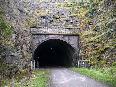
There aren't many others out today. A few random cyclists, joggers and dog walkers. The tunnels are, as expected, cold, dank and dark. Quite eerie in an echoing, hollow way, with the far end rarely in sight as we enter.


At the Litton Mill railway cutting we notice an information board on our left. To our great interest it explains the formation of the Pillow Lava in the face in front. Pillow Lava isn't that common in the UK and this is a good place to see it. For anyone interested in the geology, below is more information with the Litton details are on page 11 of the pdf and a good photo on page 12. http://geology.malvernu3a.org.uk/walks/2016/Cecs%20geological%20excursions/PILLOW%20LAVAS.pdf


The rain starts to come down heavier now, and we are getting ready for something to eat, but we aren't to far away from the Millers Dale Station, so decide to press on in the hope of somewhere dry to sit.

As we reach the bridge over the road we notice, on our left, large lime kilns. However, lunch is a more tantalising prospect than exploration, so we cross the bridge and approach the station where there are toilets, benches to sit on but, alas, no shelter.

However, the rain seems to be coming in fits and starts, so we find a bench next to the station wall and settle down to eat. Coffee is essential, and we are soon warmed through. Sandwiches/salad are quickly eaten but the buns are worth savouring and are magnificent. PC has done us proud. Tarts filled with tangy lemon 'custard' and topped with fresh raspberries. They lift the gloomy day into something special.

Once the buns are devoured, and the coffee finished, it is time to head back. Alternative routes are awash with rain and mud so it is just a case of retracing our steps. And as is so often the case, the journey back seems to be shorter and take less time than the journey out. Even the steep climb from the trail to the head doesn't take us long. 

The rain hasn't been quite as bad as we had been led to believe (so much for hour  by hour forecasts!) so we have been able to enjoy the walk, and make new discoveries along the way.

Wednesday, 21 March 2018

TOWARDS TIDESWELL AND CHOCOLATE SCONES

We seem to be having problems with the weather lately, hardly surprising in winter, but it makes choosing walks a little tricky. We've had our fill full of mud for now.

So, the decision is made to head for the Monsal Trail, but from a point a little further along than usual.

We drive past Monsal Head then down the steep road to the small parking area next to the River. The water is high and looks perishing cold.


Our plan is to cross over the river at Litton Mill and get onto the trail and walk towards Miller's Dale. But once we are suitably attired and on our way, we hit a snag. Taking the footpath through the mill grounds we come up against diggers, metal fencing and enough mud to keep hippos happily wallowing for weeks. An about-turn and change of plan is in order.


Instead we walk up the steep road adjoining the Mill and find, on our left, a gap in the wall to take us on a permissive path which is used to circumvent the flooding that is so common in Water cum Jolly Dale. This path is slippery in places, with fallen trees blocking it in others, and the decent to the path is perilous in wet conditions as you scramble down slick limestone. But we reach the path safely and amble along at the side of the river.


Through a gate at the far end we turn and end up going past a few cottages. We eye up a strategic bench with half a mind for a lunch stop, but instead continue along until I recognise the 'entrance' to Tideswell Dale. Here the river flows gently and it is a very pleasant walk up a well used path.


But lunch beckons, so we find an outcrop to sit on and enjoy lunch and coffee - along with wonderful cream filled chocolate scones. Yes, they sound weird but they are oh-so-good. And large! With a distinct feeling of being overfull we begin to retrace our steps.


At the cottages again we cross over the narrow bridge to the far side of the river and climb upwards onto the remains of the old railway that is now part of the Monsal Trail. Very familiar territory here with the numerous tunnels (cold and dripping) and cyclists coming up behind unawares. 


We walk up the bridge at Monsal Head but before crossing it we take the left hand path down and back over the river. From here it is but a steady walk back to the cars.


It has certainly been a cold day today, but despite a last minute change of plans we managed an excellent walk nontheless.

Wednesday, 16 March 2016

FROM MONSAL HEAD TO ASHFORD IN THE WATER


Something a bit different this week, another trip around a route we haven't done before. It shouldn't be too much of a strain but we are keen to avoid the wet ground and slippery limestone given the amount of rain we have had lately.

We park at out usual spot on the road leading down to Great Longstone. There's a couple of other cars there, but not many, and the main car parks are deserted.

We go across to the toilets at the back of the pub before walking past the bar with its enticing foodie smells and stand overlooking the Monsal Head Viaduct. No matter how many times we see it we don't tire of the view.


It is a bit grim today, though. Any hope of sunshine seems to be lost in the damp. Still, we go through the wall and take the path to the left, then turn left again on a narrower path that regains the height we have just lost.
We climb up and find we are only a few yards away from the pub car park, but there isn't a short cut and this is the only way through.

And, we are beginning to discover, the ground underfoot is slick with mud. This could turn out to be an interesting walk.
The path is heads between a couple of stone walls but where we have to walk is slippery along its length, and boggy in places. It is fairly level, which is a bonus, as we wouldn't fancy our chances having to climb in this.
Even the fields are boggy. We meet a few people on this walk too, a sure sign that it is easily accessible and not too strenuous.

Until I am chatting away and suddenly realise that there is no PC answering. She has succumbed to the mud and has slid (gracefully, she informs me) onto the grass verge. With the slow descent she was able to avoid landing in the mud, and fortunately she hasn't hurt herself. Once on her feet we are on our way again, but a little more cautiously.
The paths are fairly easy to follow, and it is only when we come to a 'junction' that we have to consult the map. Our route is straight ahead onto Pennyunk Lane.
It is only a rough track to begin with, though thankfully not as slippy, but that soon gives way to a firmer track - and we have to stand out of the way as a LandRover comes out of the adjacent farm.

The lane leads us down to the very edge of Ashford in the Water, a part of the village that we have never seen before, but we are no sooner there than turning left onto a tarmac road, then hopping over a stile  (with a lot of breathing in) to cut the corner off by going through a field, then another stile onto the next road which we cross to reach the next footpath.

We are surprised as we are almost in sight of the Monsal Trail here, and have completed the bulk of our walk in double quick time. Sadly there isn't anywhere to sit for lunch, everywhere is too soggy, and it has started to drizzle. So we press on.

Sure enough, we are soon mounting the stone stile onto the trail where we decide to walk towards Bakewell in the hope of finding somewhere to sit.

As it is we are at the far side of the Great Lonstone bridge over the trail before we decide that we had better sit on the mossy wall for our lunch. We are tucked away just enough from the main foot traffic and the rain has stopped.

Coffee, sloe vodka, sandwiches and bun - this time an exceeedingly indulgent double chocolate cheesecake slice each. Very very yummy but it even feels fattening! 

We definitely need to walk off the buns so we set off back down the trail ignoring the path over the fields towards Little Longstone but keeping straight on towards the tunnels. As we approach the tunnel there is a spectacular sight of water running through the moss on the walls of the cutting.

Eventually PC manages to capture a picture to her satisfaction before we go into the tunnel. The wind is certainly whistling through here today and we (I) are being dripped on from the roof.
We reach the far side of the tunnel and turn right up the slope leading towards the head again.
And really, the views haven't changed at all!
 `

Sunday, 9 March 2014

MAP READING AROUND ROWLAND

Two weeks in a row - very good going for us at the moment, but we have managed it although we have chosen what appears to be the only dull, damp day in the middle of an unseasonable clear spell. Well, we can't have everything.

We park up near the Monsal Trail just off the A6020 where the minor road (a B road, I think, but not numbered on the map) heads for Great Longstone. There is enough room for two or three cars here, and another couple of spaces at the far side of the bridge. Ample room in the week but not likely to provide much luck during weekends.

Once we are togged up ready to go, and with our waterproofs on due to the misty rain that is already falling, we walk under the bridge then take the path on our right which leads us straight up onto the Monsal Trail, a familiar place for us and easy walking. It isn't going to be a good day for photographs, particularly since PC has forgotten her camera (!) but I have mine so we should manage something even if they won't be particularly spectacular.

From a vantage point we can see the first part of the route we are planning to take, not realising from here that the distant ridge is where we will be ending up.

We come to a 'cross roads' on the Trail where we often turn right to take the path towards Bakewell, and Mollie is very keen to go in that direction, but today we go left and drop down to cross a lower field that leads to the road and Toll Bar House. On the gate someone has put up a copy of an old document relating to the Tolls.

We cross the road and go left for a little distance to the next stile - a nice easy one compared with the ones we had to negotiate last week. The only downside is the huge boggy area immediately next to it, but we manage to skirt it then set off up the long slight incline of the field. 

Although the rain has stopped the view is still obscured so we concentrate on our conversation instead. We cross more stiles and end up adjacent to a long, tall wall in an extremely muddy field. The field has been ploughed and the path sort-of reinstated, but isn't particularly good, although it could have been much worse. We come out of the field onto a slightly better track that takes us onto the Hassop-Great Longstone road where we turn right.

We haven't walked far along the road before we are stopped by a very polite White Van Man (Openreach) asking for directions! Have they not been given SatNavs? In the end the trusty OS map comes to the rescue and we are able to send the van driver (and his colleague in a following van) in the right direction. They were lucky to catch us, a little way along the road we find our next turning on the left and cross over to it.

Here things start to become a little tricky. The map shows the footpath crossing a field adjacent to a wall. On the ground, no wall, no visible path.
Undaunted we head off in what we assume to be the general direction of the would-be path and find, once we have passed the lone tree, that we can see where we need to go. Then, once more, we have a confusion of path choices in front of us, none particularly obvious on the ground. We are close to the village of Rowland now and wonder if there is some kind of conspiracy to keep hikers away! In the end we skirt the next field, ignore a promising looking crush-stile (no obvious path or exit from neighbouring field), continue along the bottom edge of the field and find an almost-new gate. Through here a short way and we come to another nearly new gate which leads onto the village road.

A quick consultation with the map (we hadn't planned a precise route today as we guessed we may have to do a bit of 'make it up as we go along') and we turn right along the road. Before long the tarmac road peters out and we are on a track leading gently uphill. On our right is a 'reservoir' which looks uncannily like a bronze-age round house on top of a hill but capped with concrete instead of thatch. 

The path we need is on our left and although it climbs quite steeply it isn't hard going as it has a roughly laid surface. Sadly the increased elevation doesn't afford us better views today, which is what we had been hoping for. On a clear day it would, undoubtedly, be excellent.
As we near the top of the incline we can hear diggers, then realise that we are coming out near a quarry. And what a size it is too. This is the Deep Rake quarry, an enormous ugly blot on the landscape, and it is almost inconceivable that an operation of this size could be allowed within the Peak Park. (If you want to read more about the quarrying around here, and what local residents have been trying to do to put a halt to it, please go to this link.)               www.longstone-edge.org.uk

At the top we turn left and walk along the wide 'roadway' avoiding one massive tractor then having to skirt a huge machine parked (complete with unconcerned driver in cab) right across the track. We have reached, and passed, the high point of the walk (still no view but plenty of noise from the quarrying) and are now on a downhill stretch. We pause to look at some windswept trees

then continue on our way until we find our next path which is on the left. And yes, there is a confusion of paths to choose from but we manage to find the right one. 

We are on a steep mossy bank and decide that we have found the perfect place for lunch. Avoiding some straggly yet prickly young hawthorn saplings we manage to find a comfortable spot just out of the wind. The Ramblers first, naturally, then a warming cup of coffee. Mollie is pleased to see that this week I have remembered her biscuits.

PC has her sandwich and I have a heavy salad, then it is bun time. Or rather, pudding time as this week it is profiteroles. Very yummy, very sticky, and very filling. So filling, in fact, that Mollie has to help us by finishing off the excess cream and sauce.

   Once we have had our second coffee we set off again, and it is all downhill. So downhill, in fact, that part of the path has been washed away in a lot of places. The photo doesn't do it justice, but it wasn't the easiest of paths to negotiate (although Mollie managed perfectly well!)
It is an interesting walk down the long slope, to say the least, but we manage to stay upright which is a consolation. At the bottom we reach a grassy track which is not noted on the OS map, so another brief debate follows. In the end we head along a narrow footpath and eventually come out exactly where we want to be. You can call it good luck though we prefer to think of it as good judgement.

A straight path through a field lies ahead of us and although there are cows in adjacent fields thankfully this one is clear. Still not much of a view, though it is probably lovely on a clear day.
At the bottom of the field we go through a gateway, turn right then left down a narrow green valley. 

The path veers to the right and up to another stile from where we can look back on the route. From here we cross a couple of fields and are soon on a track leading us into the village of Great Longstone. We have a reasonable distance to walk on the roads here, but they are quiet and the village is pretty. We pass the church then at the bottom of the street turn right before looking for, and finding, our left hand road. This is a fairly long road, but we are able to cut out a corner by using a footpath across a field which brings us out close to the Monsal Trail at Thornbridge.

Feeling very pleased with our map reading skills on this walk we descend to the Trail and turn left heading back towards the cars and our starting point.

Despite the weather, which has been pretty dull and chilly, it has been a good walk. Perhaps not one of the best - too many confusing paths for that and not enough of the wide open views that we enjoy, - but certainly worth doing. And when we get back to the cars, it starts raining again!


Tuesday, 17 December 2013

A WALK ON THE WILD AND WINDY SIDE

BAKEWELL AND THE MONSAL TRAIL


Our best laid plans have been scuppered by the weather. Gale force winds have meant that, for safety's sake, we are abandoning our higher level walk and retreating to the safety of Bakewell and the Monsal Trail. Not exactly exciting but it should be pleasant enough, if we can avoid being blown over.

Since this is a last minute decision (we were both at opposite ends of the country yesterday when the weather was fine) we meet in Bakewell and sit in the car whilst perusing the map, which is when we decide on the Monsal Trail. So, after nipping to the loos, we drive up to the old station where we find a parking space. There isn't a lot of space up here but the parking charges are less than down in the town, although clearly a lot of people avoid paying by parking on the road.

We spend some time dressing up warm, already the wind is gusting very strongly and we congratulate ourselves on our change of plan. Then we set off, back down the road we've just driven up, and into Bakewell. Before we reach the famous bridge, though, we pass through the narrow gate into the field at the side of the River Wye.


As we walk alongside the river path it starts to rain, only quite fine though, and we hope it will pass even though the clouds seem ominous. We pass through the second gate and almost straight away we have we hear a crack followed by a splash. The top part of a tree has snapped off and crashed into the water amidst a flurry of dead leaves and splinters. The log, which appears to be about 8 feet long, floats downriver. PC and I exchange a look, then carry on walking.

At the far end of the field we go through a gate and up onto the minor road, turn left and then take the right hand track (a bridleway) close to Holme Hall. As we climb up the track the rain intensifies but then eases off as we walk under the shelter of trees. Looking back we can see dark clouds but it has turned clear above us so we press on.

Emerging from the trees, the bridleway leads us gently upwards past an old quarry site, and the rain comes back again. This time we decide that it will be prudent to put on our waterproof trousers, so we balance at the side of a stone wall (away from trees!) to rummage in our rucksacks. Not a moment too soon, either, as the rainfall turns into a deluge. We fortify ourselves with a nip of Ramblers from the secret flask (Mollie has her biscuits) and continue.

The next gate leads us onto a distinct track and we climb up to what will be the highest point on this walk. It is very windy but we're partly sheltered by the stone walls and there are few trees. Sadly, though, the rain means that the views are less than spectacular.


We walk along this easy track for a while until it drops down to join the Monsal Trail. It hasn't taken us very long but we are damp and a little chilly. We could do with finding somewhere to stop for a warming coffee but there is nowhere terribly appealing. A covered shelter would be nice, with a bench, but all the benches/picnic tables are in the open exposed to the wind and the rain. There is the cafe and bookshop at Hassop Station but that isn't an option with a soggy dog.

Pressing on we find that we are approaching Bakewell Station, and our cars, far sooner than we had anticipated. Since the rain has stopped, for now, we decide that we will walk on further in an attempt to find a suitable place to stop for our late lunch.


The sun comes out - such a surprise - and the walk is in danger of becoming pleasant! Alas, the wind begins to pick up strength and the trees around us are rattling. There is a lot of fallen old wood on the floor which Mollie thinks is a wonderful treat, but she doesn't seem to realise that whilst sticks are OK, logs are not.


Eventually we see a bench ahead, close to the end of this part of the trail, and it is in a clearing with fine views towards Bakewell and no overhanging trees. With a considerable amount of effort - some of these gusts of wind have tremendous force - we manage two half cups of coffee each (only half a cup at a time as the wind is making waves in our drinks and threatening to pour it away!) and our sandwiches. But we give up on the buns and second coffee as we decide that it really is too much effort eating and keeping our balance at the same time.


We pack up and head back towards the cars where we will be able to finish lunch in peace. And what a good choice that turns out to be. Firstly we see two broken trees; one on the Trail and one in the field at the side, which have recently toppled (surely not while we were eating, although we didn't notice them on the way out) and then the rain sweeps back down on us.

We make good time back to the cars, but take a while removing our waterproof layers. At last we are able to sit in relative comfort and eat our buns.

Mince pies this week, two each. One has the inclusion of a cream cheese filling, a strange combination we thought before trying it, but it did seem to work. Not very 'cheesy' but it did impart a slightly creamy texture to the pies. The second had a brandy butter swirl on top. You could certainly taste the brandy, but perhaps there was a little too much icing sugar to make the brandy butter into butter-cream icing. No complaints though. They went down very well, especially with the last of the coffee.

The short walk means we have time to sit and chat (we are extremely good at that) until it is time to go. The wind is still howling and the rain looks to be set in for the rest of the night. We've probably done well to achieve what we have.


Friday, 27 January 2012

STEADY AS THEY STROLL - AN EASY ROUTE FROM BAKEWELL AND BACK


As promised we meet up in the Bakewell car park again, relieved to be out. What a lot has happened since our last walk, and not much of it good, so getting out will be perfect therapy. We've hardly pulled on our boots before we're exchanging news, views and sympathy and even the moody Pay and Display machine doesn't put us off our stride as it spits out proffered coins one moment only to accept them the next! As last we're ready for the off, and despite a clear day we've wrapped up warm. The unseasonally mild weather has drifted away and although the sky is clear (more or less) it's feeling bitterly cold.


We leave the car park and head up the gently sloping road to the left which winds around to the old station which is now on the Monsal Trail. We cross the car park (and note that parking here is 50p cheaper for the day) and emerge onto the Trail. There's a tempting sign at the side of the path. Handmade Chocolates. Very very tempting. PC suggests we call on the way back, even if it means making a detour. But showing admirable willpower we decide to forgo the delights that only chocolate can provide, and set off.


The Trail is very easy walking but we aren't tempted to move beyond a gentle ambling pace. We know it isn't going to be a long or taxing walk, and we need our breath to talk. A few cyclists pass us - they must be chilly in all that Lycra - and we see a few dog walkers, but it isn't very busy.


To be honest, this section of the Monsal Trail isn't particularly inspiring. There are no long-distance views as the high railway banks hide the scenery, and at this time of year there isn't a great deal happening in the hedgerows. Good job we have lots to talk (and rant) about.


We walk under the road-bridge (A619) and soon spy some picnic tables and benches ahead. Naturally they beckon to us, and we're soon sat comfortably if not warmly. Coffee is on the menu, but the immediate necessity is for something a little stronger. Out comes the Ramblers (not that we're doing much in the way of rambling today) and the Secret Flask is emptied into our plastic cups. Perfect: warming and mellowing, and we're in need of both. As a special treat we have extra buns so out come some fruit slices, and they go down very well with an excellent cup of coffee. A boisterous and inquisitive young bull terrier comes up to see what we're up to, and snuffling for any treats. It's owner catches up with it and takes it away, though it goes reluctantly.


We decide to crack open the second Secret Flask (things must be bad when we have to delve into our emergency supplies) and enjoy a nip of cointreau. It finishes off our snack perfectly and as we pack away a toddler along with Mum and Gran are hovering - apparently we have been sitting at 'their table'. Suitably stocked up we leave them to it.


A little way along and we come to another old station, this time it has been converted into a cafe and bookshop. PC needs to avail herself of their facilities and the bookshop exerts a strong magnetic pull, but I resist. Again PC suggests visiting on the way back (even though we aren't coming back this way) and again we resist temptation. Aren't we doing well? (If you don't count the extra buns and the Secret Flasks, that is.)


After leaving the cafe/bookshop and regaining the Trail we realise that we have seriously miscalculated. The walk is going to be much shorter than we had anticipated. Our intention had been to walk up the path to the left, opposite Toll Bar House, but after a brief pause for photos across the fields we decide to stroll up to the next bridge

to see what we can see. Not a great deal, as it transpires, although we note one field running with water. By now we've mellowed and have managed to discard most of our angst so we're talking about less stressful subjects, such as exams and therapy!


There doesn't seem to be much point continuing along the Trail, especially as we'll have to back-track, so we return the few yards and take the path that climbs up above the trail. It's narrow and well defined, though a little muddy in places since it isn't surfaced. As we gain height the wind cuts across the fields and we can feel the temperature drop.


It's quite a long path, a public bridleway, and at last we're getting some views but there isn't anywhere sheltered enough for us to stop for lunch. We crest the hill and start to descend towards Bakewell, finally crossing a field full of sheep before reaching tarmac. We're on the edge of the town now and we go to have a look at the beautiful old footbridge, so similar to the one at Ashford in the Water. This is Holme Bridge, built in 1664 and an old Pack Horse Bridge, probably built here to avoid the middle of the town and the tolls payable over the main crossing over the River Wye. The river is running very high and fast today, and whilst it is possible to see where there may have been a ford crossing, the prospect of doing so isn't a pleasant one.


As luck, or providence, would have it, there's a bench at the far side of the river so we cross over the narrow bridge and plonk ourselves down. It isn't warm, but at least the sun is out. We eat our sandwiches quickly so as to get to the buns: fresh cream choux buns with thick chocolate on the top. They aren't very big, but they are satisfying, especially when washed down with the last of the coffee.


It's too cold to linger so even though we're well ahead on time we return over the bridge and head towards the town. There's a path across a field and we have a good view of the main Bakewell bridge in the distance, as well as the height of the river. Some hopeful ducks come scooting up to us as fast as their legs can paddle, but they are to be disappointed.


It's a short stroll back to the cars, but since we still have time to spare we decide to spend half an hour in the town, dumping our gear in the cars before setting off around the narrow streets and some of the more interesting shops (particularly the Apothecary - wonderful smells). But we don't have time to do the whole town justice, and duty beckons, so we head back to the car park.


It has been a particularly easy day today, no stress, no strain and no mad dash. Perfectly theraputic, in fact. Next time we'll head back to the Dark Peak, and hope the promised snow keeps away.