Right, the Easter break is over and it seems half a lifetime since we were last walking so we're especially keen to be out today. However, it is raining, and has been doing so for quite a few days and at a considerable rate. We fully expect to get drenched.
We drived through heavy rain, light rain, drizzle and threatening clouds to arrive at Monsal Head, parking up on the road rather than using the car park and falling foul of the parking fees and potential to outstay our (paid for) welcome. Our first discussion - after the 'yippee, we're free' moment of glee - is a debate as to whether we don waterproof trousers now or later. We look up at the clouds and choose now. Within a few minutes it's raining again.
Along with our gear today I've included a large umbrella. It might seem a strange thing to take hiking but if Nicholas Crane (Coast) can do it, so can we. But with more style. There is a method in the madness here. Any downpour leaves us cowering beneath hoods that cut off all decent conversation, drip water down our faces and obscure vision. Also even the best waterproof coats let in some wet when constantly chafed by rucksack shoulder straps. Hopefully the brolly will prevent this. PC reckons it will be ideal for sitting under at lunchtime - she certainly has her priorities straight.
 Off we go, a spring in our step, to Monsal head and after the briefest of pauses for a photo we head off. Only once we passed through a gate and are still on relatively level ground do we realise that we've taken the wrong path. Duh! Too busy talking and not enough paying attention. And it isn't as though we haven't made the same mistake in the past, so no real excuses other than that we're so giddy with excitement at being out. We backtrack quickly and take the proper path down to the viaduct. Mollie is let off the lead to scamper in front terrorizing stones as we need to be careful on the slippery limestone.
At the bottom of the track we're out onto the Monsal Head Viaduct, and we're in for a surprise. Headstone Tunnel, closed for so many years, is now open! A couple were coming through as we looked on and we stopped for a chat. It appears that the other tunnels along the trail have been opened too with lights (on at dawn, off at dusk) in the longer ones. There is a possibility, in winter particularly, that the tunnels may have to be closed at short notice, and for anyone wanting further details please check the following website: www.peakdistrict.gov.uk/visiting/cycle/monsaltrail It gives information for walkers, cyclists and horse riders.
On with our walk, we cross the viaduct and turn left through a gate and start to climb uphill along a rubble strewn path. It's raining, but not too bad so we keep pausing to enjoy the views behind us. After a while we pause for a bit longer, to remove a layer of clothing. It's warm work walking uphill.
We pass through a small belt of trees and out into the open, still climbing but we know the top isn't too far away. Four soggy walkers pass us going downhill, and these are the last people we'll see until returning to the Trail at the end of our walk.

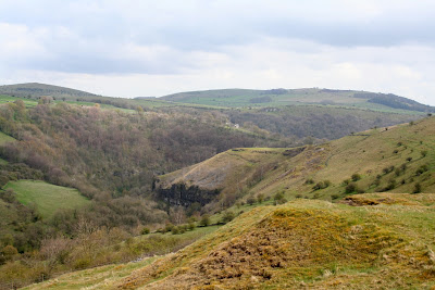
Once we're at the top of the climb we know we've done the worst of the walk. We've reached the easy-to-walk track that will take us towards Brushfield and skirts the aptly named area of High Field. It's pretty exposed up here and the rain is coming in bursts. The brolly is being put to good use, but it's a good job it isn't windy.Across the valley is Fin Cop Iron Age Hillfort (plenty of info on the web) but it is pretty much shrouded by sheets of rain. Closer to us, however, is a field with cowslips so PC goes into photographer mode and is down on her knees to capture them on film.
Back on the track we have to skirt a few path-wide puddles but none present much of a problem. The rain can't really make up it's mind and we seem to be having a couple of minutes clear then a couple of minutes wet. So far, though, we haven't had a deluge.
We come to a crush-stile next to a gate, and after I've squeezed through the crush PC calmly opens the gate for the easy option. We ignore the left hand path to Brushfields Hough, which we've taken in the past, this time carrying on straight ahead. The track dips a little and takes us towards some trees. Now it starts to rain as though it really means it. Perhaps we shouldn't have mentioned not having had a deluge.

At this point we're somewhere above Taddington Dale and the main A6. Although we can hear some traffic noise (not much over the sound of the rain) we don't pause to attempt to look at the map - the map-cover is liberally covered with raindrops obscuring all details beneath.

We go through another gate to find ourselves on the approach to Brushfield, a very attractive collection of farms and cottages, all very neat and tidy. One in particular has a small but beautifully tended garden which makes us pause in admiration. At the end of the driveway we turn right and are once more going uphill. We pass Middle Farm holiday cottages (they look very nice) and continue along the track to Top Farm. Despite the lack of signposts we guess we're on the right path, following it behind the farm buildings to come out above High Dale. The rain has stopped again giving us some excellent views.
It's a straight, easy path again with a few dips and rises although in one dip the whole path is covered in water. We manage to skirt it on a high verge that is very muddy and are soon at the other side. A quick wipe of the map-cover to check the map and at the top of the track turn right to climb over a stile (one of the awkward ones with a tiny gate on top). We've just entered Priestcliffe Lees Nature Reserve (SSSI). The only nature we can see at the moment are a small flock of soggy sheep running away from us.
We're in a long, narrow field with a series of humps and hollows, which may be evidence of past lead mining. The path takes us downhill, through another stile then into another, larger field with more humps (fewer hollows). These are lead spoil heaps and provide a special place for wild flowers, which we see straight away when we spot clumps of wild yellow pansy. Even on a soggy day their small flowers are so cheerful.
This is a perfect spot for lunch, especially since the rain has stopped, so we find a suitable vantage point to sit down overlooking distant Litton Mill with Millers Dale on the right and Tideswell Dale to the left. Out comes the Ramblers - we've earned it today - followed by sandwiches and buns. Our post holiday treats are lemon scones - plain scones with lemon curd and fresh cream. Yum. As we start on our first cup of coffee the rain starts, so up goes the umbrella and we sit there snug and dry waiting for it to pass. We wait, and wait, and wait. After the second cup of coffee the rain eventually abates so we pack up our gear ready to set off.
Within a couple of minutes the sun is out; full, bright spring sunshine that makes us start to steam. But not for long. A couple more minutes, on the slippery downward slope, and it's raining again. By the time we reach the stile leading to the Monsal Trail at Litton Mill it's pouring. Five more minutes and we've crossed the trail to descend to the bridge spanning the very wide, full, fast flowing River Wye - and the rain has stopped again.
We turn right at the end of the bridge over the river and walk past the old mill buildings to take up the path at the side of the river. The last time we were here the river was calm and clear, not so today. It is an angry river, although a brown and white Dipper doesn't seem to be the slightest bit troubled as it skims the fiercely flowing water to land on a rock in the middle of it all.
This path is wide, level and so easy to walk, perfect on a good day for just about every member of the family, but fairly popular at any time. We don't even wonder why there are no other walkers on this path today, until we round the bend towards Water-cum-Jolly Dale and find that the path has disappeared. It is all under water. Not a happy prospect near the end of a walk!
At first we scout next to the cliff to see how deep the water is - very. Almost up to Mollie's belly. Then PC decides to try the submerged hedgerow/verge next to the river and pond. It's one of those hold-your-breath moments as she slowly feels her way along, using her walking poles to guage the depth. She sees clear path ahead, around the bend, but there's a lot more water to get through first and we don't know how bad the path is further on. I'm not keen as we still have quite a distance to go.
Then a walker on the opposite side, high up on the cliff, shouts down to us that the path is completely submerged further on too. Thank you walker in the blue jacket, you saved us finding out the hard way. We now have no choice but to back-track and make our way to the road. It's going to add a considerable time to our walk, but it can't be helped.
However, a little way back I spot a sign at the side of the path (unnoticed in the opposite direction) and it's pointing out an alternative route for 'when the path is flooded'. Obviously a regular occurrance. The alternative, though is a steep uphill climb over slippery smooth limestone. This calls for good boots, stamina and handholds. Mollie, naturally, thinks it's a perfect place for finding stones and rolling them downhill. Under our feet. One way to become a very unpopular dog!
 The climb is short and sharp but we're soon well above the river. The path leads us to a stile (a fence rail with a stone on either side - handy if your legs are long, not so good if they aren't) and a field skirting Cressbrook Hall. Wow. What a gorgeous house. We've seen it before from the opposite sideof the Wye valley, but it is far more impressive close up. The path passes a sloping bank on which there are primroses and in a wooded area we see the first bluebells of the year.
The path takes us around the edge of the hall then down a steep step to follow it through the light woodland towards Cressbrook Mill. We're walking through ramsons here though they aren't in flower yet so their heady garlic scent isn't apparent. It seems that the path will take us right down to the water's edge again but instead it veers left and leads us out onto the road instead. No problem with cars today, though, as there is a 'road closed' sign higher up.
We walk down the road and choose to take the path through the Mill towards the huge pond at Water-cum-Jolly Dale to see how high the water is. Very! It's pouring over the weir in a torrent and we can see - or rather, can't see - where the path is completely submerged. It will take a time for that to clear.
 We cross over the bridge, aware of the sheer volume of water rushing beneath our feet, then climb up the steps to the path. It's raining again - naturally. Soon we're heading back towards the Monsal Trail along the single-file track on the hillside. No one on it today - not surprising given the weather although it is more likely because the tunnels are now open and people don't have to negotiate this stretch.
Once back on the trail we're passed by two cyclists (are they cyclists if they are laying down on their bikes which have 3 wheels) whizzing along at a cracking speed. We walk along at a more sedate pace although it doesn't take long for us to reach the final climb up towards Monsal Head.
The sky has cleared at last and as we make our way back to the cars we're debating on where to go for our next outing. We're still undecided, so it will be a surprise for everyone. Just hope that the weather improves.
We cross over the bridge, aware of the sheer volume of water rushing beneath our feet, then climb up the steps to the path. It's raining again - naturally. Soon we're heading back towards the Monsal Trail along the single-file track on the hillside. No one on it today - not surprising given the weather although it is more likely because the tunnels are now open and people don't have to negotiate this stretch.
Once back on the trail we're passed by two cyclists (are they cyclists if they are laying down on their bikes which have 3 wheels) whizzing along at a cracking speed. We walk along at a more sedate pace although it doesn't take long for us to reach the final climb up towards Monsal Head.
The sky has cleared at last and as we make our way back to the cars we're debating on where to go for our next outing. We're still undecided, so it will be a surprise for everyone. Just hope that the weather improves.


 `
`


