Stanage

Thursday, 10 November 2011

VISITING HOPE CROSS AND THE HIDDEN RIDGE AND FURROWS


This is a walk we've promised to return to for some time, and at last we're ready for it. Yes, the day is terribly gloomy with patchy fog and threats of rain, but we're treating it as atmospheric rather than murky.


We've parked at the side of the road near the Yorkshire Bridge Inn, and are careful of the traffic speeding past. I'm the later of the two, as usual, and PC is almost ready. As I'm hurriedly pulling on my boots she comes to join me at the back of my car, carrier bag in hand. I expect her to bring something out of it but no, she merely stands there a little forlorn, holding the bag. The reason: she's forgotten her rucksack! How can anyone forget a rucksack? Well, if anyone can, it's PC. At least she remembered the coffee. So we load her stuff into my now bulging rucksack (making sure the buns don't get squashed), and she offers to carry it at some point. I suggest she takes it when we come to the uphill bits!


We set off in the morning chill but are soon warmed up by walking. First we cross the oh-so-familiar path across the dam wall and turn right at the far side. The first part of the walk is by the side of the reservoir, level(ish) and easy, so we can chatter away without running out of breath. The trees are still managing to hold onto some of their golden autumn colour but the low cloud means we aren't getting much of a view across the water.


As we round the point at The Springs we get a clear sight of the creamy-white arches of the bridge which carries the A57 to Manchester, and we can hear the traffic noise too which carries loudly across the water. The tree colour on the hillside opposite looks quite promising, but we need the murk - sorry, atmosphere - to lift before PC can take any worthwhile photos.


We're pretty much alone on this stretch of the walk. We do pass a lone walker going in the opposite direction but other than that it's just us and the scenery. Every now and then we come up against pockets of bright autumn colour on the valley side, and an almost-break in the clouds lets us look up to Crook Hill and see the top.


Ladybower is narrowing now and just around the bend, out of sight, it returns to being the River Ashop (joined by the River Alport before it reaches Ladybower), a very narrow river to feed such a large, thirsty reservoir. Two cyclists disappear up a track to our left which means we haven't that far to go to reach the track we need.


Soon enough we see a white gate across the wide path (it wasn't there last time, was it?) with a sign saying Path Closed due to landslip. Fortunately, the path we want climbs up to the left so after a few sniggers at 'Council-Speak' on the notice we set off up the path. You will notice that, at this point, PC does not actually offer to carry the rucksack!


Once we're on the track, which is quite muddy in places, it all starts to seem very familiar. A large swathe of conifers has been cut down with just a few, single specimens jutting skyward. The path climbs quite steeply, but the views back are superb - except for the jutting conifers blocking the way. Three quarters of the way up PC pauses to take some pictures, and I press on to see if there's a better view from the top. There is, so PC joins me and then offers to take the rucksack! I refuse - I'd much rather talk about her (he he he).


From here we enter the wood; dark, dank and eerily still. PC says it's like Primeval. Very reassuring - not. The path is very wide, and to our left is a partly collapsed stone retaining wall. We remember that from last time and scramble over the fallen stones to walk on the broad walkway that must have been the proper path in the past. It isn't until we are clambering over the assault course of fallen trees that we realise that, even though we'd walked on here last time, it had been a bad idea. It's not such a good idea now, but with an inelegant amount of reaching, stretching, cursing and grumbling we do eventually reach the far end. We'll remember for next time - we hope.


Here we reach the ruins. There is no name on the map for this tumbled down and moss shrouded collection, nor it is possible to tell from looking at the remains what the purpose of the buildings was. But it is likely that it could have been a farmstead at some time, there are paths to and from here and Hope Cross, at a crossroads of old packhorse routes, isn't far away. The impenetrable conifers would not have grown so it would have been possible to farm here, although it would not have necessarily been a particularly hospitable location.


We leave the sad remnants behind and a little way past them take a sharp left hand path which is wider and smoother than the other boggy tracks. This climbs steadily upwards taking us high above the deserted buildings quite quickly. The trees form an enclosing tunnel around us with the promise of light in the distance drawing us on. It feels very earthy, very old.


As the trees on our right become wider spaced we see the features that so intrigued us on our last visit. Beneath the trees and damp grass are the definite curves and hollows of ridge and furrow ploughing. How old are these ghosts of farming practises? Who knows? Certainly older than the trees whose roots grow over and into the gentle mounds. Maybe they are linked to the empty buildings we've left behind, or possibly they were here already. It's certainly a tough spot for a ploughed field, without the trees as a shelter the wind would rip mercilessly across the land, but this is angled on the kinder side of the hill, so maybe the crop was worth the effort. Again, I've been unable to find any information on this patch of ground and we wonder if it has been overlooked since it is out of the way and easy to miss.


We amble on, pleased with ourselves. We've done most of the climbing now, and we've seen 'our' ridge and furrow field again. We pause to study and old unused gatepost, its partner nowhere near as substantial, then press on towards Hope Cross which is now in sight. A pair of walkers pass us, deep in conversation, and we look back to see if they notice the field. They don't even take their eyes from their feet - they'll notice nothing.


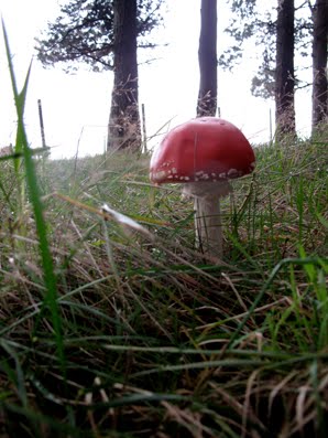
We see a perfectly formed red toadstool (fly agaric) which demands its own photograph then prepare to emerge into the open.


As always at this point, and I do mean always, it has started to rain. I don't think we've ever been to Hope Cross on a perfectly clear day. So since I have to down the rucksack (yes, I'm still carrying it) to get out my waterproof coat I fetch out the Secret Flask too. The Ramblers' Restorative does just what it says on the Flask. A couple of nips each and we're raring to go - after we've clambered over the two stiles.


Someone has left some yellow flowers on top of the cross which look very cheerful in the midst of the drizzle and low cloud. I go around the high wall to study the cross. It is dated 1737 with its four sides signed Shefield (yes, one f), Edale, Glossop and Hope. It is believed that this is a restoration or a replacement of an earlier cross.


The flat topped cross sits next to the ancient roman road which ran from Glossop to Brough and which is still, in places, a path. Here is one of the heavily used stretches and it has been said that, at certain times, roman soldiers can still be seen marching here. Never actually seen them ourselves, so we can't substantiate this!


We walk along the side of the path keeping between the high wall and the tree line to protect us from the rain. There are more walkers out on this side of the hill, though not a large number. Soon, though, the rain stops and we discover that we should have walked on the path this far, as we've come up against a no-stile. Basically, there are some fencing rails and a gap where the step should be. PC curses as she climbs over it, damning it as the worst stile in the Peak District, although she'll probably reallocate the title elsewhere in the future.


It's up and down underfoot next to the treeline, but we shun the well trodden path because we're a bit perverse like that. We do see a lot of fungi, though, ranging in colour from sickly cream to deep burgundy, and do benefit from shelter provided by the wall. Some of the sheep give us odd looks, but they're sporting purple splodges on their fleeces so they've no need to stare!


By the time we're in sight of our turn-off back down into the woods we're more than ready for our lunch, and fortunately there are enough tumbled sections of wall to provide somewhere comfortable to sit.


It's nice to get the rucksack off (yes, I'm still carrying the rucksack) and enjoy a cup of coffee. PC's made a good flask of coffee today (even though I've carried it all the way here) and as the first cup is downed the sky looks as though it might manage to clear. After the coffee we eat our sandwiches (yes, carried them too), have a second coffee, then fetch out the buns.


Mr Morrison has provided puff pastry fresh cream mince pies for us today. They're 'new', a welcome precursor to the Christmas season (unlike the infernal jingly songs blasted out in every shop and supermarket at this time of year which are only guaranteed to make goodwill to all men evaporate at super speed). The mince pies go down extremely well, and are washed down by the final dregs of coffee. At least when the rucksack is packed it is much lighter.


From here it's going to be pretty much all downhill. What a pity then that the path (a Footpath, not a Bridleway) has been churned into a slippery mess by mountain bikers. We pass two on our way down, but they don't seem even slightly ashamed that they are on a footpath and shouldn't be there.


The second part of the path through a young conifer plantation isn't nice to walk on; stony, rutted and churned in the centre, slippery at the edges. But when we can look up from where we're walking the views opening up across to Crook Hill are superb. The cloud has lifted and although the sun isn't shining at least it is clear.


We turn right on the broad track which contours the hill so remains fairly level, and since the trees to our left have been cleared we can see the patchwork woodland on the opposite side of the valley. Narrow lines of russet and pointed triangles cut through dark green blocks to make geometric shapes. We could make some interesting mathematical questions using the shapes - how many trees will you need to fill a space the size of...maybe not.


The path is a little soggy in places with one or two puddles, but we haven't walked too far when it suddenly changes and becomes a gouged hollow in the ground. Clearly diggers have been cutting a deep track though why the cut needs to be so severe is a mystery to us. From hereon we are walking below ground level on muddy (sometimes extremely muddy), stony ground. It isn't particularly pleasant as we have to watch where we're putting our feet as opposed to enjoying the view and when it starts to slope down we have to be doubly careful.


At one point, where a stream discharges on the track, we have to do a balancing act on a log to avoid being sucked into the mud. The potential for humour or disaster are great, but both are avoided. Eventually the path nose dives and takes us down to the broad path that skirts the reservoir. Now all we have to do is walk back.


We've made good time, but the clouds are gathering again and the light is fading. As we approach the path to the dam wall there's a biker repairing a puncture. Poor guy, hope he hasn't far to go afterwards or he may be caught out.


We're soon across the dam and back to the cars. I take off the rucksack and hand PC her flask (yes, I've carried it all the way and no, I won't let her forget it), but we don't have time to linger. Next week's walk is already planned so we're into our cars and away before the dusk swallows us up.


Friday, 4 November 2011

AROUND THE RESERVOIRS


A CIRCUIT OF HOWDEN AND DERWENT


We're back after the enforced absence caused by school holidays and we've got a good one planned. Or rather, we'd planned a different good one, but you know what they say about the best laid plans...


Our original intention had been to go up onto Howden Edge - a long and pretty tough walk given the time constraints and our fitness (lack of) levels. However we'd decided we were up to it, until the torrential rain of the two previous days and nights planted the seeds of doubt and watered them thoroughly.


We meet up at the Fairholmes Car Park under glorious blue skies, avail ourselves of their excellent facilities, then return to our cars for the long winding drive along the western side of the reservoirs (this road is not open all the time although there is a bus service for walkers when the road is closed to traffic). On the way something becomes very evident. We have hit upon the perfect time to observe the most glorious autumn colour, something we hadn't expected to experience this year. So when we finally reach the end of the road (literally) and park up we decide on a change which will enable us to make the most of the sunshine and trees. We'll walk around the reserviours.


Naturally, being seasoned hikers we load everything into our rucksacks, just in case the weather changes or we get lost and have to camp out for a week. PC chooses the direction - clockwise - to make the most of the way the light is illuminating the trees.


We follow the bridleway, broad and easy walking, to the Stepping Stones bridge, and whilst PC stops to take some photos we realise that the sun has disappeared. Undeterred by this minor hitch we decide that it makes no difference, and it might clear up later, so we cross the bridge and continue on the bridleway which doubles back and climbs slightly up onto Cold Side (marked 'cycle route'). Below us the fledgling River Derwent is starting to broaden out, and the contrast between the dark green conifers, golden leafed beech, yellow birch and russet moors is stunning. It's a shame that the sun has gone, but the scenery is no less spectacular for it.


A few cyclists pass us, but there are never very many walkers on this part of the circuit - it's a long way from Fairholmes on foot and most people who drive up the valley as we have done tend to pause for long enough to admire the view only before heading back. So we're finding it extremely peaceful as we catch up on news and discuss everything from school awards to medical students.


We pause frequently to watch the changing scenery and colours, as well as take photos. We pass the path that leads up to Howden Clough, which would have been our downward route had we gone onto Howden Edge, and when we reach the stretch of woods known as The Coppice it's time to remove a layer. And naturally, since the rucksack has to be taken off, I delve for the Secret Flask and we treat ourselves to a swig of Ramblers' Restorative. Oh yes, that is so right, like a burst of sunshine in the stomach radiating out to all points and vying with the copper and golden leaves for brightness!


Suitably restored we trek on ignoring the light shower of rain that does absolutely nothing to dampen our spirits. It only lasts a few minutes and by the time we reach Howden Dam it has stopped. Here we meet the first of the walkers up from Fairholmes who are already turning back. It's funny to think that this is as far as we made it a few months back when PC was getting started after her hip operation. We're certainly doing a lot more today!


As we round the inlet where Abbey Brook joins Derwent we realise how low the reservoir is. There are huge swathes of greenery on the muddy ground which should, at this time of year, be underwater. This newly reclaimed land stretches almost all the way across the valley with only a thin river of water (and the mud) separating the two sides. It will take a lot of rain to re-submerge this area.


We're halfway down the length of the Derwent Reservoir on the eastern side and we're beginning to feel heavy legged and tired. There's no way we can stop to eat yet, we aren't even half way around, and we are wondering if we're tackling a bit too much for our first outing in 3 weeks, but we remain stoically silent about our discomforts (we'll only admit it later) as there's absolutely nothing we can do about it other than turn around or press on. We choose to press on, distracting ourselves with 'what we did on our holidays' which, for PC, seems to have involved a lot of water!


The rain makes a few more attempts to get going but it hasn't really managed very much and we soon reach the steps leading down at the side of the Derwent Dam. We've been here with the water gushing over the top but today the stones are dry. It will be some time before the water levels are high enough to produce the spectacular waterfall.


Once across the grassy field at the base of the dam wall we turn sharp right and up the steep, stepped path to reach the western road. It makes us puff a bit, but the good thing is that we have managed to push our way through the 'walkers wall' and no longer feel as though we're on our last legs. Good job too. Although we've past the turning point of the walk and are on the way back, we aren't yet half way around as the western road is considerably longer than the eastern track.


At the side of the dam wall there are relatively new information boards about the dam busters and mention of the Derwent Dam museum. We've never heard of it - but a quick trawl on the internet reveals that it is situated in the west tower of the Derwent Dam (yes, I know, we were stood right next to it) but it is only open on Sundays and on Bank Holidays, 10am - 4pm. Admission is free, although they welcome donations and they have an interesting web site (http://www.derwentdammuseum/).


There are a few more cars driving along the road now than earlier, so we have to be careful until we pass Gores Farm where there is a wide verge to walk on. We haven't walked far before the rain starts again, and this time it seems to be more determined, so we pause to drag on our waterproof coats. As soon as we're togged up and walking again it stops. Typical. But we decide not to bother removing our waterproofs because we've seen something interesting. A bench which beckons two very hungry hikers. (Us.)


Yes, we've sat here before, and enjoyed the same view - give or take some sunshine, tree colour, fungi etc - but today it seems especially welcome. First it's coffee, then sandwiches, then the buns. Oh, how we've waited for the buns. Today they are especially low calorie (honest) cream doughnuts. Plenty of jam in the bottom, and a convenient shape for eating. They go down extremely well, and very quickly. A second cup of coffee follows then we're packing up ready to go. No time to linger today. We still have a long way to walk, and if we sit for too long we're likely to sieze up!


We have cars coming at us both ways now, those intent on reaching the end to take a photo, and those that have taken their photos and are on the return. But there aren't too many of them. The rain is making more of an effort to keep going and although we're having drizzle then dry, it isn't they type of weather to encourage people to come out for a drive.


We turn the corner near Birchinlee and have a straight run towards Howden Dam. Here the trees are particularly spectacular, and PC stops to take lots of photos of their sweeping black braches laden with glinting golden leaves like pirate treasure.


It's a short haul up a slope at the side of the Howden Dam, then it's the long road along the narrow valley that ultimately leads to Westend Moor (although the road doesn't go that far). The worst thing about it is that we know we have to walk up the full length at the other side too. And it's raining again. Really raining. That doesn't stop us pausing to admire the cathedral arches of beech trees above the road at Hern Side, a marvellous sight despite the rain.


This is a long haul, especially now the rain has set in. The sky is dark and it feels like dusk rather than the middle of the afternoon. There are no cyclists, no cars and we passed the last walkers a while back. We're certainly on our own.


At the bottom of the road we cross the narrow stone bridge and double back on the opposite side of the valley. We know it isn't too far to go now and despite everything we manage to push the pace a little. When we round the point between Ridge Wood and Nether Wood Plantation we know that the end isn't too far away. It's a straight, easy stretch and our two lonely cars have never looked so welcoming.


Yes, it's been a long tiring walk. We're pretty much soaked and our feet ache, and we'll probably not be able to move like normal human beings in the morning. But we both have that silly smile on our faces that confirms that it's been a wonderful day's walking, with autumn colour that we'd have been daft to miss. Will we do it again? Definitely - but not until we've had a while to recover.


Thursday, 13 October 2011

STEEPLY UP AND GENTLY DOWN


A CIRCUIT FROM CHATSWORTH TO BEELEY AND BEYOND


We've met up (eventually - after getting lost somewhere above Matlock!) in the car park at Chatsworth, after negotiating the very poor signs into the car park (OK, so I went in the exit) and paying our £2. We both remember the days when it was free.


Today we are following another of our 'revisited' walks, one we haven't done in a very long time, and fortunately the weather seems to be willing to be a little kinder to us than last week. Still, PC is taking no chances and duly pulls on her waterproof trousers and woolly hat. I'm going to risk it.


The first trip is a quick visit to the garden centre loos where, as I wait for PC, I am being out stared by a frog. I don't like frogs. I dislike them almost as much as cows. So it is with great relief (no pun intended) that we set off.


Exiting the garden centre car park we gasp at the price label on a Betula jacquemontii and escape by taking a right hand turn down the bank through the trees. Almost immediately that wonderful heavy woody, loamy smell of autumn hits us. There are lots of fallen leaves on the floor already being crushed into the muddy path but around us the trees themselves are still very green. We debate the possibility of a colourful autumn, but both doubt it will happen. We're expecting it all to fade then fall. We'll see.


There's only a short stretch of road to negotiate to the single width road bridge over the River Derwent and we pause to look at the murky brown water surging beneath. It has rained quite heavily the last few days so it isn't surprising that the river isn't running clear. Once over the bridge we turn right through the metal gate and into a long, closely cropped field. There are sheep in the field, not cows as last time (thank goodness), and we walk along the clear, wide track to the gate at the other side which brings us to the road again, directly opposite Beeley Church.


We take the road up the side of the church, pause as PC removes her waterproof coat (it isn't even trying to rain), turn right then left, and we're on our way past the pretty old houses of the village. For some reason we start talking of a few people we went to school with, way back in ancient times, and trying to picture how they'd look now. Have they worn as well as we have? Doubtful!


PC is quite taken by some chickens and a cockerel, so stops to photo them. They're hurrying for cover. We've heard a buzzard, and maybe they have too, or they could just be camera shy.


The tarmac runs out, or rather it turns right towards Moor Farm, and we head straight on and up along a grass and mud track instead. Ahead is a heavy old gate, but fortunately there is a newish kissing gate next to it. At the other side it's time for me to remove my fleece - it must be getting warm!


The grassy track continues uphill and although the path actually follows the wall line there is another gate (and very nice stile although you need extremely long legs to use it) leading into Beeley Plantation. It is open for access and a more attractive proposition.


In the woods the path is wide and the trees bring that autumn smell with them. We're quite high up and down to our right is Beeley Brook on its way to join the Derwent, but at the moment the path is fairly level. We cross over the brook at some conveniently placed stones before the uphill starts in earnest. We pass a small group of school children wearing hard hats (why?) accompanied by their teachers and a very watchful border collie.


The path is quite boggy in places here and we have to be careful of prominent tree roots, but we're still climbing and beginning to feel warm. Once the boggy bits are cleared the path becomes easy again, though still steep. We've passed a few walkers on our way, perhaps a half dozen or so, but not so many as we thought would be out on a clear day.


When the path levels out PC has to stop to remove her jumper. She's really feeling the heat, especially as she's still wearing the waterproof trousers.


There are two options ahead, straight on or up to our left, and it's the left hand path we take, climbing steeply once more, but as it levels out we know that we're almost at the top of our walk. The brook has to be crossed in a little while, but there are lots of lovely large boulders here just begging to be used as seats, so we find a suitable one, sit down and fetch out lunch.


We were going to start with coffee, but decide that it really is time to sample this years Ramblers Restorative. It's spicy and warming with a promise of Christmas and intoxication. Perfect. We follow it with coffee, then it's lunch and buns. We're back to the fresh cream scones again, and again they're from Morrisons. Without any doubt Morrisons really do the best scones. Especially as these were on offer - buy one get one free. And no, we don't have two each (but we were tempted). Another coffee, and a long talk, and it's time to get moving.


It's easy crossing the brook up here, but the waterfalls promised on the map are very disappointing. They may look good during or shortly after a heavy downpour, but today they're an uninspiring trickle. We're walking across the head of the woods now, and to our right the trees thin sufficiently for the sunlit views beyond Rowsley to unfold. Yes, the sun is out.


When we leave the woods we turn sharp left onto the very rough track which leads down towards Beeley. We do debate, briefly, going across the strangely named Rabbit Warren, but since there isn't a path from it back down to this track (though I think there used to be) we decide not to bother.


We have some wonderful views across the fields and valleys from here, all illuminated by autumn sunshine. It even feels warm in the sun, surprising given the up and down weather we've been experiencing lately. The track widens and smooths out before turning lumpy again, and we see a 4x4 on its way up. We make way for it (there's not a lot of option) and wonder how it's going to cope with the deep ruts and gouges at the top of the track. Since it isn't a Land Rover we reckon the track will win.


The lane is a little muddy near the farm but once past it we're on tarmac again. There's a lovely collection of stone mushrooms (saddle stones) at the roadside and the houses here at Beeley Hilltop look very neat. We pause to admire the trees on the edge of the Chatsworth Estate, the colours are subtly different giving a textured effect rather than a great blaze of autumnal hues. In the foreground is a dead tree, pale and stark against the darker woods, with a parliament rooks perched on its bare branches. (Yes, the collective noun for rooks is parliament - I looked it up!)


We're nearing the bottom of the lane now and the road (B6012) is in sight. It's a sign it's a warm day, there are plenty of open topped cars driving past.


It's a bit tricky negotiating our way back to the bridge, there isn't a pavement and the verge is almost non-existent, but we manage not to be knocked down or crushed by cars, and we pause on the bridge to look along the length of the river. Then it's a short haul back up to through the wonderful smelling woods and to the car park.


Sadly, we'll be a few weeks before walking again due to school holidays and other commitments, but we're determined to do a good one when we meet again at the beginning of November.

Friday, 7 October 2011

WHAT A DIFFERENCE A WEEK MAKES or VENGEFUL AUTUMN RETURNS


MILLSTONE EDGE TO HATHERSAGE


It's hard to believe that exactly one week ago we were slathering on the suncream and worrying about the heat. Now, we're prepared to be battered, blown and soaked. Yes, autumn is well and truly here, and we're daft enough to be out experiencing it in all its fury.


We've driven through a few heavy showers to reach the Surprise View car park but the sky is clear as we struggle into our gear: extra jumpers, fleeces, waterproof coat and trousers. Add a scarf, woolly hat and gloves and the ensemble is complete. Then we turn around. The thick, dark clouds on the horizon look less than friendly, and the severe winds bring them and the accompanying rain towards us with alarming speed, so we retreat to the shelter of the car. PC has a moment of sparkling inspiration and brings a sample of her Sloe Gin with her.


As the wind rocks the car and the rain hammers down we cosily sip PC's brew. It is excellent, though different to mine. Less syrupy, slightly different taste. Odd really, as we used the same sloes and the same recipe, but we think she may have added more gin. Nothing wrong with that!


As last the clouds clear so we do battle with the ticket machine - credit cards only - but we know what we're doing this time after the last debacle. Then it's time for the off.


We are battling against heavy winds as we wander up the path through the heather towards Millstone Edge. The Surprise View here isn't very surprising at all. Another band of rain is sweeping in obscuring everything. Hoods up, heads bowed we plough on as the torrent hits us. Wow, it really means it. Not only are we being bullied by the wind and soaked by the rain, but we have the added discomfort of hail. Hail! In October. Urgh.


It's hard to keep our feet as we crest the high point of the edge opposite Mother Cap and we can feel the stinging hail though layers of waterproofs and trousers. A couple of walkers pass us from the opposite direction, heads bowed, and our cursory greetings are whipped away on the wind. We hope the whole walk isn't going to be like this.


As the path descends close to Over Owler Tor the rain stops, the wind eases and the sun comes out. It would be glorious if it wasn't so cold and our fingers weren't freezing inside sodden gloves.


Crossing the moor though the bracken and heather is easy, and we now have the far reaching view that eluded us higher up. Naturally, the eyesore of the cement works is prominent, especially when a stray ray of sunlight illuminates its stark pale presence. It really isn't a good advert for the Peak District.


We reach a small group of wind beaten trees and pause to inspect what appears to be a buried cairn and mound. We're at a point where 'the wood that wasn't there' would have been. I really must get around to writing about that.


We continue straight on as though heading to Higger Tor, but follow the path down towards the road. The drop from the stile here is a bit severe unless you have very long legs or are extremely agile. We can admit to neither. Then it's up the road a short distance, discussing Stephen Fry's autobiography, before crossing over to the path on the other side which marked on the map but has no sign post.


When we last came this way it was even colder and the deeply rutted track had a series of treacherous ice covered puddles along its length. The deep ruts are still there, and you have to walk carefully, but it seems that those who have caused the most damage (vehicles) have now been stopped by gates. The second part of the track is easy to negotiate and in the dip of the hills it is wind free and quite pleasant.


We pass Callow on our right and Mitchell Field on our left before reaching the road which runs from Hathersage to Stanage and beyond. There are a number of bends on the road which mean we have to be careful, but we also find a perfectly positioned bench up and to the right. It is too tempting to ignore so we climb the few steps up to and sit down, giving a thank you to Peter Townend in whose memory it has been erected.


We intend at first only to have coffee, but it is almost lunchtime and we know that picnic spots further on are pretty much non existent, so after our first drink we fetch out the sandwiches, and then the buns. We've gone retro today, and PC has brought for our delight some Apple Charlottes (although Tesco calls them Apple Custard Tarts or somesuch). It takes us back years to our childhoods when we would be able to buy these treats at the corner shop, not in packets but delivered by the bakery each day. Nostalgic, and good. We manage to finish them as another wave of heavy rain hits us and as it abates we finish off the coffee.


The walk down towards Hathersage is enlivened by PC trying to take a picture of an uncooperative goose, and a swan behind a fence that hisses at her when she turns her camera on it instead. Obviously not happy to be thought of as second best to a goose.


In Hathersage we make a detour to the loos, then we walk up the hill and out of the village, enjoying some good views across the fields towards Abney. It's sunny again, gloriously so, and we're looking forward to getting back onto high ground.


We're out of the village proper now and cross the road to a footpath which runs steeply up between some houses, easily missed if you're not looking for it. It's shaded here, but steep so we get warm very fast. However, we do manage to keep the pace up and make it to the top, where there's a stile into some woods, with only the briefest of pauses. There are two paths, one ahead, one to the right, and it is the one ahead we need. We take the right hand one. It does end up in the same place, but not without petering out half way leaving us to tread warily at the side of a stone wall.


As the path climbs out of the woods it starts to rain again, so wait for it to pass. Although the individual trees do not seem particularly ancient the woods themselves feel old. There is a fine gnarled, many trunked sycamore specimen and a lovely beech whose leaves have already turned into golden medallions of autumn. Why this tree alone has turned so wonderfully when the rest have not is a mystery, unless it is perhaps in a chilly spot where it catches the cold winds.


Breaking out from the woods we enjoy and fantastically clear view of Winyards Nick on the horizon. We wonder if this would have been a landmark back in the iron age to guide travellers towards Carl Wark and Higger Tor, neither of which are visible from here. We're intrigued.


Pressing on we walk across an open field and see, to our left and to our great surprise, a large house. It looks very 'Jane Eyre' but there's no name for it on the map.


Our route takes us down the driveway of the house, then across the minor road where we decide to go through the splendidly named Whim Wood rather than slog across the moor, a prudent move given the next wave of incoming rain.


It's a very pleasant walk through the wood, hugging the wall on our left, and although we're climbing we're sheltered from the rain and the extremes of the wind. At the top of the wood the path becomes a little indistinct but not too hard to follow, and it brings us to a wall and a gateway leading to the more open but still wooded land directly beneath Millstone Edge.


Ignoring the right hand option which would only take us back to the main road, we turn left and prepare for a steep clamber up to the edge. As it is, the path isn't too bad though the shoulder high bracken means you have to keep our eyes on where we're going. At least we don't have to actually climb the edge.


A stile leads us onto another path which in turn takes us up towards Over Owler Tor. We're retracing our steps now but the views behind us are spectacular.


Up a little higher and we're back on the top of the edge - and again being hammered by the wind and rain. Surely it can't have been like this up here all day! We detour from the path to take a more direct route through the heather towards the car park, arranging where to meet next week as we walk. There isn't much time to stop and chat now, dark grey clouds are looming and we've only just managed to take off boots and waterproofs before the rain hits us, so it's straight into the cars and away. We're a little soggy around the edges and windswept and hoping that the weather is a little kinder next week.

Saturday, 1 October 2011

SEPTEMBER SUNSHINE WITH SUNGLASSES, SUN CREAM AND SLOE GIN


FROM BASLOW TO WELLINGTON'S MONUMENT, THEN ON TO THE ROBIN HOOD FOR A RETURN THROUGH CHATSWORTH


Today we have something quite unexpected, even though it has been forecast. A stunningly blue, clear and hot late September day. This is what is called an Indian Summer. Long may it last!


We meet up in the large car park at Baslow keen to follow a route we last walked during our 'dog days'. After some memory dredging and using our fingers to help calculate, we reckon it must have been about 8 years ago. A long time to leave before revisiting a good walk.


Before we set off we sort out our rucksacks, and I pull out a small bottle of Sloe Gin - the final product from our walk back in October last year where we managed to salvage some sloes in Deepdale. Rather than carry an unsafe glass bottle around with us (or at least, that's the excuse we use) we feel it's better to sample the gin before walking. Who cares that it isn't yet 10 o'clock? Yes, it's a good one. Pity we haven't got PC's to sample yet (get it bottled, girl!) but this taster certainly puts an additional rosy glow on the walk.


We pay our dues at the parking meter, wincing a little at the cost, then don rucksacks and cross the main road. Where we pause to study the map. Well, it is 8 years since we last walked here and finding the way along residential roads is always harder than moorland paths. We think we're sorted, and set off up behind the italian restaurant (it looks nice, must go sometime) and talk about work, or the lack of it, for those leaving university.

Just as we begin to wonder if we're going the right way we see Bar Road ahead of us and turn up it. This should take us up towards Baslow Edge, and with a few more pauses to check our route we're soon on the tree lined track that presses steeply upwards. There are cows in the fields and walkers aplenty. There's also a heat haze covering the view so that PC is worried that her photos won't turn out.


By now we're discussing upcoming university choices and 6th form choices. Both are equally traumatic. We're also feeling the heat now, so PC ties her hair back with a shoelace and I zip off the bottom of my trousers to make them into shorts. We find a nice boulder to sit on and have a quick drink before we head on through the gate and onto the moor. Good job we have plenty of water with us.


We go through the gate and onto the well trod path up onto the moor. We seem to remember that last time it had been very muddy, rutted and churned up here, possibly by motorbikes, but maybe we're on a slightly different path. It doesn't look to have suffered much recently.

To our left it looks as though there are old quarries gouged out of the hillside, long disused now with tumbled stones being buried by heather and bracken. To the right are superb views across towards Birchen Edge and beyond. There are plenty of people out now, too. Hardly surprising given the glorious weather.


Ahead of us there's a bench, and it doesn't take any persuasion for us to go and take a seat, shrugging off our rucksacks and settling down to enjoy the view. We haven't been walking long, admittedly, but a comfy bench is just too good an opportunity to miss. Sunglasses and sunhat are now essential but we're not complaining.


We've obviously bagged a choice spot, quite a few couples and small groups hover close by for a while hoping we're going to move, but we could quite happily sit here all day. Eventually one party of three, plus dog, sidle towards us and as we start to sort out our rucksacks they stand so close we feel as though we should be on first name terms! The moment we move away, the pounce, and are on the seat before the bench has had time to cool.


Cresting the small rise in the path we can clearly see Wellington's Monument to our right and the prominent Eagle Stone to the left with someone at its base clearly considering climbing it.


We move to the right then realise that the path we need actually started somewhere back down the way we have come. We must have missed the turning since we were enjoying the view so much (or talking to much). Undaunted, and despite eating apples freshly picked this morning, (our concession to healthy eating, they counteract the buns), we follow a very steep narrow path downwards. We're obviously not the only ones to have missed the right turning, but this path would be a little bit scary if the ground was wet. It would probably produce a swift, slippery decent with an uncomfortable landing.


But today the ground is dry and with the help of a few tree branches we make it to the path beneath the Monument with minimum fuss.


Here it is cool and shady, and quiet. There's no one else to be seen or heard as we walk along the slowly descending woodland path. Moss covered boulders loom out of the undergrowth and there's a smattering of golden leaves on the floor. The tree canopy is thinning but most trees have yet to make the dramatic change into autumn colours. Apparently plant life has been lulled into thinking that this is another Spring, and in some parts of the country Spring flowers are already making an appearance. They'll be in for a shock. We see a toadstool the size of plate, then another 'fairy toadstool', the red and white spotted poisonous fly agaric (Amanita muscaria). PC duly takes a photograph.


We pass through a small gate which leads us to a path between a hedge and a wall. Beyond the hedge is a large house and garden which can be glimpsed from time to time. The path takes us down towards Bar Brook and a beautiful stone footbridge across it. From this bridge the dominating view is of the massive concrete bridge which arches over the brook to link the houses with the road. It's an eyesore, and one that we wouldn't like to have the expense of maintaining.


From the bridge we climb slowly up to the road (A621) and emerge into the sunlight once again. It's a fast road, so we have to be careful as we cross over to the stile adjacent to the cottage opposite. Once again we're amongst trees, but these are sparse and consist mainly of spindly birches. The path climbs slowly uphill with plenty of inviting boulders. Eventually we choose a conveniently shaped one to sit on for lunch which gives us good views despite having a stone wall in the foreground.


Salad, sandwiches and coffee are consumed along with the bun - iced cinnamon swirls. Not quite as good as they promised, a little on the dry side and very heavy, but full of essential calories. PC declines a nip from the secret flask (freshly prepared Ramblers Restorative), convinced that added to the earlier sloe gin it will be overkill. So the Ramblers is safe for another week.


It's hard setting off again on a full stomach with the sun beating down, but it isn't far until we've reached the highest point on this side of the walk where we inspect, but don't climb, the huge gritstone rock formation. From here it's all downhill, and crossing the close cropped grass we come upon the remains of an enclosure - clearly marked on the map but not so clear on the ground if you aren't looking for it.


Down the path to the road (A619) we have to negotiate and awkward (for us) stile before facing the traffic again. Swiftly crossing we plunge steeply downhill (via stone steps!) to the wooden footbridge crossing the beautifully named Heathy Lee Brook. The last time we crossed this bridge it was extremely slippery underfoot, but since that ancient time the bridge has been replaced - a plaque stating that it was put up in 2007 after the floods. We hadn't realised, though, that the waters had been so strong as to wash away the original bridge. Must have been scary.


(We remember the floods with stark clarity. We were actually out walking near Derwent not expecting the weather to be quite as bad as it turned out to be. In the end it took me 5 hours to get home as all routes were closed. Oh yes, very memorable.)


Now it's an easy stroll along the back-tracks of the Chatsworth Estate, with one or two rather high stiles to negotiate. We remember the last stile as being a real trial to the dogs last time, but this time we're on our own, and it's a trial for us instead. Then we're into the park with the afternoon sun beating down on us. In the distance we see a herd of deer running, the antlered stage bringing up the rear. Then I realised that we're in a 'field' with cattle. I make a quick dash for the stile, even though the beasties don't even notice us.


We follow the fence around to the Canon Gate which leads us onto the Baslow path. Not far to the car park now, and there are people coming along the path in droves. The good weather has certainly fetched them out.


Naturally, the car park is heaving when we get back, and the inside of the cars boiling. Just enough time to finish off the water and plan for next week. It's been so good revisiting an old walk that we'll try to do the same again.


Thursday, 22 September 2011

WE'RE BACK WITH A GENTLE AMBLE AND A SPRINT FINISH


UNDER DERWENT EDGE TO LADYBOWER AND ASHOPTON


Summer is over and we're back - at last. There's so much to catch up on, so much gossip and so many happenings that we've planned an easy walk to give up enough breath to talk. Although we've both been keeping fit(ish) over the holidays (PC sailing and me walking) we've both managed to put on a bit of weight. Too many Cornish Pasties for PC while I've been enjoying the Cumbrian ale! Still, we're ready now, and raring to go.


Cutthroat Bridge is our familiar starting point and we have one of those wonderful autumn days where the air is crisp and fresh but the sun is bright. We had hoped that the heather would still be in full bloom - two weeks ago the moors were a vivid purple - but it's gone over and we've missed the best of the colour.


We avoid being run over on the A57 and make our way onto the bridleway at the opposite side of the road. We have an easy walk along this path which gives us plenty of time to start catching up on the last few weeks: holidays, exam results, family etc etc.


We haven't gone far before we have to stop - not to rest but to de-layer. The sun is starting to make itself felt and our fleeces and jumpers aren't needed. We're passed by some other walkers and a pair (or is it a tandem, brace, duo, couple?) of cyclists, and we remember that this time of the year is still the holiday season for many, especially those with no need to keep to the school term times.


It doesn't take us very long to reach the gap beneath Whinstone Lee Tor where we pause to take in the wonderful view, and to get out the map to decide what to do next. Our original plan (such as it was) would have taken us on the path over Lead Hill following the route of our very first blog. However, after a brief discussion we decide to continue on the bridleway which runs beneath Derwent Edge, something we can't recall ever having done before.


By now the sun really is shining and since we seem to have lost all the other walkers and cyclists (who prefer to keep high up on the Edge itself) we decide to find somewhere to sit for a coffee. Not quite as easy as we first thought as although there is a lot of heather and grass, all very wet from yesterday's rain, there's not much in the way of handy boulders on this part of the path. In the end we find a grassy platform where we make ourselves comfortable and fetch out the two flasks - the coffee and the secret flask. We savour the last of the Ramblers' Restorative (good job I have another batch almost ready at home) followed by coffee and enjoy the view along with a good talk.


We sit for longer than we intended, it's almost lunchtime, but buoyed up by our refreshments we press on, initially ignoring the path down to our left which leads to Ladybower and taking the narrow track straight on which flanks the drystone wall.


It's really warm now, and we're feeling peckish. Fortunately, there are a lot of boulders around here so we scramble through the bracken and heather to reach a huge slab of gritstone at convenient seat-height. Sandwiches, coffee and our first-of-the-season fresh cream scones are consumed with great satisfaction.


We don't really want to get up and move, it feels a really lazy day, but we know we can't sit around forever. Again, we consult the map and decide to retrace our steps and take the downward track towards Ladybower and Grindle Clough. We're onto the subject of books by the time we're on the broad path heading towards the woods.


The path is a bit stony, the usual case when a track is heavily used by mountain bikes, but it's easy enough to walk. We certainly wouldn't really fancy it uphill, though. We go through a gate then across the stream before reaching another gate which takes us into an old yard and barns, renovated by the National Trust.


The first building is Grindle Barn, now made into a shelter for walkers with a wonderful 'duck' bench and ceramic tiles set into the walls made by local schoolchildren back in 2002. Outside, above the entrance, is a carved wooden board showing life in the valley and on the hills. It really is worth seeing.


As we pass through the yard the last barn on our left has date carved into the lintel: 1647.


From here the downward path is paved, a bit strange and heavy on the feet, but it does stop erosion. By the time we're at the bottom on the Ladybower path we're onto the subject of the prices some charity shops charge for things they were given for free. Like £70 - yes, £70 - for a dress in Kendal. Needless to say, that one was left on the rack.


We're enjoying the view and the steady pace, but when we glance at the time we realise that we're later than planned and that we to get a move on. So we step up a gear, not fast, but we're making a bit more effort. Not easy when we've eaten all the food and drunk all the coffee (and the Ramblers').


It's a long, steady haul along the side of the reservoir, which is rather low despite us thinking we'd had a pretty grim summer. As we approach the long, multi-arched bridge we veer left past the houses at Ashopton and out onto the path beneath Ladybower Tor. It's single file on the narrow track until we're through the gate and in the shade cast by the trees behind the Ladybower Inn. The temperature is really high now and it feels more like mid-summer than early autumn.


It doesn't take us long to reach the broad stony path that runs parallel to, but above, the A57. Here I get a phone call from home - a sure sign we're late and with a fair walk back to the cars there's no likelihood of being home soon. Ah well, can't be helped.


The walk up the path is steeper than we remember, or maybe it's because it's so hot and we, quite honestly, are getting tired. Obviously, we ain't as fit as we thought! However, once we've hit the high point it doesn't take us long to yomp the rest of the way, completely ignoring the wide views and peace.


We make it back to the cars hot and sweaty, not a good look, and with the first rosy glimmers of sunburn. Yes, it really has been that hot. No time to hang around, though, so we make hurried arrangements for our next walk in two weeks time before heading our separate ways and a return to what passes for normality.

Sunday, 17 July 2011

END OF SEASON CHALLENGE - THE GRINDSBROOK HORSESHOE


OR: UP HIP AND AWAY.....


It's hard to believe that this is to be the last walk of our 'season'. School holidays put an abrupt end to our walking although we'll both be putting one boot in front of the other albeit separately and in different locations.


So, for our Grand Finale we meet up in Edale. It's a choice spot for high summer walks because of the long days, the large choice of routes and - hopefully - good weather. Today we seem to be in luck as despite a few dodgy clouds looming on the way here we seem to have lost them and the sun is shining out of an impressively blue sky. I'm even wearing shorts - scary!


We've decided to head up Grindsbrook and discuss our route as we walk. Normally we take the popular track up to the head of the Clough then make the steep climb up to the top, and once we even went up the Grindslow Knoll route (never again), but this time as we stride into the meadow after crossing the bridge over Grinds Brook and clambering up the steep steps at the other side, we choose to turn right on the path that climbs up towards The Nab, Ringing Roger and the edge of the Kinder Plateau.


The grassy path starts to climb immediately and we're soon feeling warm, and not just because of the sunshine. Soon the grass gives way to an eroded path which, in turn, leads us to a gate in the wall. Once through this we're really on the long haul upwards. The path has been laid over with stones because, no doubt, of severe erosion and we consider that a pretty good job has been done. The 'steps' are fairly even and of a reasonable stride length which makes climbing up so much easier. The path takes a sharp left and we continue to follow it as it zig-zags its way up the hillside. Naturally we keep stopping to admire the ever-widening view over Edale and the Great Ridge beyond.


When the path suddenly becomes easy, rather than be elated we tread suspiciously, and sure enough our suspicious thoughts are confirmed. Ahead lies the steep, eroded and rocky clamber up Ringing Roger. Of course, we could go around, there is a lower path, but we're making excellent time and aren't feeling even slightly weary, so onward it is.


Naturally, it isn't too easy. The erosion and loose stones make it a bit of a challenge, but it's well worth the effort and soon we've made it around the top and onto the path leading to the head of Golden Clough. Standing on the path overlooking the deep valley of Grindsbrook below, feeling the wind in our hair and the sun on our faces is one of the magical moments that makes us get out walking whenever we can.


It's only a short haul up to the very top now, and again the path has been paved against erosion though not as sensitively as at the bottom as some of the steps are high, others low making you walk unevenly. Still, it's a little matter once we're on the top and walking across Nether Tor.


The path is level and almost sandy with tiny pebbles of quartz scattered all around. The views are spectacular and some of the rock formations amazing. There are huge slabs of almost flat rock, then tortured, wind-sculpted monuments.


When we arrive at the superb rock formation called Hartshorn we manage to squeeze down out of the wind and threatening clouds to sit for lunch whilst enjoying the dizzying view.


Since it's our last walk the buns are really special and summery: shortcake pastry, creme anglaise and fresh strawberries. Funny how we go silent when we're eating something so nice!


The clouds are moving fast, changing from dark grey to white to grey again, so it's off with the sunglasses and on with a fleece as we leave our lunch spot and continue on our way. We've decided by now that we're going to go the for complete horseshoe. After all, going down the rocky wall at Grindsbrook Head isn't something we were particularly looking forward to and we don't reckon we'll lose much, if any, time going the slightly longer route.

The path meanders a bit in places to avoid having to cross deep water run-off from the plateau, although at time time of year there is barely a puddle or two to negotiate. We have to do a little bit of rock climbing (OK so we'd not picked up the 'easy' path but hey, no problems) and we're soon at Grindsbrook Head. No, we're definitely not going down that way.


As we walk around the top of the Head and photograph the mushroom shaped rock the sun comes out again and the grey clouds have disappeared. Wonderful.


It's an easy enough walk up to Grindslow Knott although PC decides to skirt around its side rather than go straight over the top, but the views from the top are amazing. There's a whole 360 degree panorama that no amount of photographs can do justice to. There's also splendid views of the far ridge we've just walked too.


Next is the descent, and the first bit can be a bit tricky although we manage well enough (utilizing hands, feet and bums) but it reminds us, as if we needed it, why we don't walk up this way any more. It is steep on the way down, and pretty relentless. Although really it is fairly easy it can make the legs ache.


Soon enough, though, the gateway is in sight and we're walking through the grassy sloping fields towards Grindsbrook Booth. The last section of the path is beneath a canopy of trees, then we're out on the road again and heading down to the car park at Edale.


It's been a marvellous walk to end a marvellous season. Little did we imagine back in the Winter when PC had her hip replacement that we'd be doing anything as good as this so soon. We'd both thought that a route such as today's would be out of the question for at least another year, but we're both pleased to have been proved wrong.


So that's it until September. Over the summer we might be able to get around to putting some more photos on the blog, or some details of older walks (and the Missing Wood), but we'll also be out walking, just not in the Peaks.


Happy Holidays.