We haven't been doing terribly well lately with our walking. Injury, illness and absenteeism have all taken their toll so it was with huge relief that we were able to arrange a trip out. Except that we were having problems sorting out where. PC came to the rescue with a walk suggested by her husband (one of his 'training walks' for his Coast to Coast jaunt) and to be on the safe side I drove up the motorway to meet her at her house so she could lead the way to the parking point.
We park up in Worrall, a place I don't know at all but one that PC is fortunately quite familiar with, and make preparations for a soggy day. It rained heavily last night and although it is clear now the wind is cold and we're not expecting a dry run.
Mollie is eager to go so once she is out of the car we set off up the road, turn onto Kirk Edge Road heading towards Bradfield School then look for the footpath on our left at the end of the houses. The sign has a number on it (we discover that all the footpaths around here are numbered, useful if we'd known about it or known which numbers to follow!). It's a narrow ginnel and at the end the path goes right through a (very) narrow crush and over a wall. The crush certainly lives up to its name, we have to remove our rucksacks to get through it, and go through sideways too. It is on the tight side and anyone who is heftily built would really struggle.
At the other side we cross a very soggy field, waterlogged from last night's rain, then it is a series of stiles, gates and bizarre obstacles designed to keep stock in and make walkers think carefully. We pause to rescue and warm up a sad looking butterfly which is languishing in the damp grass. PC cups in her hands until it flutters off, and promptly lands in the next damp field!
We eventually go through a muddy field which brings us out at Low Ash Farm where we turn right, then left as we reach the road. We've only a short walk down the road to the next corner where we take the track to the right. We are following part of the Sheffield Country Walk and it is clearly quite well used.
We're doing well with the weather now, though. Although it is still windy the sun is out and we are starting to enjoy far reaching views across the Loxley Valley.
The track we are on now is broad and runs across Low Ash Common with mounds of illegal tipping on the right now covered with vegetation to make it look innocent, though goodness knows what is under there. The track carries on towards a farm but the path we need veers off to the left and over a stone wall. We're certainly getting in a lot of stiles on this walk - the exercise must be good for us.
The path runs straight ahead following a stone wall with a few more stiles ahead crossing intersecting walls. Unfortunately there are cows in some of the fields. And in the final field there are cows RIGHT ON THE PATH. I hand Mollie's lead to PC, let them go over the stile first, then sprint past using Mollie and PC as a shield between me and the cows. Phew. Safe! Though the cows don't seem to have noticed me at all.
We have a small wooded area to walk through, then another field (and stile) before we come out on a quite road at Holdworth, a sleepy little hamlet. We don't meet any traffic as we walk up the road then down another small lane before finding the path on the right though fields next to Holdworth Hall which is the continuation of the Sheffield Country Walk.
The path is easy to follow, even when we have to walk through the yard at Cliffe House Farm, and we are soon on a distinct lane descending towards Loxley Road which leads to High Bradfield. Before we reach it, though, we see a steep path up on our right which leads, enticingly, towards Castle Hill. We decide to take it; it looks like it will provide a good stop for lunch, and the Castle name is intriguing.
It is a short, steep climb up through the bronzed bracken and we emerge on the top of the hill next to a ladder stile with excellent views all around. Balancing precariously on top of the stile I attempt to take a panorama shot, and hope it comes out well because I'm not doing that again.
On the far side of the stile we are walking on level ground and soon come to Castle Hill where there is evidence of plenty of activity (mounds, ditches etc) but no stonework. It is marked in English Heritage's records as a Motte Castle, though the nearby Bailey Castle (behind the church in High Bradfield) does offer more prominence and interest. It seems possible that they may have been linked in some way, although the site at Castle Hill may be earlier. Sadly there is insufficient information on the site.
However, we do decide that it is a perfect place to stop for lunch, so we find a comfortable place in a hollow where we are sheltered from the wind, and celebrate our return to walking with a nip of Ramblers before having a warming cup of coffee. (Note: new flask this week as the old one was, as PC put it so nicely, 'developing a personality of its own'!)
Then we quickly eat our sandwiches, Mollie enjoys her biscuits, as we are eager to get to the main event. Muffins, but no ordinary muffins. These are apple and blackberry fresh cream muffins, and are really rather splendid. They are devoured with undisguised glee then followed by a second coffee and a final tot of Cointreau.
Suitably re-energised we pull on our rucksacks and return to our walk.
We descend from Castle Hill and at the next ladder stile we find the take off and landing very soggy as a small stream runs past. We trudge through it then across the next field to yet another stile which takes us, via a very steep descent, onto the road in High Bradfield. We have some road walking to do here, but it isn't too busy. But we do have a lovely view of the very attractive parish church of St Nicholas.
The road takes us down to Low Bradfield and Damflask Reservoir. We take the small road on the northern side of the reservoir until we are able to drop onto the reservoir path. It's lovely in the afternoon light with the sun filtering through the leaves. And down here the wind has dropped so that we aren't surprised to see so many people out running and walking.

We pass the sailing club then ascend the slight slope to return to the road. It can be very busy on here, but there is a good pavement and Mollie doesn't seem as worried in traffic as she used to be. It's a fair walk on the road, but easy going, and soon we have to cross over to another stile at the side of the imposing gates leading to Loxley House. This path runs very straight, though a field of three donkeys (the Three Amigos) who are very friendly, then over more stiles as it steadily climbs uphill. We have to cross the immaculately tarmacked Myers Lane (soon to be part of the Tour de France route, apparently) then climb some more until we come out close to Low Ash Farm.
From here we have to retrace our steps; stiles, stiles and more stiles then the final crush where we still have to remove our rucksacks to get through. Clearly we haven't lost that much weight on our walk!
The sky is starting to turn dull, not from rain but from the early dusk we will have to get used to now that the clocks have been altered. But we have had a really good day. A bit soggy around the feet at times but not a drop of rain, and an area that I, at least, don't know at all.
Fingers crossed, we'll be able to get out again next week and begin our autumn/winter walking in earnest.


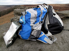
 Plenty of layers, then, as a guard against the cold, after which we need to restrain Mollie who is more than eager to go.


