Stanage
Showing posts with label River Lathkill. Show all posts

Friday, 24 February 2017

SLOW RETURN - LATHKILL TO CONKSBURY

We've had far too long away and even now it's a stuttering start. Too many other demands on our time means we're lucky to squeeze in any walking at all.

But here we are at the Over Haddon car park and joy of joys, the toilets are open! We pay our parking charge (not cheap) and wrap up warm. Mollie is very keen and looking forward to a day out, as are we.

We've never seen many cars here even though there's extensive parking, so it must get busy at weekends or holidays, but today there are only a couple more cars.

We leave the cars and head right and down the steep lane. On the first bend a digger is carrying out some repairs, and further down the disabled parking area is full to bursting (but no disabled badge in sight).

We go down to the bottom where the River Lathkill is crossed by the bridge - and yet more cars are here.

We don't go over the bridge but turn left and follow the path at the side of the river. There's not much vegetation at this time of year, but there's plenty of mud! Not that it bothers us much, we have far too much to talk about.


We pass the picturesque weirs and meet some dog walkers, then once through the gate we decide to pause on the bench for a coffee and some ginger biscuits.


Once refreshed we're on our way again, narrowly avoid being mown down by someone cyclists on Conksbury Bridge, then making our way up the road until we come to the path on our right. It leads to the farm and isn't properly signposted, but it is a public footpath.


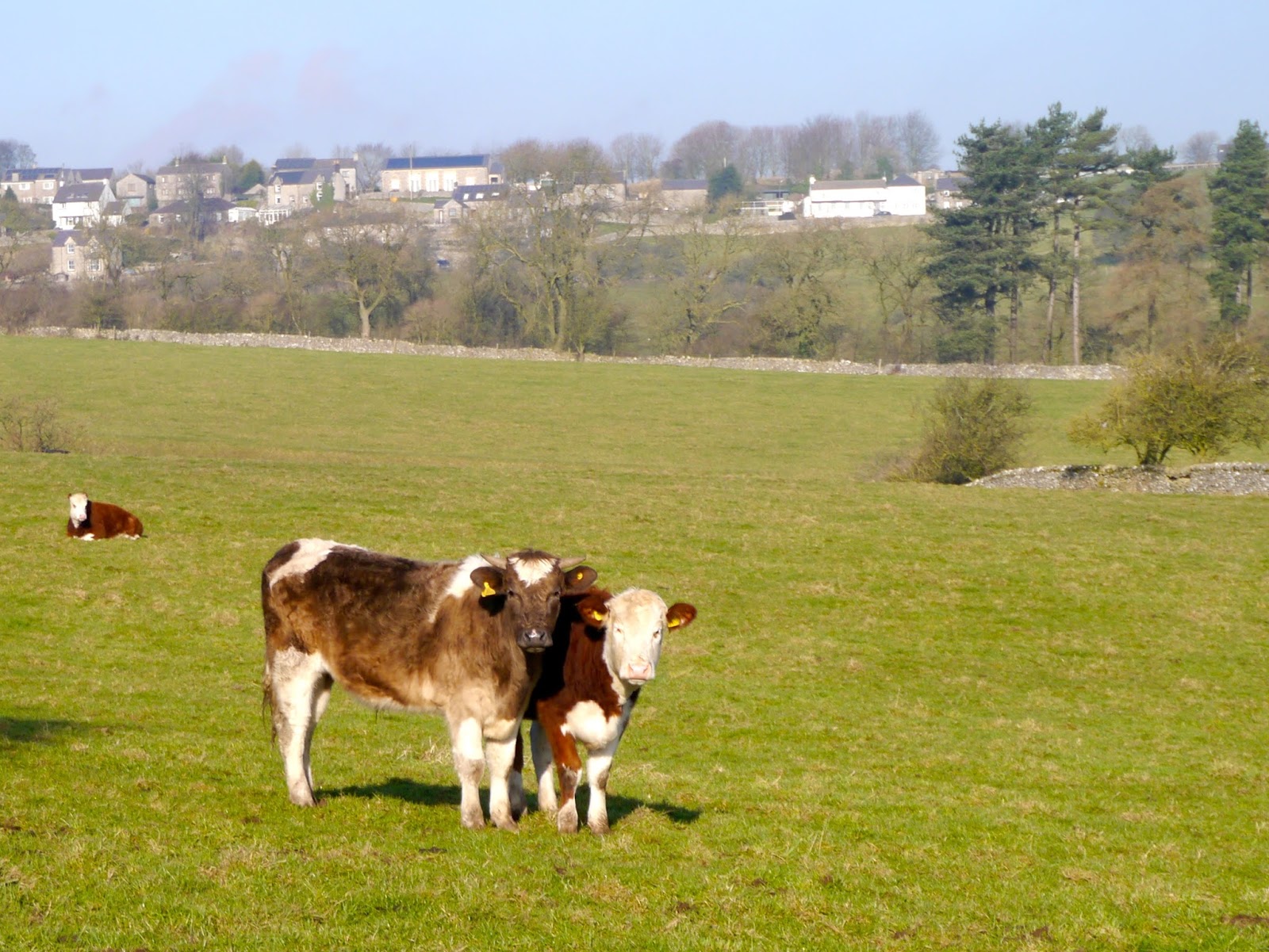
Very easy walking here, and quite dry underfoot, until we have to pass through the farmyard and the quagmire next to the cattle yard. The gate is a bit of a pain to open but soon were striding across the field towards the woods.


We realise that we've run out of good places to stop for lunch, and we don't have far to go, so as we walk down the path through the woods we decide to detour through Lathkill Dale.


We cross the bridge, skirt the parked cars and turn left along the familiar track. The day has turned murky and down here there are still wisps of mist hanging in the tree canopies.


Eventually we find a good spot for a late lunch: a fallen tree next to the water. Mollie talks the chance to go and paddle as we settle down with food.

Then we hear some vehicles, and moments later a straggling convoy of 4 x 4s makes its way from down the dale, complete with dogs, guns and men in shooting garb. As we are finishing lunch they return, no doubt having enjoyed a 'proper' lunch to fortify themselves for their extreme sport. Watch out all you fearsome birds, the gunslingers are out to get you.

We saunter back along the dale, it's turning quite chilly now, especially down here. As we climb up the steep roadway to the car park we hear the sounds of gunshots in the distance. Glad we're not too close!

Tuesday, 8 December 2015

BIRTHDAY WALK AROUND LATHKILL DALE

Today's walk is our closest to PC's birthday, so she has the honour of choosing where to go so we are off around Lathkill and Conksbury on one of her favourite walks.


Unfortunately the weather doesn't seem to be too promising as we pull up in the car park at Over Haddon after we have both suffered from slow, tedious journeys to get here. Rain seems to be a distinct possibility too, so in order to be prepared I've brought the big brolly. If nothing else it will shelter our birthday buns when we are eating them.

This is a very familiar walk and we hardly need the map, but we bring it along with us, just in case. Like boy scouts, we like to be prepared.

Leaving the car park we head off down the sloping lane towards the valley bottom. The lane winds around a bit before we reach the bottom and find that the river is flowing briskly, but beautifully clear, thanks to recent rainfall.


We cross over the narrow bridge and onto the track at the far side which is a muddier mirror of the one we came down on: climbing steeply with a sharp bend. Mollie is allowed off the lead for a little while here, there are no sheep or livestock for her to bother with and she is completely engrossed in a game of find a stone to play with.

At the top of the track we go through the gate and into the field leading down to Meadow Place Grange Farm. At least the field isn't muddy (nor has any cows in it) but the farmyard, which we have to pass through, is most certainly muddy. But fortunately not deep.

We are soon on the hard-surfaced lane leading away from the farm and passing, on our left, the remains of the medieval village, the humps and lumps in the far fields less distinct on this murky day than they are in full sun.


Before long we are onto the tarmac road, and quite surprised at how quickly we are walking. We decide to try to find somewhere to stop for a drink which means taking a small path through a copse of trees on our right. We climb over a stile and down a slope with a hill on our right with small limestone crags and trees. It seems the only possible place to stop so we clamber up the hill and find a table of sorts cut into the crags. Alas there is nowhere to sit but that doesn't stop us. We break out the flask (orange gin) and a packet of maltesers while Mollie crunches up her biscuits. Well, it is PC's birthday after all.

Suitably replete, and after saying a Good Day to a few other walkers, we carefully go back down the hill and retrace our steps to the Conksbury Road. It is a narrow road, and some cars travel far too fast on it, so we are very careful and wary on the tight bends.

It doesn't take long to reach the lovely Conksbury Bridge where we pause to take a couple of photos and another couple race to pass us. They make a bee-line for the benches on the upward side of the bridge, clearly determined to stake their claim before we get there, although they can't know that we don't plan to sit there this time.


At the far side of the bridge we go through the gate at the side of the river and find the bench part way along vacant. We sit down and prepare for lunch.

Salad and sandwiches, coffee, a glass of birthday wine (red, to keep the chill at bay) and banoffee pies with fresh cream are the bun of the day. We start off with gusto, but gradually slow down as we get fuller and fuller. PC stoically manages to eat everything of hers, but I end up giving the last of my pie to Mollie - who isn't complaining.


We are well ahead of schedule so linger for  quite a time over our coffees as a few wakers pass us. Then we pack up our things and head on up the river.


We pass the tree with its fallen bough up on our right where we often sit on this walk, and Mollie heads towards it, clearly remembering. But not this time.

The river and its weirs are full today, and we watch with amusement as some ducks half paddle, half fly up the mini waterfalls. And we see a dipper as well as a grey wagtail. Clearly the late season hasn't put them off.

The path climbs up above the river and where it becomes rocky there is a fence-cum-handrail on the left hand side, very useful given the slickness of the boot-polished limestone when it is wet. Once down on the level again it is only a short walk back to the bridge where we set out. 

It does seem to be getting chillier, and duller, but as yet I have not needed the brolly at all (though no doubt if I hadn't brought it along we would have had to put up with a deluge). Then we are off up the last pull of the lane up to the car park. We see a lost balloon tangled in a shrub, its Happy Birthday message upside down but still amusingly appropriate.

Then we are back at the cars with enough time to sit for a while under our fluffy blankets (always handy when waiting around in a cold car) and chat some more.

No walking next week, PC is away for her birthday, but we are hoping to manage the week after.


Monday, 23 March 2015

OVER HADDON TO CONKSBURY CIRCUIT

Well we've managed it, the only wet (very wet!) day in a week of clear skies. Nice to see we haven't lost the knack.

Mollie is back with us today as we meet in the comparatively large car park at Over Haddon. We've only ever parked in the upper section as there have never been many cars when we've walked, but we can imagine it gets pretty full at the weekend. Of course it is a Pay and Display but it also has the benefit of toilets that are open.

Once we've togged up - waterproofs from the start today - we set off down the steep road to Lathkill Dale with the rain running in rivulets by our feet.

At the foot of the road we come to the River Lathkill which, no surprises, is flowing swiftly. It looks lovely despite the starkness of the winter landscape, and with the added addition of snowdrops on its scrubby banks. In fact, today turns out to be a very snowdroppy walk as we see them everywhere.


After some photos we cross over the clapper bridge and head upwards through the trees on the distinct track. This turns a sharp right then takes us higher still until we go through a gate and into a field which, thankfully, is devoid of cattle!


We cross the field and head towards the farm of Meadow Place Grange, once a monastic holding (see previous blog post) where we go through another gate and through a muddy yard. We then head for the track on our left which is relatively dry, unlike the muddy field path ahead. Glad we aren't going that way today.


As we walk along the farmer approaches with his tractor so we step aside out of his way. He waves his thanks as he passes and as I turn to see what PC is up to I see, for the first time despite looking for years, the distinctive outlines of Conksbury Medieval Village on the opposite hillside. Trees have obscured our view before though it is probably more obvious if walking from the opposite direction.

The link below gives the English Heritage listing for the site with more information.http://list.english-heritage.org.uk/resultsingle.aspx?uid=1014589
I have tried to find an aerial photo of the site but sadly had no success.

We continue along the track to the road, which tends to be quite busy for a small rural road, and go down it a little way before hopping onto a track on our right. We walk along a little way through some trees to a gate but decide to turn back as this clearly leads towards Alport and that isn't in our plan for the day.


Back at the road we walk downhill towards the impressive Conksbury Bridge and once at the far side we make a bee-line for the benches. They are wet but slightly sheltered from behind, and I have brought a large umbrella with just this scenario in mind. So, beneath the brolly we have a nip from PC's secret flask (the last of the Cointreau), a cup of coffee and two of today's buns (which are quite small, honest).


Sadly, despite appearances to the contrary, they are not up to the standard expected. They are quite dry and in need of a quick zap in the microwave. Not that it stops us eating them.

So with us set up and Mollie having had some biscuits we put down the brolly and take the path at the side of the Lathkill. There are a few walkers about now, but this is a lovely path which opens up to lovely views up the river. There are a pair of swans in the distance and moorhens bobbing around.


We scramble up the slippery slope on our right to find a makeshift seat on a fallen tree (been here before) and up comes the brolly again as we settle down for lunch proper. And it's a good job we have the brolly too as the heavens open and it absolutely pours down.

Salad, sandwiches, coffee and the last two buns which leave us with a sense of disappointment. Ah well, we'll know for next time.


By the time we have finished eating the rain does ease a little so we carefully step down the slope and back onto the path. Now we follow the river and as the path climbs up I avoid looking at the young cows, then we take care on the downward stretch and the limestone underfoot can be very slippery when wet.
We aren't far from the clapper bridge now but we still have the delights of huge clumps of snowdrops to enjoy. Then it is just the steady trudge up the steep hill and back to the car park.
Naturally, as soon as we are ready to leave the rain stops, and by the time I am half way home the sun even starts to shine. A fairly typical day's walk for us!

Sunday, 26 January 2014

ALPORT,ROBIN HOOD'S STRIDE and A STONE CIRCLE


We're back, but it has been a bit hit and miss (more miss, to be honest) and we're tackling this at our second attempt.

We meet in the layby at Alport, the pretty village close to Youlgreave, and as we pull on our layers we catch up with all the news since before the New Year. It seems forever since we were last out!

The weather has been pretty grim these last few weeks so we are hoping that we haven't picked a walk that is too muddy. We have been on part of the route in the past, but much of it is completely new to us so we don't really know what to expect.


We set off down the road and cross to post a letter before taking some pictures of the river, then take the path at the side of the red telephone box. The path is broad, and firm, but there are some large puddles.

In a field adjacent to the path are two very noisy, bossy geese who seem to be less than pleased to see us. PC chats to them as she tries to persuade them to pose for a photo (yes, honest) but I eye them warily and am glad that we aren't any closer.

The path follows the course of the River Lathkill (or is it now the River Bradford?) and we pause to admire the attractive packhorse bridge 


over the water before we press on. The path leads us to the road in Youlgreave at the start of Bradford Dale (and another attractive bridge) 


but instead of crossing over the road and entering the Dale we turn left and walk up the road a little way. There is an old stone building in the field to our left, and just beyond it a signpost pointing across the field for the Limestone Way. This is the one we want.

To say that the Limestone Way is one of the major Derbyshire walking routes we are quite surprised to find that the path across this field, and subsequent ones, is not heavily used. It is well signed, though, which is an advantage when crossing fairly featureless fields.


We do have a couple of sections of mud and waterlogged ground to tip-toe through, and when we come to Bleakley Dike we find that one of the rickety stepping stones to the stile-gate is completely submerged beneath fast flowing water. Good boots a necessity!


There is an uphill stretch here, but with excellent views behind to the village of Youlgreave if you care to pause and look. Ahead of us is a ploughed field which we are not particularly looking forward to crossing.

In the end the ploughed field isn't quite as bad as we had feared - the farmer has 'reinstated' the path but it is still extremely claggy underfoot and at the far end we have to spend a while remove excess mud (and weight) from our boots.

Around the next bend in the path we have yet another wet and muddy section to negotiate, and a choice of routes. The Limestone Way turns sharply left to enter an unnamed wood, whereas the other path takes us through Harthill Moor Farm and adjacent to Castle Ring, and ancient earthwork. We decide to follow the Limestone Way so avoiding the farm, even though we don't have Mollie with us today.

The wood is quite dank and it is chillier here, not that we would call it particularly warm in the open. Still, we spy some rocks which look inviting enough to sit and have a drink (a nip of Ramblers to keep the chill at bay) and a huge triple chocolate chunk cookie to keep up going until lunchtime.

It is too cold to sit for very long so we continue on the path and reach a minor road where we decide to turn right, continuing on the Limestone Way, since we are well ahead of time. There is a farmer muck-spreading in a field at the top of the lane, but fortunately not in the field we plan to cross.


We spot what looks like some standing stones away to our left, and also have our first glance of the very impressive Robin Hood's Stride which we are now keen to visit. 


We debate as we walk as to whether the stones are standing stones, a stone circle or the remains of a farm building, but we check the map and after a while they come into clearer view and they are, without doubt, a very impressive stone circle.


There are four stones standing (the highest in Derbyshire) but are called the Nine Stones Close. We don't walk up to them as there is no Public Footpath to them, and with the farmer busy close by we decide not to risk being caught trespassing, though they may be worth a visit at another time.

Ahead of us the most impressive rocky outcrop called Robin Hood's Stride (also known as Mock Beggar's Mansion or Hall) with its two pinnacles (Weasel Pinnacle and Inaccessible Pinnacle). 


Naturally we clamber up and around it, and finally sit on the rocks close by with a wonderful view of the outcrop while we have lunch.


The sandwiches are typically boring but we have a small bottle of vino to help them down (long story, but not a celebration) and after the wine we have ginger muffins which are suitably gingery and sticky. The warming coffee is more than welcome after our lunch, and with the sun shining it is very tempting to stay for while, but we must press on.


We return to the path which is gouged deep between the Stride and the area which leads to Cratcliffe Crags. It is still the Limestone Way and is probably the route of the old Portway. We plan to return another day to explore the side near Cratcliffe Crags, and to find the Hermit Cave there.


The path is taking us downhill towards the road (B5056) and the worst part of this walk. We have no alternative but to walk along the roadside until we reach our return path, and there are no pavements or even grass verges to use as escape route on what turns out to be a very fast and quite busy road. Also, the sun has gone in casting us into gloom. Not pleasant, but at least we don't have Mollie with us as she hates traffic.

We pass the turning the Birchover and continue until we spot the Bridleway sign across the road, and go onto the path gratefully. It is very muddy across this field but we are pleased that we don't have to paddle across Ivy Bar Brook since there is a double bridle-gate and bridge.

From here it is uphill, and slippery. Where the path narrows it is extremely churned up by cyclists and it is hard to keep our footing. Clearly no horses have used this track for a while as the overhanging hedgerows wouldn't allow mounted riders (or anything other than small ponies) to pass safely.

At the top we come out at a gate and cross a large sheep field with clear lines of old ridge and furrow ploughing. Sadly the lack of sun means there aren't any shadows cast so our photos come out flat rather than interesting. Shame.


The farmer has very kindly put large, round sheep feeders right in the middle of the path, and many little sheepy feet have managed to turn the area around them into a quagmire. Lovely! Still, we soon reach the gate onto the road and cross over another field towards Lower Greenfields. We pass a few old caravans that seem to have been disused for some time, then once on a firm track we pass a small, neat caravan site. What an attractive holiday spot.

The lane continues gently downhill and soon we find ourselves (as planned - always a relief) on the track next to the river on the way back to Alport. A short stroll now (and an absence of geese this time) and we are back at the cars.

The weather has turned dark and gloomy, it will undoubtedly rain later, but we have succeeded in having a very good walk and opened up new possibilities for us in the future.


Tuesday, 24 December 2013

BEYOND YOULGREAVE AND THROUGH LATHKILLDALE

Well, the weather isn't too brilliant for today's walk, it is damp and foggy, but we are hoping for things to clear up later. But the first obstacle isn't so much the weather as actually meeting up.

Our plan, which seems eminently sensible when you look at the map, is to meet in the car park at the end of Moor Lane which leads out of Youlgreave. Simple, you'd think. Not so.

I'm the first to arrive by virtue of being the map reader and having a decent sense of direction, but it was touch and go. Moor Lane is a tiny offshoot from the main road in Youlgreave, easily missed unless you are expecting it and only signed with a hand painted sign. The narrow street I drove up looked as though it was someone's private driveway, then when I turned right onto the main lane I was greeted with a narrow lane and a sign saying 'Quiet Road'. To cut a long story short, it was an interesting drive and I was lucky only to encounter one car coming in the opposite direction (driven by an elderly gentleman who looked, quite frankly, scared and lost) and wasn't surprised to be first to arrive in the deserted car park.


To cut a long story short, it takes a few phone calls (thank goodness for modern technology and mobile reception) and hastily garbled directions (and a couple of chapters of my book as I wait) before PC manages to reach the car park a little late but in one piece and relieved not to have met any other traffic.
We're late setting off, but we're undaunted. We're Mollie-less until after Christmas so we only have ourselves to sort out, and we dress ourselves in our waterproofs from the outset as we doubt that the weather will clear much.
PC worries that the day won't produce many decent photos - there is the prospect of good views from the edge of the car park on a clear day, but all we see is murk - so she starts snapping straight away.
We walk down the 'quiet lane' and haven't gone far before a farm lorry comes rumbling up behind us! We both scale the grass bank at the side of the road and thank our lucky stars that we didn't meet it when we were driving. Once the lorry has passed we continue down the road, pause to photograph a statuesque tree which is posing grandly, then meet a footpath on our left which crosses a couple of grassy fields to another road (Back Lane).


Across the road we take the next footpath which, again, crosses fields. One thing that becomes immediately apparent is that the stiles around here are not terribly forgiving! Many are high off the ground for their first step meaning a good leg stretch for all but the long limbed, then fairly high too. No matter though. We're coping without any trouble and the weather has improved slightly too.
It is a fairly straight path, punctuated only by stiles, downhill towards Meadow Place Grange, a large farmyard. The current farmhouse is a Grade II listed building dating from the 18th century, but the original grange farm belonged to Augustinians of Leicester Abbey until the dissolution of the monasteries. Today it is still a working farm, and as we paddle along the muddy path towards the very high stile - which we clamber over with grace and dignity (naturally) - we realise that it isn't long since the inhabitants of the field passed this way too. Sure enough, at the other side we see cattle inside a large barn, and one cow in particular seems very interested in what we are doing.
 
We cross through the farm yard (fortunately, not so muddy now) and take the path directly opposite which climbs gently through a grass field before bringing us to the top of Meadow Place Wood.
The downhill path between the trees is a bit slippery in places, but soon we are approaching the River Lathkill and the footbridge adjacent to the ford. A group of hikers are sat around having lunch (is it that time already?) but we press on and onto the path which runs along the length of the Dale.
It seems very murky and gloomy in the Dale, although the recent rain has meant that the river is high. We have been here in the past when there has been no water at all, but not today. There are hardly any people about, not surprising since the weather has turned damp again. It doesn't encourage people to get out and we suspect many people will have hung up their boots for the winter. 

It is a pleasant enough walk along Lathkill Dale, even if the weather is grim, and we are able to talk about all sorts of things. One thing we do notice, though, is the amount of broken and shattered timber left over from last week's gales. Glad we weren't here then.
We are getting peckish but there aren't very many stopping points to eat a picnic, especially in the rain. The one place we were hoping to stop (opposite the path we will need later) is already occupied so we walk a little further until we find a comfortable ledge of limestone on which to sit.
We need a small drink of Ramblers first, and this is the last of the batch. Good job I have another bottle at home ready for straining. From the Ramblers we move onto coffee to warm us up before we start on the sandwiches. There's not a lot to say about sandwiches (other than they are very welcome) as it is the bun that excites our interest. Today they are muffins, with cream and a 'spiced fruit compote'. The compote has a few small lumps of fruit it in, not much, but it does make a nice change, and muffins always go down well. A second coffee sets us up ready for the next part of the walk.
We retrace our steps and once again we cross the river, climbing up the limestone path into Calling Low Dale. Thank goodness we chose to do the walk this way around as the slippery limestone requires care and the risk of falling always seems greater when going downhill.

Calling Low Dale is very quiet even though it leads to the Limestone Way, although most walkers in Lathkill Dale probably tend to go 'end to end'. The narrow path forks and we take the left hand, downward path which takes us to a wooden stile and a signpost. Yes, we're going in the right direction, although the sight ahead is not appealing. Steep limestone steps climbing seemingly straight up a very steep hillside. Once again we are reminded of the stairs of Cirith Ungol (Lord of the Rings) and hope that Shelob isn't at the top waiting for us!

We keep our eyes on where we are putting our feet, it is drizzling with rain again and we don't want to slip, but despite the climb we ascend with more ease that we had expected, although it may have been better to have walked up before the muffins (although PC is adamant that she needed the energy from the muffins to get up here). The views are pretty good, but spoiled by the poor weather. We'll have to revisit on a clear day.
We are on the Limestone Way now, and the path is very clearly signposted which is a rare bonus. We pass Calling Low Farm, skirting the buildings via fields and a small copse, then come out to another field. Here an eager horse trots up to greet us, clearly not thrilled with staying out in the cold and wind, and trying its hardest to persuade us to either feed it or take it in. Eventually it leaves us and goes to look over the field gate to the farm, hoping to attract attention.


The path across the field is diagonal, with an interesting waterlogged section in the centre, but we're soon over it and into the edge of another small wood before emerging back onto farmland. Here again the signposting is very clear and we are soon within sight of the blue P sign for our car park. Not far to go, and only one final stretch of a stile for us to negotiate.

From here we don't have far to walk before we are back at the cars in the otherwise empty car park. Despite the weather, and the initial problems finding our starting point, the walk has been very good. We've managed to go on paths we've never ventured on before, and we'll be taking a slightly different route home!

Since this is to be our last post of 2013 we wish everyone a very Happy Christmas and an excellent New Year.