Stanage
Showing posts with label Grouse Inn. Show all posts

Thursday, 14 April 2016

WHITE EDGE AND CURBAR EDGE - AND A SOGGY SEASON END


Bit of a tough choice for this week. I'm waiting for a couple of important phone calls which means we need to walk where there is a half-decent signal (no way are we giving up a walk!), and it is also my 'birthday walk' so I don't want to walk anywhere too dull. Added to the mix is also that we are in the midst of the Easter break which means many more people out and about.

In the end we decide on a walk that we haven't done in a while, taking us onto Curbar Edge and White Edge - or the snake walk as we remember it since last time we were hereabouts we were startled by an adder! This time we will do it in reverse, and get the snakes out of the way.

At least it is sunny this morning, a bonus since the weather is so variable at this time of year and we have already had our fair share of rain, and we park in one of the small bays beneath Curbar Edge and away from the main Pay and Display car park which is already filling up with visitors.

We are soon sorted and cross the road before heading uphill. PC stops almost immediately to take the first photo of the day over the valley and towards Bakewell.


And we are only a few yards up the road when PC spots a carving
in one of the stones at the roadside. It looks like Hebrews
7 25, though it isn't that clear on the photo due to the moss and lichen, some of which we cleared away to see better. It is surprising that we have never spotted this before despite walking up and down here many times over the years.

 We continue up the road, wary of the cars on this narrow winding stretch, and manage to get onto the narrow verge path.  The car park is certainly getting busier now but most people are heading for Curbar Edge first, so we bypass them and go through the gate adjacent to the road to take us onto the access land.

Here it is relatively quiet as we follow the broad swathe of a path as it sweeps around the drystone wall and starts to go downhill. As we approach Sandyford Brook in the dip we are confronted by a quagmire. It is always a bit muddy here but the recent rains have made it particularly unpleasant. Nevertheless, we pick our way across the sludge and manage to avoid the worst of it. On the far side we ascend without slipping back down again, quite a feat.

At the top of the slope there is a sign at the corner of the drystone wall, but we know our way and turn left, walking up the eroded path to the top which is blissfully dry. We pause to enjoy the views westward.
A small group of people are a little way in front of us, they hadn't walked up the same way as us but appear to have come along the vague path linking this side of the road with the bridleway at Jack Flat, so we wait a while to let them get out of the way.
It is a bit unusual to see many people on this higher path, most stick to the Curbar Edge, but it appears that today we'll be seeing a lot of holidaymakers as well as local walkers.

We walk around the large boulders and see the trig point off to our right. We don't bother walking up to it, this part of the moor is soggy again, and there is another group of walkers wandering around is a slightly absent-minded fashion.
It is a straight, easy walk along here as the path gradually segues into White Edge. The boulders are rugged and very enticing, so we stop for a while for a cup of coffee and a chat, although we haven't actually stopped talking since we set off!

The flattened rock we sit on has lovely medallions of lichen growing on it.


Post coffee break and we are off again, continuing along White Edge. Sadly, by now, the sun has gone and a fair breeze has struck up. It hasn't stopped the walkers, though, who are out in droves. We have never, in years of walking around here, seen so many people on this usually ignored Edge.

It is surprising, too, how many of them don't bother to keep their dogs on a lead - and not many of those dogs are well trained (nor are their owners). Clearly the 'All Dogs on Leads' signs don't mean them! Mollie, however, is on her long lead and behaving beautifully.
We are debating how far we'll take the walk. We're tempted to continue to the end of the edge, then drop down to the road near the Grouse Inn, walk along the road then rejoin Curbar Edge at the Froggatt Edge end. The drawbacks, though, are Mollie's fear of heavy traffic and that we know the route down is very muddy at the best of times. And we are getting hungry.

We pause to take a photo of four trees perfectly silhouetted on the horizon, then find a huge rock outcrop to sit beneath. Not only does it shelter us from the path and the wind, it also provides shelter from the few spots of rain that want to ruin lunch.


PC has brought a celebratory (mini) bottle of fizz and proper glasses to drink it out of. A superb treat. As are the buns (the sandwiches, honestly, don't merit a mention). Wonderfully rich and moreish chocolate cheescakes. Mmmm. They taste so good that we don't even care how many calories they have. Followed by coffee we have to agree that it was a superb lunch, and that we are much too full to bother walking all the way around. We shall return, partly, the way we came and cross over to Curbar Edge at some point.

We head off back and just as we are looking for the path off of White Edge I get the first of my phone calls. All is going according to plan. 

We find our path and descent, but the flat moor with its huge tussocks of coarse grass is also wet and muddy. We hop from tussock to tussock with a reasonable amount of agility, until I take a wrong step and, unable to halt my momentum, continue along the route I had planned, go knee deep into a bog and topple with a splat. Fontunately I'm up fairly quickly and out of the mire, but I'm now walking with a distinct squelch and look non too smart either. At least I didn't have much of an audience.

A couple of minutes later I get my second phone call, and I'm pleased it didn't come while I was fishing myself out of the mud.

Then we are up onto Curbar Edge, and the number of people here increases dramatically. We amble over to the very edge to look over.

The views are, naturally, excellent, though it is a pity that the sun has gone in. The hefty breeze is drying out my walking trousers brilliantly though.

Even looking down from here, though a little bit vertigo inducing, is a treat, and we see a partly completed millstone abandoned at the bottom of the rocks.


We continue along to the end, then through the gate onto the rubbly path taking us back down to the road and the cars. And still more people are setting out.

A few minutes and we are back at the cars. 

We weren't certain at the time, but now we have confimed it, that was our last walk of our current series. PC is off away on her boat again so won't be back until summer. Until then I hope to get out myself - but I say that every year and rarely succeed. But if I do, I'll post my walk.

Monday, 17 November 2014

GROUSE INN, RIVER DERWENT AND FROGGATT

This morning we are greeted by fog, in some places thick, in others thicker, but undeterred we set off from our respective starting points to meet at the Grouse Inn which sits on the A625 above Grindleford. By the time we meet up some of the fog is beginning to disperse, so we are hopeful of a clear day.


The lay-by is pretty full of cars but none of the walkers seem to be going our way. We head over the stile at the side of the Inn and cross over the fields and into Hay Wood, admiring the lingering mist as we go. For some reason we always have to puzzle our way in the wood, but mutually decide to set off downhill on a very muddy path. Then a brief retreat to try to find PC's lost lens cap for her camera, and for a change we are in luck, then retrace our steps again.

The wood is very attractive even though many of the leaves have already fallen, and we continue downhill ignoring the many paths leading off left and right. As we come to a high stone wall on our right we meet a dog walker and stop for a chat before continuing  down towards Grindleford. A gate and a rough surfaced path later and we reach the main road in Grindleford village. We turn left and just before the bridge we go left again through another gate and across a field of sheep.


We are surprised that this low-lying field isn't boggy after recent rainfall, but pleased nonetheless. The small stream is easily crossed and we head uphill into Horse Hay Coppice. We are now following part of the Derwent Valley Heritage Way.

There are a number of lovely streams running down the hillside, one with a calm reflective pool, so we reflect a while with a nip from the secret flask. My home-made Ramblers again!


This part of the walk is very straight forward and easy underfoot. We eventually pass out of the wood and go through a couple of fields (one with cows, but they are not close) then through a potentially very tight crush - depending on your weight - and onto a narrow track. A little way along a tractor and trailer is parked almost blocking the track, the farmer is cutting back some overgrowth, but we manage to get past.


We are now in the pretty village of Froggatt, still following the Way, and admiring some of the gardens. We cross over the bridge and keep on the track that runs at the side of the River Derwent. We recall that further along there is a secluded bench, and when we find it we settle down for lunch.

We have a good view of the larger bridge over the Derwent, and are surprised how many heavy lorries use it. We start off with coffee, then sandwiches - always a non-event - then the buns which, today, are Spiced Apple Fresh Cream Muffins. Not too stodgy, they go down very well followed by a second coffee.


We sit and chat for a while, and as we are talking we see a disturbance in the water. To our delight we are able to watch a water vole swimming along, it surfaces, sits on a semi-submerged branch for a few moments, then slides into the water to swim away. Magical.


Time to go, though, and we are aware of the nights drawing in, so we continue on our path, climb up the slope then over the bridge, descending by the steps at the opposite side of the river.


Now we have a gentle amble along the river bank back to Froggatt village. Here we decide to take a small road uphill, turn left, then right then straight on until we see a footpath on our left. Once again we are in the woods.


This part of the woods seems less well used, probably mainly by dog walkers, but it is lovely, especially with the low light slanting through the branches. A way along we see some rocks, which appear natural, but have an inscription carved into them relating to the dedication of 16 acres of Froggatt Wood. It is almost hidden and it is difficult to take a good photograph.

In places the path along here is fairly boggy, and we have to make a few minor detours, but after a while we come up to some 'shelters' and an outside camp area complete with branches for seats and a fire pit. It looks wonderful!


We descend now and are soon retracing our steps down towards Grindleford. We make our way back up to the woods, and the uphill climb certainly makes us warm. Mainly due to good luck rather than good judgement we end up on the right path and come out exactly where we entered the woods this morning. Only a short stretch now across the fields to the cars, with ours being the only two left.


As we ready to leave we notice that the sunlight is giving the surrounding moors and trees a spectacular burnished glow. They look amazing, their brilliance keeping up for the most of the journey home, a lovely end to a good day.

Saturday, 23 March 2013

SNOW, SNAKES AND STONE CIRCLES

THREE EDGES: WHITE EDGE, CURBAR EDGE AND FROGGATT EDGE


This is a seriously cold day with high winds and a smattering of snow on the high ground. First thing this morning everything was white; snow coupled with a heavy frost, but underfoot it was wet and slushy. Not exactly perfect walking conditions, but we are nothing if not hardy!

We meet up next to the Grouse Inn, as we did on our last walk, but our route is to be different. We layer up - plenty of layers given the driving wind - then cross the road and head for the path which cuts across the field opposite the Inn. It takes us a while to get from one side of the field to the other, nothing to do with the conditions but more to do with numerous texts from daughter relaying the outcome of a (thankfully good) school report.


With that little drama out of the way we cross over a makeshift bridge of stone slabs, then go through a gate and walk up what appears to be a semi-permanent stream-bed. We're in sparse birch woodland here, but the path is clear. When we reach the wooden signpost we turn right then almost immediately left, clambering uphill over some gritstone boulders. 

As we gain height we get some excellent views all around, but we are already finding quite deep pockets of snow and the muddy bogs are covered with ice. When we come level with White Edge there is another useful wooden signpost, and we turn right onto the edge.

We can really feel the cold wind here. It is extremely bitter, and the edge is very exposed. To our left is the broad, relatively flat expanse of the aptly named Big Moor, to our right the edge drops away to Stoke Flat.

A short distance along the edge we come to a sculpture, a gritstone inscribed  'cube'. We've seen similar before on a walk (see: Moors, Reservoirs and Stone Circles - posted 8.3.12), and they are the result of the endeavours of Arts In The Peak: see www.companionstones.org.uk

This looks as though it should turn (like a Rubik's Cube), and the photographs on the above website seem to support this, but the stone is weathered and a little mossy and we couldn't move it! And, as with most of the other stones we have encountered, we struggle to make sense of the poem inscribed on it.

We pass the stone and continue along the edge, trying our hardest to avoid as much of the mud as possible, but that is a hard job. The path starts to rise and we start to feel some snow blowing on the wind; the hard kind of snow with ambitions to become hail! Fortunately it doesn't last long and we - at the point of no return - are relieved.

Although it is still too early for lunch we decide to stop for a 'snack'; ie a nip from the secret flask and some home-made Florentines. We descend from the ridge to find a suitable boulder to sit on, and as we are preparing our elevenses PC spots a pair of deer. They are large, but quite hard to see until they start to move. They don't seem unduly worried about people, until some walkers on the ridge with a loose dog come along. The dog scents or sees the deer and sets off after them. The deer run, but don't put too much effort into it, obviously conserving energy. They are right to do so, too. The dog soon gives up and the deer saunter away.


We enjoy our nip from the flask (home-made Ramblers Restorative) with a ginger Florentine, then some Cointreau from the second flask with a glace fruit Florentine. Mmm, they bring a glow to the cold day.

Back up on the ridge we head towards the trig point, surrounded by snow, then continue onwards and slowly downwards as the path grazes the corner of a field and gives us a choice. Ultimately we want to go right towards Curbar Edge, but it seems like a good time to stop for lunch as the sun is making a feeble, half-hearted effort to emerge, so we go straight on looking for somewhere suitable to settle down to eat.

There are fewer comfortable looking boulders here, but there is a lot of dry, dead bracken which should make an adequate cushion for us out of the wind. We choose a likely spot and start the long process of remove rucksacks, cameras etc prior to settling down. That's when PC sees it. Right where she would have sat down is a snake, an adder, basking in the weak sunlight. It is sluggish with the cold (thank goodness) and about 2 foot long! Urgh. As we watch it slowly burrows back into the bracken and within five minutes it is completely hidden from sight.

Our mind is made up. No sitting in the bracken. We'll wait until we can find an adder-free spot for lunch.


We go down the hill, cross over the extremely muddy patches near Sandyford Brook, then climb gently upwards towards the road and the car park at Curbar Gap. Before we go through the gate to the car park we spot another Companion Stone with a more understandable poem.

We cross the car park, climb up the few steps and head on the path towards the gate which gives access to Curbar Edge. Before we reach it, though, there are some picnic tables and a bench. Perfect. We settle down for lunch with a good view, and no chance of sitting on a snake.

It seems to have become colder, there is no hint of sunshine now and the wind speed seems to have increased. We hurry up with our lunch, and even the very good fresh cream eclairs are gobbled rather than savoured. After eating we huddle over our coffee cups trying to leech some warmth from the hot brew, but forgo a second cup in favour of getting moving.

Once on Curbar Edge we press on. I don't think I have ever been so cold on a walk before, despite wearing five layers, as well as scarf, hat and two pairs of gloves. The wind really has managed to get through everything.


There are more people here on this edge, but they are all walking pretty swiftly to keep warm. We keep pausing for PC to take photos, and once we start to descend it starts to feel better.


As we come up toward some trees we notice some stones poking out of the ground, and they appear to be in a roughly circular shape. Sure enough, checking with the OS map, this is a stone circle. We're both surprised that we have never seen it before, it is very close to the path, but maybe it has been covered with bracken before. Anyway, we have to stop to look at it and take some pictures. See: www.megalithic.co.uk  (Stoke Flat - Froggatt) for more details and photos.


Leaving the circle behind us we continue on the path and through a gate. The path gets extremely muddy in places but with trees growing all around it is, at least, sheltered from the wind and we feel much more comfortable.


It doesn't take us long to reach the main A625, but we cross over and down the steep steps which firstly cross over a stream then take us up into Hay Wood where we were last week. From here it is only a short walk across the fields and back to the cars next to Grouse Inn.

Despite the bitter cold, and the close encounter with the snake, it has been a very enjoyable walk. We may have a few interruptions to our walks over the next few weeks, but we'll definitely get out when we can.

Sunday, 10 March 2013

GRINDLEFORD AND THE RIVER DERWENT


The weather couldn't be more different this week from last. Instead of sunshine with pockets of crispy snow we have fog, drizzle and a bitterly cold wind to contend with. And PC's unerring ability to lose her way!

We eventually meet up in the lay-by near The Grouse Inn on the A625 (Froggatt to Fox House) after PC has enjoyed a scenic drive-around in the area courtesy of her SatNav! The fog is pretty widespread and has been for some days, and though there is a cutting wind blowing it isn't actually clearing the murk.

It doesn't take us long to layer up then head up towards the pub where there is a stile into the adjoining field. We've been here in spring/summer and the field is a beautiful meadow, but today it is covered with a layer of farm-muck. Fortunately it has been down a while so there it isn't actually unpleasant, but it was probably a bit grim when it was first spread.


We cross the fields diagonally then pass through a gate onto a path at the top of Hay Wood. After getting our bearings (we've been here before and have found the multitude of paths criss-crossing the wood quite confusing) we head more or less straight ahead on a narrow path that starts to go downhill almost immediately. It's fairly muddy and we're careful not to slip. The trees surrounding us are mainly birch; tall, thin and spindly.

At the bottom of the path there is a rough crossroads and again we go straight on and continue descending. It is very pleasant in the woods, we're out of the wind and the fog seems to be clinging to the tree canopy rather than filtering down to us, but it is very popular. We've already seen more people out walking in the first half hour - mainly dog walkers - than we tend to see on a whole day's outing.


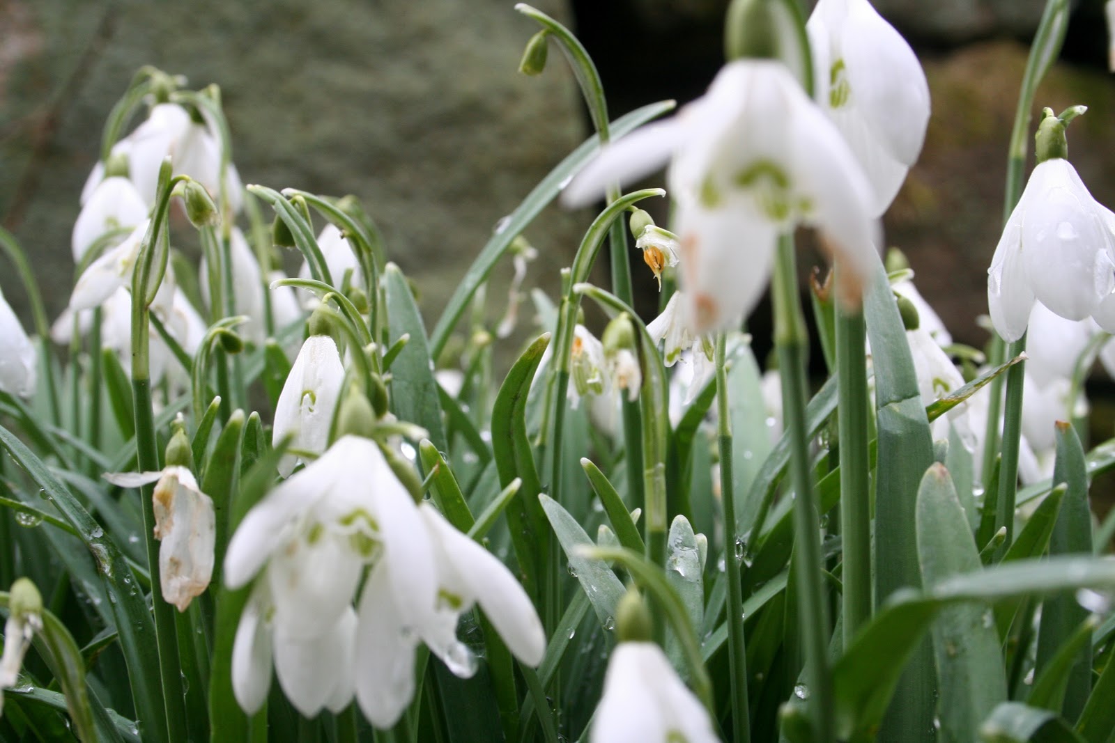
The downward path continues until it is following a wide stream, then we go through a gate and onto a lane with a little more substance to it. At the first house PC spots a clump of snowdrops at the entrance to the driveway, so goes up to photograph them. Once satisfied we continue between a number of cottages and a moss-covered drystone wall.


At the bottom of the lane we come to the village's 18th Century 3-arch bridge crossing the River Derwent, but rather than cross over we take the gate into the adjacent flat meadow and follow the footpath across it, which is part of the Derwent Valley Heritage Way. We cross over small but deep stream, a bit muddy on the far side, then follow a path to a gate where, on the other side, we are in woods again.


We don't walk far before we cross over yet another stream and pause at some boulders on the far side to sample one of my treats - not a nip from the secret flask today, but I've some of my Blue Russian (home-made Blueberry Vodka). I've tried it before, but I wanted PC's opinion, and I'm pleased to say that she considered it a success!

After the break we continue through the woods, then across a few fields (thankfully livestock-free) before coming to a gate and an extremely narrow crush-stile. Folk must have been a lot thinner in the days when these were first erected!


We follow the lane (Spooner Lane) to the bottom of Froggatt where the cottages cluster close to the river. We ignore Froggatt Bridge for now and go through a wooden gate when leads us to a path at the side of the river. We haven't been walking for long before we pause for PC to take a photograph of the bridge, and as she is preparing her camera I spot something on the other bank. A water vole! Ratty himself from Wind in the Willows. We are entranced, watching the well camouflaged wee beastie as it scuttles up and down the river bank, eventually slipping into the water and swimming gracefully downstream a little way. It is such a joy to see this rare and elusive creature, and we are seriously tempted to stay watching it for far longer than necessary, but eventually we move on.


Further along we find swathes of snowdrops at the side of the path, and PC is in her element! They look wonderful, and despite being white they do brighten up the monochrome day.


The path continues at the side of the river to New Bridge near Calver Sough, we climb up the stone steps onto the road, cross over the river then take the path along the opposite bank of the Derwent.

It is very different here, with marsh and wet-lands and a newt pond. We haven't gone far before we find a suitably placed bench where we sit down for lunch. We have a lovely view of the river and bridge as we eat our sandwiches, drink the coffee and enjoy the buns. This week we have fresh cream doughnuts with enough jam in them to dribble out stickily.

We know we are lingering for too long, so as soon as we have eaten we pack up (rucksacks lighter) and continue along the path. It is a broader path here and more open. We soon pass the spot where Ratty had been exploring, but no sign of the vole now, then we're at Froggatt Bridge.

Once across the bridge we retrace our way, meeting a four-month collie pup out with its owner. Mollie and the pup - young and (not too) old - sniff and make friends. We walk along Spooner Lane, renegotiate the narrow crush then cross the fields and into the woods. Soon we come to a right hand footpath which will give us some height, and the path higher in the wood is well marked on the map so we're feeling very confident.

We should have known better! After climbing the clear path turns right, which is fine, but then begins to deteriorate into a series of muddy quagmires. We manage to keep following the route though, the path appearing and disappearing from time to time with us making a few detours to avoid  the mire.

Arriving at a fence and wall we cross the stile (if it can be called that) then follow the barely visible path at the other side. It skirts a wall, then we cross a stream via a very high stone culvert/bridge before continuing until the path peters out. We press on, encounter a vast area of swollen water/mud and are forced to pick our way the best we can, holding onto overhanging branches and using partially submerged stones so we don't sink without a trace.

Eventually, after crossing another stream, we come to a broken section of wall with a clear path at the far side. We take the path which, naturally, disappears into nothing. We've come too far to turn back so we take our bearings, decide that we know what we're doing and where we're heading, so push on uphill through the trees and brambles.


Our endeavours are rewarded when we eventually reach a clear path - one marked on the map! As we reach it PC spots three deer amongst the trees ahead and to the right of us. They aren't far from the road, and they are moving away from us, but they do seem quite large. We weren't even aware that there were any deer around here.


On this path the walking is easy, but it is starting to rain. We continue until we come to the ragged crossroads we encountered this morning, so we turn uphill but then take an easier path that leads us past what was possibly an old quarry before passing a small car park and finishing at the gateway out of the woods. Then it is a short stroll across the fields and back to the cars.

The fog still hasn't lifted, but we aren't too bothered. It has been a good day, we've been pretty well sheltered and we have seen some interesting wildlife.