Well, the weather isn't too brilliant for today's walk, it is damp and foggy, but we are hoping for things to clear up later. But the first obstacle isn't so much the weather as actually meeting up.
Our plan, which seems eminently sensible when you look at the map, is to meet in the car park at the end of Moor Lane which leads out of Youlgreave. Simple, you'd think. Not so.
I'm the first to arrive by virtue of being the map reader and having a decent sense of direction, but it was touch and go. Moor Lane is a tiny offshoot from the main road in Youlgreave, easily missed unless you are expecting it and only signed with a hand painted sign. The narrow street I drove up looked as though it was someone's private driveway, then when I turned right onto the main lane I was greeted with a narrow lane and a sign saying 'Quiet Road'. To cut a long story short, it was an interesting drive and I was lucky only to encounter one car coming in the opposite direction (driven by an elderly gentleman who looked, quite frankly, scared and lost) and wasn't surprised to be first to arrive in the deserted car park.

To cut a long story short, it takes a few phone calls (thank goodness for modern technology and mobile reception) and hastily garbled directions (and a couple of chapters of my book as I wait) before PC manages to reach the car park a little late but in one piece and relieved not to have met any other traffic.
We're late setting off, but we're undaunted. We're Mollie-less until after Christmas so we only have ourselves to sort out, and we dress ourselves in our waterproofs from the outset as we doubt that the weather will clear much.
PC worries that the day won't produce many decent photos - there is the prospect of good views from the edge of the car park on a clear day, but all we see is murk - so she starts snapping straight away.
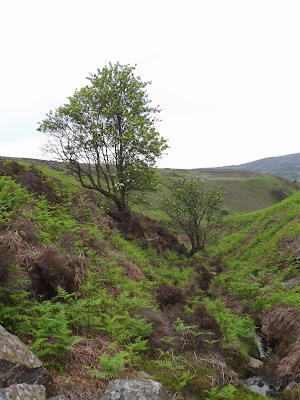
We walk down the 'quiet lane' and haven't gone far before a farm lorry comes rumbling up behind us! We both scale the grass bank at the side of the road and thank our lucky stars that we didn't meet it when we were driving. Once the lorry has passed we continue down the road, pause to photograph a statuesque tree which is posing grandly, then meet a footpath on our left which crosses a couple of grassy fields to another road (Back Lane).
Across the road we take the next footpath which, again, crosses fields. One thing that becomes immediately apparent is that the stiles around here are not terribly forgiving! Many are high off the ground for their first step meaning a good leg stretch for all but the long limbed, then fairly high too. No matter though. We're coping without any trouble and the weather has improved slightly too.
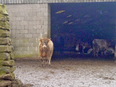
It is a fairly straight path, punctuated only by stiles, downhill towards Meadow Place Grange, a large farmyard. The current farmhouse is a Grade II listed building dating from the 18th century, but the original grange farm belonged to Augustinians of Leicester Abbey until the dissolution of the monasteries. Today it is still a working farm, and as we paddle along the muddy path towards the very high stile - which we clamber over with grace and dignity (naturally) - we realise that it isn't long since the inhabitants of the field passed this way too. Sure enough, at the other side we see cattle inside a large barn, and one cow in particular seems very interested in what we are doing.
We cross through the farm yard (fortunately, not so muddy now) and take the path directly opposite which climbs gently through a grass field before bringing us to the top of Meadow Place Wood.
The downhill path between the trees is a bit slippery in places, but soon we are approaching the River Lathkill and the footbridge adjacent to the ford. A group of hikers are sat around having lunch (is it that time already?) but we press on and onto the path which runs along the length of the Dale.
It seems very murky and gloomy in the Dale, although the recent rain has meant that the river is high. We have been here in the past when there has been no water at all, but not today. There are hardly any people about, not surprising since the weather has turned damp again. It doesn't encourage people to get out and we suspect many people will have hung up their boots for the winter.
It is a pleasant enough walk along Lathkill Dale, even if the weather is grim, and we are able to talk about all sorts of things. One thing we do notice, though, is the amount of broken and shattered timber left over from last week's gales. Glad we weren't here then.
We are getting peckish but there aren't very many stopping points to eat a picnic, especially in the rain. The one place we were hoping to stop (opposite the path we will need later) is already occupied so we walk a little further until we find a comfortable ledge of limestone on which to sit.
We need a small drink of Ramblers first, and this is the last of the batch. Good job I have another bottle at home ready for straining. From the Ramblers we move onto coffee to warm us up before we start on the sandwiches. There's not a lot to say about sandwiches (other than they are very welcome) as it is the bun that excites our interest. Today they are muffins, with cream and a 'spiced fruit compote'. The compote has a few small lumps of fruit it in, not much, but it does make a nice change, and muffins always go down well. A second coffee sets us up ready for the next part of the walk.
We retrace our steps and once again we cross the river, climbing up the limestone path into Calling Low Dale. Thank goodness we chose to do the walk this way around as the slippery limestone requires care and the risk of falling always seems greater when going downhill.
Calling Low Dale is very quiet even though it leads to the Limestone Way, although most walkers in Lathkill Dale probably tend to go 'end to end'. The narrow path forks and we take the left hand, downward path which takes us to a wooden stile and a signpost. Yes, we're going in the right direction, although the sight ahead is not appealing. Steep limestone steps climbing seemingly straight up a very steep hillside. Once again we are reminded of the stairs of Cirith Ungol (Lord of the Rings) and hope that Shelob isn't at the top waiting for us!
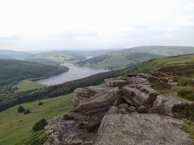
We keep our eyes on where we are putting our feet, it is drizzling with rain again and we don't want to slip, but despite the climb we ascend with more ease that we had expected, although it may have been better to have walked up before the muffins (although PC is adamant that she needed the energy from the muffins to get up here). The views are pretty good, but spoiled by the poor weather. We'll have to revisit on a clear day.
We are on the Limestone Way now, and the path is very clearly signposted which is a rare bonus. We pass Calling Low Farm, skirting the buildings via fields and a small copse, then come out to another field. Here an eager horse trots up to greet us, clearly not thrilled with staying out in the cold and wind, and trying its hardest to persuade us to either feed it or take it in. Eventually it leaves us and goes to look over the field gate to the farm, hoping to attract attention.
The path across the field is diagonal, with an interesting waterlogged section in the centre, but we're soon over it and into the edge of another small wood before emerging back onto farmland. Here again the signposting is very clear and we are soon within sight of the blue P sign for our car park. Not far to go, and only one final stretch of a stile for us to negotiate.
From here we don't have far to walk before we are back at the cars in the otherwise empty car park. Despite the weather, and the initial problems finding our starting point, the walk has been very good. We've managed to go on paths we've never ventured on before, and we'll be taking a slightly different route home!
Since this is to be our last post of 2013 we wish everyone a very Happy Christmas and an excellent New Year.


